Key Points – Tuesday, July 25, 2017:
Synopsis: Good Tuesday morning! Today we discuss the latest data regarding the heavy rainfall and strong storm threat later Wednesday into Thursday…we have a growing concern for a dangerous storm cluster pushing east here. We get warm Wednesday ahead of the front and then temperatures fall as it passes Thursday into a very nice weekend ahead. Details in the video, have a blessed day!
Today’s video (6 min):
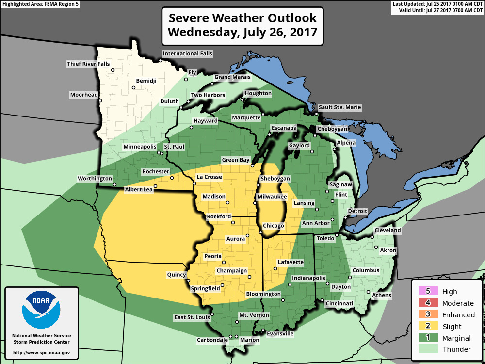
Latest risk Wednesday into Thursday…we honestly think this could be upgraded and shifted east into an “Enhanced Risk” for severe storms. Biggest threats being damaging winds and very heavy rainfall; power outages cannot be ruled out here as well which is common with strong storm cluster (MCS) events.
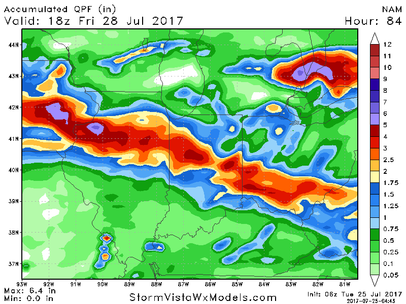
Rainfall totals…certainly on the table here is a lot of rainfall quickly as a piece of energy rides over the “Ring of Fire” (ridge to the south) in the order of 2-4″+.
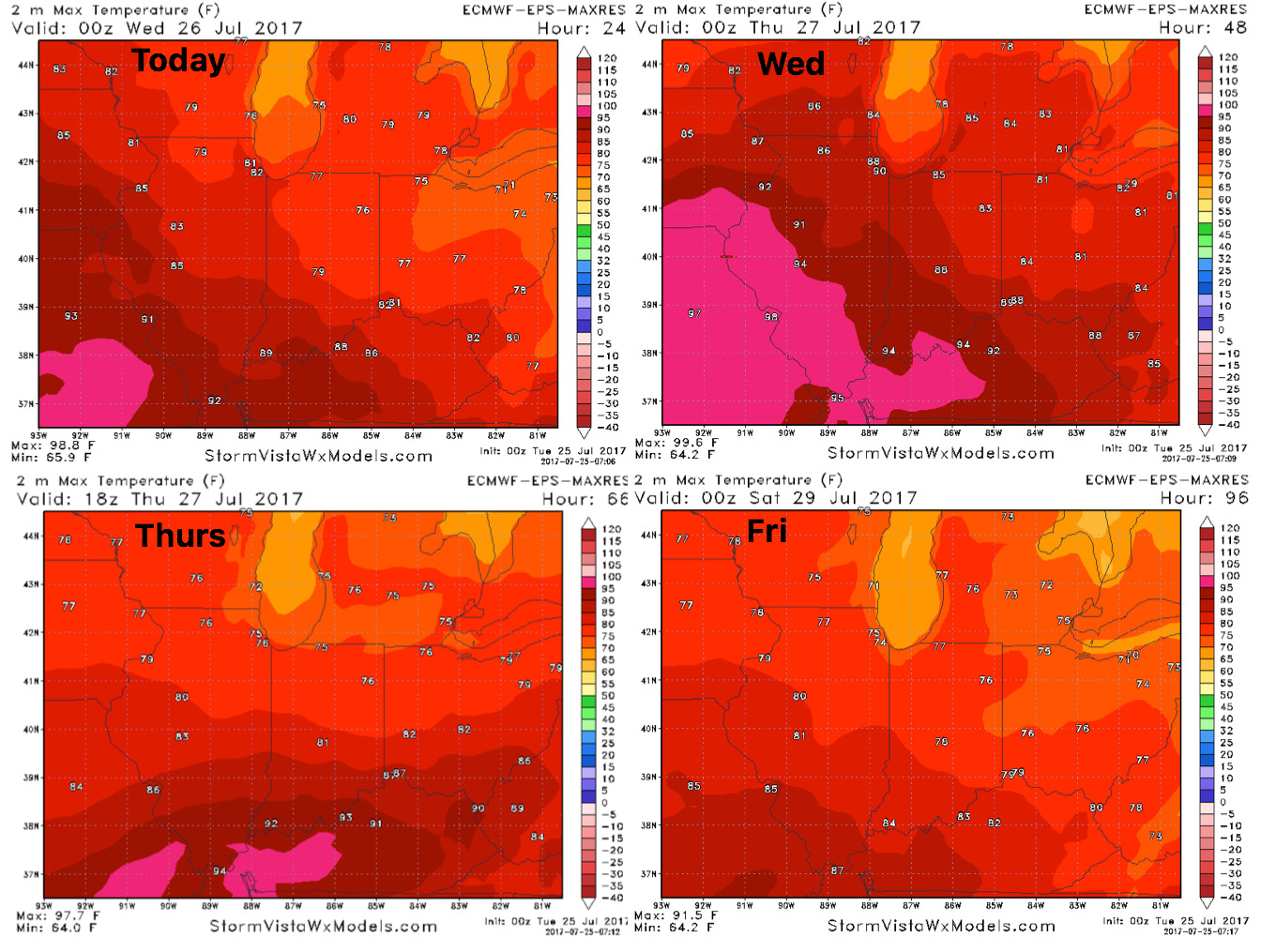
Temperatures into the weekend…much nicer as the front passes:
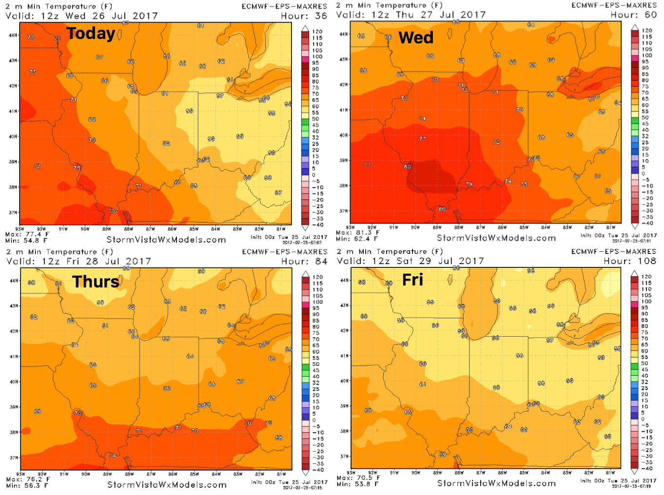
Overnight temperatures here as well will feel very nice:
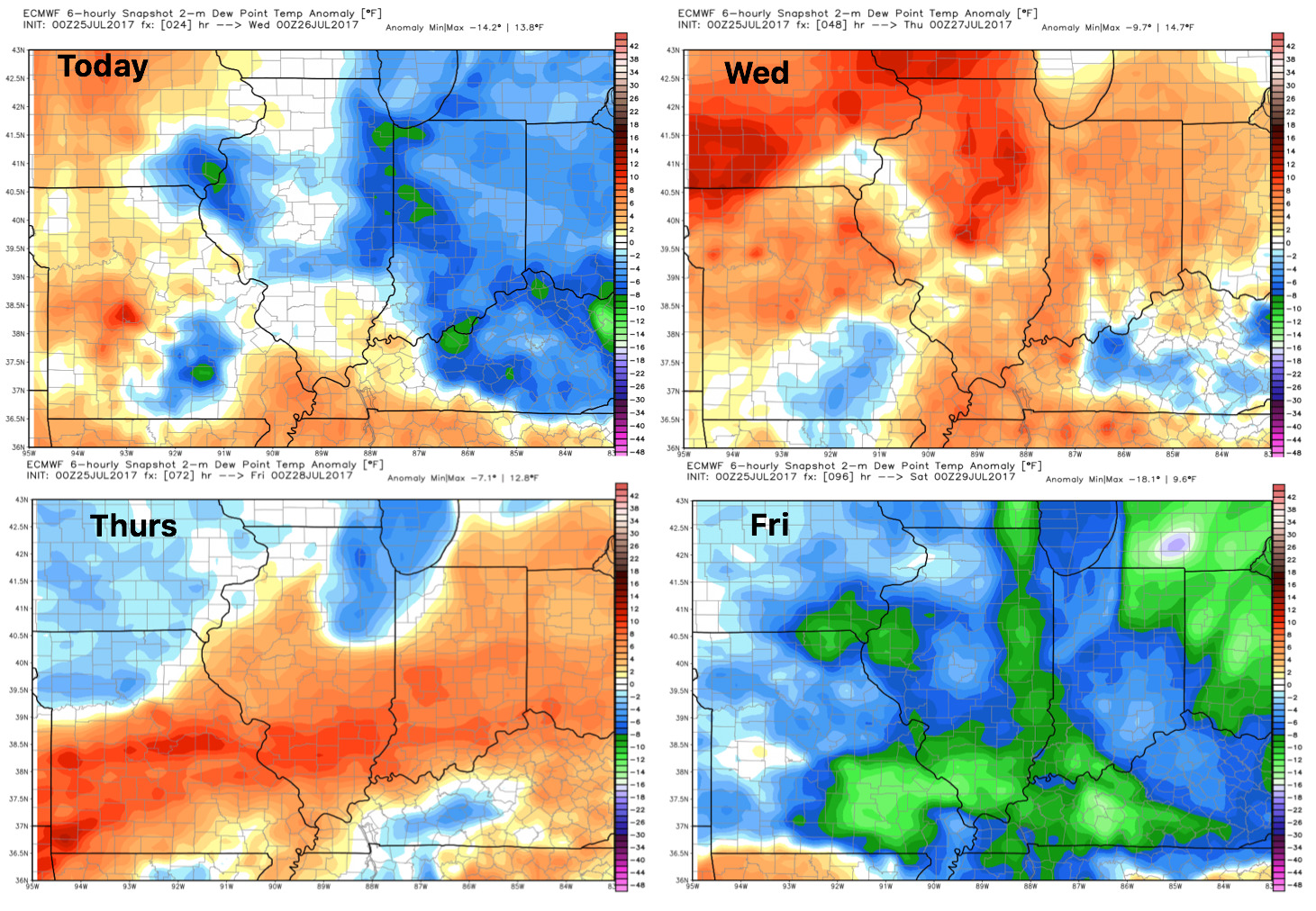
Dew points from normal…humidity relief into the weekend:
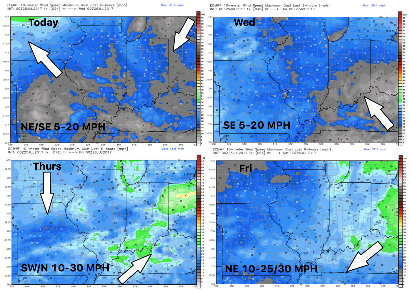
Wind forecast next 4 days:
Confidence:
- Above average confidence of storms, some being strong and heavy, moving east later Wednesday into Thursday morning.
- Average confidence on the exact track this cluster of storms travels as it travels east and where the heaviest rainfall sets up.
- Above average confidence very nice temps and humidity-relief work in late week into the week as the front passes.