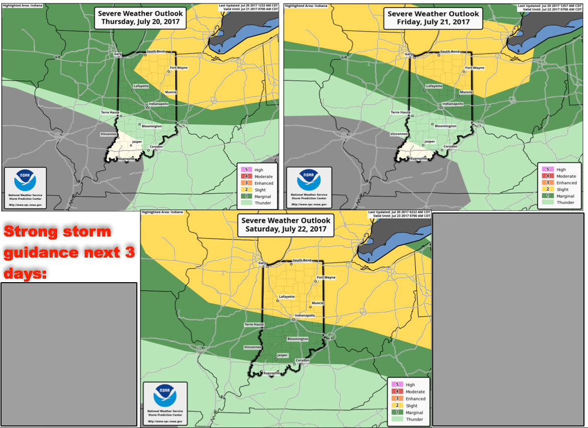
Key Points – Thursday, July 20, 2017:
Synopsis: Good Thursday morning! Today we target the northern half of the forecast area for multiple chances for strong storms and localized very heavy rainfall…with drier conditions continuing to the south and west. Also, we continue to cover the latest details on the heat through Saturday, before temperatures reside on Sunday as a front pushes the heat to the south. If you have any questions, please don’t hesitate to reach out! Have a blessed day!
Strong storm guidance over the next 3 days…as we mentioned above, multiple shots north for strong storms and heavy rainfall:
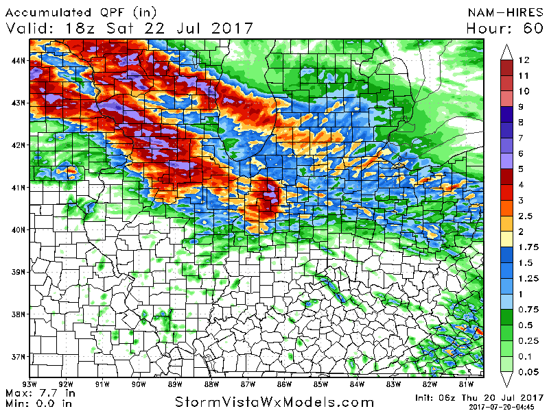
Rainfall guidance over the next 60 hours suggest localized very heavy rainfall possible north of I-70…certainly can’t rule out 3″+ in some areas:
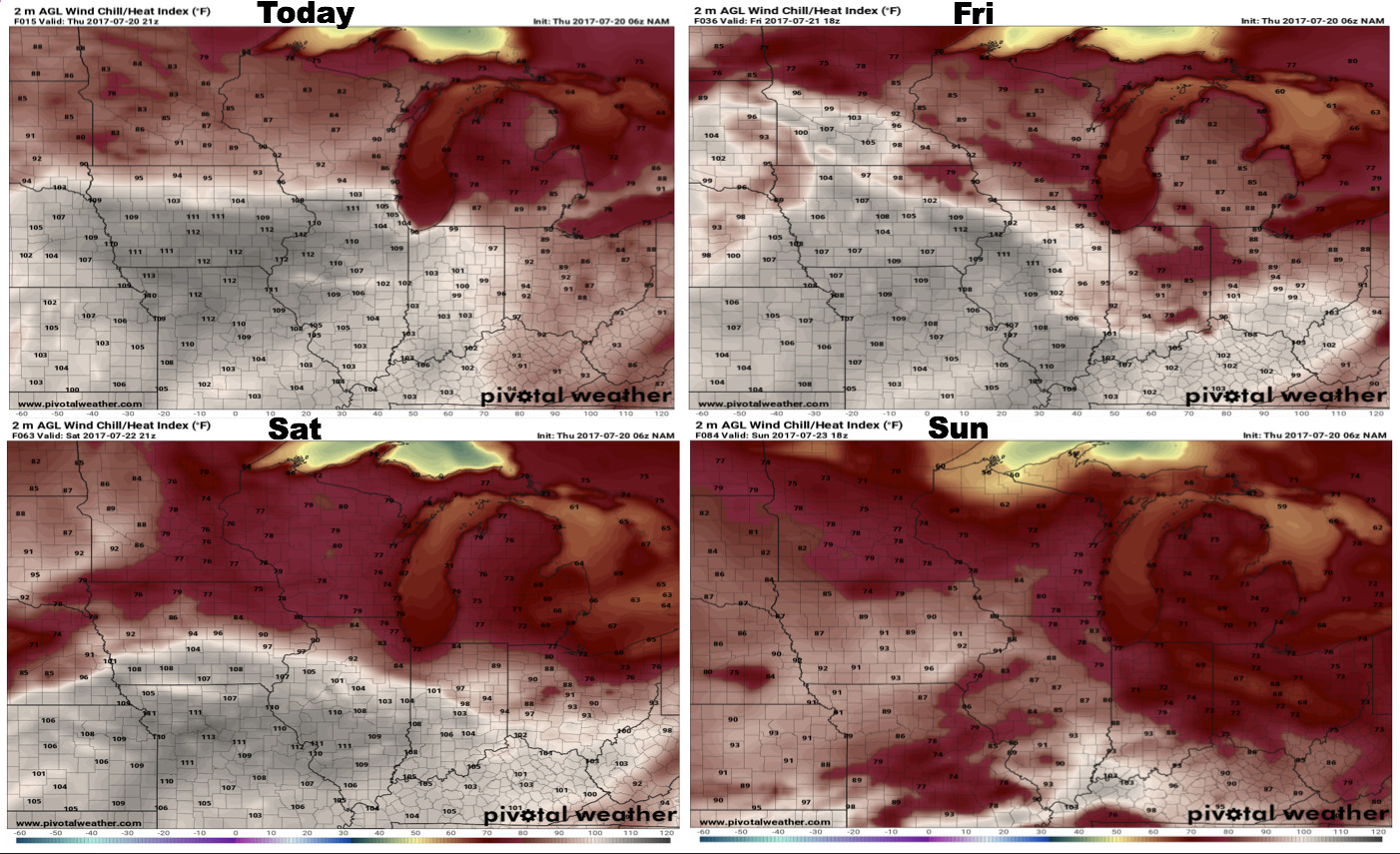
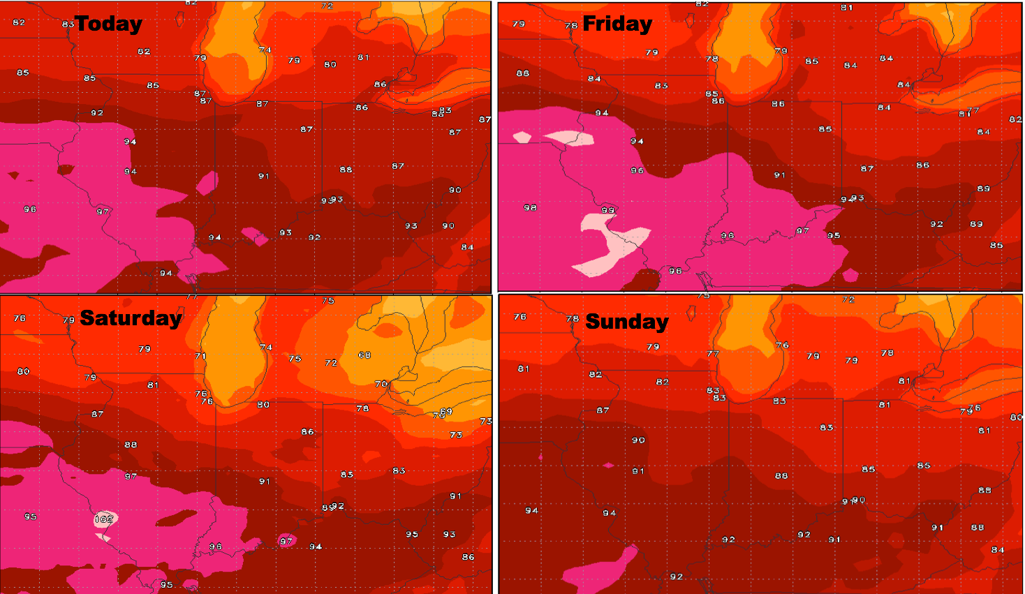
Heat index guidance next 4 days…very warm especially west:
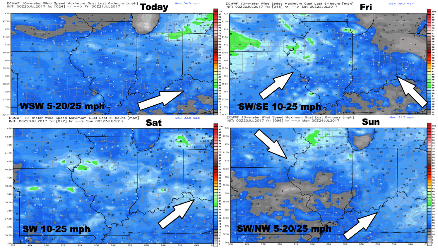
Wind forecast into early next week:
High temperatures over the next 4 days:
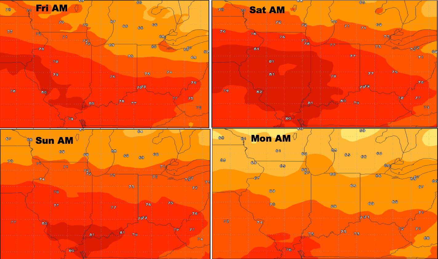
Overnight low temperate guidance:
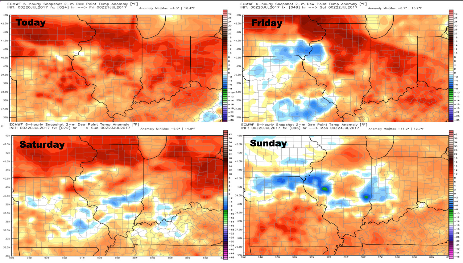
Dew points from normal:
Confidence:
- High confidence the next 3 days will be quite warm with heat indices of over 100º possible before a cold front knocks the warmth down on Sunday.
- Above average confidence for multiple waves of energy moving through into Saturday that’ll bring localized heavy rainfall and strong storm potential.
Video (7:40 min):