Key Points – Thursday, July 6, 2017:
Synopsis: Good Thursday morning! Today we discuss in detail the storms today into Friday, some being strong to severe with localized heavy rainfall possible. High pressure settles in briefly on Saturday for a very nice day, however, we expect later on Sunday into next week for the storm chances to reemerge as we feel the influence of a northwest flow. If you have any questions please let us know, have a blessed day!
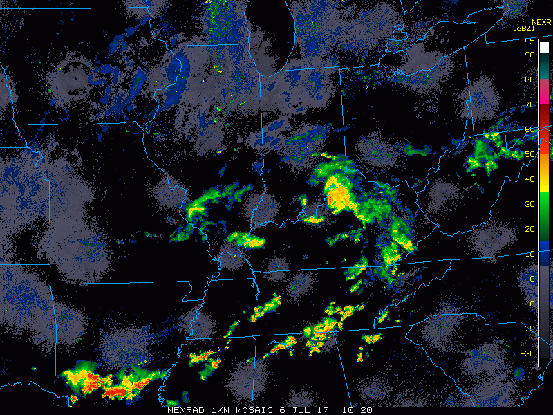
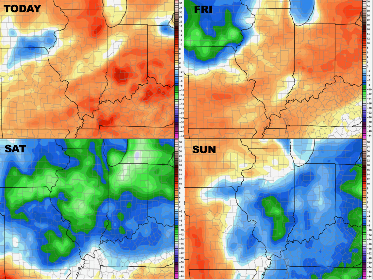
Current Radar:
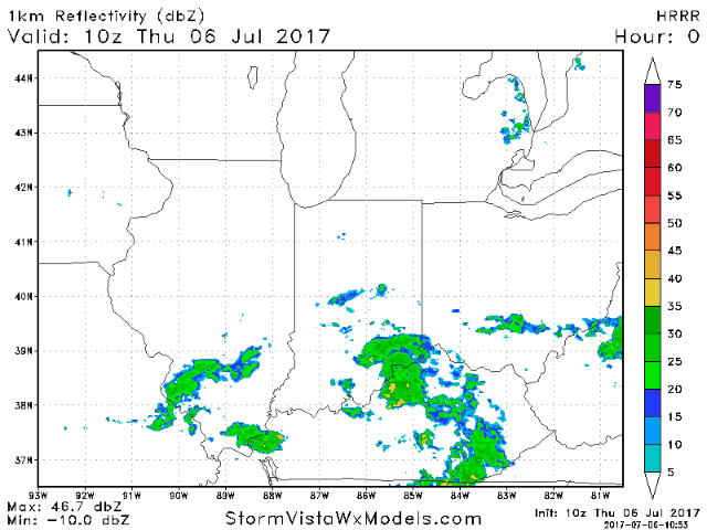
Simulated Radar today via the HRRR…storms hanging around the I-70 shifting off to the east through the day across IN/OH will be focus.
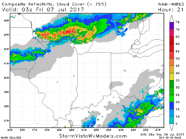
Storm risk to cover the cluster late tonight into Friday morning:
Getting into Friday we continue to see the risk for a storm cluster to move northwest to southeast across the Midwest…in the video we discuss how some of these may strong to severe in nature.
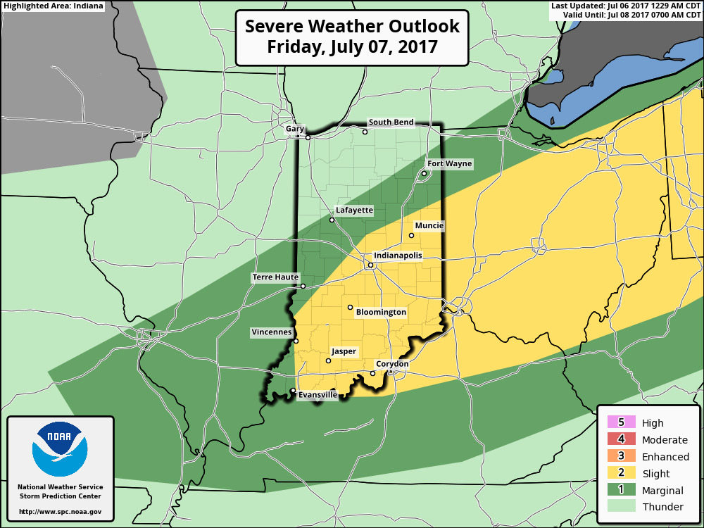
Strong to severe storms will be possible here across Indiana and Ohio locations as the storms redevelop on Friday afternoon:
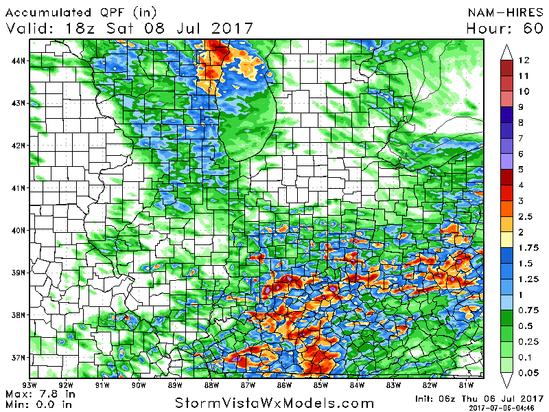
Total rainfall guidance from the 3km-NAM…certainly 1-3″ on the table here in localized locations, we wouldn’t be shocked to see isolated amounts of 4″+ as well.
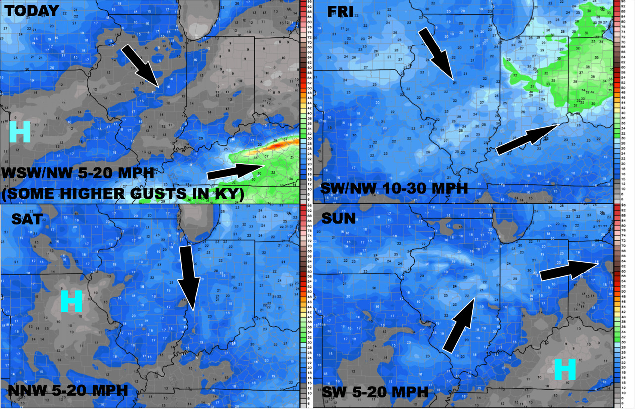
Latest wind forecast through the weekend:
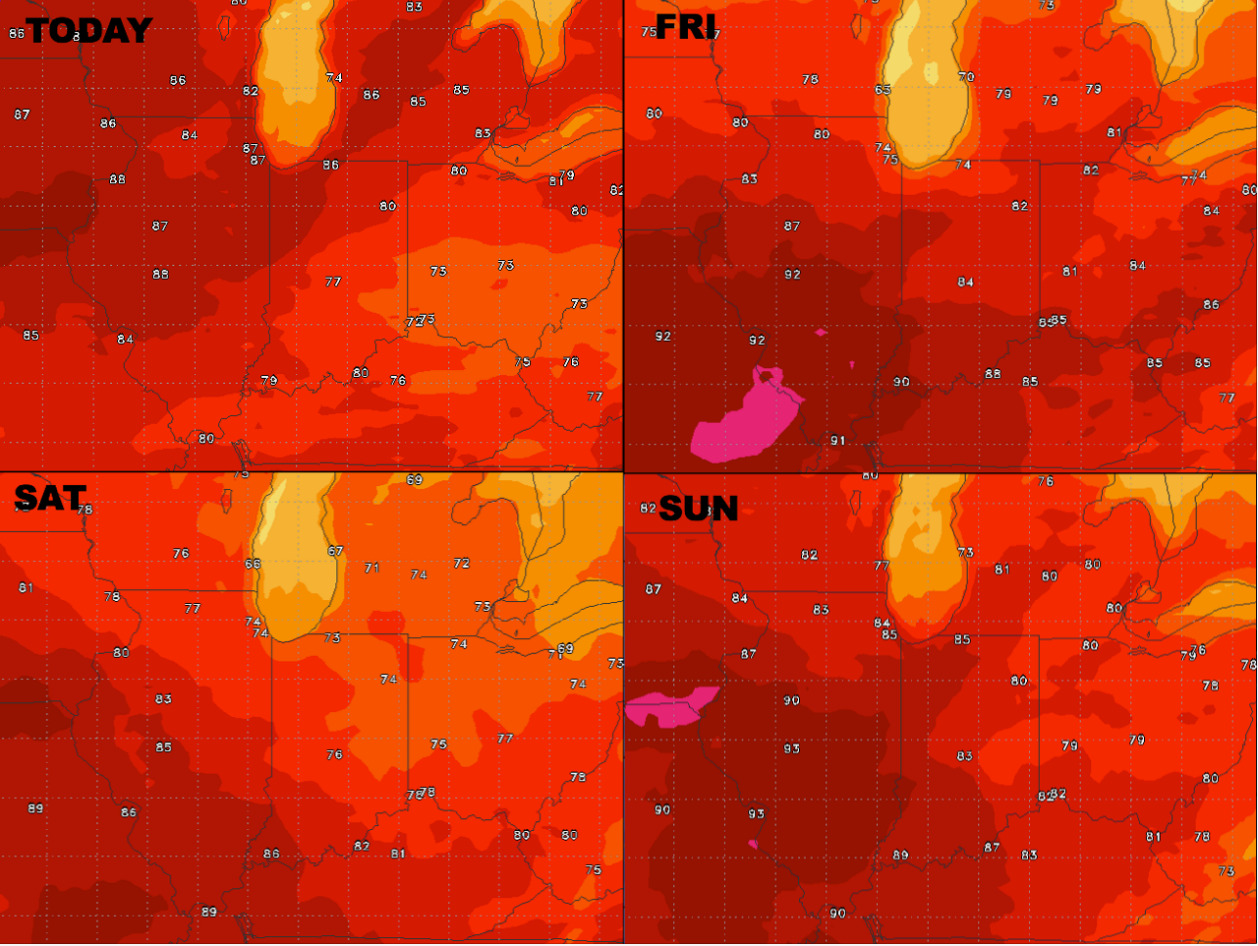
Temperatures through the weekend as well:
Dew points from normal…we stay relatively humid through Friday, as soon as the front passes east a much more comfortable pattern settles in Saturday into Sunday:
Saturday will be a very nice day as the cold front passes and we get under high pressure, isolated to scattered storms are reintroduced across the western Midwest later on Sunday into next week. The pattern in the 6-10 day certainly resembles a classic northwest flow continuing, which we know means we need be wary over performing rainfall to continue across the Midwest.
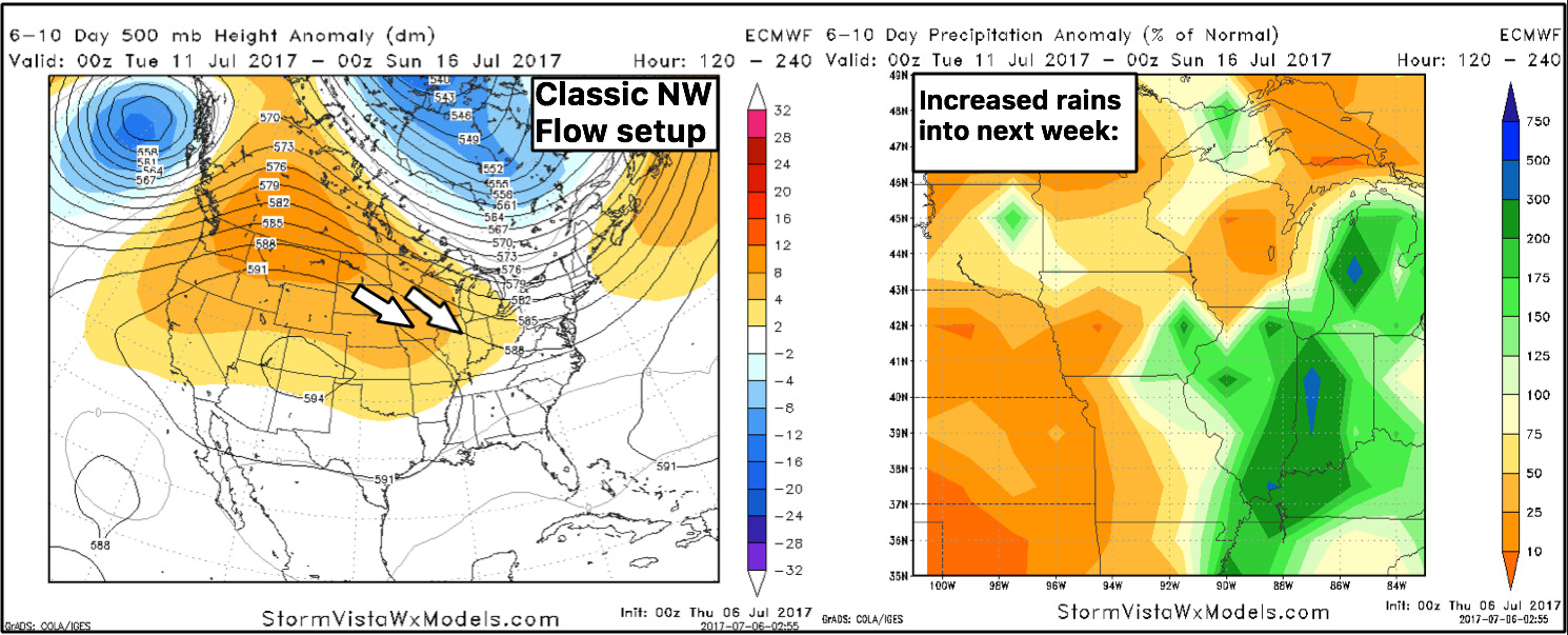
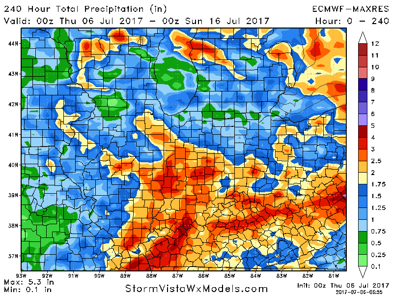
10-day rainfall guidance from the European gives us the right idea with active rainfall continuing…again, these models aren’t good for getting very specific with exact totals, but showing the overall theme here that multiple rain chances are in the forecast going forward for many to cash in on.
Confidence:
- Above average confidence showers and storms, some heavy, continue mainly across I-70 south in IN/OH today.
- Average confidence of a storm cluster pushing southeast late tonight into Friday morning, impacting mainly IL/IN locations…some of these may be strong.
- Average confidence the line of storms redevelops mid-day Friday mainly across central/southern IN/OH locations…some of these may be strong as well.
- Increasing confidence after a nice day on Saturday, the pattern ramps back up later Sunday into next week under a northwest flow across the Midwest.
Video (8 min):