Key Points – Thursday, July 27, 2017:
Synopsis: Good Thursday morning! Heavy rain continues across southern Illinois and southern Indiana…very beneficial rains as well as these areas have remained drier overall this summer. As we go throughout the day today showers and a few rumbles of thunder will be possible, they will be scattered in nature across the northern half of the forecast area; I-70 south some heavier rainfall will be possible. As the front moves east, much nicer weather, drier as well, works in Friday into early next week. All the details in the video, if you have any questions please let us know!
Today’s video (6 min):
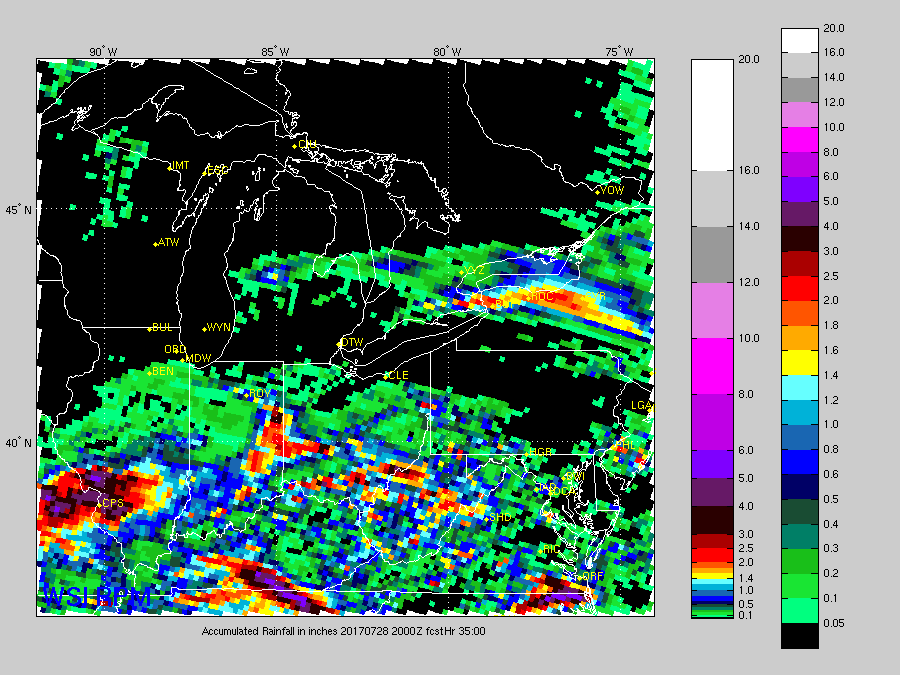
Rainfall guidance over the next day and a half from latest guidance…the takeaway here is the rainfall placement, some localized heavier rains will be possible ~I-70 south of 1-3″. The threat will be more scattered across the northern half of the forecast area.
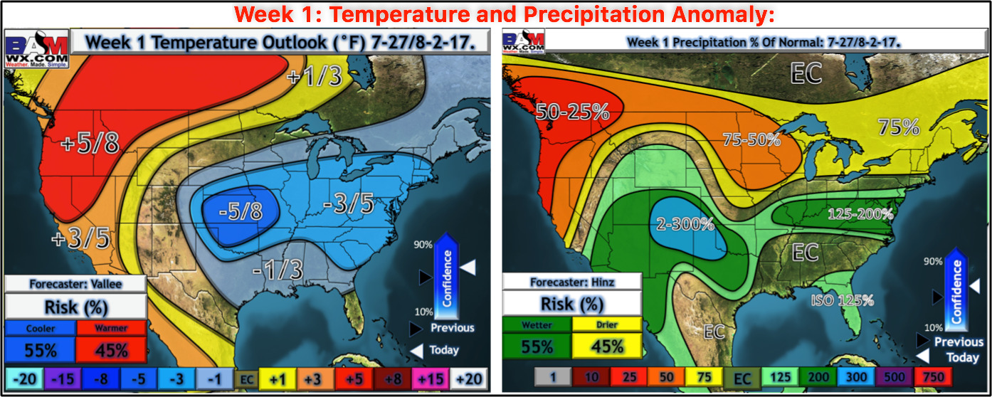
Here’s our custom outlooks for temperature and precipitation over the next week:
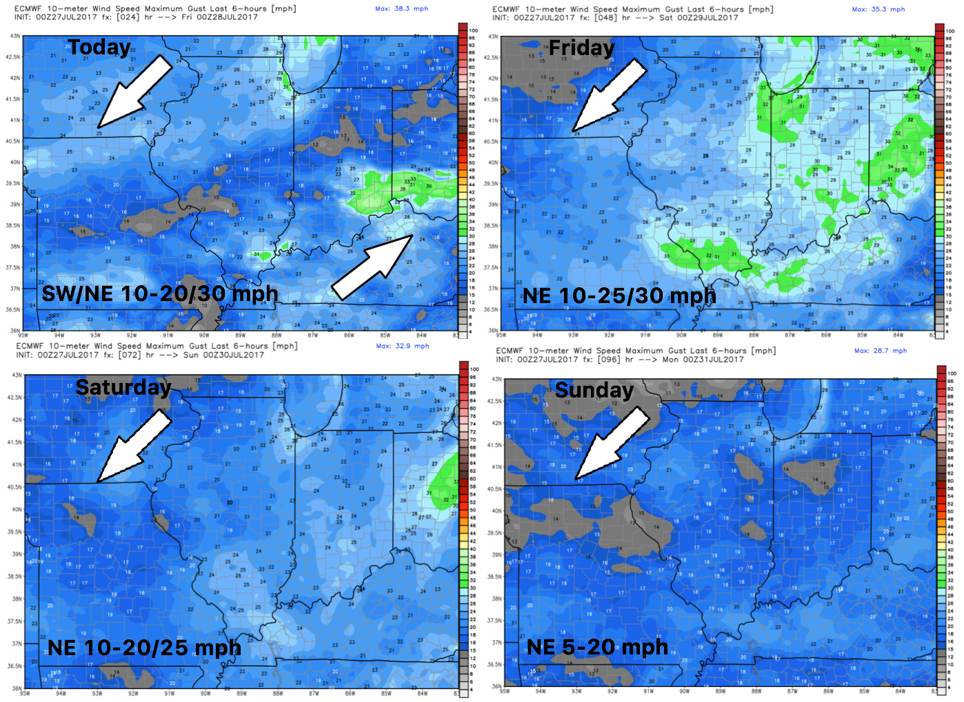
Wind forecast through Sunday…turning out of the northeast ushering in more comfortable air:
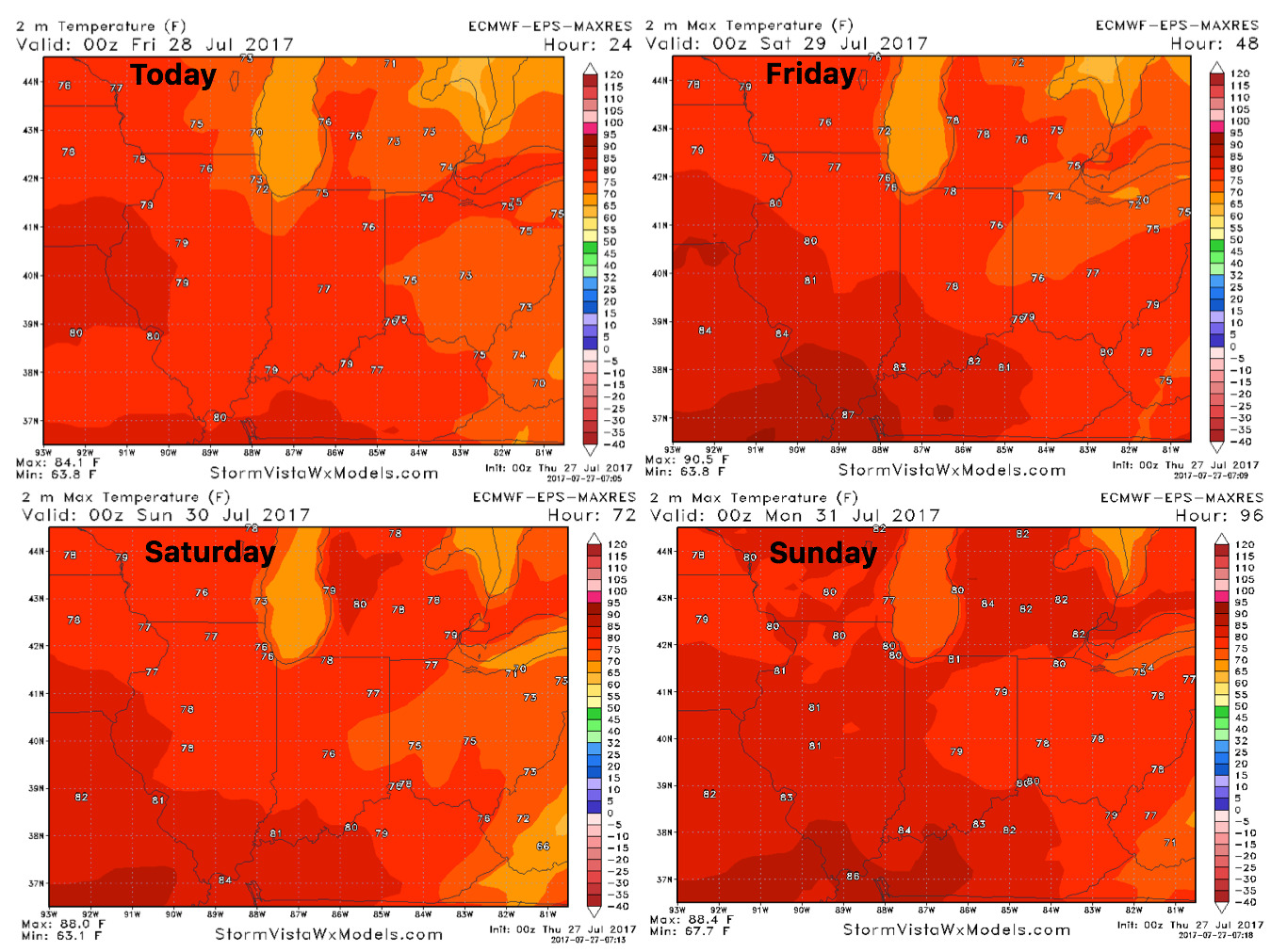
High temperatures into the weekend as well feeling much cooler:
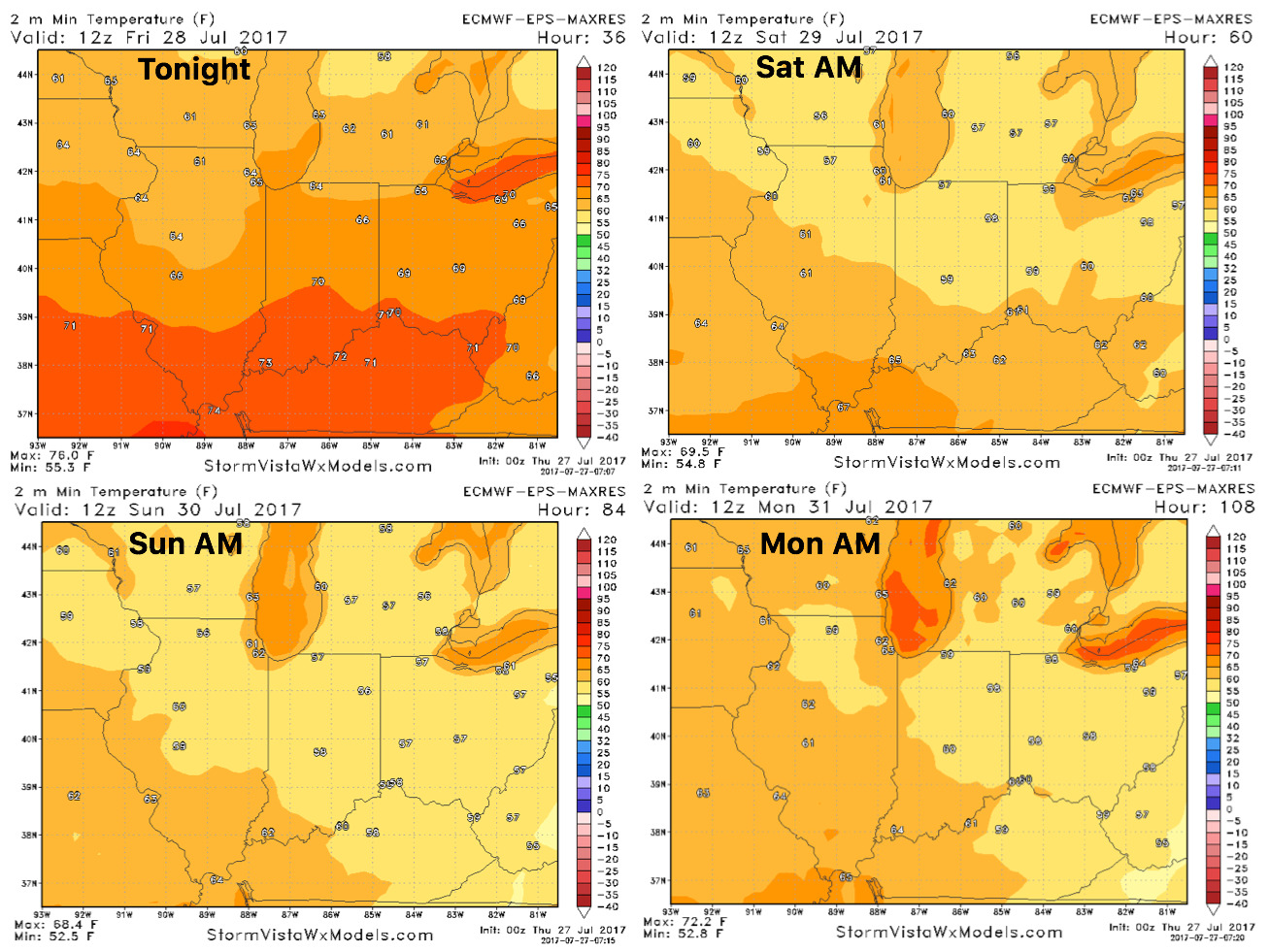
Overnight temperatures over the next 4 days…impressive to see consistent lows dipping into the 50s:
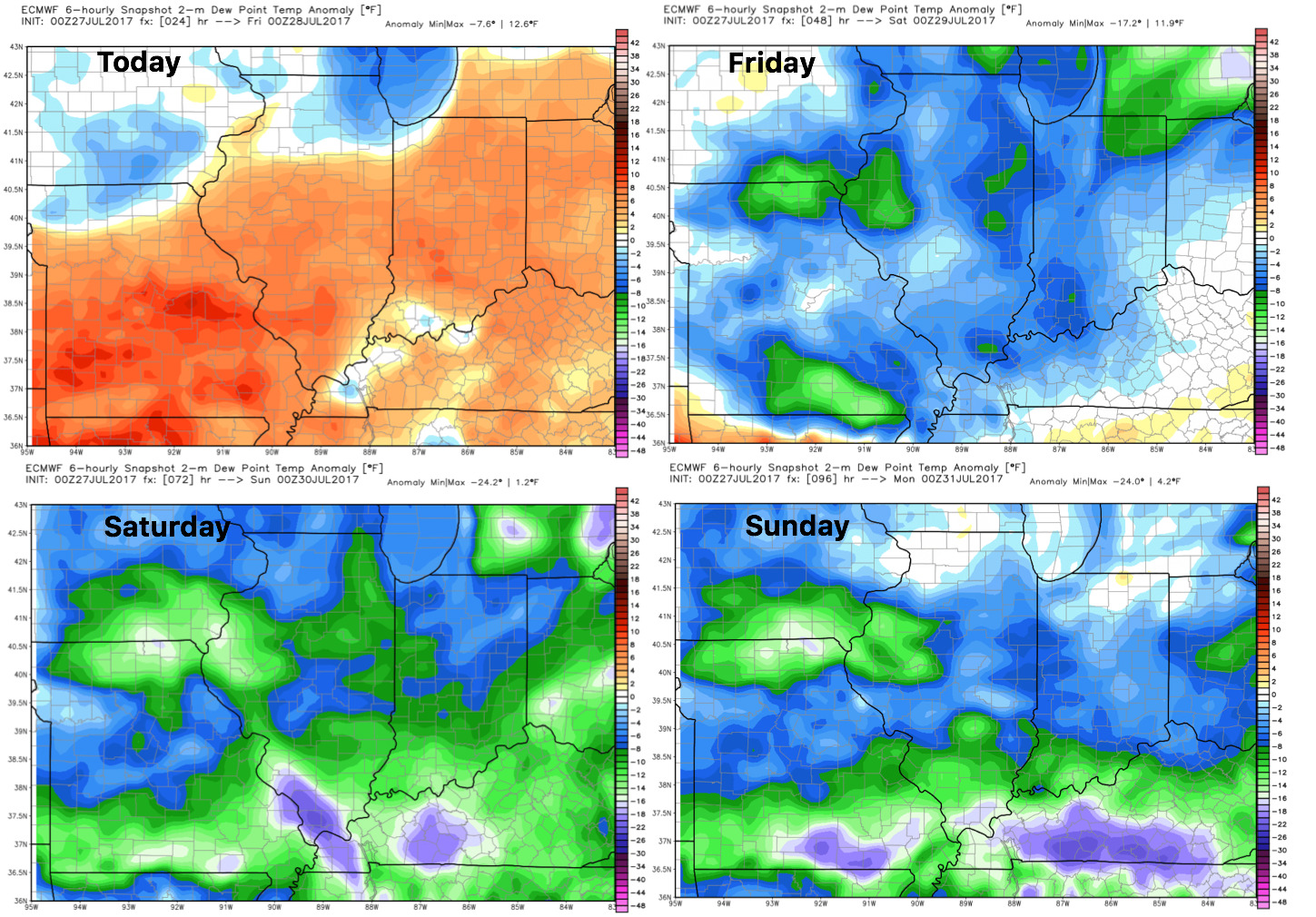
Dew points from normal: