Key Points – Friday, July 8, 2017:
Synopsis: Good Friday morning, we discuss the strong storms expanding in coverage to the south and east across eastern Illinois, Indiana and Ohio locations…an enhanced risk was just updated this morning as well…unfortunately, right in the areas that just don’t need the rain. With high precipitable water values today, some heavy rainfall, even flash flooding can’t be ruled out. The cold front moves through later today into tonight to the southeast, ushering in much nicer conditions on Saturday. In the video we discuss the active pattern into next week, looks to be potential rains in parts of the Midwest nearly everyday with an active northwest flow. Have a blessed weekend!
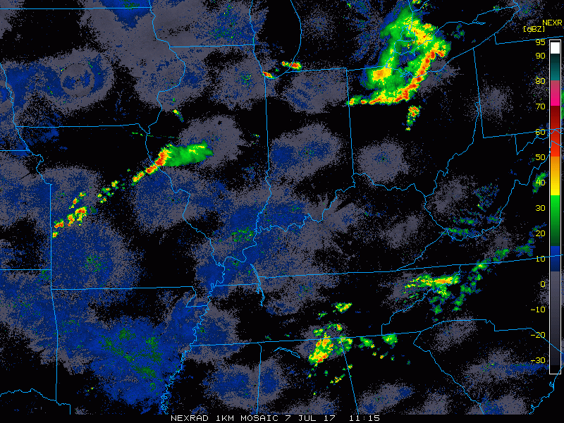
Current Radar:
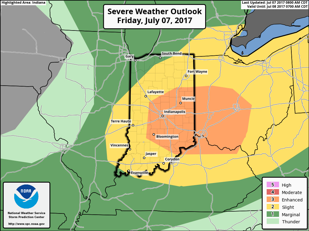
Strong storm outlook for today…damaging winds, large hail and very heavy rainfall at times will be possible.
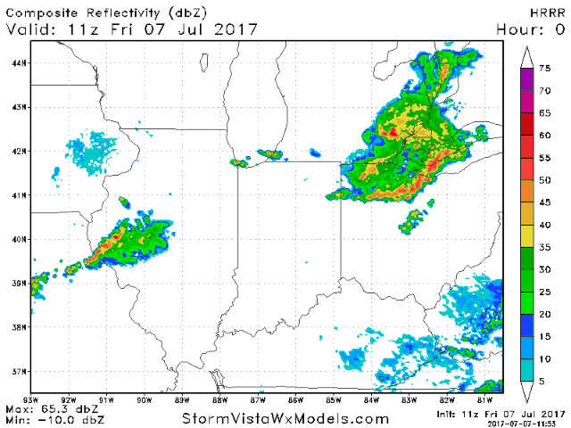
Simulated radar guidance through tonight…t’storms start to erupt around noon across north/central Indiana into western Ohio, heading south throughout the evening hours:
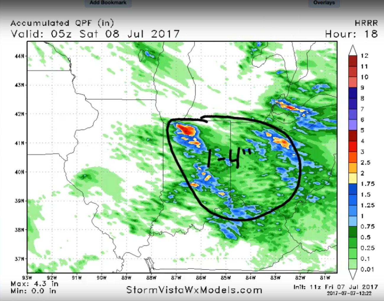
Expected rainfall guidance here as well:
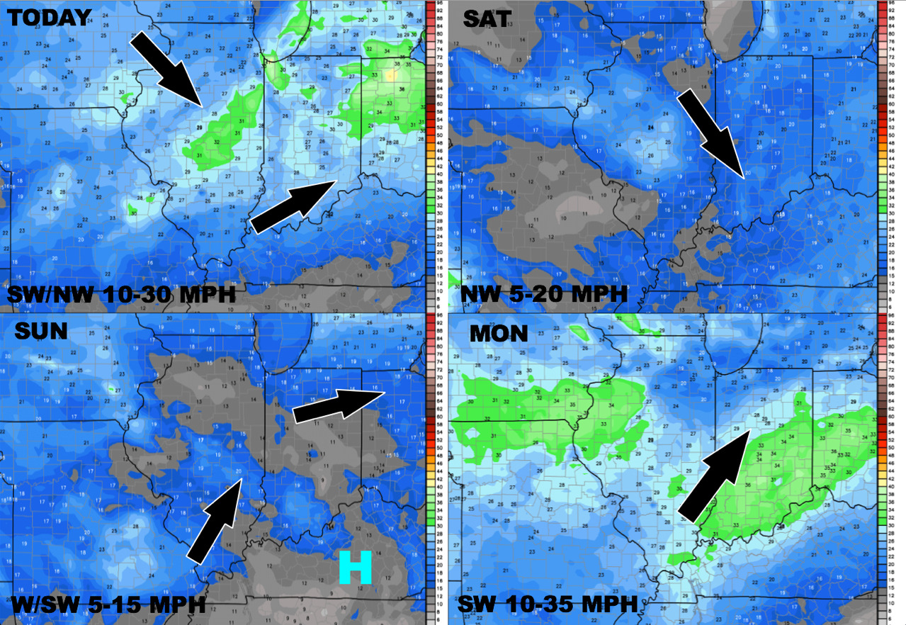
Wind forecast over the next 4 days:
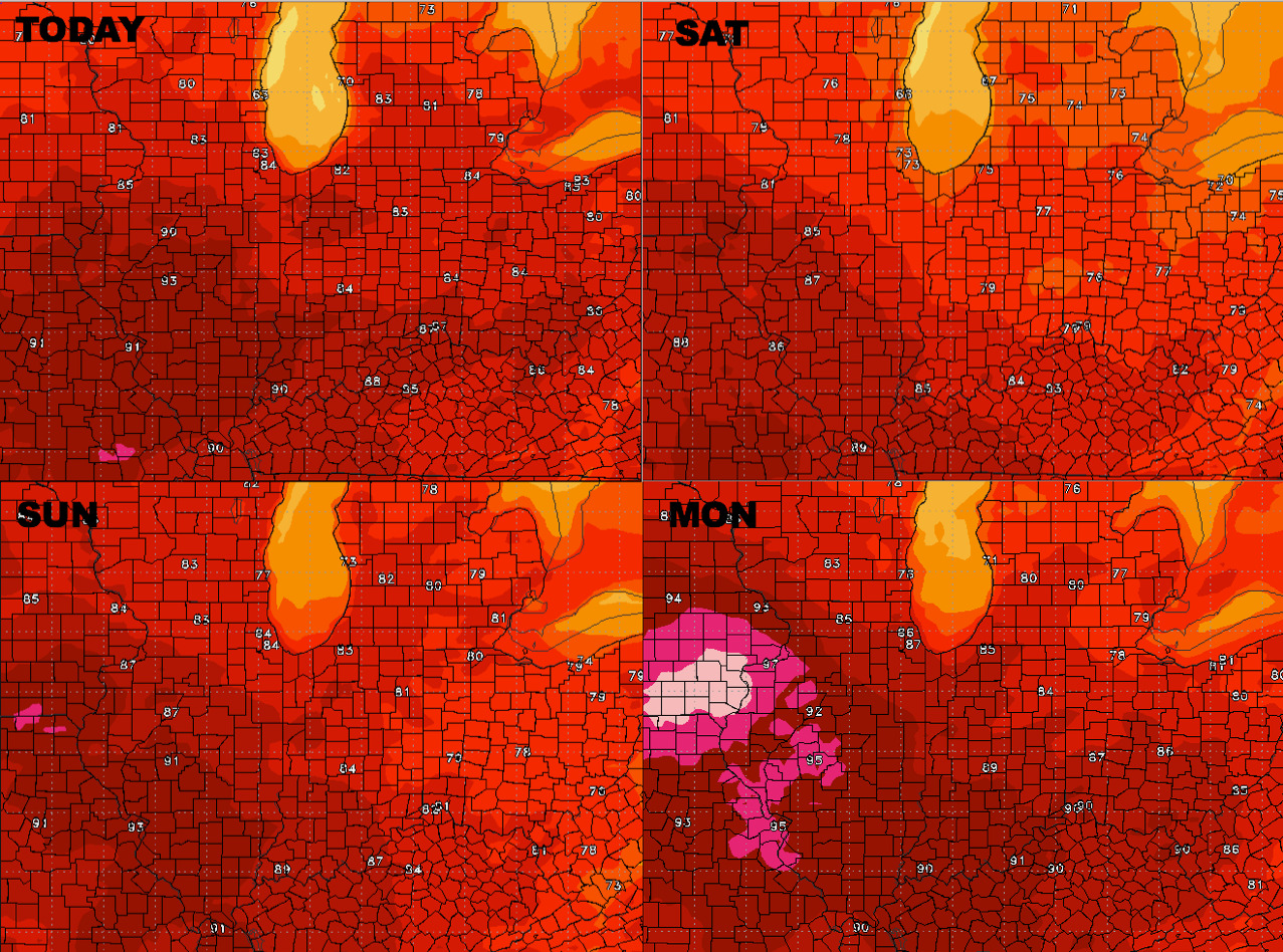
Temperatures into early next week:
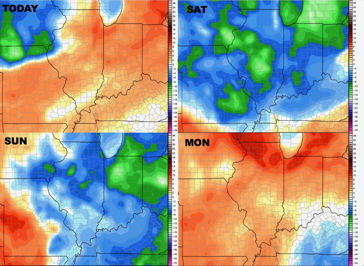
Dew points from normal over the next 4 days:
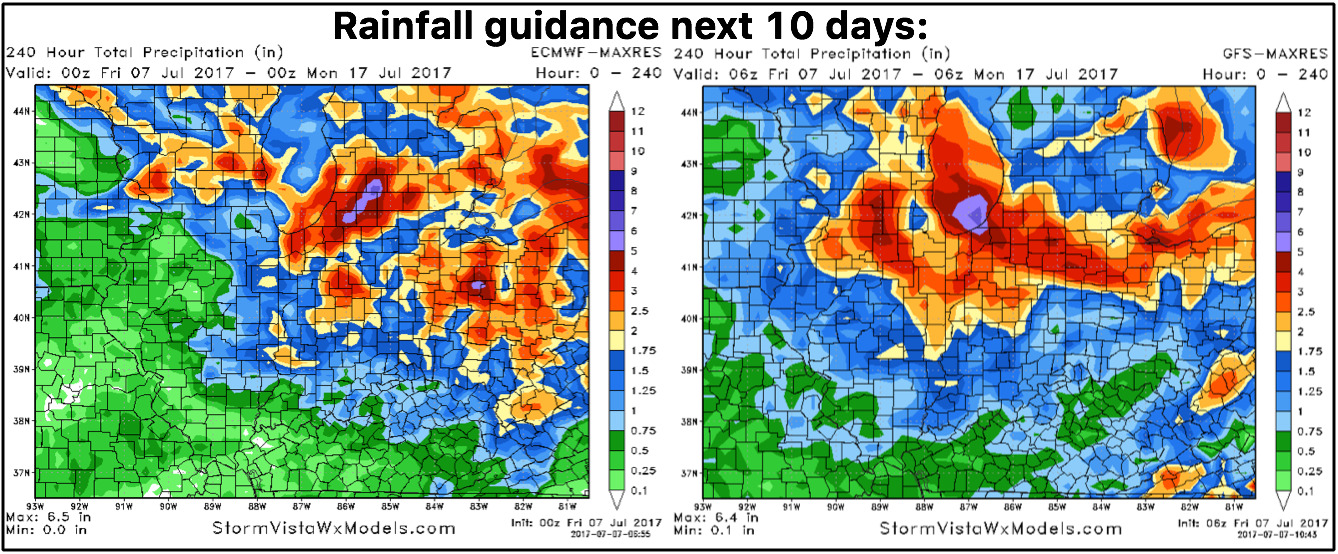
Another very nice day on Saturday, it’s into next week we see nearly a daily storm threat especially across eastern Illinois, Indiana and Ohio…here’s the latest 10 day rainfall guidance:
Confidence:
- Above average confidence of additional showers and storms, mainly across eastern IL, IN and OH today moving south and to the east.
- Average confidence some of these storms may be severe with very heavy rainfall exceeding 2-3″+ as well.
- Above average confidence a much nice and more comfortable next expected Saturday under high pressure.
- Getting into next week, we feel average confidence right now that multiple storm chances will form across the Midwest as we feel the influence of the northwest flow.
Video (6 min):