Key Points – Monday, June 5, 2017:
Synopsis: Good Monday morning! A front sags south as we go throughout the day today which will give us a focal point for a redevelopment of storms later this evening…high pressure works in behind it giving us a dry, comfortable week ahead. Next precipitation chance doesn’t enter until late week, getting warm throughout the weekend into next week as well. Have a blessed week!
Current Radar:
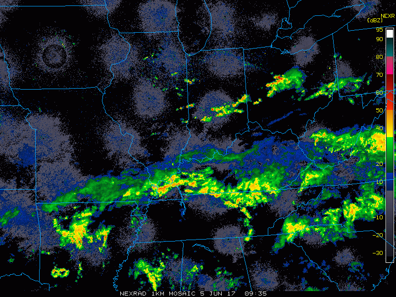
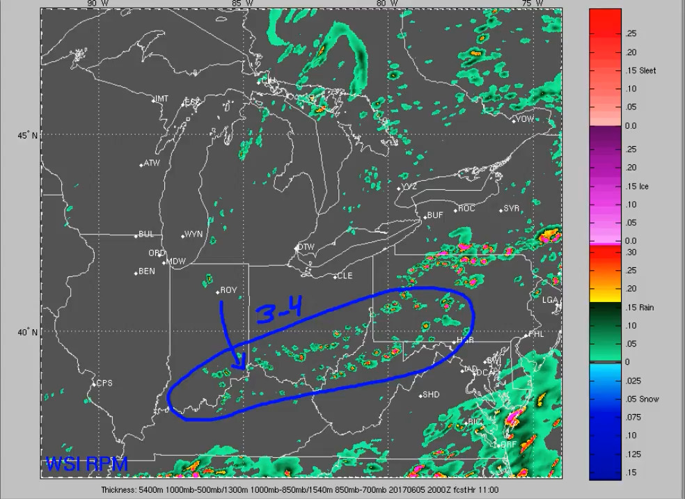
Watching for a redevelopment of scattered storms ~3-4pm as the cold front sags to the south…showers and storms should be out of here by 8-9pm.
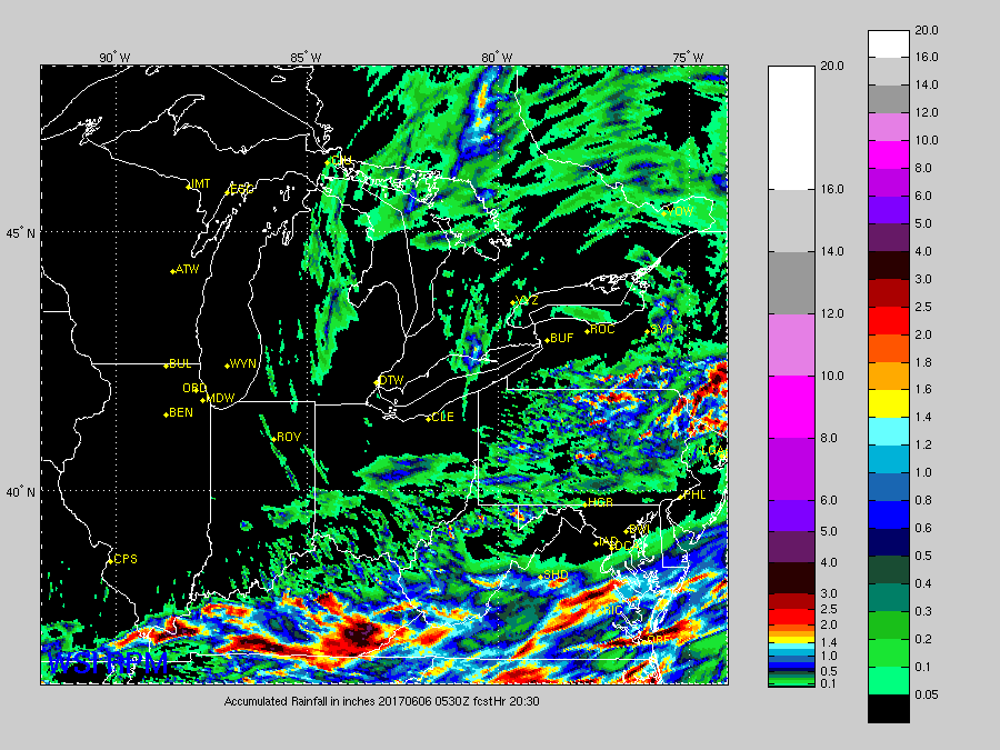
Total rainfall with remaining storms…higher amounts possible across Kentucky (localized 1-2″)…other locations that see scattered storms could see an additional 0.5-0.1.0″ of rainfall.
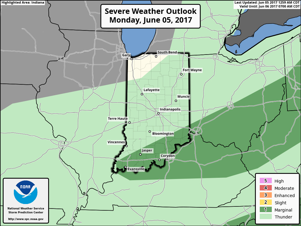
There is still a marginal risk for some stronger storms across parts of southern Indiana, northern Kentucky and southern Ohio for gusty winds and small hail possible later today where that redevelopment happens along the cold front.
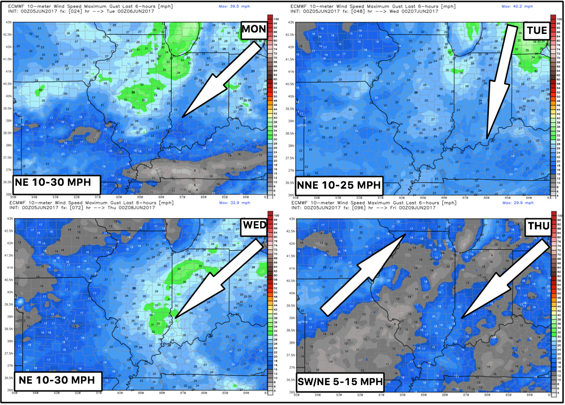
Wind Forecast next 4 days:
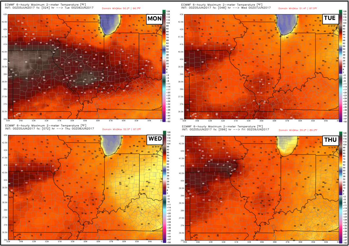
Temperatures next 4 days…beyond today, we will have comfortable temperatures settling with drier weather as we get under high pressure. A few 90s possible today, however, across parts of Illinois.
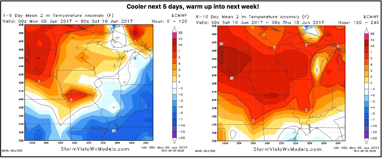
Temperatures from normal through the next 10 days:
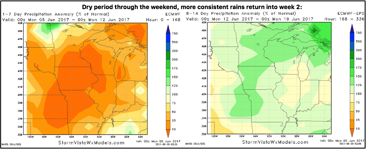
Precipitation from normal next 2 weeks…overall drier stretch settling in through the next week, more consistent rains return during week 2 as the ridge in the west relaxes, allowing the pacific jet influence to work more into the Ag Belt and Midwest.
Confidence:
- Above average confidence the showers and storms sag south throughout the day along the front.
- Above average confidence a drier stretch of weather sets in through the weekend.
- Above average confidence a cooler next 5 days sets in, then a warm up through the weekend into next week.
Today’s video (7:40 min):