Key Points – Monday, June 19, 2017:
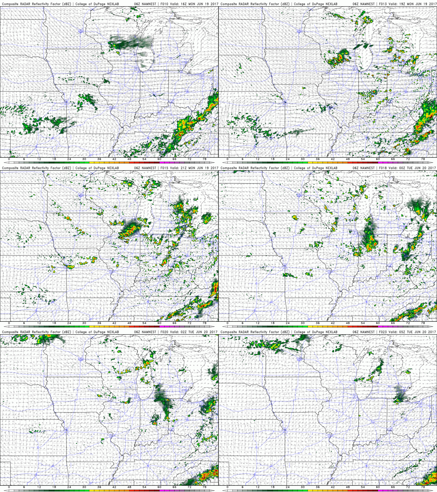
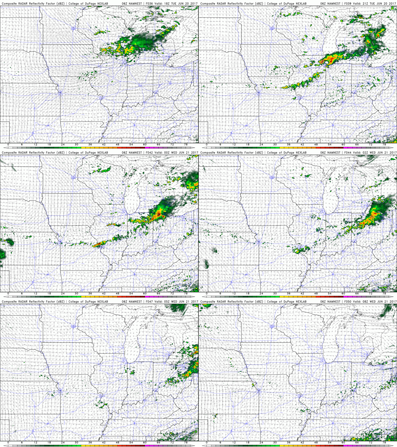
Synopsis: Good Monday morning! Today we discuss the “pulse”, scattered storms ~30/40% coverage today as we heat up during the day, dying with sunset. Working into tomorrow we watch for a weak front approaching from the northwest, triggering a chance for storms to develop across northern IL and skirt to the south and east later Tuesday night. We also discuss temps from normal into the weekend and early next week and late week/weekend rain chances. Have a blessed day!
Scattered storms today ~30/40% coverage today…fading as the sun starts to set.
More scattered storms later Tuesday into Tuesday night as a weak front scoots to the southeast…coverage expected ~30/40% as well.
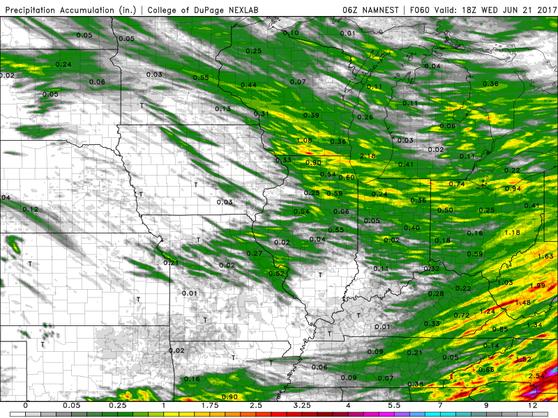
Hit or miss overall with isolated 1-1.5″ possible under the heavier storms…not everyone gets in on these rains it should be noted:
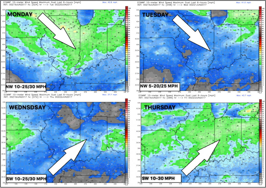
Winds next 4 days:
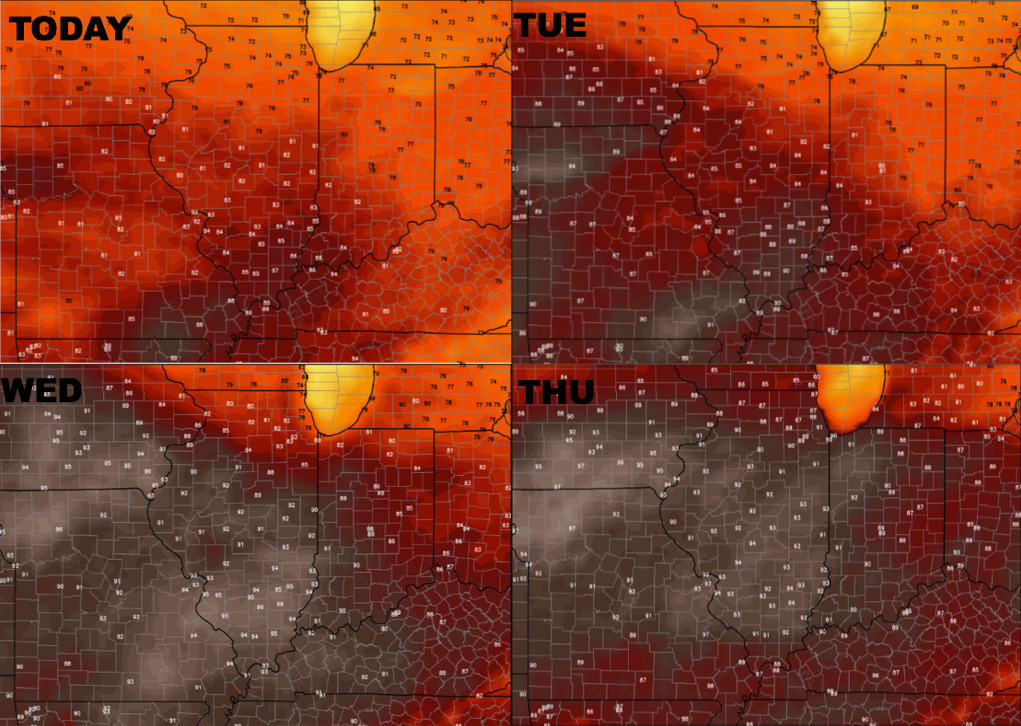
Temperatures next 4 days…we warm up pretty good through Wednesday and Thursday for sure.
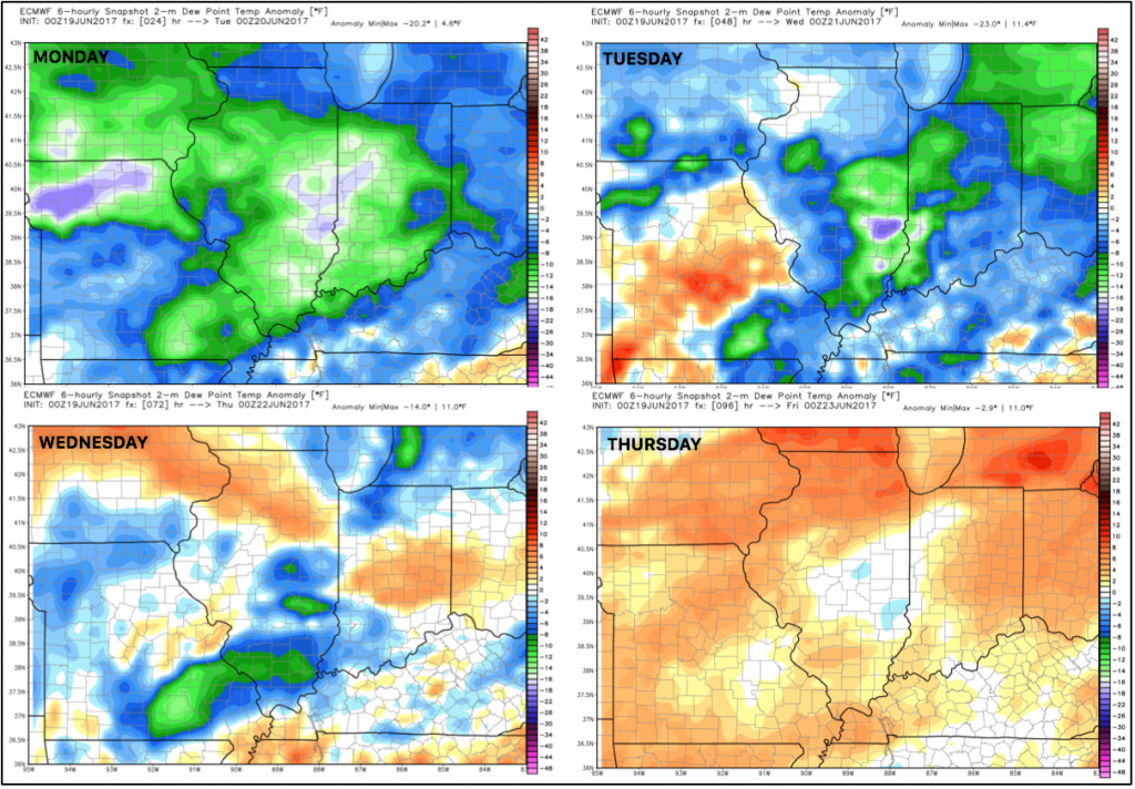
Dew points from normal next 4 days…very nice the next 2 days with some increased humidity the next 2 days prior.
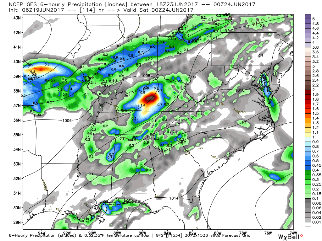
Watching Friday into Friday evening for a heavier rain event that we are watching closely:
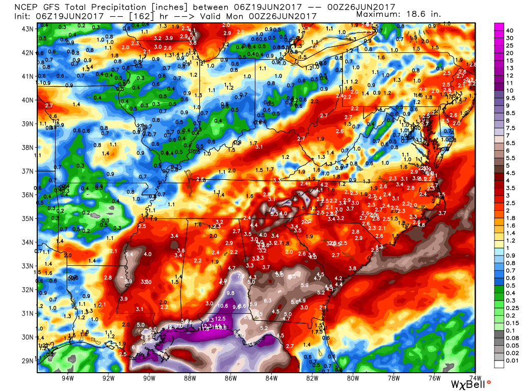
Thoughts on total rainfall through Monday morning…it’s hit and miss, “have’s and have-nots”…some locations get 0.5” of rain others get 2″+.
Confidence:
- Above average confidence some instability showers pop later this afternoon with a coverage ~30/40%…fading by sundown across the Midwest.
- Average confidence additional storms possible later Tuesday afternoon from northwest to southeast as a front sags south…coverage ~30/40%.
- Average confidence we will be overall slightly cooler than normal through the next week, despite some warmth coming mid-week.
- Increasing confidence of some heavy rainfall possible on Friday moving through the Midwest.
Video (6:30 min):
