Key Points – Friday, June 9, 2017:
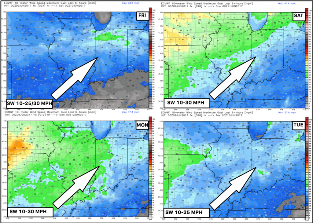
Synopsis: Good Friday morning! We have a scattered storm threat later today across the northern Midwest, fading by sundown…the bigger story is the big-time heat moving into the weekend with temps getting into the upper 80s to lower 90s across many locations with southwest winds 10-25/30mph. In terms of precipitation getting into next week, pretty marginal threats through mid-next week, watching late next week into the weekend for more favorable rain chances as discussed in the video. Have a blessed weekend!
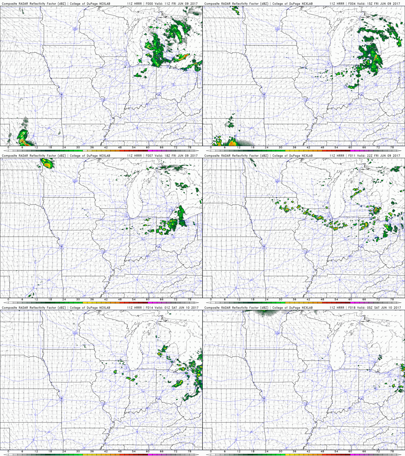
Watching an area of storms to develop today into tonight…looking at ~4-5pm for storm initiation across northern Illinois, northern Indiana northwest Ohio continuing east through the evening.
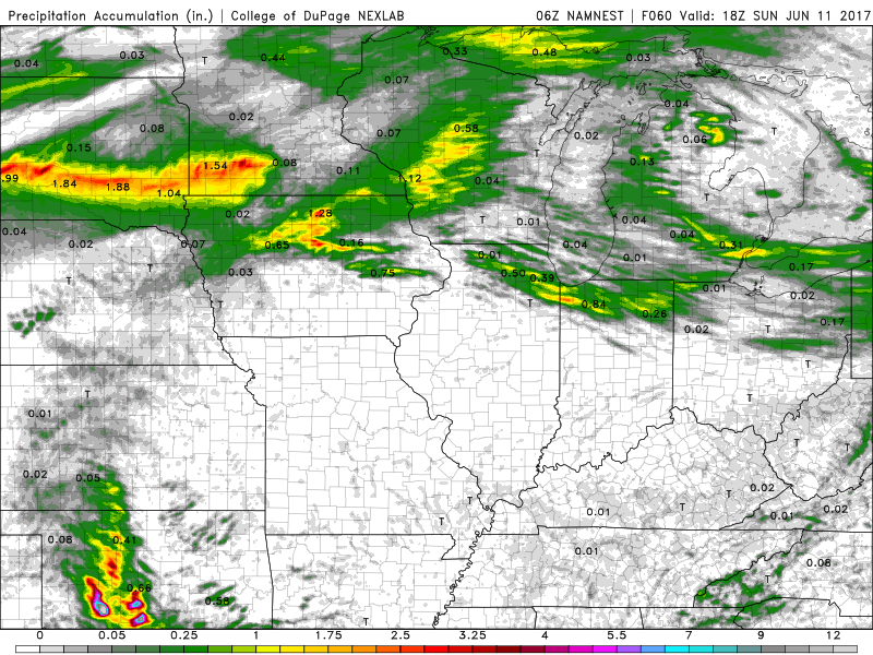
Total precipitation with this wave of storms, where it does rain a spread of 0.5-1.0″+ will be possible to the north…locations to the south will see plentiful sunshine and dry conditions.
Wind forecast next 4 days across the Midwest…will be fairly windy this weekend:
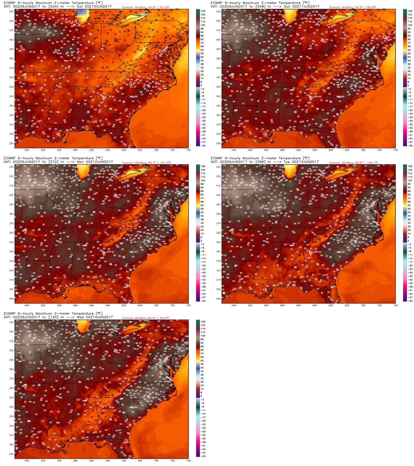
Temperatures next 5 days put in motion to show the warming trend through early next week…upper 80s to lower 90s likely getting later into the weekend:
Dew point anomalies over the next 5 days as well show conditions relatively comfortable over the next 3 days, then the dew points increase into early next week making things more muggy.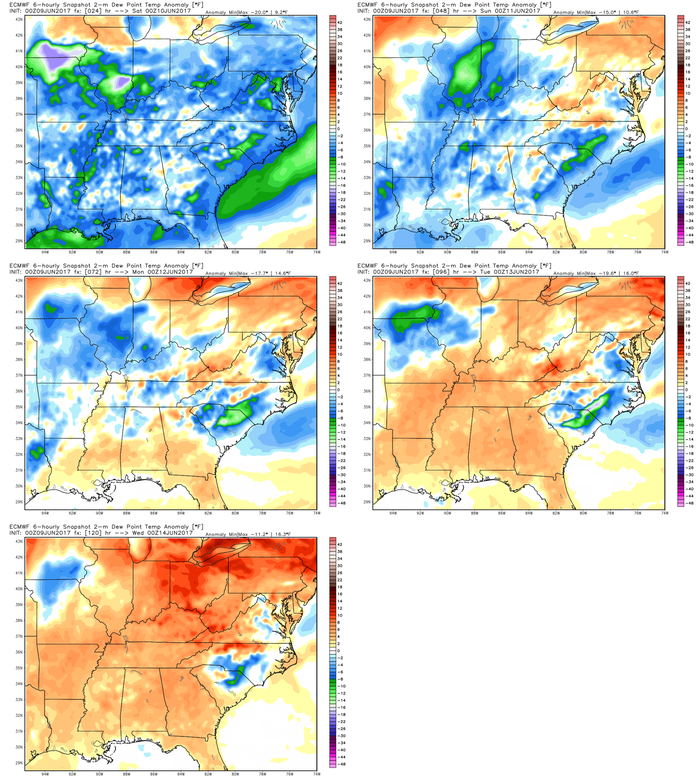
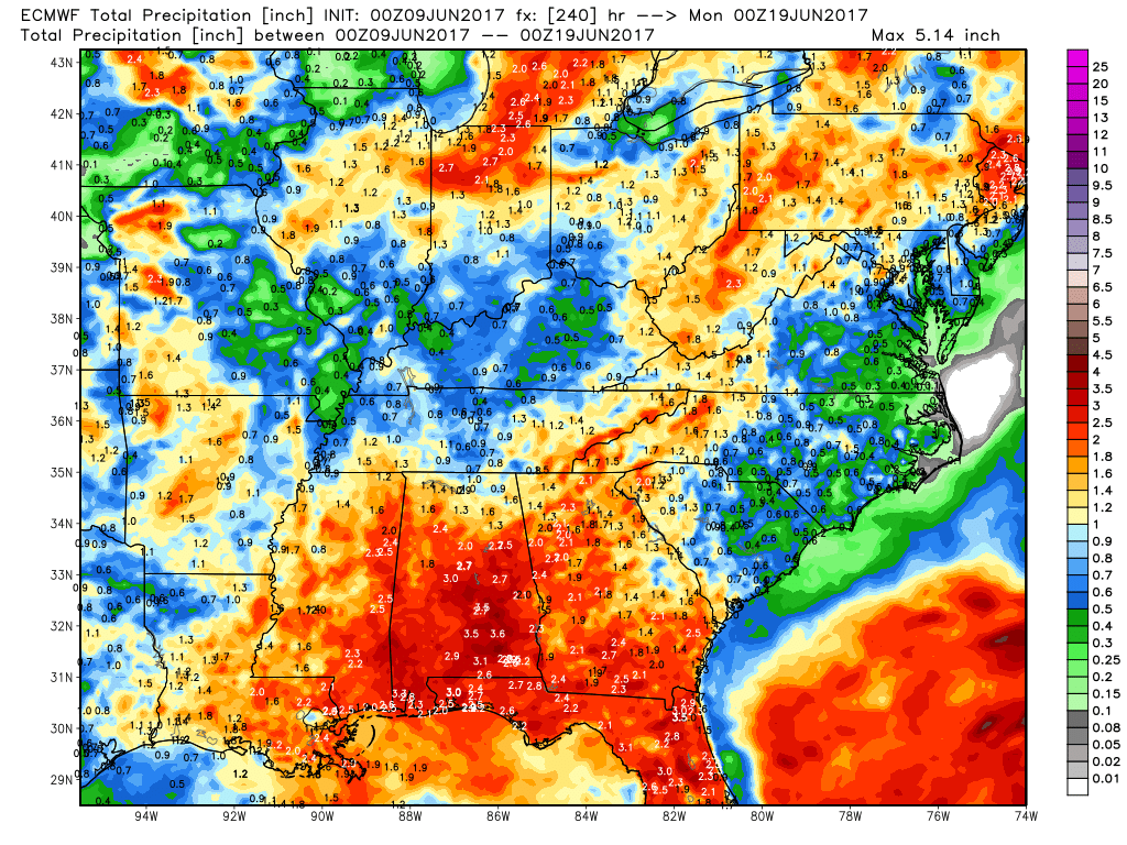
This weekend will be largely warm and rain-free, we discuss in the video how the active pattern picks up mid-to-late next week…looking at rainfall totals from the European over the next 10 days is encouraging for those needing rains. Disclaimer though, there’s much we still need to fine-tune with the rainfall next week, it’ll continue to be the haves and the have-nots.
Confidence:
- Average confidence some showers and storms pop across the northern Midwest later today, fading after dark.
- High confidence of above normal warmth forecast through early next week.
- Still below average confidence in our precipitation chances into next week as well.
Video (6 min):
