Key Points – Thursday, June 8, 2017:
Synopsis: Good Thursday morning! Today we discuss the mostly sunny skies and warming trend into early next week, however, we do mention the risk for some spotty showers today and scattered storms working northwest to southeast across the northern Midwest on Friday. Very warm this weekend and a little wind as well, widespread 90s possible by Sunday/Monday. Rain and storm chances increase mid-next week and watching for a more widespread rain maker later next week. Have a blessed day!
Energy works its way in today, very spotty chance for showers today into tonight from northwest to southeast, otherwise, mostly sunny skies; coverage ~20-3o%. Some showers likely linger across northern Indiana, southern Michigan and northwest Ohio into the pre-dawn hours of Friday morning.
On the day on Friday we need to watch for an area of development across the northern Midwest for scattered storms…again, not everyone gets in on these especially the further south you are located. Overall, plentiful sunshine expected today through the weekend.
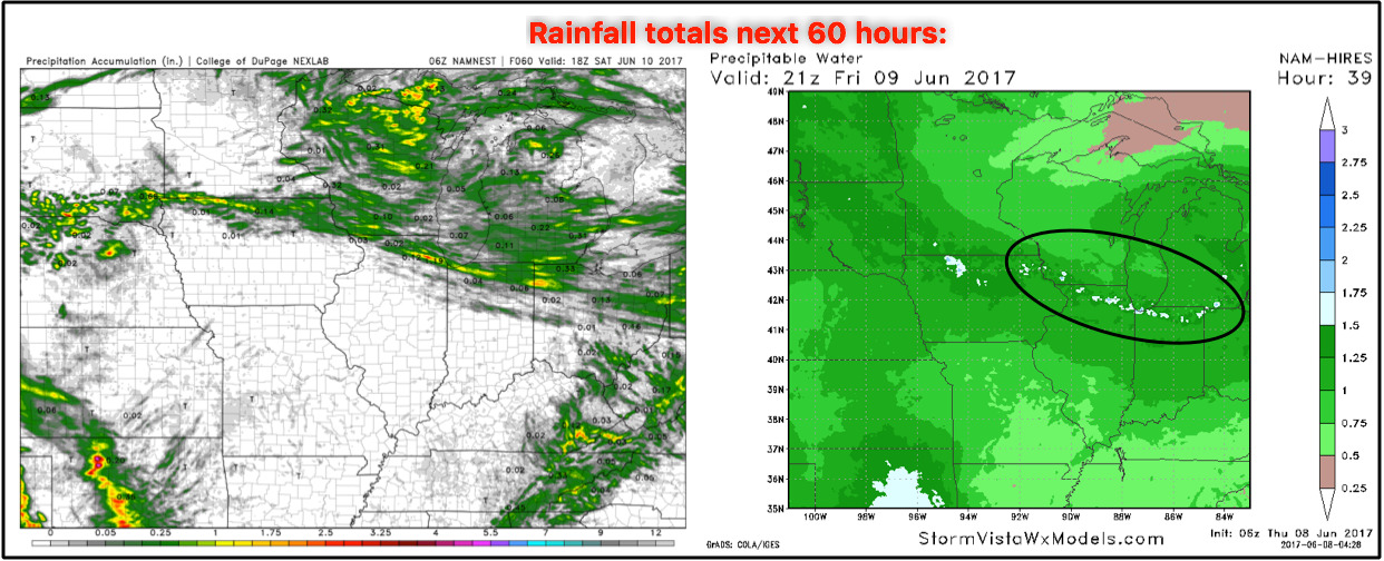
Total rainfall over the next 60 hours…lower confidence on this, but it’s not out of the questions we see spotty 0.5-1.0″ amounts where the storms development later Friday given the relatively high PWATs (precipitable water values).
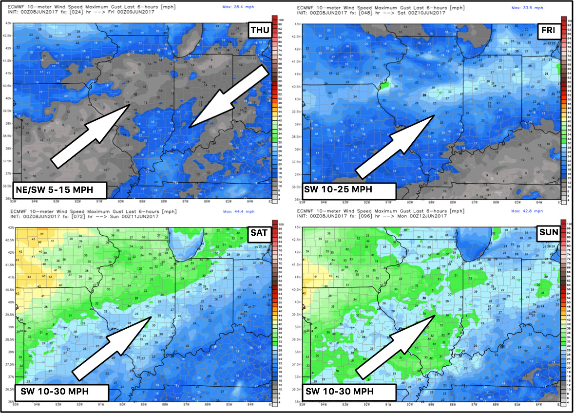
Winds over the next 4 days…a little breeze into the weekend.
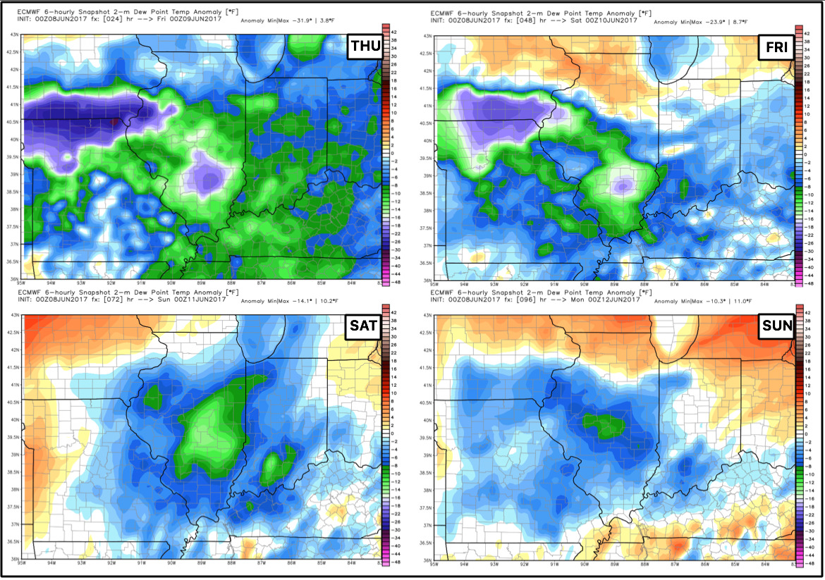
Dew points from normal next 4 days…very comfortable today, dew points increase into the weekend.
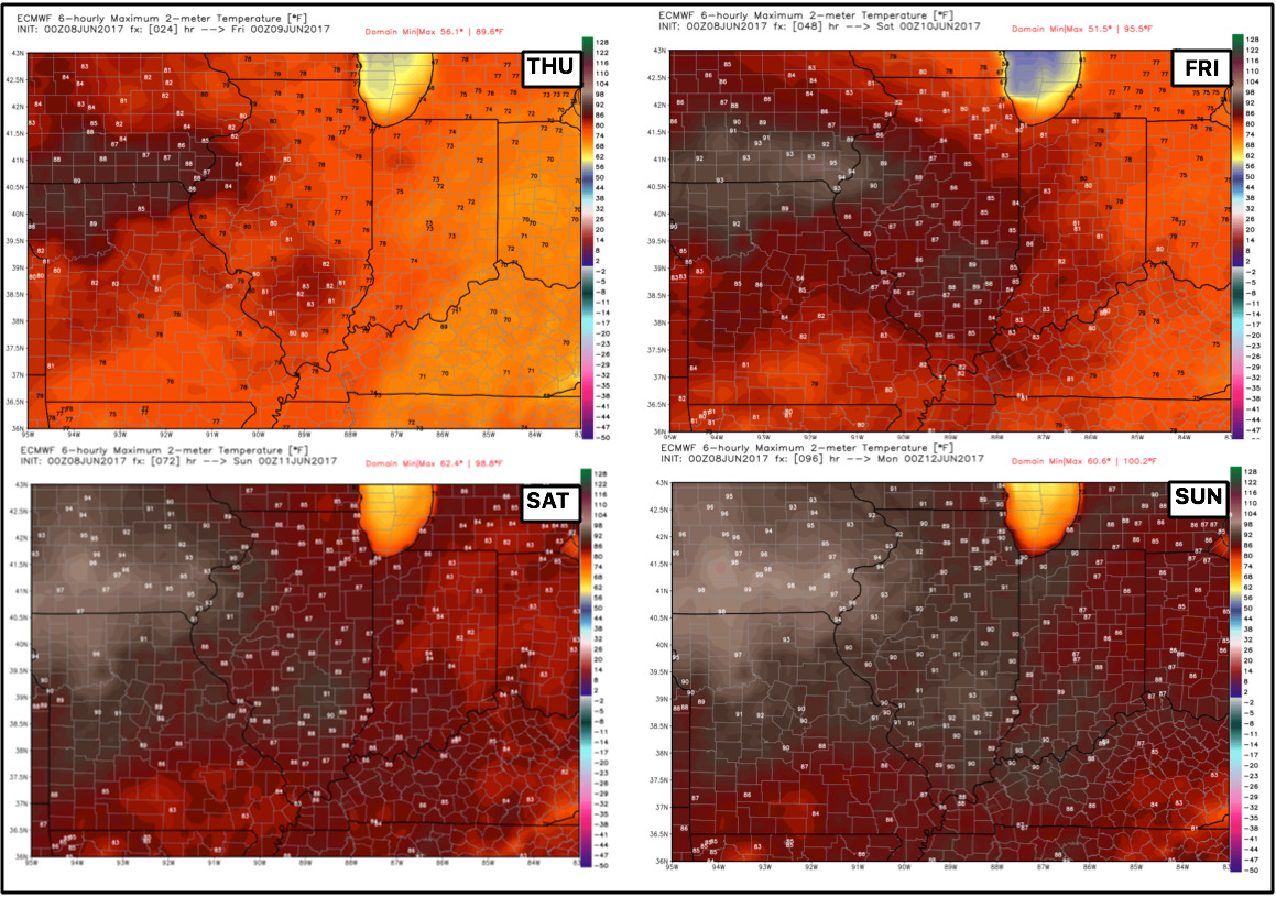
Temps next 4 days…widespread 90s by Sunday especially west.
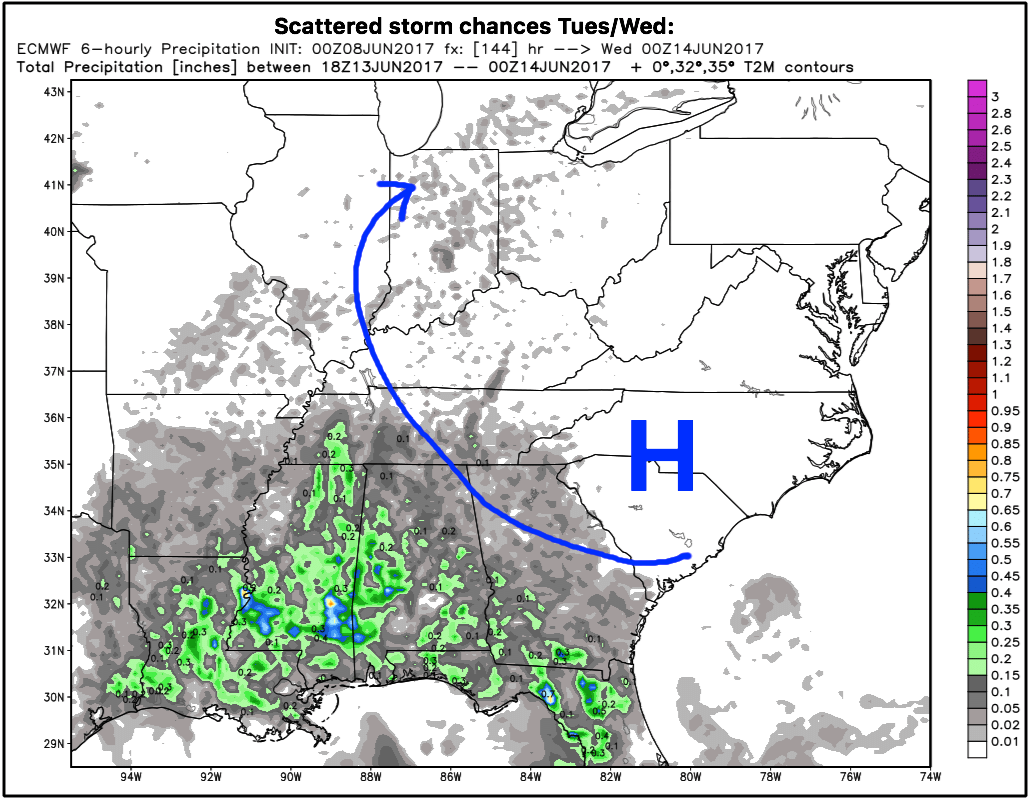
It’ll be a sunny, dry and warm weekend into Monday, no real chances of precipitation to discuss. It’s getting into Tuesday and beyond next week where we start to see more chances for storms and rainfall increase. We discuss the “why” in the video, but we get that return flow from the high pressure across the southeast, which ushers in moisture into the Midwest.
Need to continue to watch for a bigger system to move through ~15th, which is next Thursday across the Midwest from west to east…this has been on of our targeted dates for quite some time.
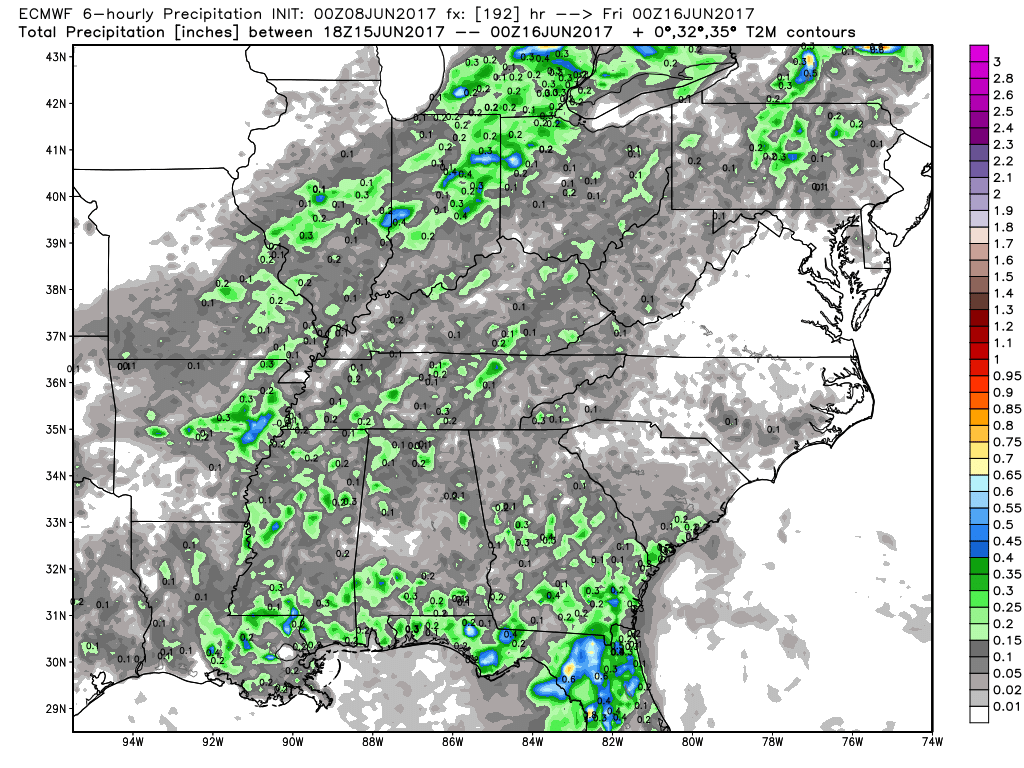
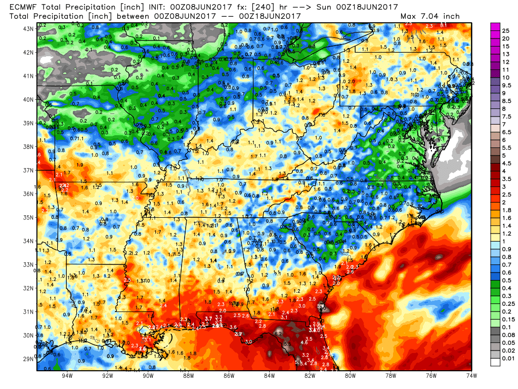
Total rainfall next 10 days from the European, it’s the haves and have-nots, folks, not everyone sees rain, others may see an inch or so…just the pattern we are in right now.
Confidence:
- Average confidence a few spotty showers work their way southeast this afternoon/evening into the Midwest…most areas stay dry and sunny.
- Average confidence of a scattered storm threat across the northern Midwest before working out of the zones east early Saturday morning.
- Above average confidence of a very warm and sunny weekend ahead into Monday…highs in the upper 80s to lower 90s possible.
- Increasing confidence of scattered storms Tues/Wed next week as we get in on some moisture return from the high pressure to the south and east.
Video (7 min):