Key Points – Friday, July 14, 2017:
Synopsis: Good Friday morning! Once this stalled out stationary boundary gets out of here to the south and east we will usher in much nice, more comfortable conditions across the Ohio Valley through Saturday…have to watch for a fog threat Saturday morning as well from all of the moisture we’ve received lately. In terms of the pattern next week, first wave we target it Sunday night into early Monday there’s a shortwave coming through from north to south…can’t rule out an isolated strong storm as well. Beyond this, a couple of things happen: we think it gets warmer and we also see multiple disturbances swinging through from west to east. All the details in the video, if you have any questions please let us know! Have a blessed weekend!
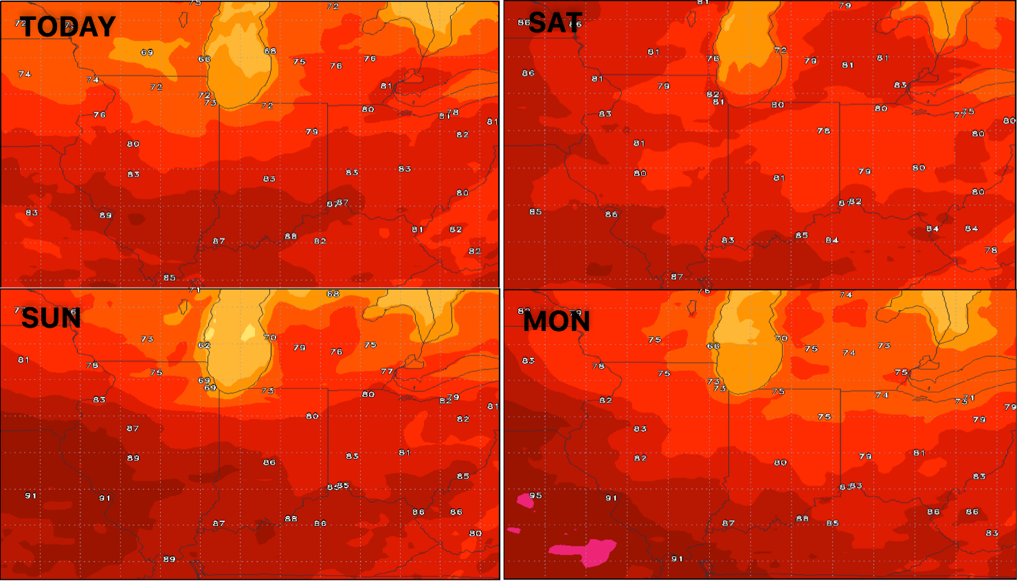
Temperatures next 4 days:
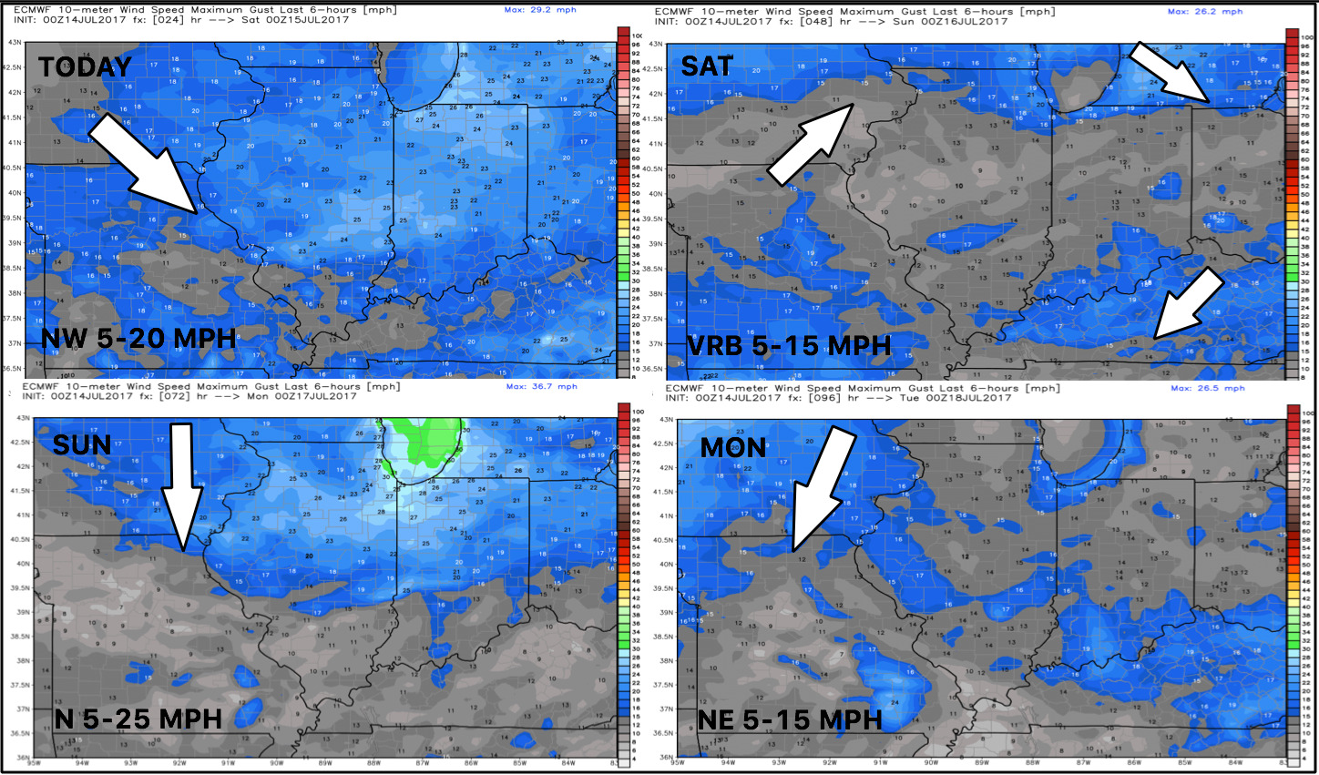
Wind forecast into early next week…not much wind to be had under higher pressure:
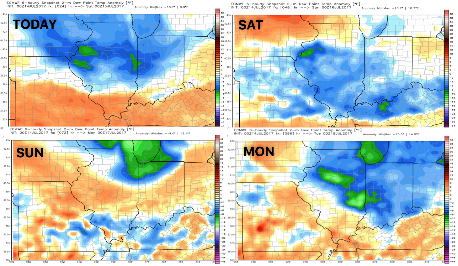
Dew points from normal…pleasant relief as the front slides to the east today into Saturday:
Video (6:30 min):