Key Points – Monday, June 12, 2017:
Synopsis: Good Monday morning! The pattern is about to turn active as we head into the second half of June here. Several storm chances start to evolve this week, with a storm chance basically every day through the weekend. It’ll be quite warm and humid as well, with many seeing upper 80s to lower 90s especially west. Have a blessed week!
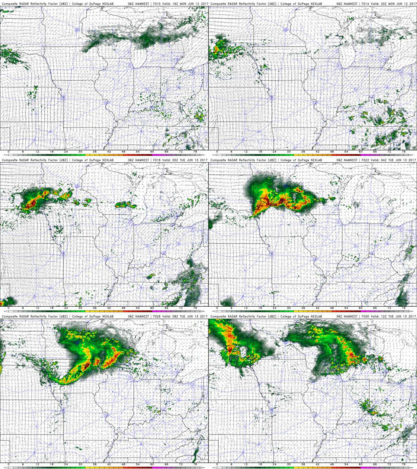
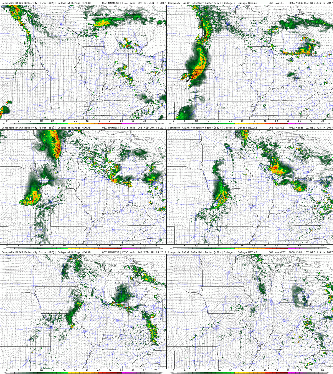
Very small chance for a pop up storm today ~10-20% exists, watching for scattered storms to linger across southern IN and southern OH later tonight through Tuesday morning as well.
On the day on Tuesday into Wednesday more “pulse” storms will be possible through the heating of the day ~30/40% coverage. Also of note is a cluster of storms across northern IN, southern MI and northwest OH into early Wednesday morning.
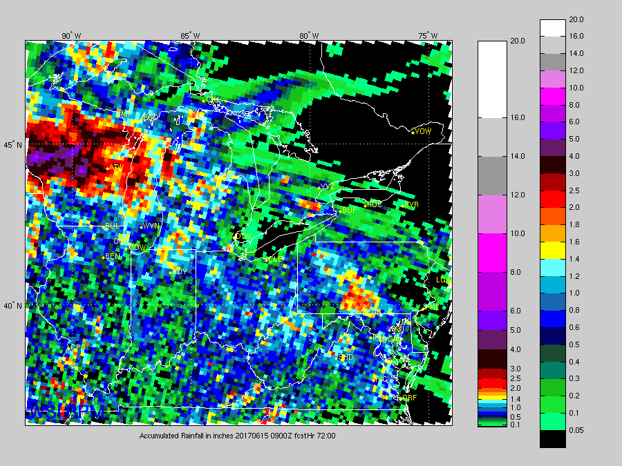
Total rainfall next 3 days…still hit or miss, some locations get 1-2″ and others may not get any at all.
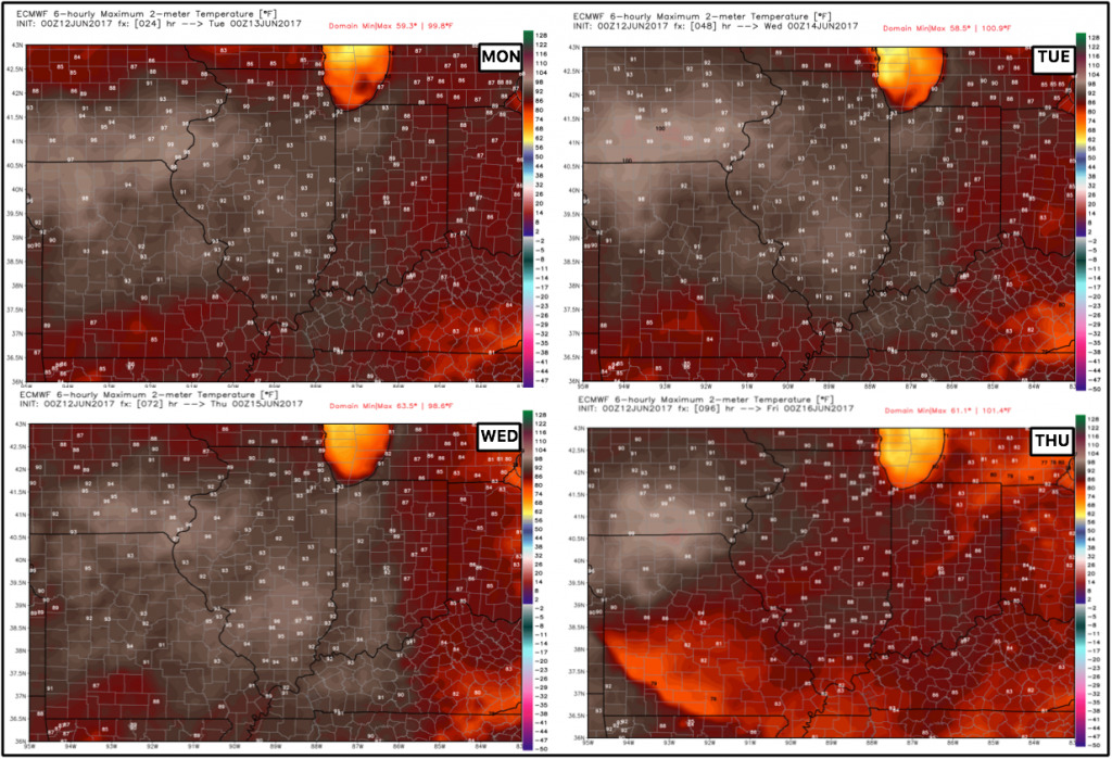
Temperatures next 4 days…very warm, especially the further west you are located:
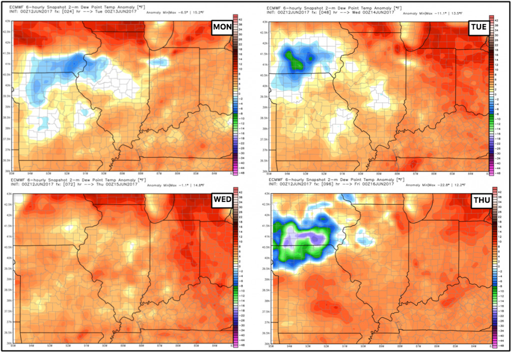
Dew points from normal over the next 4 days…overall it’ll be quite humid across the Midwest:
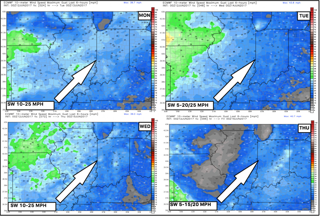
Winds next 4 days, with the focus of the stronger wind gusts further west out of the southwest:
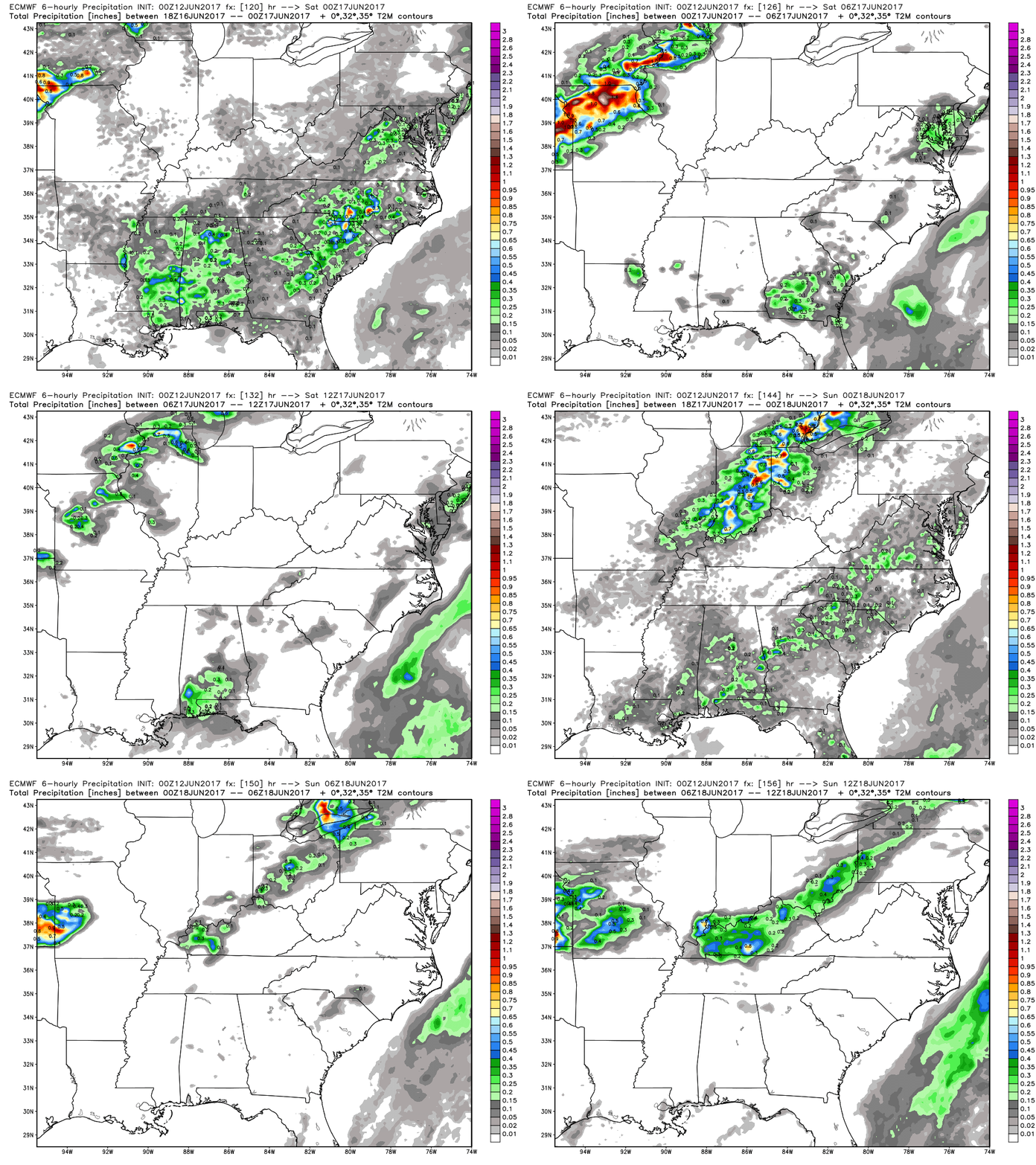
Next more robust, widespread rainfall chance moves in this coming weekend from west to east as a frontal boundary swings through:
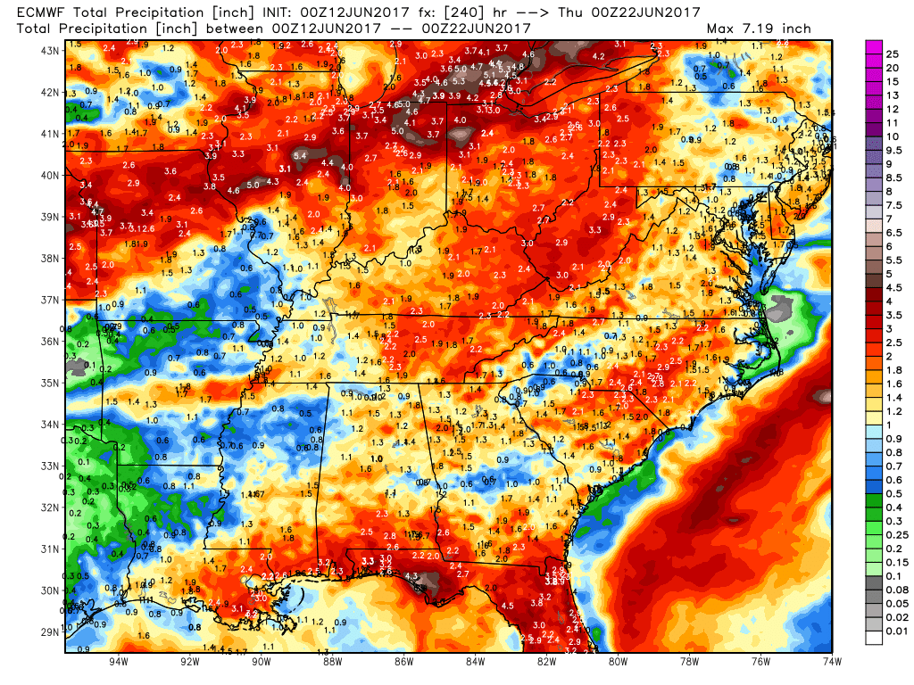
10-day rainfall total from the European is impressive with a widespread swath of 2″+…like we mentioned, the pattern starts to ramp up this week and beyond.
Confidence:
- Average confidence of pulse storms possible over the next 3 days across the Midwest…very hit or miss in nature.
- High confidence of above normal continues through the next week…humid too.
- Increasing confidence of a more robust rain chance from west to east this week as a frontal boundary swings through.
Video (6:40 min):
