Key Points – Wednesday, June 7, 2017:
Synopsis: Good Wednesday morning! Very spotty showers possible across parts of Indiana/Ohio today, otherwise we are largely dry through Thursday and comfortable. Friday into Saturday morning we have an isolated shower/storm threat across the Midwest. We start a warm and dry trend through Saturday into early next week…also, we need to be on alert for our first 90º degree day for many locations this weekend as well. In the video we discuss a more active pattern than we are currently in looks to return Tuesday/Wednesday of next week, but overall we see a quiet stretch of weather into early next week. Have a blessed day!
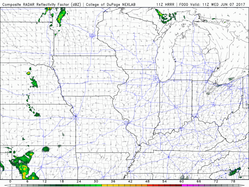
Some very spotty showers across parts of Indiana and Ohio today, coverage is around 20%.
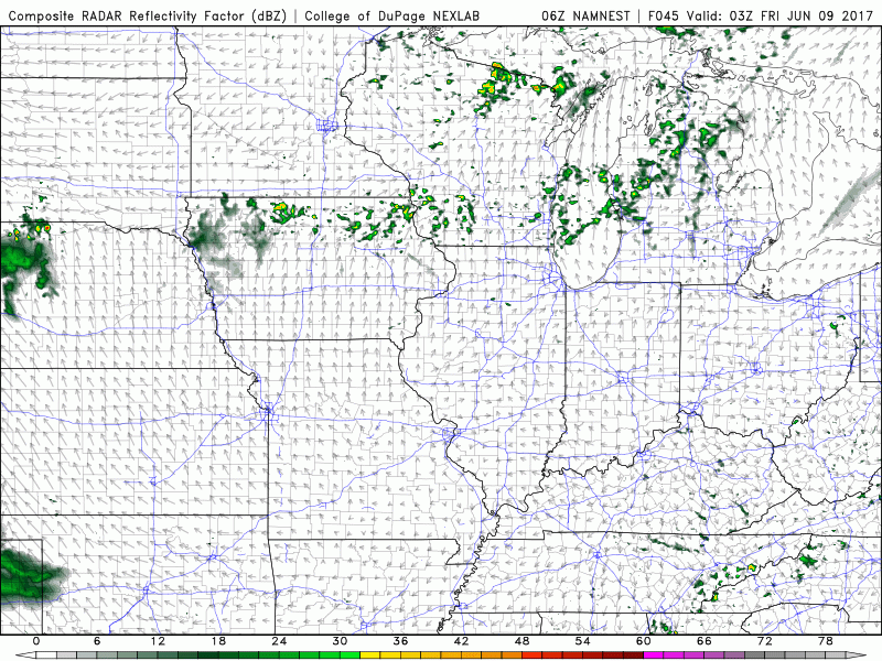
We stay dry and comfortable on the day on Thursday, it’s getting into Friday morning and on the day on Friday we need watch for some scattered showers and storms ~20-30% across northern Illinois, northern Indiana into northwest Ohio. These could sag south a bit, a trend we need to watch.
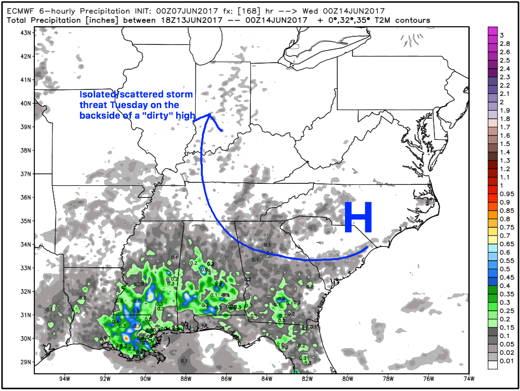
We start a warming trend through the weekend, won’t be shocked if by Sunday we see multiple reports of 90º across the Midwest with plentiful sunshine expected through Monday. High pressure situates itself across the southeast early next week (this is what we like to call a “dirty high”), so we feel some scattered storms are possible Tuesday afternoon getting a return flow of moisture on the backside of that high pressure.
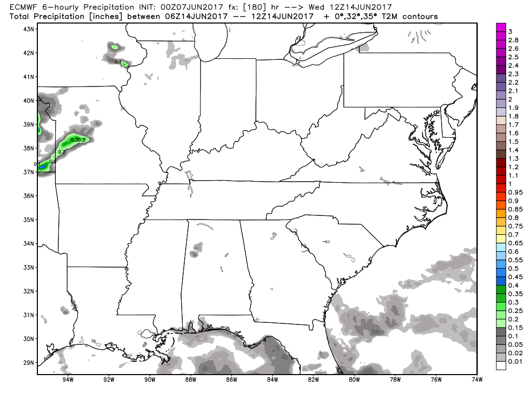
We mentioned in the video how mid to late next week looks to become more active in the precipitation department, we are watching for a couple of disturbances to move into the Midwest Wednesday and beyond for more of a widespread shower/storm threat. Need to watch how the details unfold as we get closer, stay tuned on this.
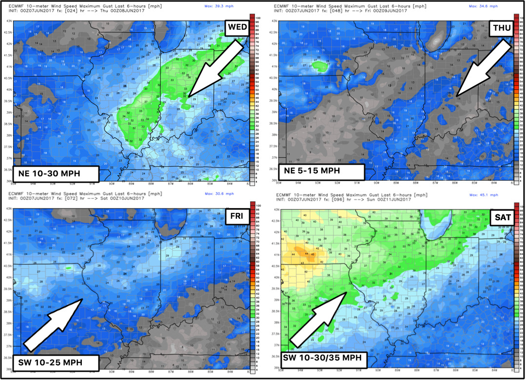
Wind forecast next 4 days…a bit breeze today, more calm Thursday and then winds start to pick up Friday into Saturday.
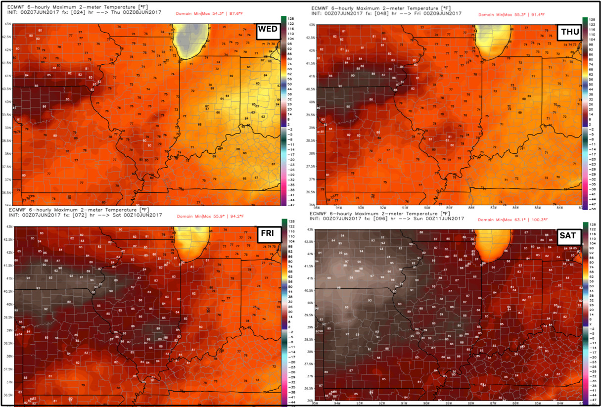
Temps next 4 days…we start a warming trend each day, and as we get into the weekend we need to be on alert for many locations getting near 90º especially by Sunday.
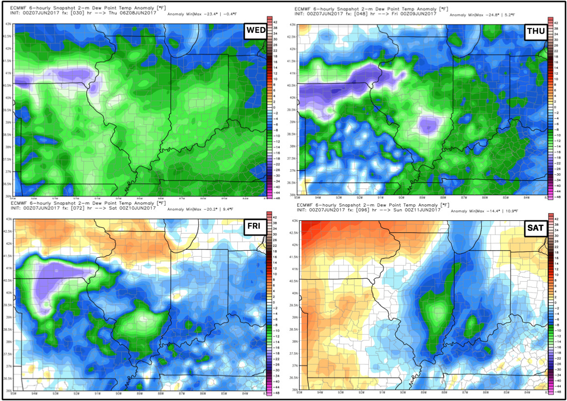
Dew point anomalies next 4 days…overall, cooler and comfortable through Friday, it’s Saturday into early next week where things get a little bit more “sticky” with higher dew points expected.
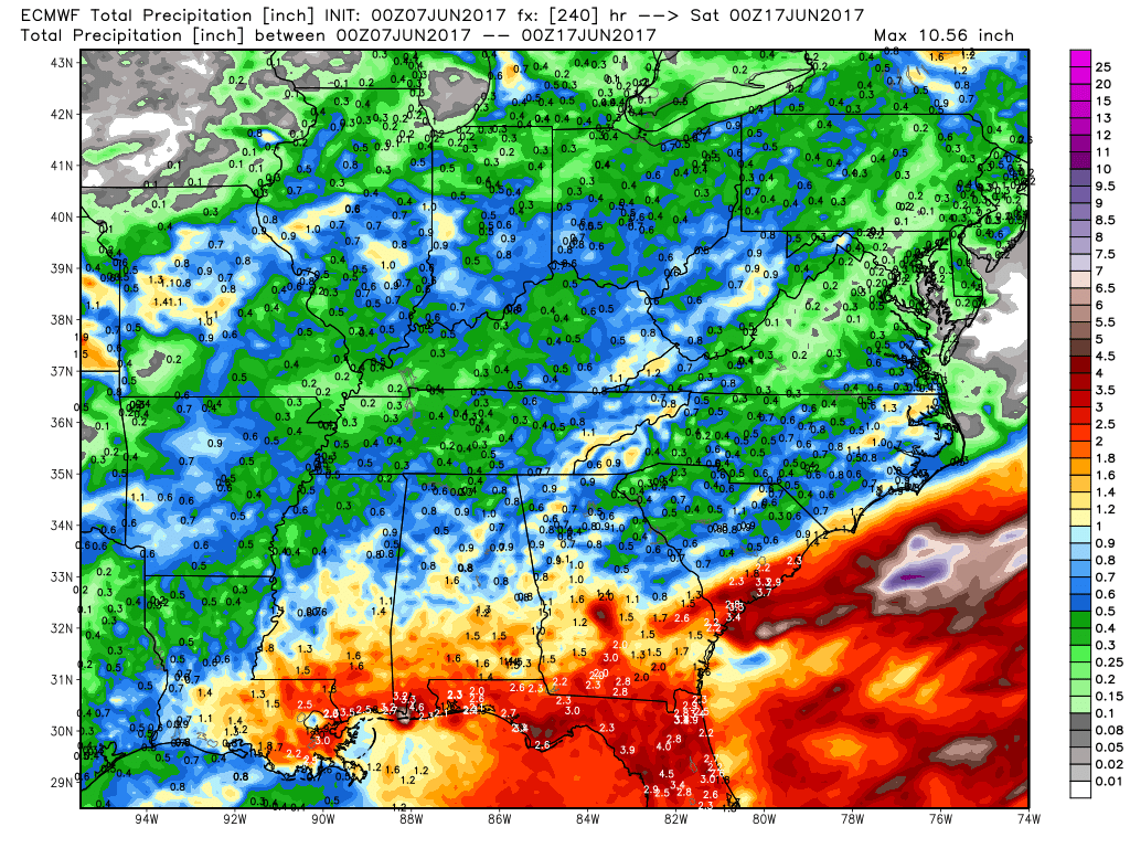
Here’s the 10-day precipitation from the European, nearly all of this rain comes 7 days and beyond next week, but it’s good to see the pattern get a little more active again.
Confidence:
- Average confidence of some spotty showers across parts of IN/OH today.
- Average confidence of isolated showers/storms on the day on Friday across the northern parts of the Midwest.
- Above average confidence we are overall drier than normal through early next week.
- Above average confidence we start a warming trend through the weekend, with 90s possible by late weekend/early next week.
- Below average confidence on the rain chances mid next week and beyond…need to watch as new data unfolds.
Video (7 min):