Key Points – Tuesday, June 13, 2017:
Synopsis: Good Tuesday morning! Today we discuss the chance for “pulse” storms with the heating of the day, it’ll be warm again with temps in the upper 80s to lower 90s and humid. In the video we discuss the additional heavy rainfall/strong storm risks over the next 2-3 days along with continued warmth and humid conditions persisting. However, a cooler regime looms this weekend into next week…details in the video. Have a blessed day!
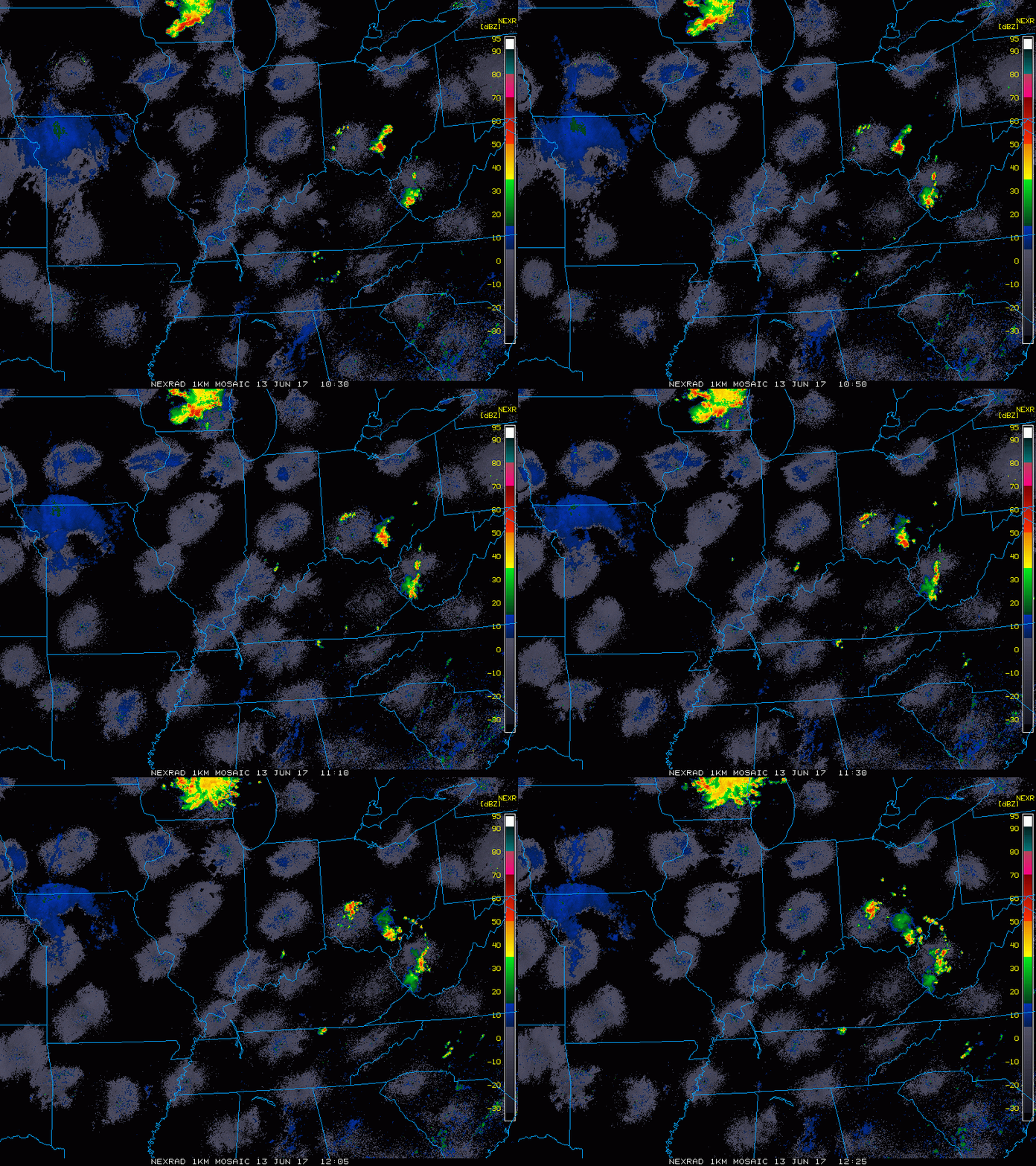
Current Radar:
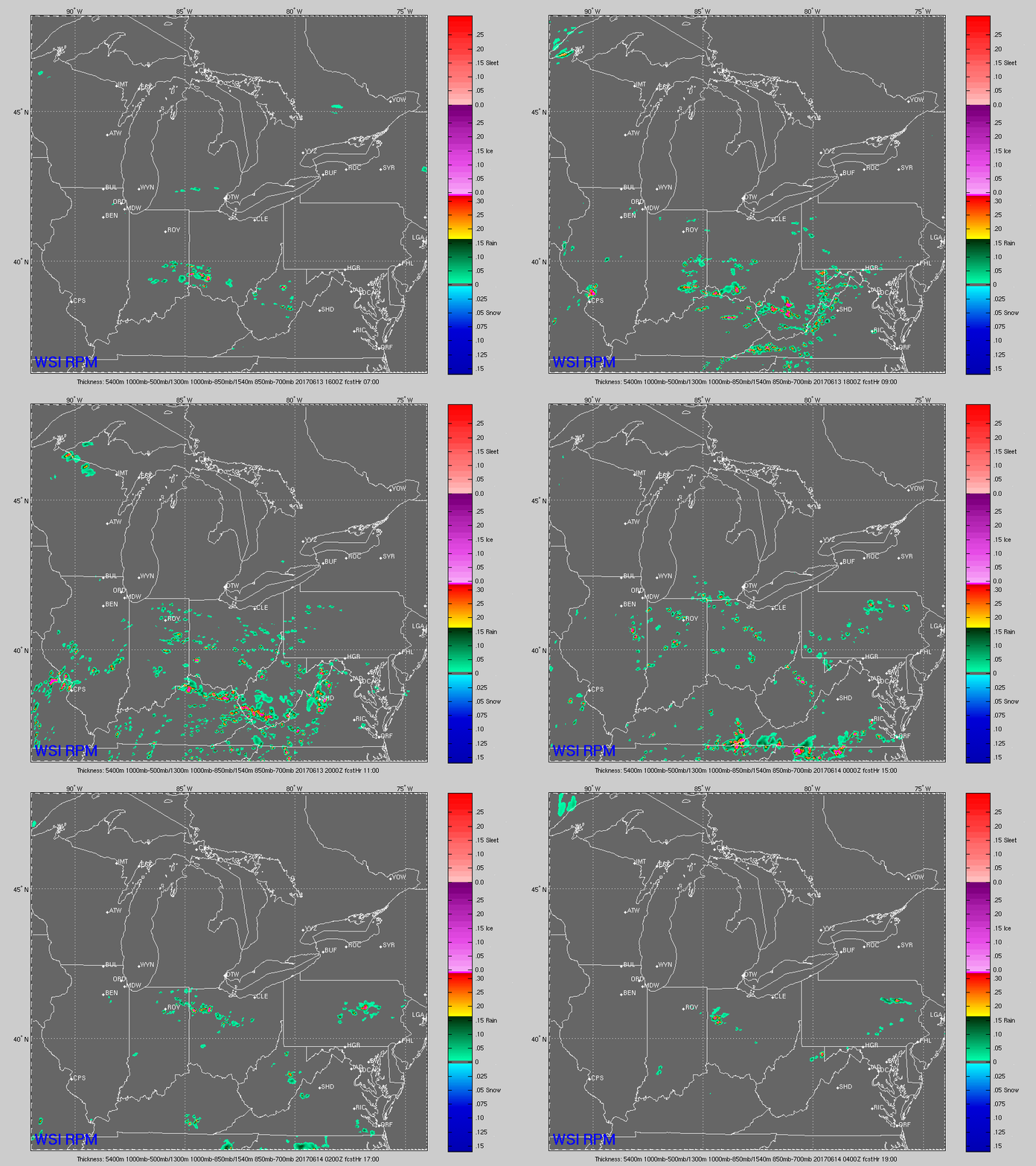
Simulated Radar…getting to ~4-5pm with a coverage around 40% seeing storms starting to pop…very difficult to pinpoint exactly where, but some heavy, localized rainfall will be possible in a short amount of time. These likely fade away as the sun starts to set.
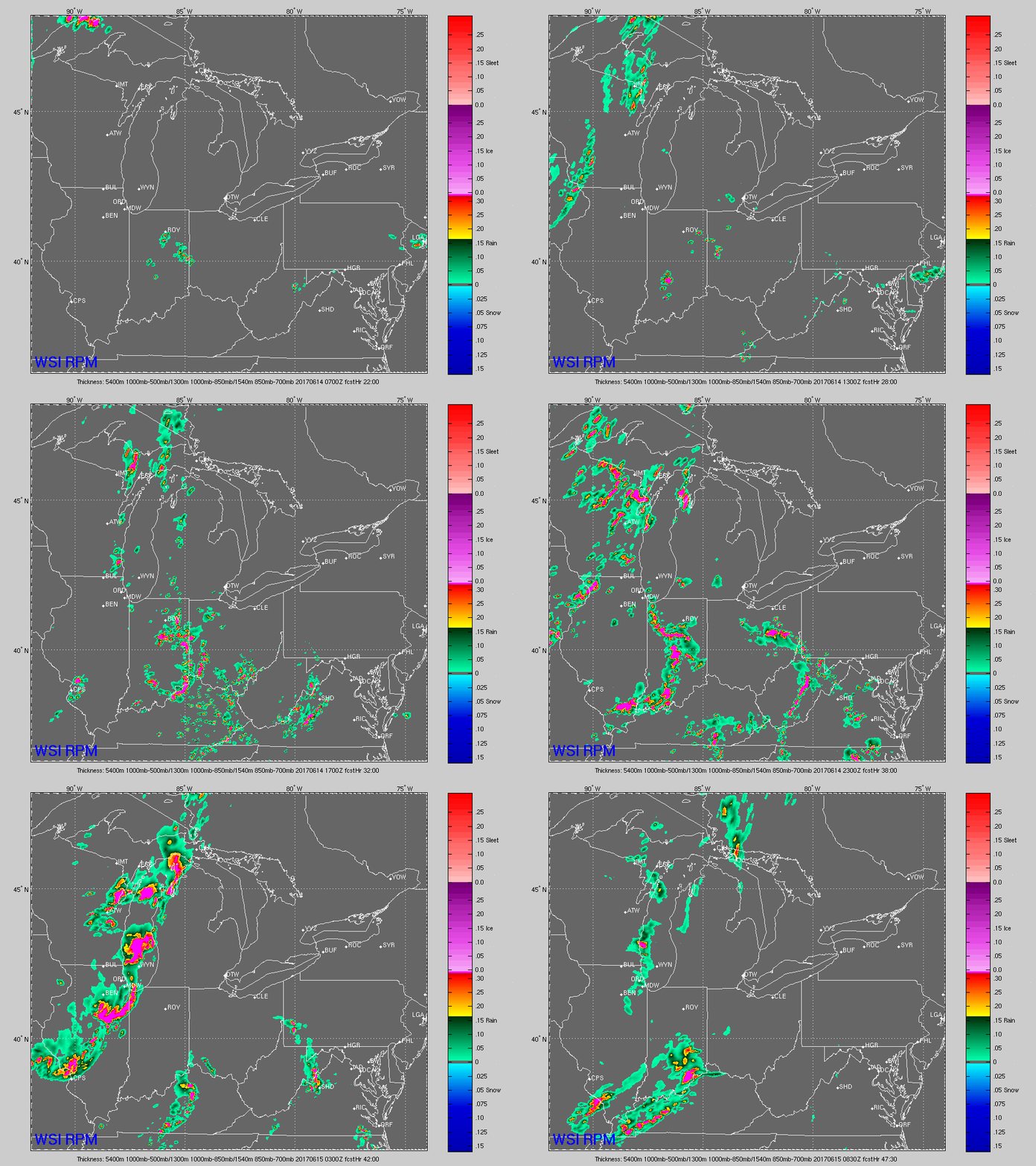
Residual boundaries look to hang around early Wednesday morning, seeing this possible across parts of Indiana and Ohio locations…coverage ~30/40%. By 2pm and beyond, storm coverage intensifies across the Midwest, additional localized very heavy rainfall and isolated strong storms will be possible.
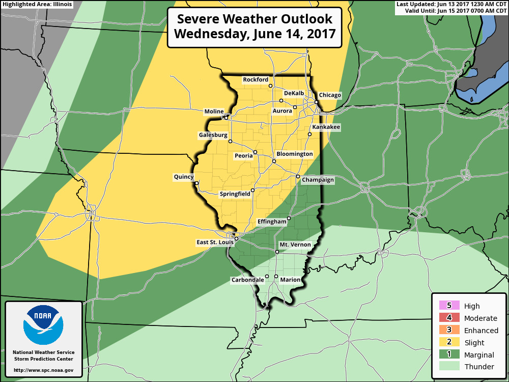
Strong storm risk for Wednesday…definitely feel this slight risk needs to be pulled further east across Indiana and Ohio. Main risk will be damaging winds, very heavy rainfall and isolated large hail.
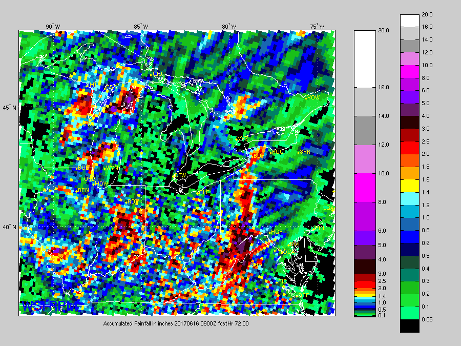
Rainfall totals next 2-3 days…as mentioned above, very heavy, localized rainfall will be possible…wouldn’t be shocked for some locations to get 4″+ here. But it also needs to be noted, these storms are very difficult to pinpoint an exact location, some spots may get on very little total rainfall.
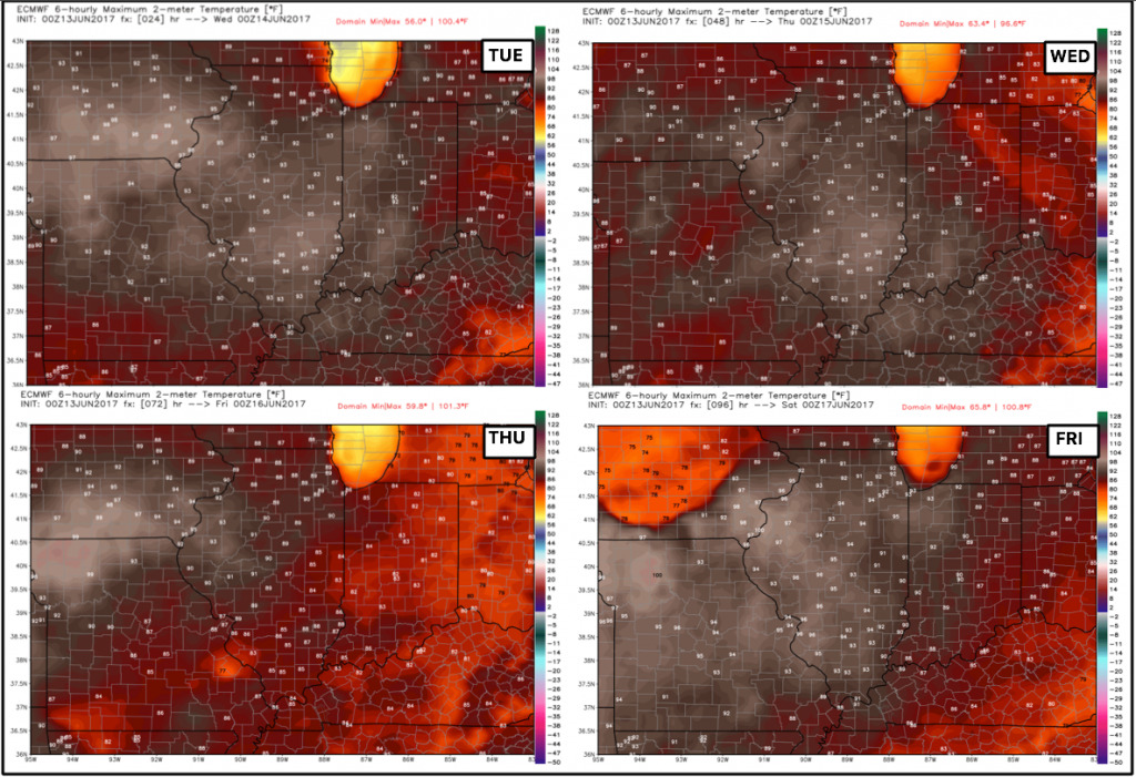
Temperatures next 4 days…very warm pattern continues with widespread 90s possible.
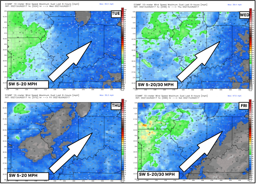
Winds next 4 days…windy more to the west, calmer to the east:
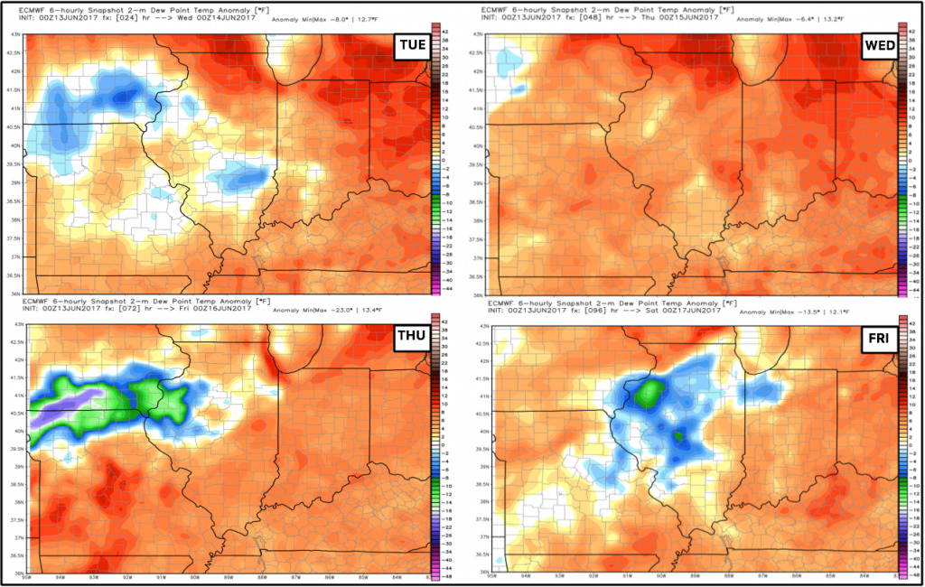
Dew points from normal…the humid conditions will persist overall across the Midwest (the reds and oranges mean higher dew points than normal…aka more humid):
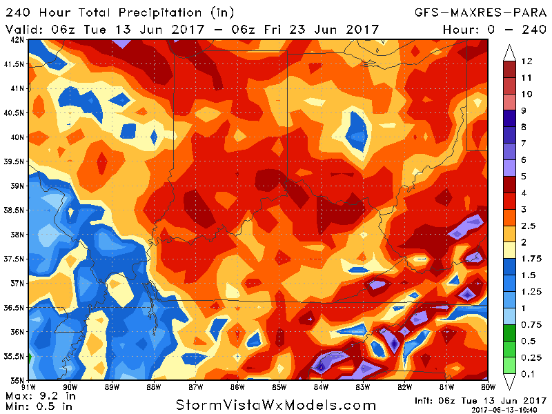
Forecast guidance for rainfall the next 10 days…the overall takeaway here is that the pattern is ramping back up today and beyond providing good opportunities for much needed rains.
Temperatures take a turn to cooler through the weekend into next week as a cooler air masses arrives:
Confidence:
- Average but increasing confidence of pulse storms today and tomorrow with a coverage ~40/50%.
- Average confidence localized heavy rainfall > 2.0″ in some spots will also be possible through Wednesday.
- Above average confidence the pattern stays active through the weekend with multiple storm chances late week into the weekend.
- Increasing confidence the pattern transitions to cooler this weekend into next week as the front passes and a trough starts to dig into the Midwest.
Video (7 min):
