Key Points – Wednesday, July 19, 2017:
Synopsis: Good Wednesday morning! Much needed rains falling across central IL today…but the story is going to be the heat through the weekend, it’ll be the hottest week since summer 2013! We continue to see overnight lows forecasted in the mid to upper 70s, even lower 80s are on the able for western locations, not good for the crops this time of year (although there will be a little wind around). Isolated storms possible today with the heating of the day, the real focus will be to the north and west overnight because we are under the impression the storm cluster could take a southeast dive…can’t rule out a strong storm as well. The majority of the storm coverage will be to the north into the weekend, locations further south especially south of I-70 will stay drier, as the focus of the energy to the north. If you have any questions let us know, have a blessed day!
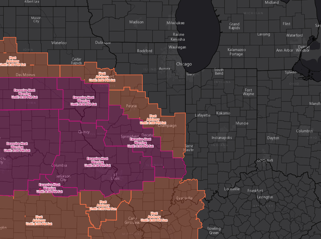
Latest excessive heat advisories/warning through Saturday…likely see these expand further east into IN:
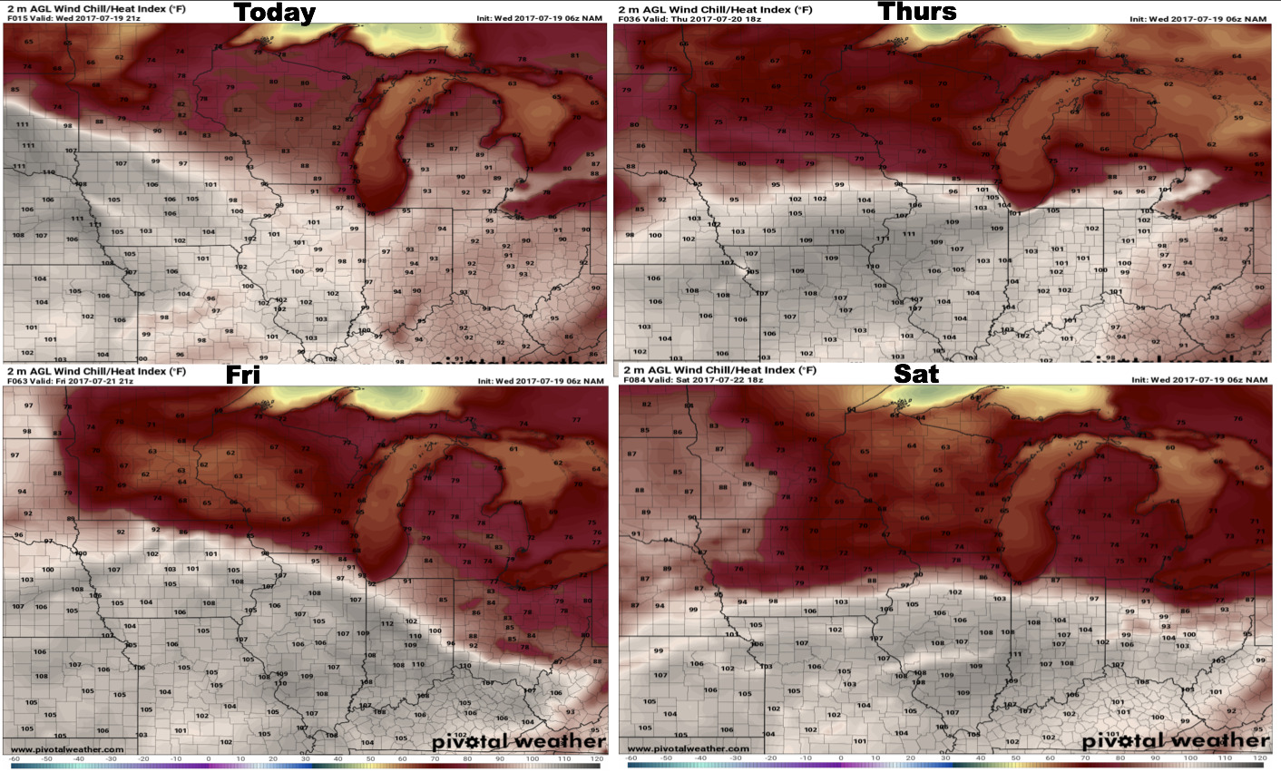
4-panel of heat indices into the weekend…it’s one of the warmest weeks since summer of 2013 with heat indices forecasted above 100 over the next 4 days!
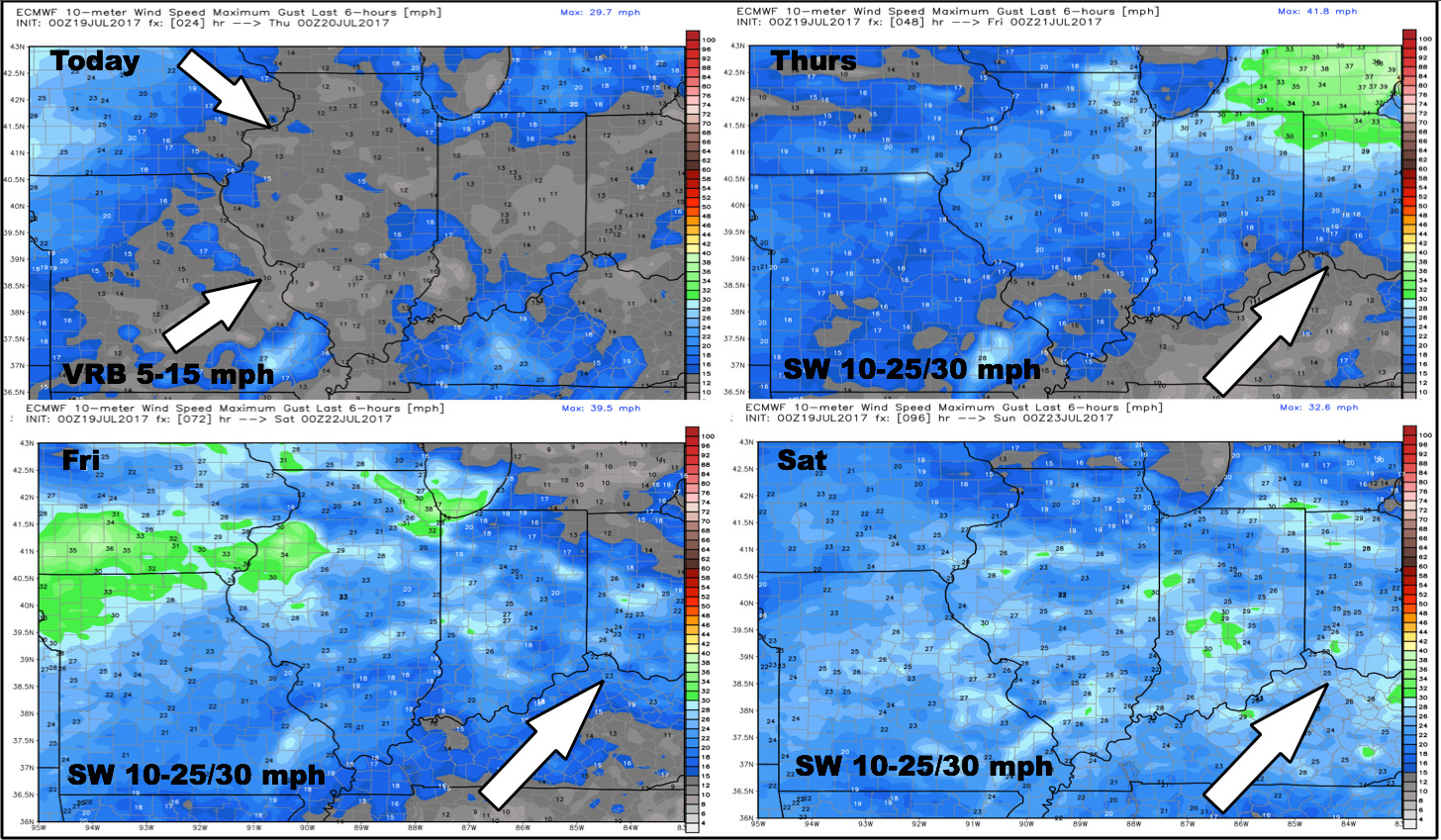
Latest wind forecast through the weekend…winds pick up Sat/Sun:
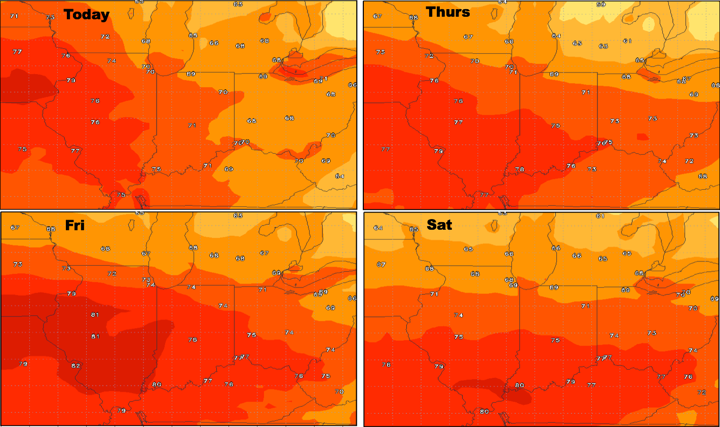
High temperatures over the next 4 days will be quite warm:
Overnight lows will continue to be elevated:
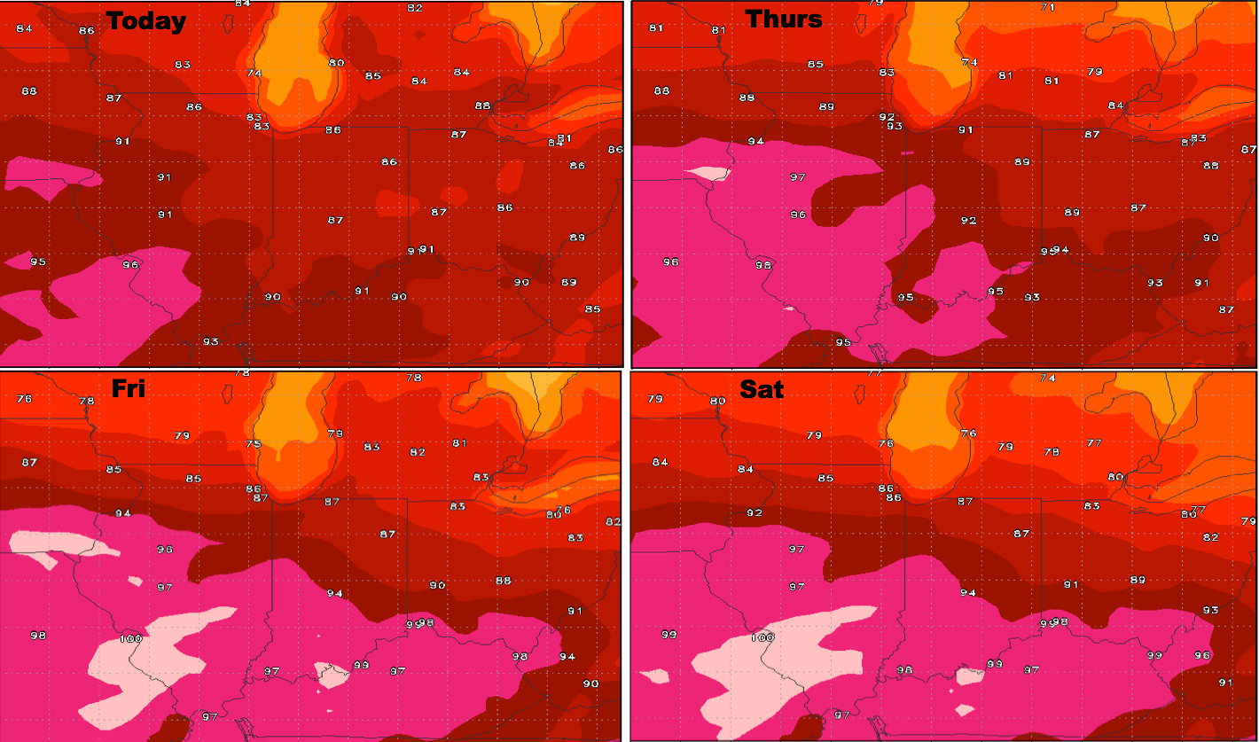
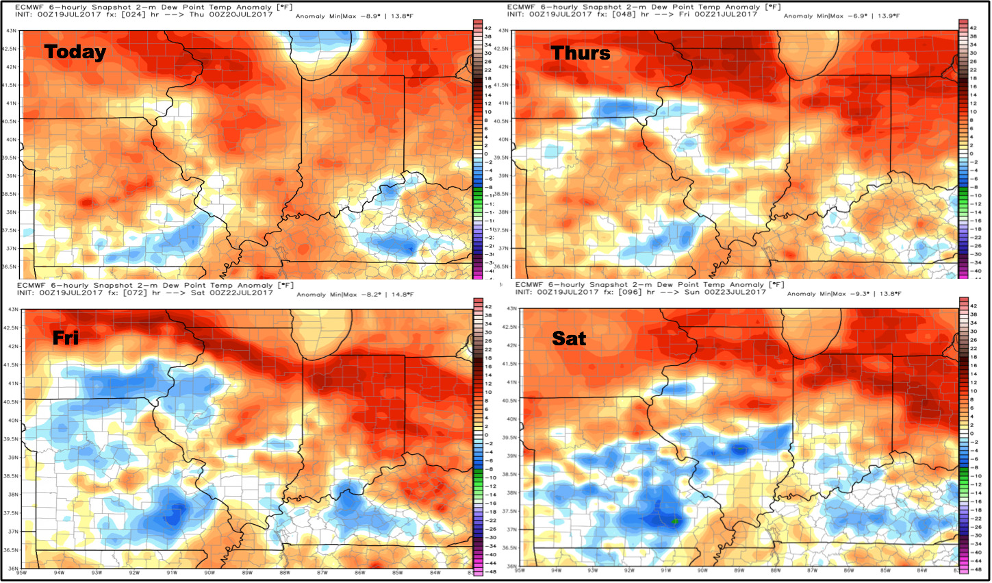
Dew points from normal guidance:
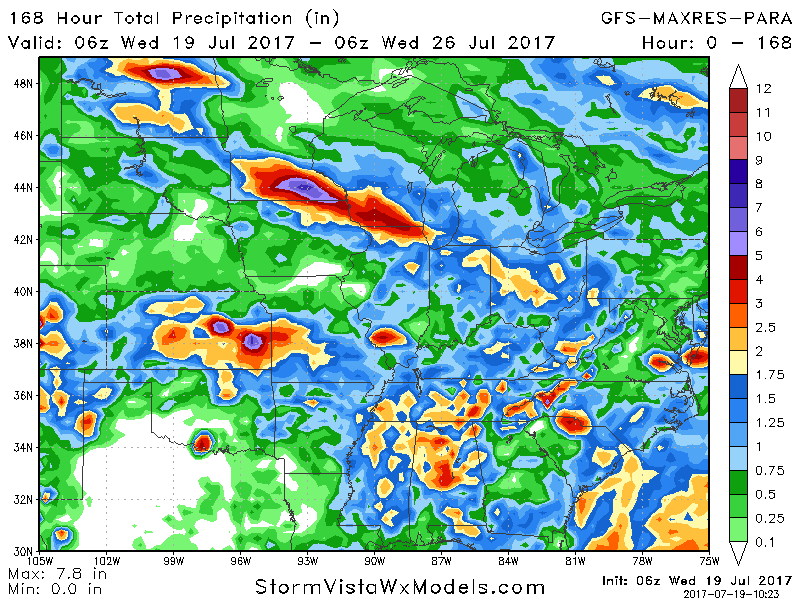
Latest rainfall guidance next 7 days…the focus for rainfall will be I-70 north overall for rainfall, with the highest focus across the northern third of the Ohio Valley where 1-3″ and isolated higher amounts possible.
Confidence:
- High confidence it’ll be one of the warmest weeks of the year, actually, one of the warmest weeks since summer 2013!
- Slightly above average confidence the storm cluster will move southeast into the northern Ohio Valley overnight into Thursday morning.
- Average confidence we see additional storm chances as we head into the weekend, focused north of I-70.
- Increasing confidence we turn cooler into next week.
Video (5:40 min):