Key Points – Monday, July 17, 2017:
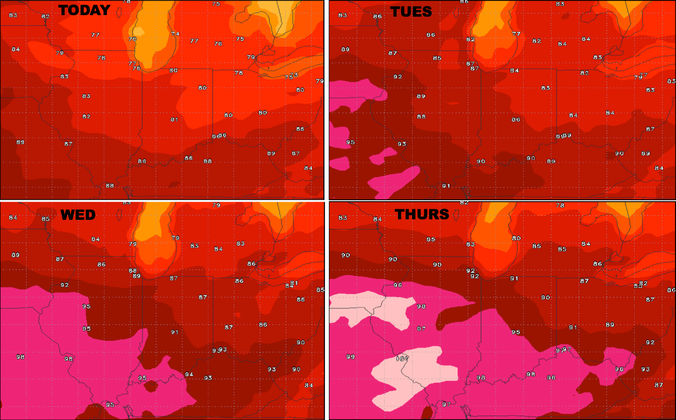
Synopsis: Good Monday morning! We think this week has potential to be the hottest week of the summer as the ridge finally flexes east for a short duration. A small 20/30% chance for isolated storms today especially across the western half of the Ohio Valley today, but next real chance won’t move into the area until Wednesday morning especially north, and Wednesday evening into Thursday morning. Getting into the weekend, Friday night into Saturday morning we are watching for a more organized and widespread rain threat and another on Sunday. The focus of the rain will be across northern half Illinois, Indiana and Ohio over the next 10 days as the flow will be from the northwest to southeast in orientation. If you have any questions please let us know, have a blessed week!
Temperature forecast into late week:
Wind forecast next 4 days:

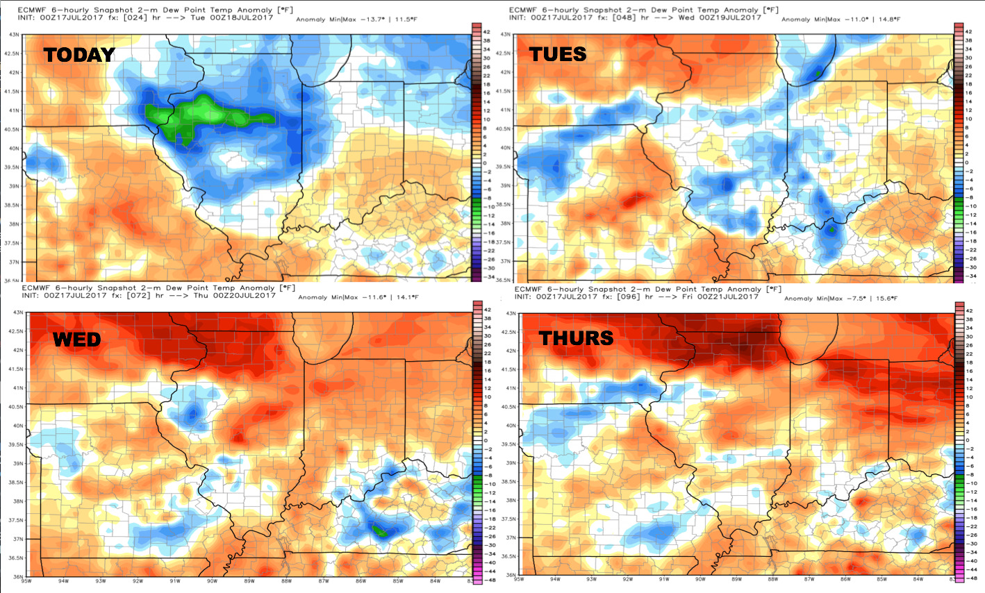
Dew points from normal…humidity grows into mid-week:
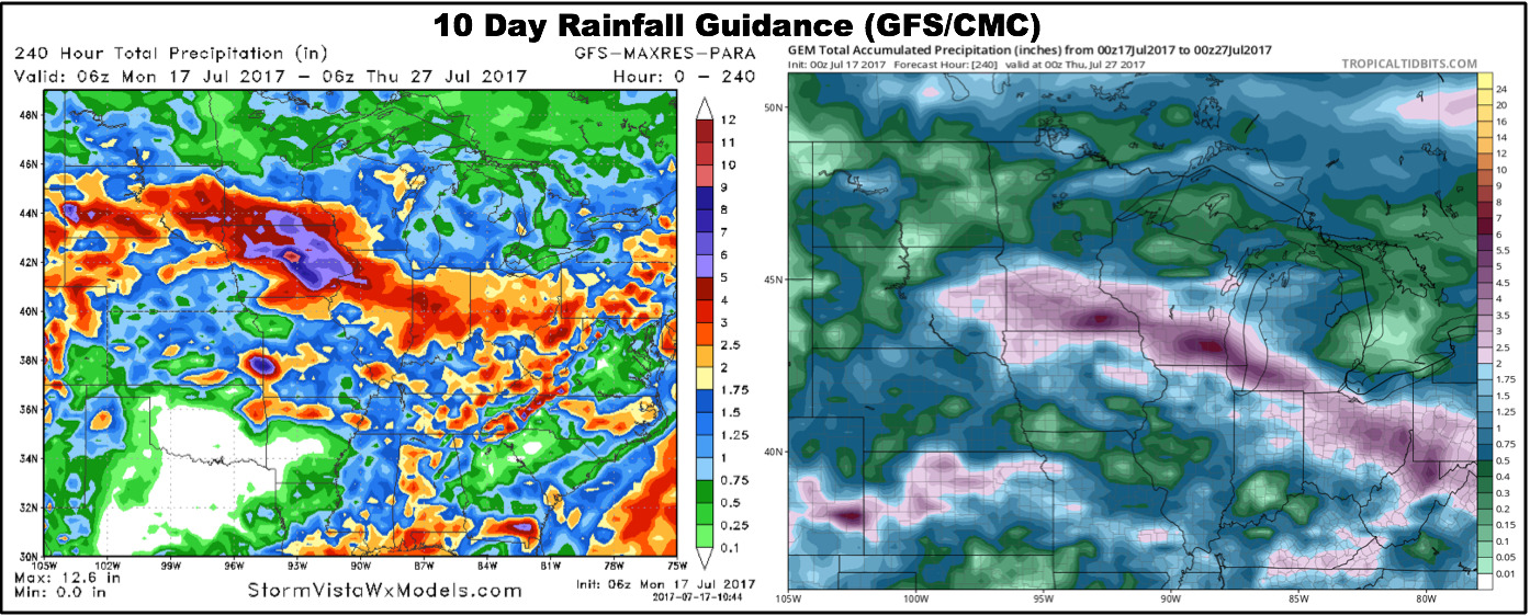
Rainfall guidance next 10 days from the GFS/Canadian models…note the northwest to southeast orientation of the rainfall.
Video (6:30 min):