Key Points – Wednesday, June 28, 2017:
Synopsis: Good Wednesday morning! Showers and storms moving across northwestern Illinois this morning which will be the focal point for storms today with the storm threat shifting east into Thursday into Friday for additional strong storms possible. We also discuss in the video the risks for some excessive rainfall, aka flash flooding here as well as we get into late week. We open July with some warmth, all the risks discussed in the video, have a blessed day!
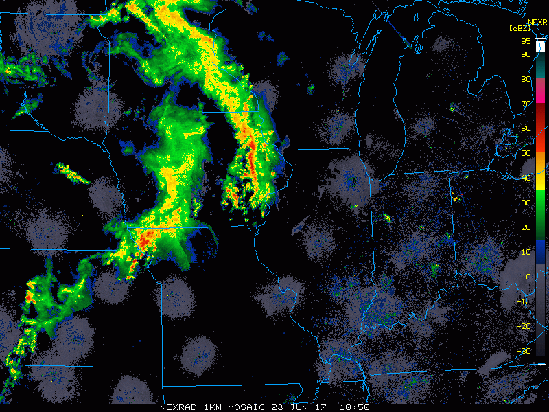
Current Radar:
Strong to severe storm threat over the next 2-3 days:
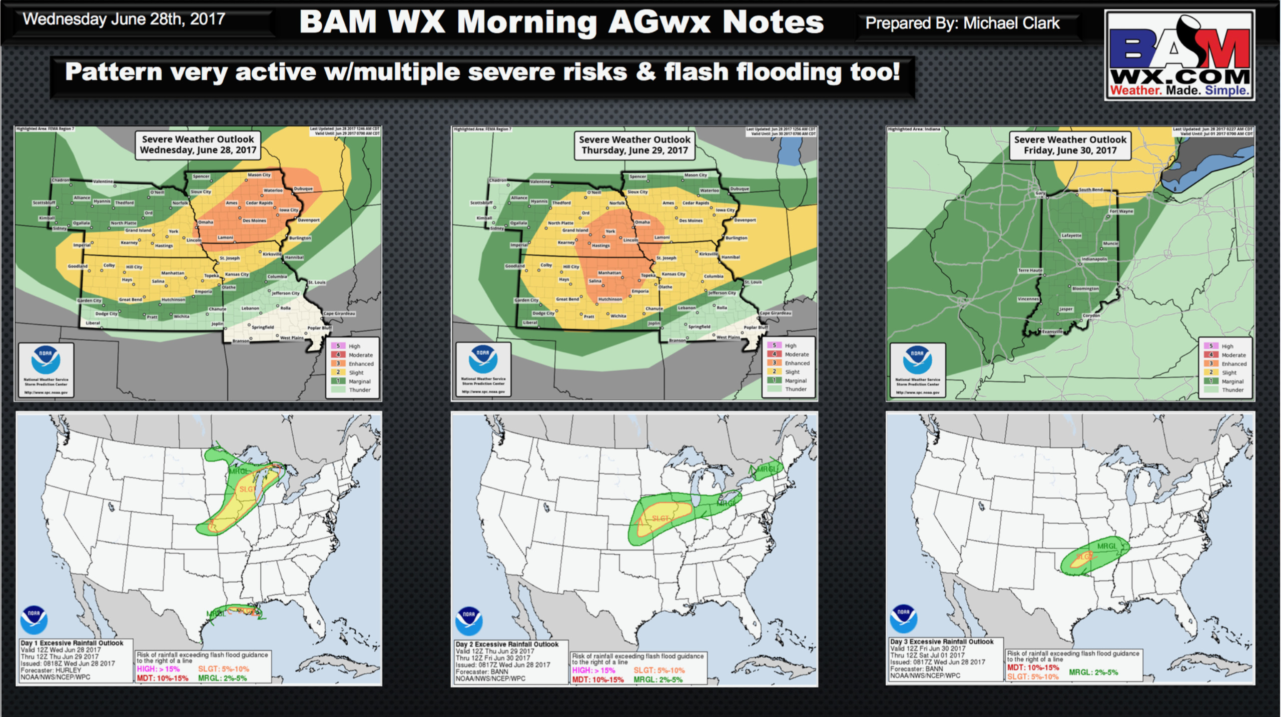
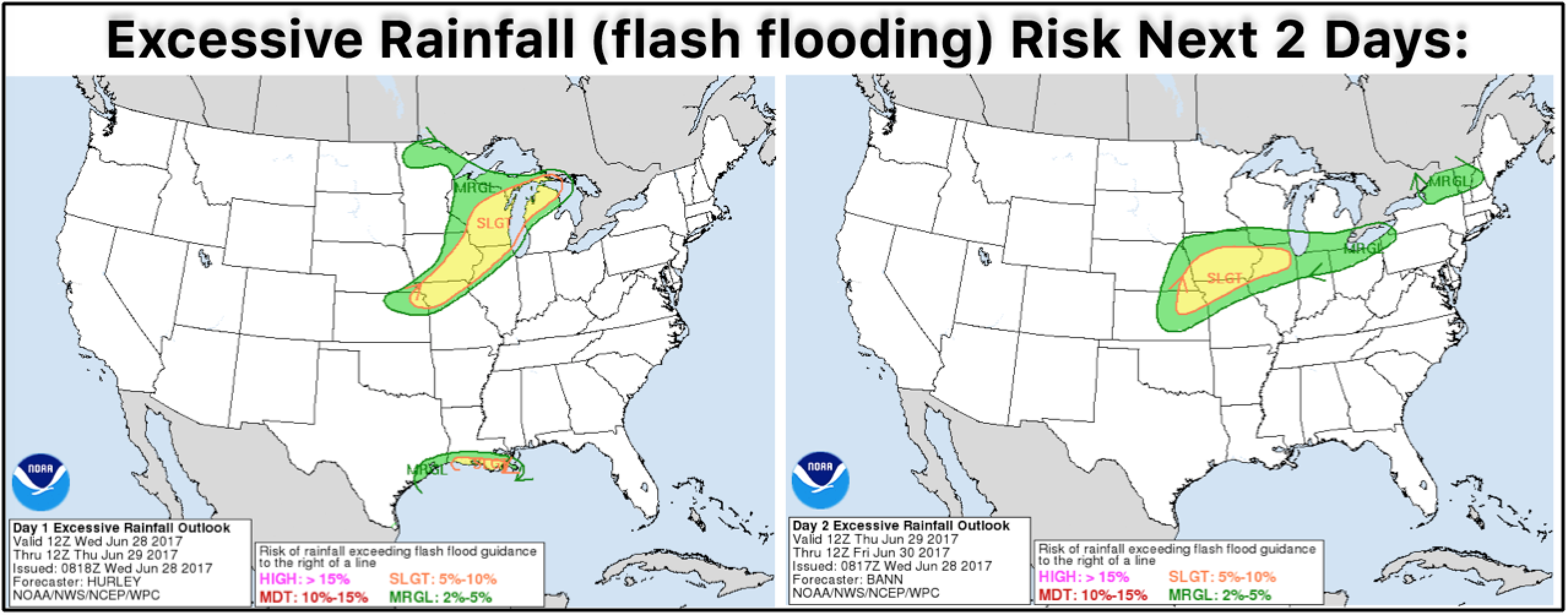
Excessive Rainfall risks exist here as well…aka some flash flooding cannot be ruled out:
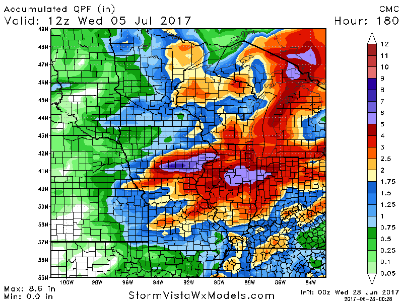
Latest guidance on rainfall over the next 7 days from the Canadian…we have a solid risk for 1-3″ across many locations with isolated higher amounts possible exceeding 4″+.
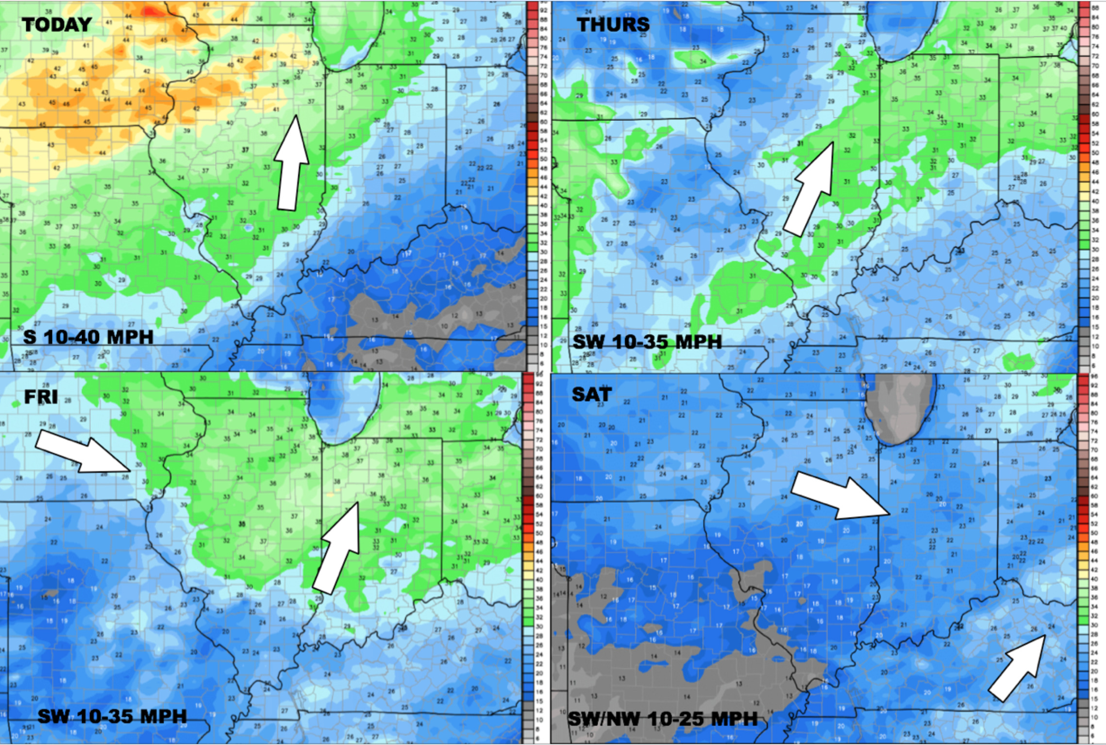
Wind forecast over the next 4 days:
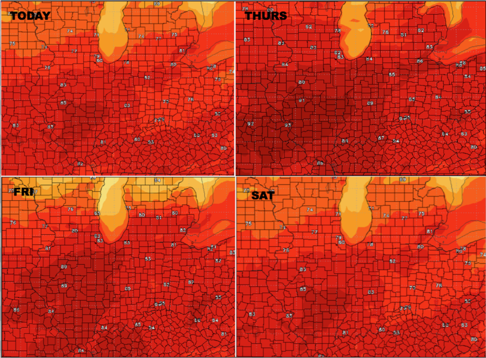
Glance at temperatures over the next 4 days:
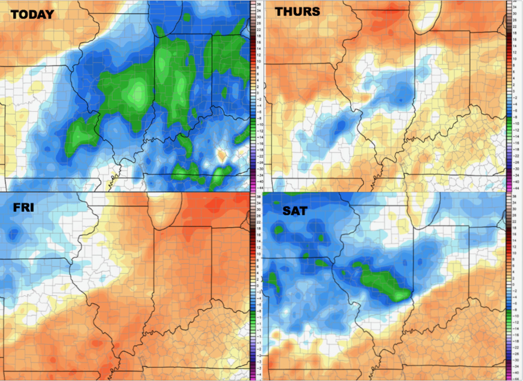
Dew points from normal here as well:
Confidence:
- Average confidence the majority of the storms stay to the north and west today…some being strong.
- Average confidence additional storms, some beings strong push further east into Indiana and Ohio Thursday into Friday.
- Below average confidence on weekend storms, something we need to fine-tune more as we get closer.
- Increasing confidence of warmer temps slowly starting to work into the Midwest as we open July.
Video (6 min):