Key Points – Wednesday, August 2, 2017:
Synopsis: Good Wednesday morning! As we go throughout the day today we watch for additional scattered storm development (can’t rule out an isolated strong storm), it’s getting into Thursday where the marginal risk for strong storms we mentioned yesterday was actually upgraded to a slight risk. As the front passes east a much cooler air mass works its way into the forecast area Friday into the weekend…many locations seeing 70º days into early next week. If you have any questions please let us know!
Today’s video (7 min):
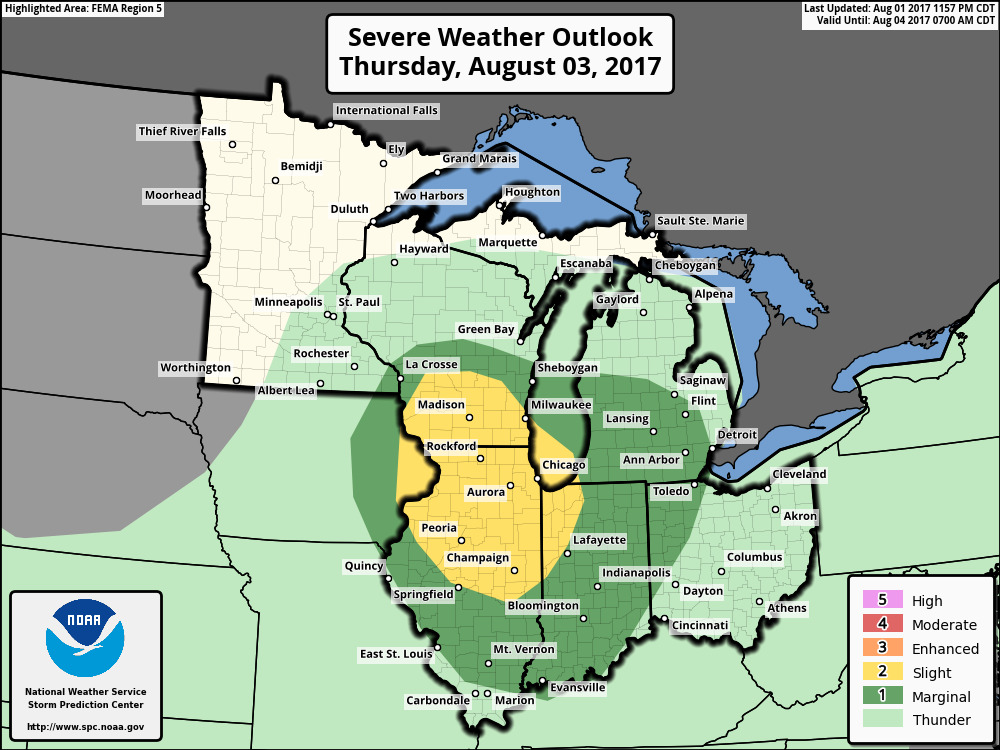
Strong storm risk upgraded to a slight risk on Thursday as the cold front swings through…localized heavy rains, dangerous lightning, gusty winds, isolated large hail and even an isolated tornado cannot be ruled out (keying in on northern Illinois).
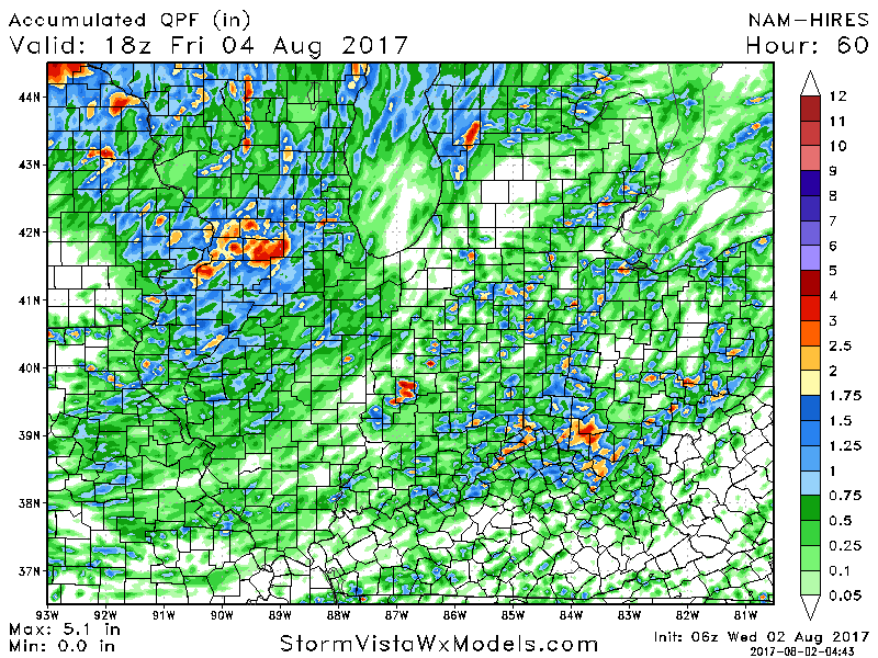
Where these storms pop up, localized heavier rainfall totals possible of 1-2″+ over the next 2-3 days. Some locations will stay drier hear, it’s not a widespread rainmaker this week.
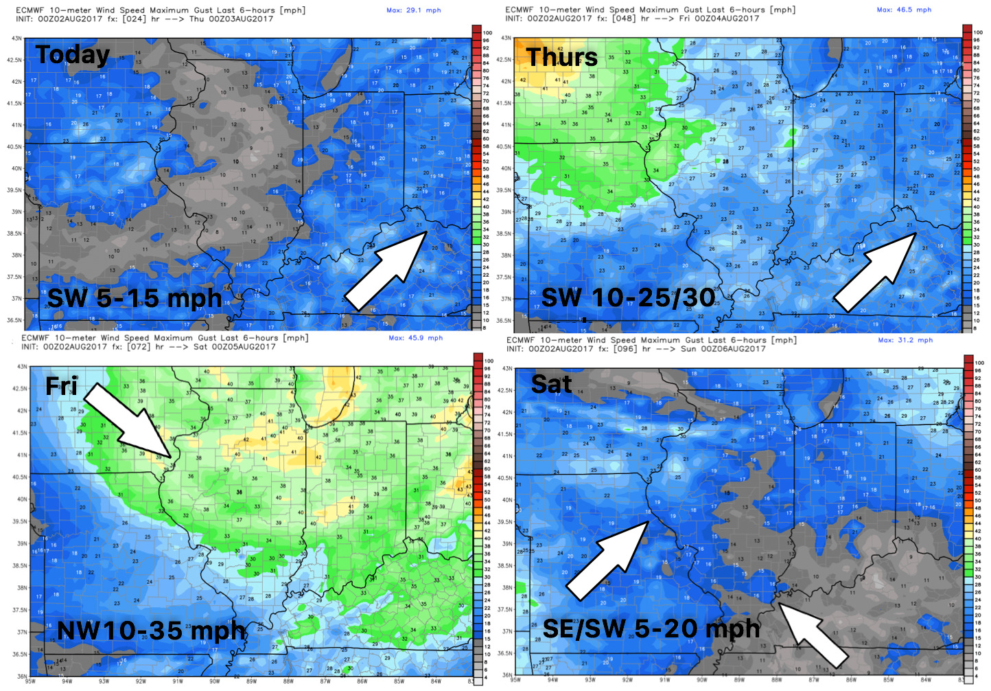
Wind forecast into late week:
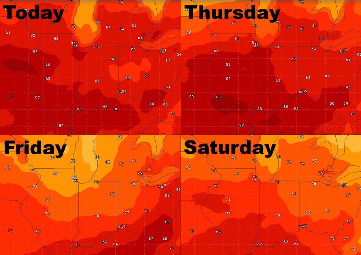
High temperature guidance over the next 4 days…cooling off in a big way into the weekend:
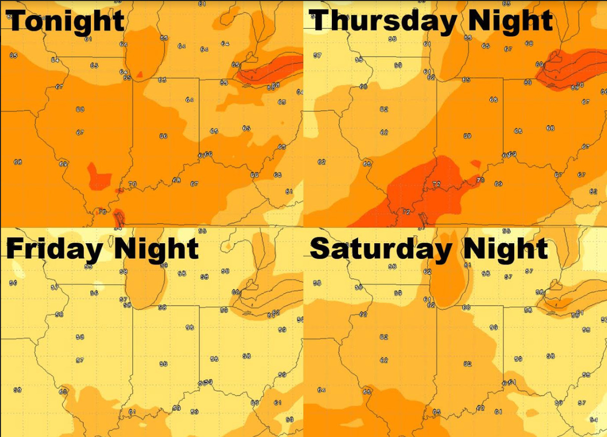
Overnight lows take a dive late week/early weekend as well:
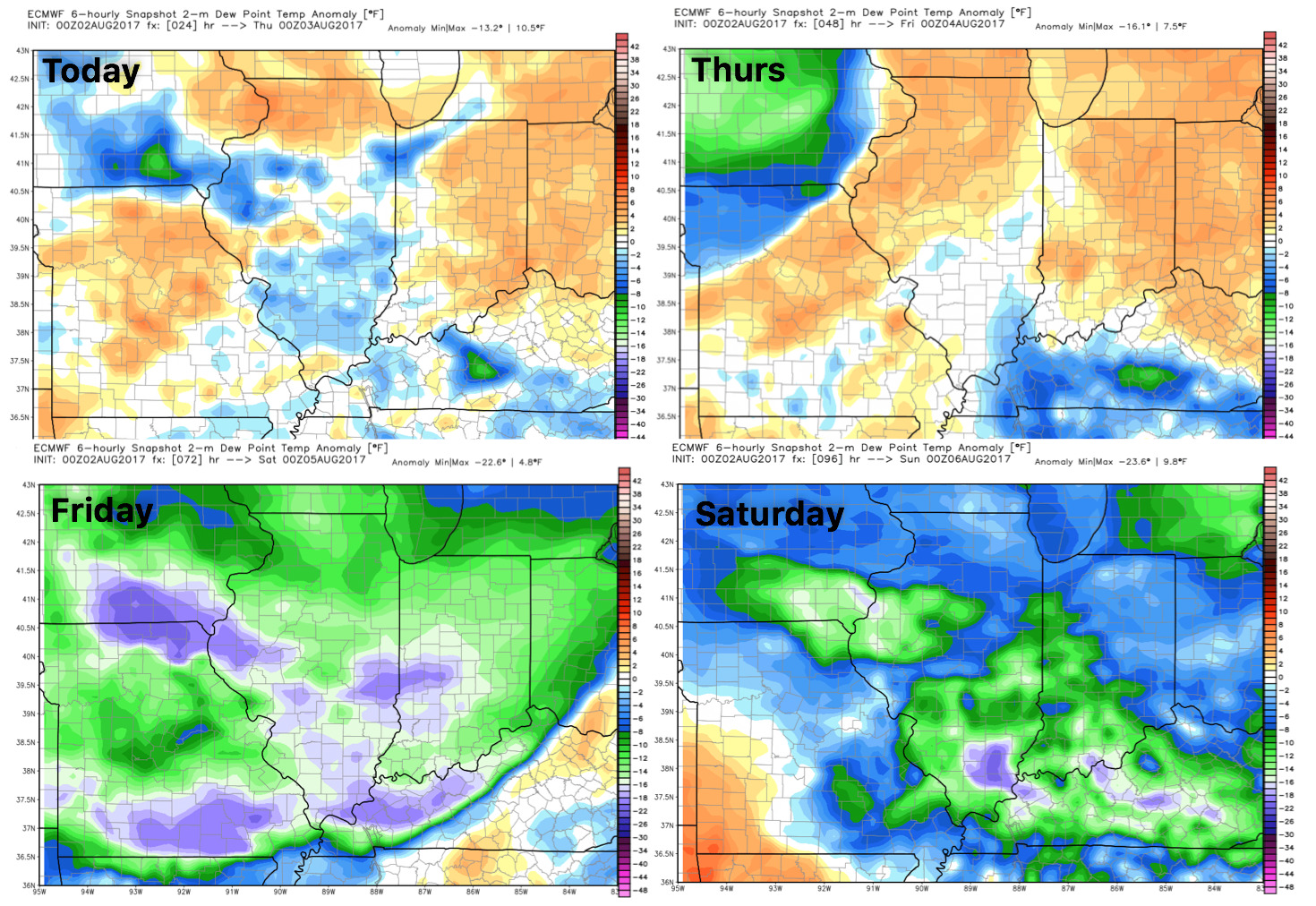
Dew points from normal show as the cold front passes east a MUCH cooler air mass moves across the Ohio Valley: