Key Points – Monday, July 31, 2017:
Synopsis: Good Monday morning! We target a few isolated showers today, increasing chances of scattered storms on Tuesday and into mid-week…the key here is not widespread coverage. It’s not until we get into late week late Thursday into early Friday morning we see higher chances for storms along a cold front that sweeps through, leaving much cooler air this weekend feel like Autumn once again. If you have any questions please let us know, have a blessed day!
Today’s video (5 min):
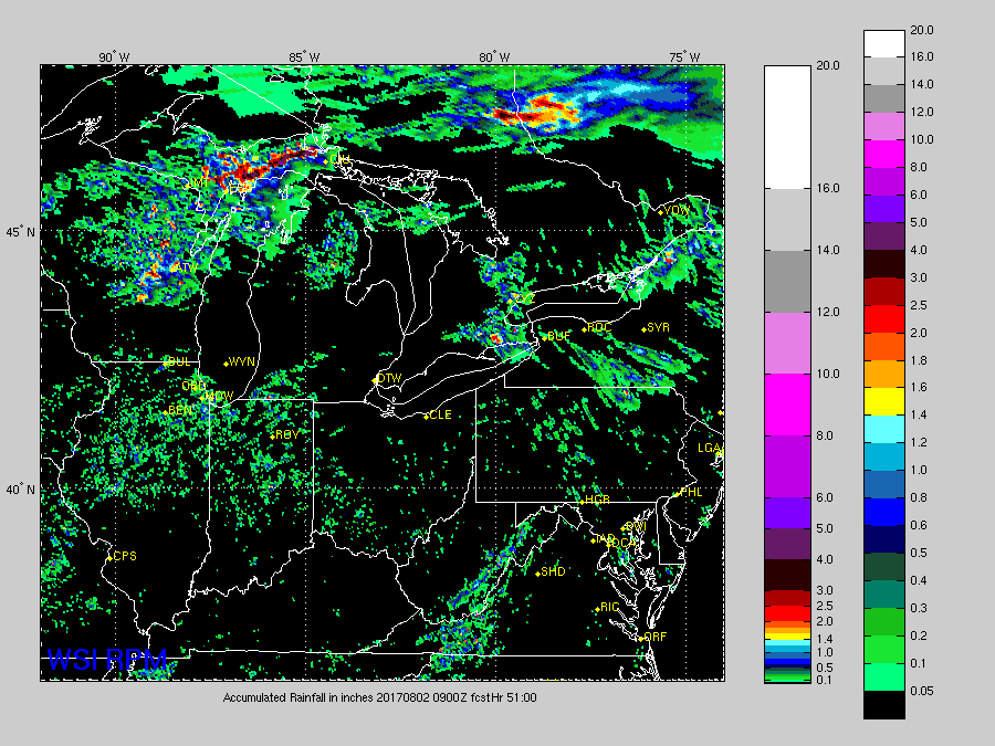
Rainfall guidance next 2-3 days is very isolated in nature…0.25-0.50 at best.
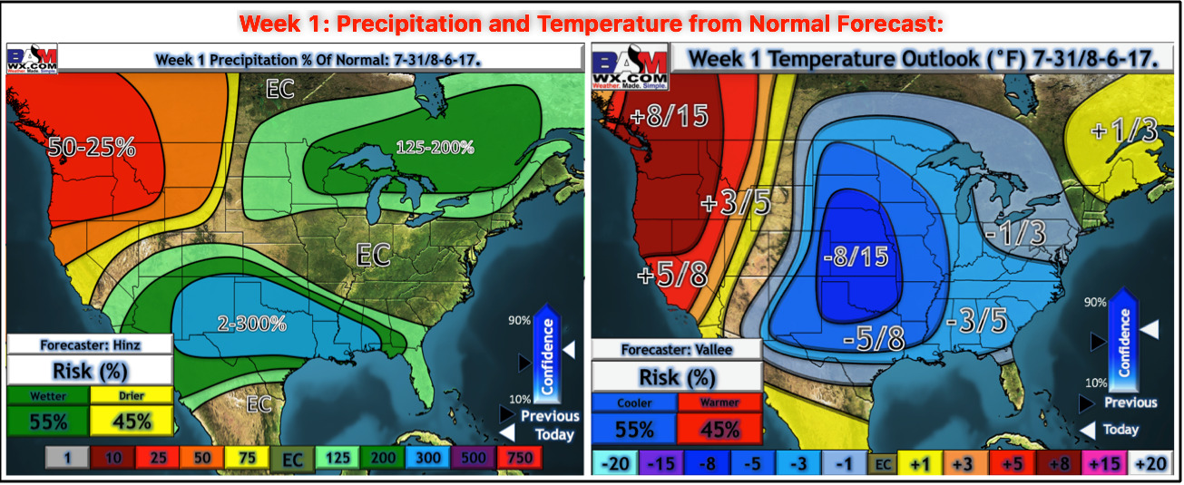
Week 1 temperature and rainfall from normal guidance:
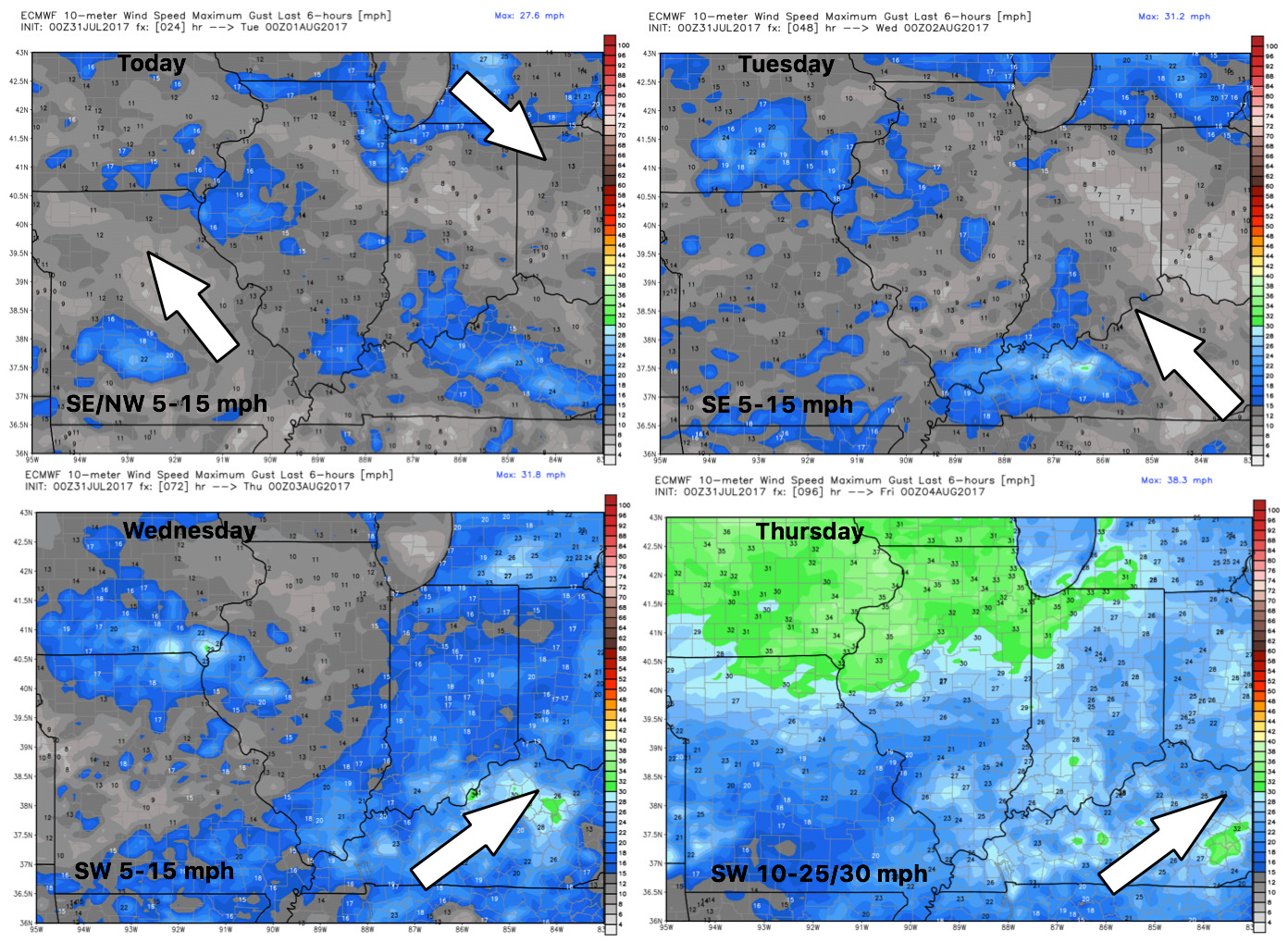
Wind forecast into mid-week:
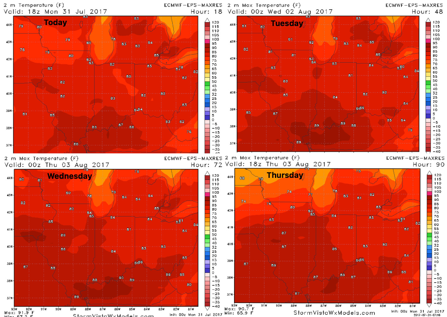
High temperature forecast guidance next 4 days:
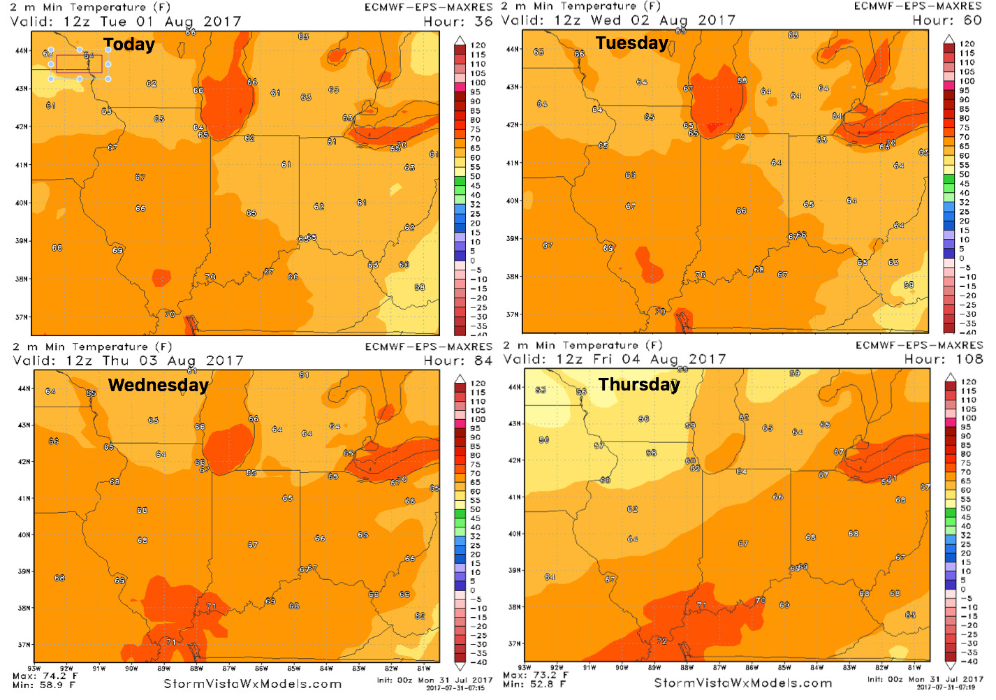
Overnight low temperature guidance here…still elevated a bit with all the moisture in the ground which makes it harder to cool:
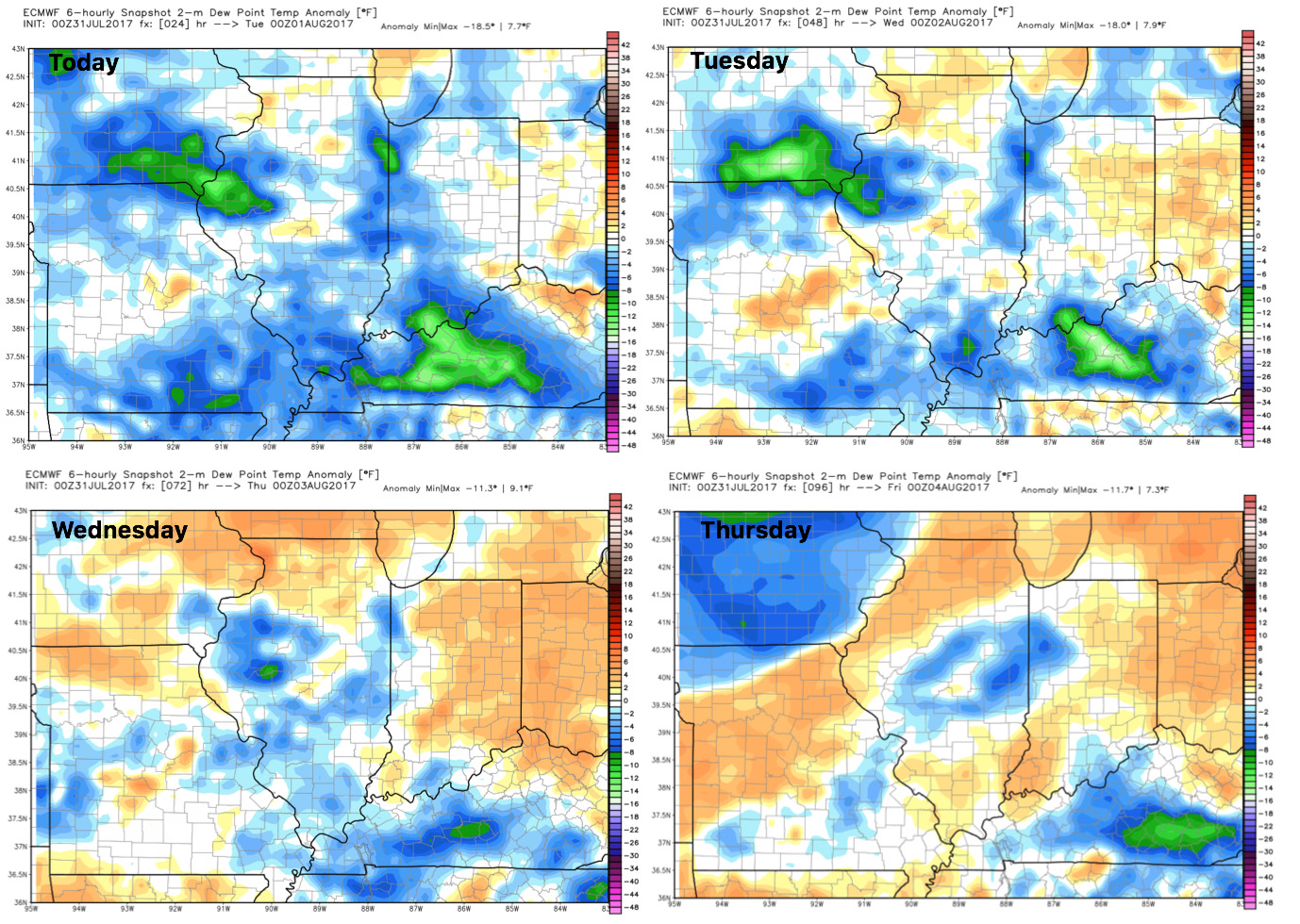
Dew points from normal: