Key Points – Wednesday, July 12, 2017:
Synopsis: Good Wednesday morning! Today we look at rains that fell over the past 2 days, some locations have seen 5″+ of rainfall here…it’s certainly been extremely wet over the past 2 weeks with this pattern we’ve been stuck in. We also discuss the latest strong storm and heavy rainfall risks over the next 48 hours before the cold front sweeps south and east Friday, ushering in a much nicer first half of the weekend; all the details in the video, have a blessed day!
Current Radar:
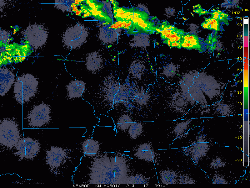
Strong storm risk focused across the northern parts of the Midwest today:

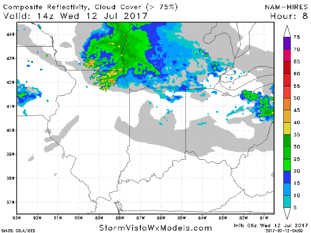
Simulated radar guidance for today shows a brief lull in precipitation during the late morning and early afternoon hours before showers and storms creep from west to east across parts of northern IL, northern IN and southern MI later tonight; some of these storms may be strong with heavy rainfall.
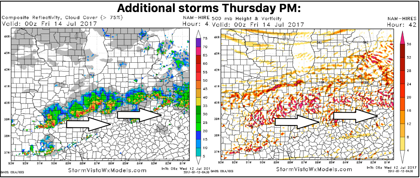
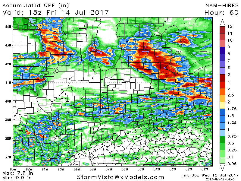
Moving into Thursday, another slight risk for strong to severe storms has been placed across central parts of the Midwest. Could see the slight risk (yellow) expanded to include more of central IL locations.
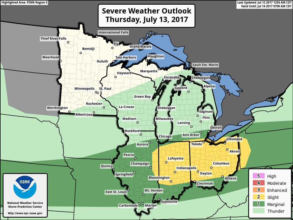
When looking at the energy aloft in the atmosphere, we see it focused across central to southerly parts of the area getting into late afternoon/evening Thursday…some of these storms, once again, could be strong to severe with additional heavy rainfall. Can’t rule out flash flooding here.
Looking at total rainfall with our best guidance this morning, it’s likely underdone in spots across central/southern parts of the forecast area…if we see the flash flooding scenario pan-out Thursday evening, totals likely not high enough here…we discuss the risks in the video.
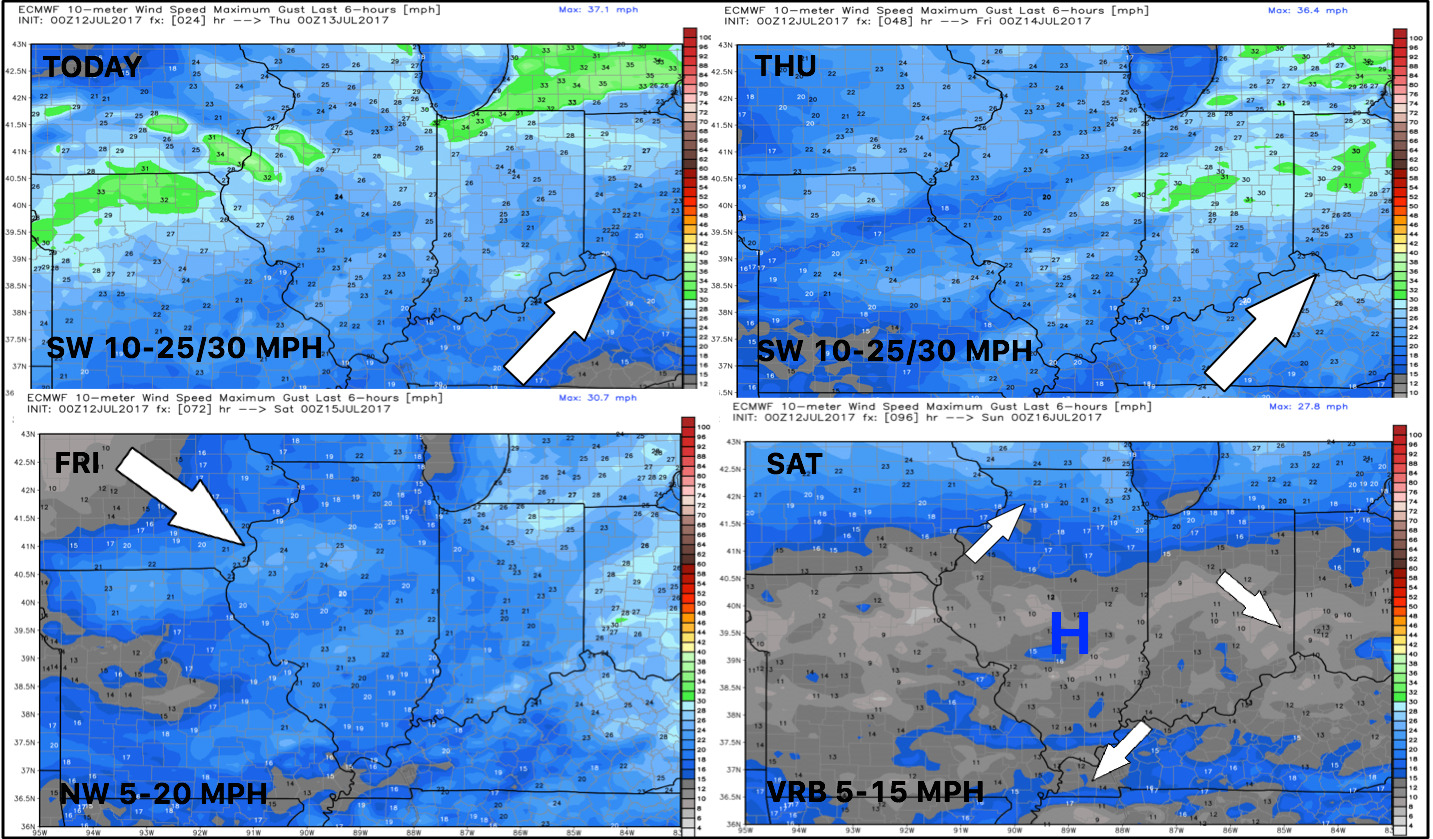
Wind forecast into the weekend…calmer winds ahead as we get under high pressure:
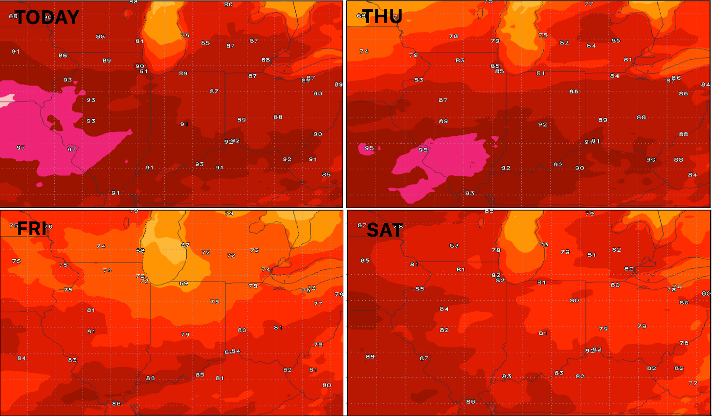
Temperature forecast guidance into the weekend…warm today into Thursday before a refreshing feel Friday into Saturday with a frontal passage:
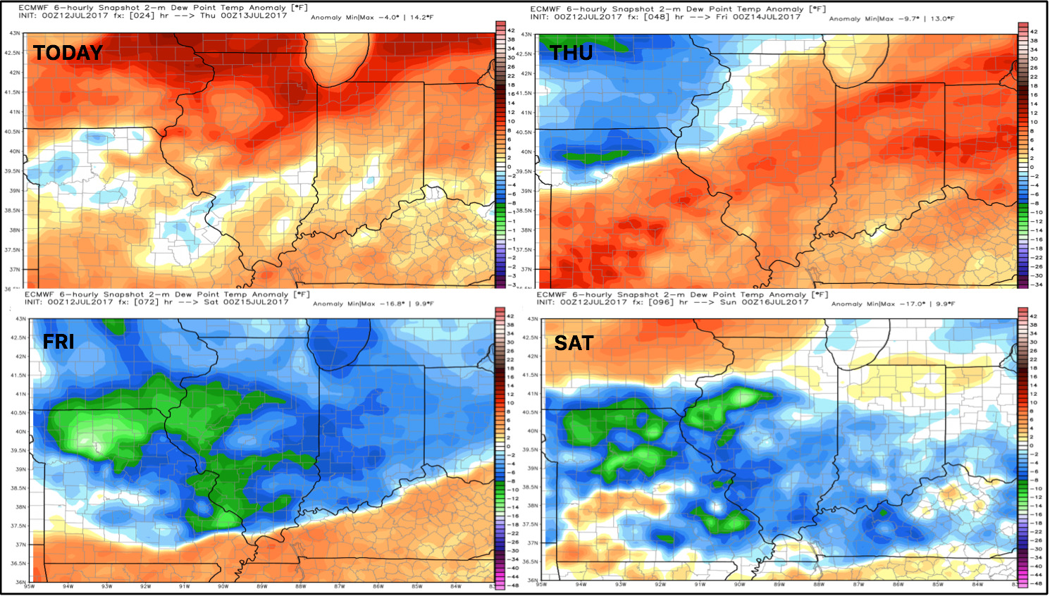
Dew points from normal show the relief ushering in as the cold front pushes south and east on Friday:
Confidence:
- Above average confidence the majority of the showers/storms stay north into tonight…some being strong in nature.
- Average but increasing confidence we may be dealing with another heavy rain maker with strong storms along the I-70 corridor Thursday evening.
- Above average confidence a much more comfortable feel works in Friday into Saturday as the cold front sags south and east.
Video (7 min):