Key Points – Friday, June 2, 2017:
Synopsis: Good Friday morning! Another day full of sunshine and warmth across the Midwest expected today, watching for some energy to move east across Iowa, Illinois, Indiana even parts of western Ohio on the day on Saturday for some scattered storms…would make sense as a warm front sweeps through as well. The cold front is forecasted to then move east Sunday through Monday which will also bring a scattered storm threat…with this being said, we do expect a mix of sun and clouds on both days as well. High pressure sets in Tuesday/Wednesday bringing additional dry time with sunshine, it’s Thursday into Friday we need to watch for our next storm threat as a cold front is forecasted to sweep northwest to southeast.
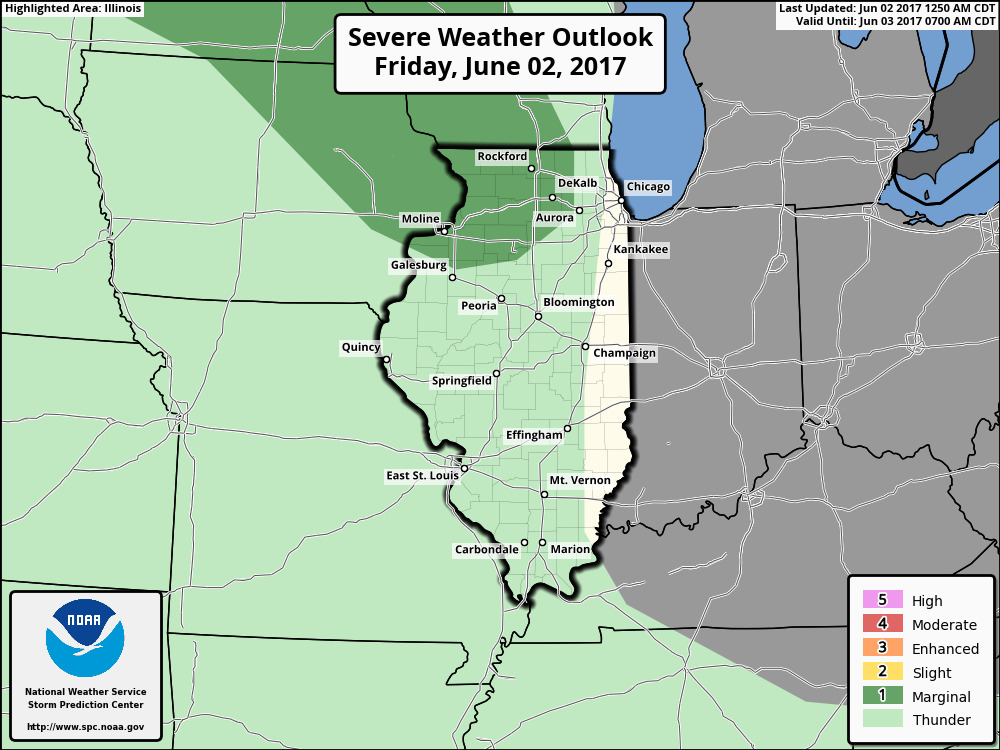
Mostly sunny skies expected today…need to watch this piece of energy that streams east across Iowa through Illinois and Indiana on Saturday morning through the day for a scattered storm threat…a few of these may enter western Ohio as well.
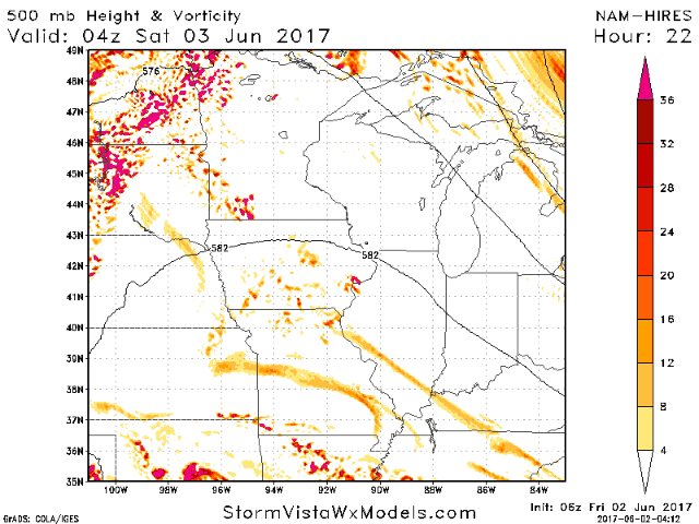
Can’t rule out a strong storm across eastern Iowa and northern Illinois as well…main threats being gusty winds and some hail.
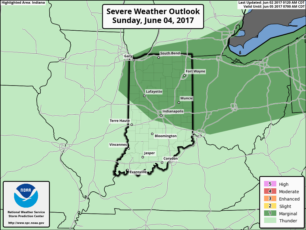
Cold front then sweeps east Sunday into Monday bringing additional scattered storms, with a greater focus will be across Indiana and Ohio.
A strong storm threat isn’t out of the question as the cold front makes its way through the Midwest during this timeframe as well…the risk areas is outlined below. Again, gusty winds and isolated hail will be possible in any strong storms.
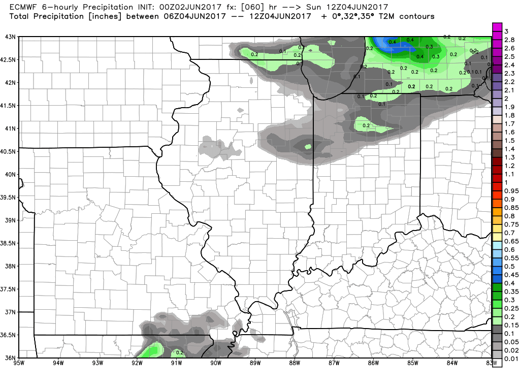
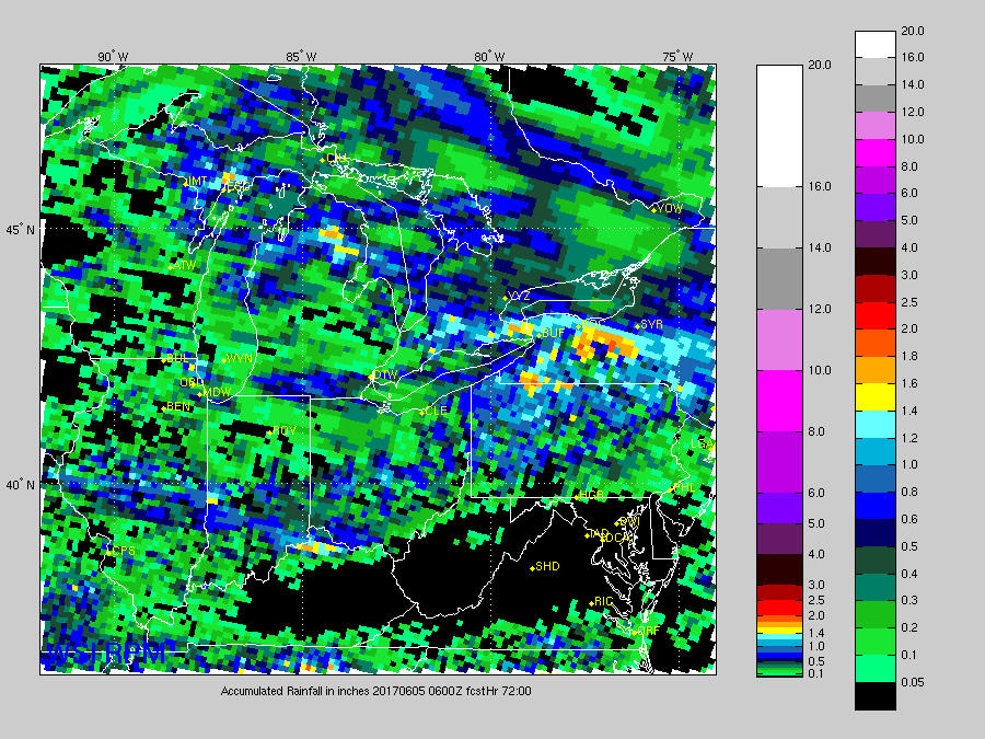
There really isn’t a perfect forecast model to use for total rainfall, but we feel more confident with the latest RPM which suggests ~0.5-1.0″ of rain…there will be locations that don’t see any rainfall at all and stay sunny.
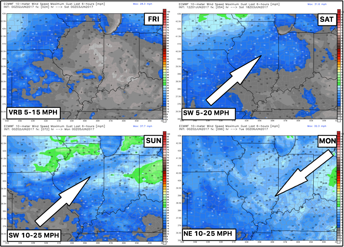
Latest wind forecast next 4 days:
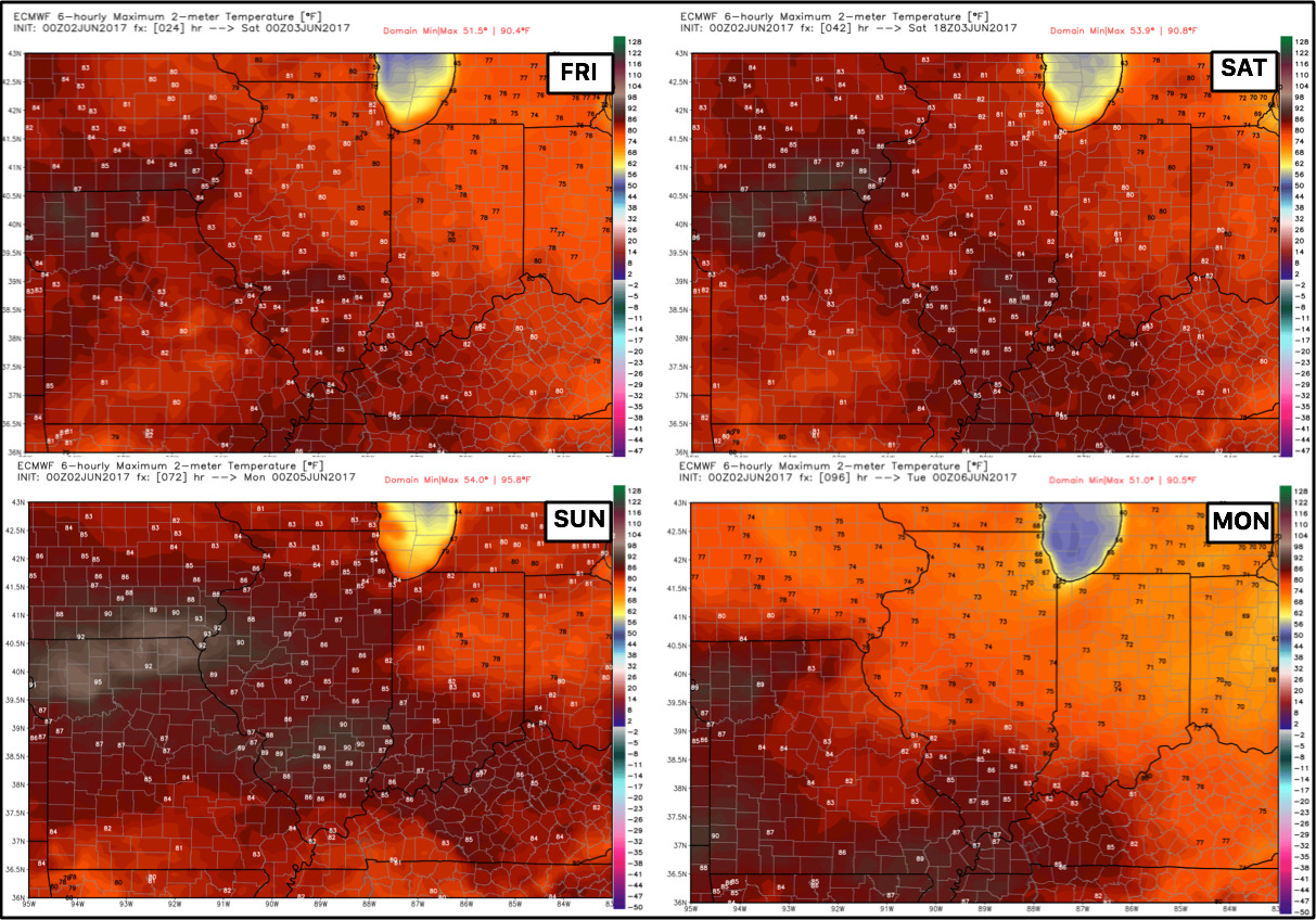
Temperatures through early next week across the Midwest will be pretty warm featuring a lot of upper 70s and 80s..wouldn’t be shocked if folks further west touch 90º.
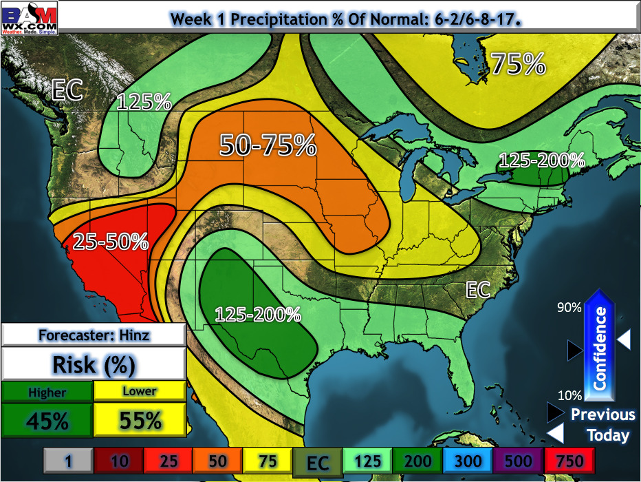
Precipitation from normal over the next week is largely drier than normal across the Midwest.
Confidence:
- Above average confidence we see a lot of sunshine through the weekend and stay warm.
- Average confidence of scattered storms Saturday and Sunday, potentially lingering into Monday as well.
- Lower confidence on a strong storm risk given marginal ingredients.
- Above average confidence we will see slightly above normal temps through the next 5 days, beyond that we have higher confidence of a return to more “seasonal”.
Today’s video (8 min):