Key Points – Tuesday, April 25, 2017:
Synopsis: Good Tuesday morning! Targeting heavy rainfall starting as early as Wednesday evening and working in through Monday morning next week. Rainfall starting to work east across the Plains today, very heavy rains and some strong storms will work in expected tomorrow especially across Illinois. Another robust storm system works east Friday into Saturday as a warm front lifts into the Midwest bringing very heavy rains, and then a cold front sweeps east Sunday into Monday that will also bring heavy rains and gusty storms. All the details are posted in the video, please let us know if you have any questions.
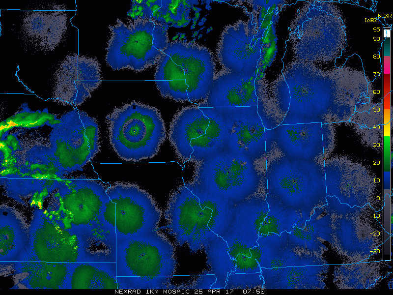
- Current Radar:
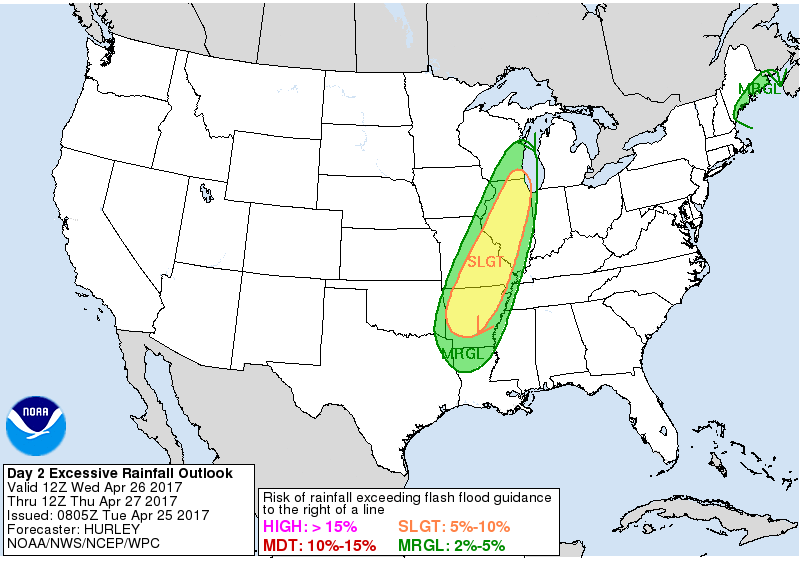
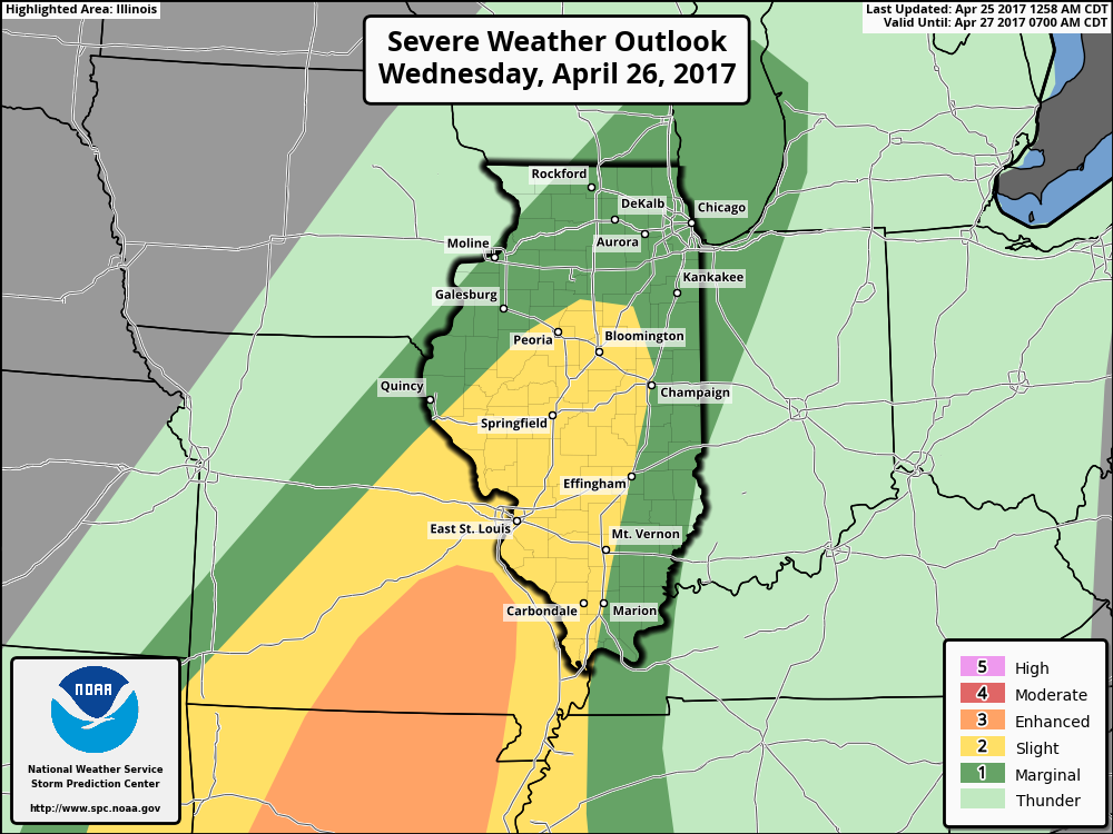
- Excessive Rain for Wednesday across Illinois…will need to be watching for some localized flash flooding along with strong storms.
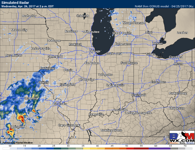
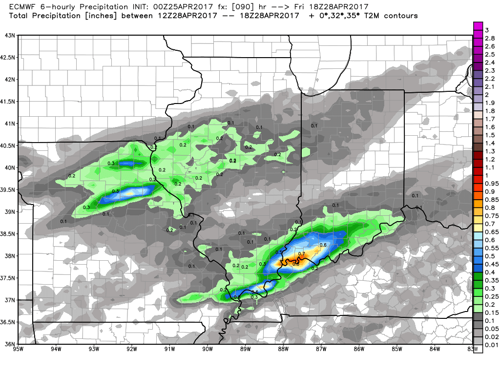
- NAM 3km model for Wednesday: ~4pm rain starts to work in and then by 7-8pm we are watching for some continued heavy rains and strong storms across Illinois. Wednesday night into Thursday morning the heavy rainfall will continue to work east across Illinois and weaken into Indiana and Ohio on the day Thursday.
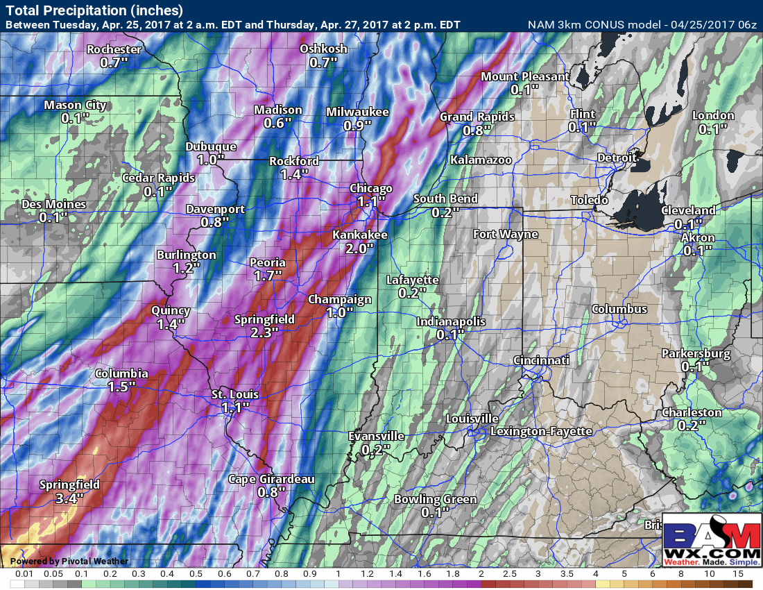
- Rainfall totals next 60 hours, mainly 1-2″ possible across Illinois (with localized 3.0″+ possible) into Thursday, and you can see where the storms weaken across Indiana and Ohio there will be lesser amounts possible.
- Slight risk also issued for strong storms on Wednesday including damaging winds, isolated large hail and cannot rule out a couple of tornadoes although confidence is below average on this.
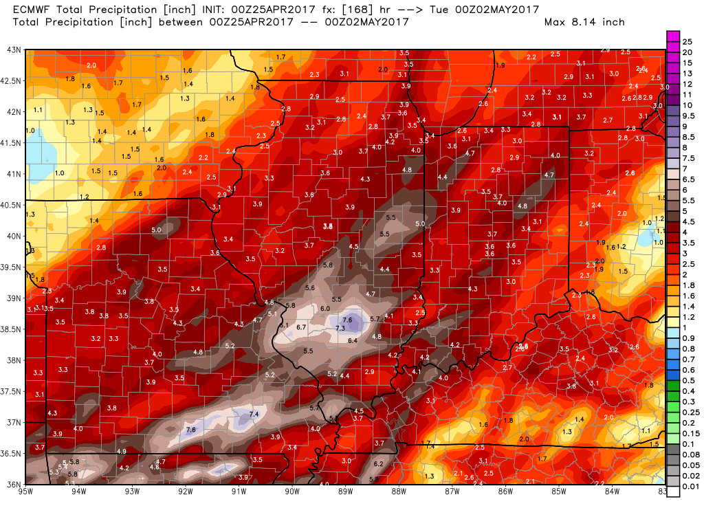
- European model by Friday: precipitable water values are more than twice the normal for this time of year (2.0″/hr+) will bring heavy rain by Saturday morning into the afternoon across Illinois and Indiana along the warm front and then a cold front sweeps east across Illinois, Indiana and Ohio with some gusty winds possible Sunday into Monday.
- European total rainfall through Monday (2-3″+ possible, wouldn’t be shocked to see some spots at 5″ or greater if this stalls out)…trying to stay objective with this, but we can’t ignore the heavy rainfall signal across Illinois and Indiana over the next 6-7 days.
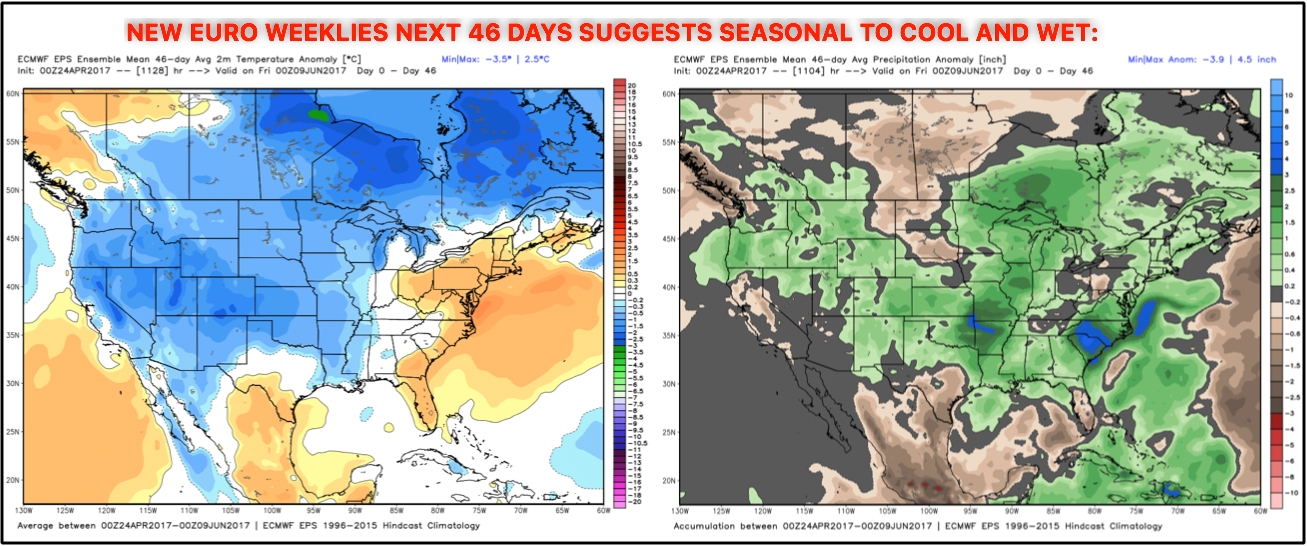
- New Euro Weeklies with a seasonal to cooler look into May (slightly warmer east) and wet as well.
Confidence and Risk:
- Above average confidence showers and storms moving into the Midwest Wednesday into Thursday.
- Average risk for some localized very heavy rainfall mainly across Illinois into Wednesday as well with localized 3″+ possible and flash flooding also a risk.
- Average to slightly above average risk for strong storms across Illinois on Wednesday as well.
- Average confidence a warm front lifts into the Midwest Friday into Saturday, confidence is starting to also increase on the timing of things.
- Still average risk for very heavy rains as model data is still working itself out with where the heaviest rains set up.
- Average risk for gusty to strong storms on Sunday as a cold front sweeps east.
Today’s video (8 min):