Key Points – Monday, April 3, 2017:
Synopsis: Absolutely packed update today, highly recommend watching the video through the end. We have gusty storms possible today and a threat for heavy rains and strong storms mid-week remains by Wednesday. We cool down late week and then turn the furnace back up by the weekend…mid-70s? Certainly not out of the question! Our latest data is quite impressive with widespread 2.0″ of rain across the Midwest over the next 10 days, that “active pattern” continues with system after system. Again, we highly encourage staying up to date with each forecast as there is a lot of weather going on this week.
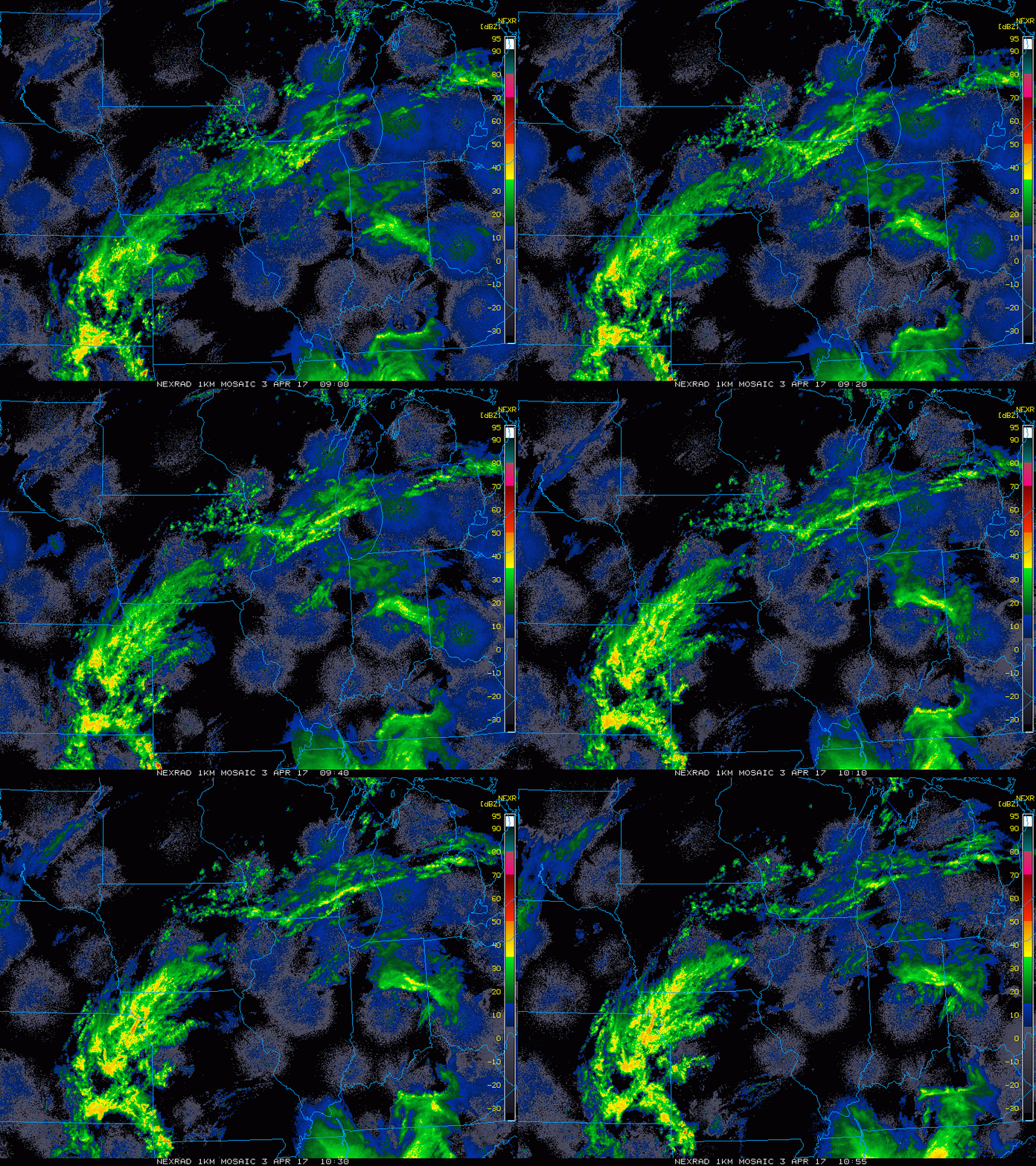
Current radar this morning:
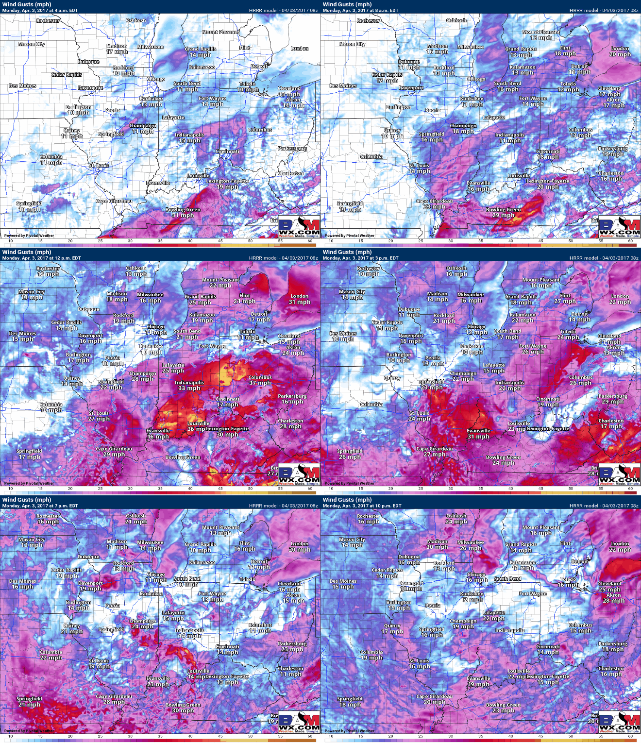
Showers and storms increase in coverage especially afternoon from west to east into tonight…winds will be gusting today out of the southeast turning to southwest later today in excess of 40mph at times as shown below.
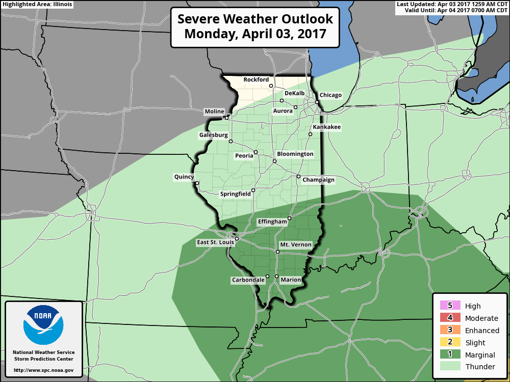
Here’s the latest strong storm risk area, it’s a marginal threat as of right now, but as mentioned above if we can get some extra energy and sunshine storms could develop a little stronger in nature. Need to watch this and update this afternoon accordingly. Again, main threats will be gusty winds and small hail.
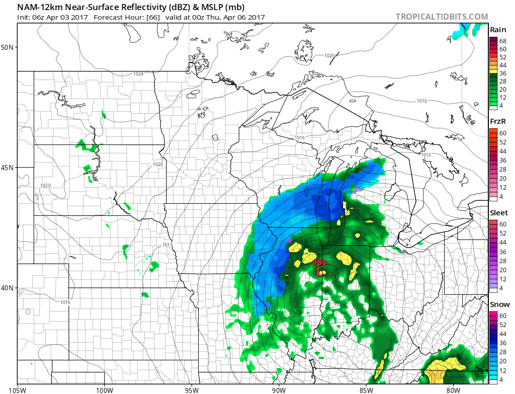
Our weather takes a small hiatus on Tuesday but picks right back up later Tuesday into Wednesday as a strong low pressure makes its way into the Midwest. We time things out in the video and mention below this, a strong storm threat given some of our latest data. This situation is still fluid so check back often.
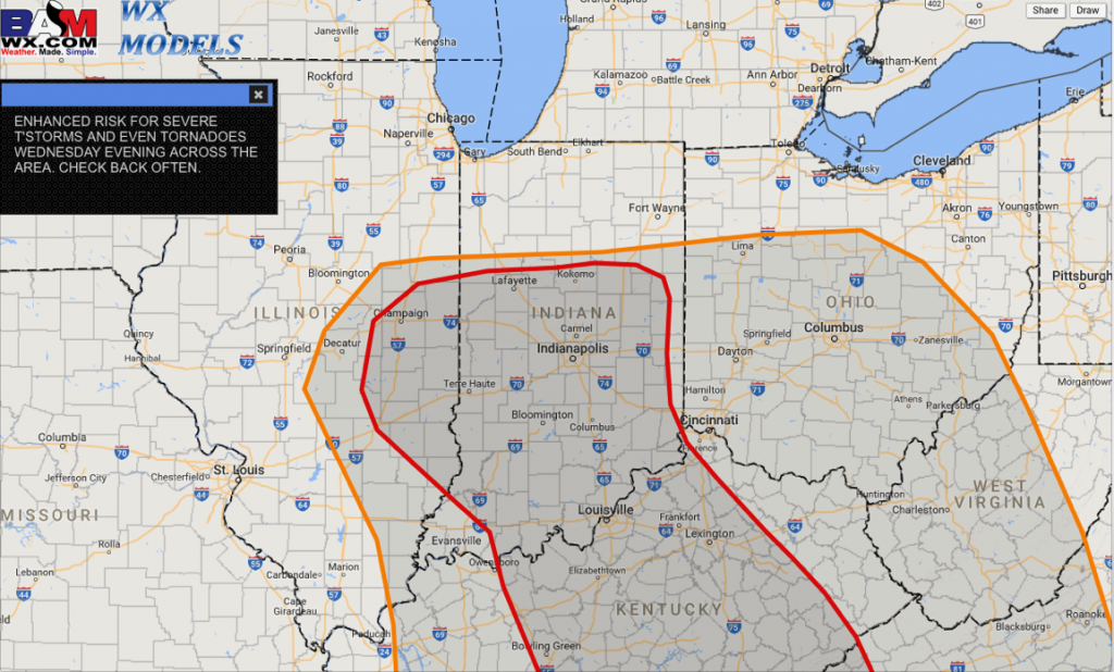
If things come together right on Wednesday, this is the area where we are eyeing severe weather potential, including tornadoes. If we can get southeast winds at the surface and plenty of mixed layer CAPE (energy or sunshine) we will have a conducive environment for severe weather.
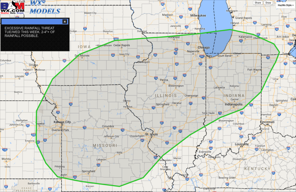
This is the area where we are concerned with excessive rainfall through mid-week…the threat for 2-4″ is possible through Wednesday. Can’t rule out some flooding issues in low-lying areas as the ground has already become very saturated.
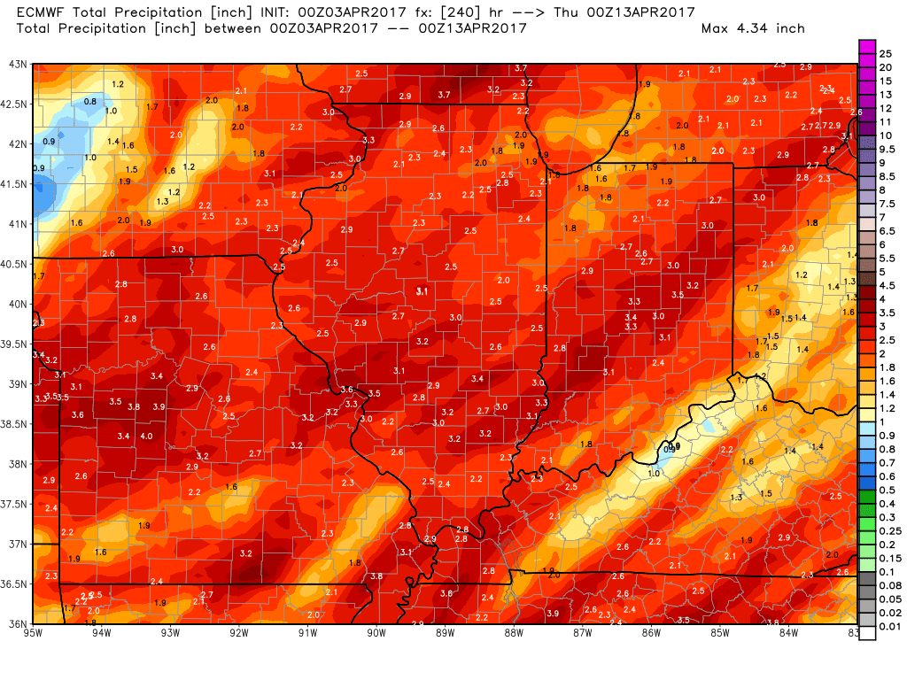
Rainfall totals over the next 7-10 days are very impressive…the active pattern continues especially through the first half of April.
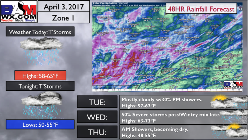
Zone 1 Quickcast…isolated heavy rains possible.
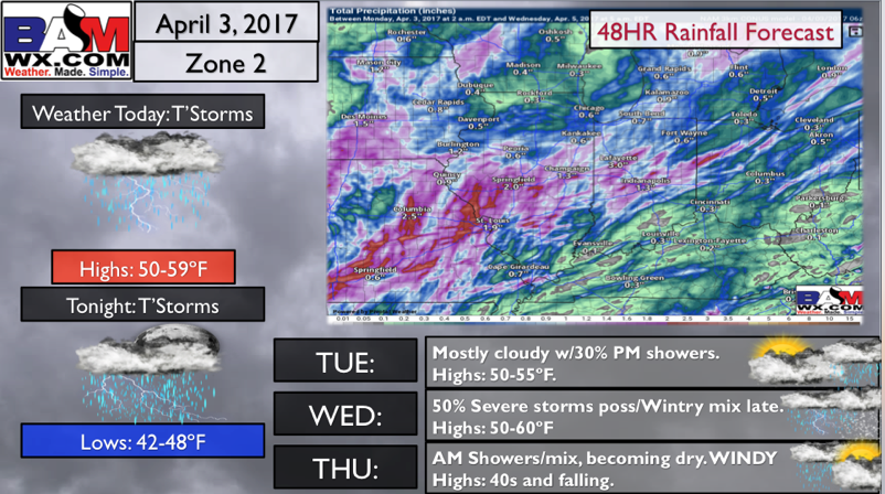
Zone 2 Quickcast, isolated heavy rains possible.
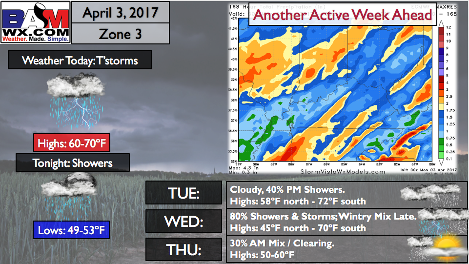
Zone 3 Quickcast, very active week including storms possible.
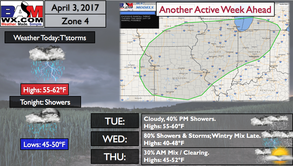
Zone 4 Quickcast, excessive rainfall over 2.0″ possible through mid-week!
Confidence and Risk:
- Above average confidence of showers and storms picking up in coverage this afternoon into tonight from west to east.
- Above average risk mentioning strong storms today, as we are relying heavily on receiving more sunshine to fuel these storms.
- Above average confidence the risk for showers and storms increases into Wednesday as another powerful low pressure moves into the Midwest.
- Above average risk for strong storms here as well given a lot of uncertainty in the parameters we need for severe weather.
- High confidence our pattern remains active over the next 10 days, with a concern for very saturated soils even flooding at times in low-lying areas.
Today’s video (7 min):
