Key Points – Tuesday, March 28, 2017:
Synopsis: Today we discuss the brief lull in precipitation today into Wednesday in between systems, before our next shower and storm chances approaches from the west. We can’t rule out a few gusty storms and small hail that we discuss in full detail in the video. Showers move out of the Midwest to the east on Friday giving way to more calm weather conditions on Saturday and Sunday with high pressure conditions overhead; with a northeast wind on Saturday that will likely keep us slightly cooler than normal in the temperature department, but as the high moves off to the east on Sunday we return to slightly above normal temps. This weekend will favor more chances for sunshine as well. Our next chance for showers comes Monday into Tuesday which fits the pattern of having a system every 3-5 days in the current pattern. Overall, despite a few cooler days over the next week we are largely above normal in the temperature department across the Midwest…have a terrific Tuesday!
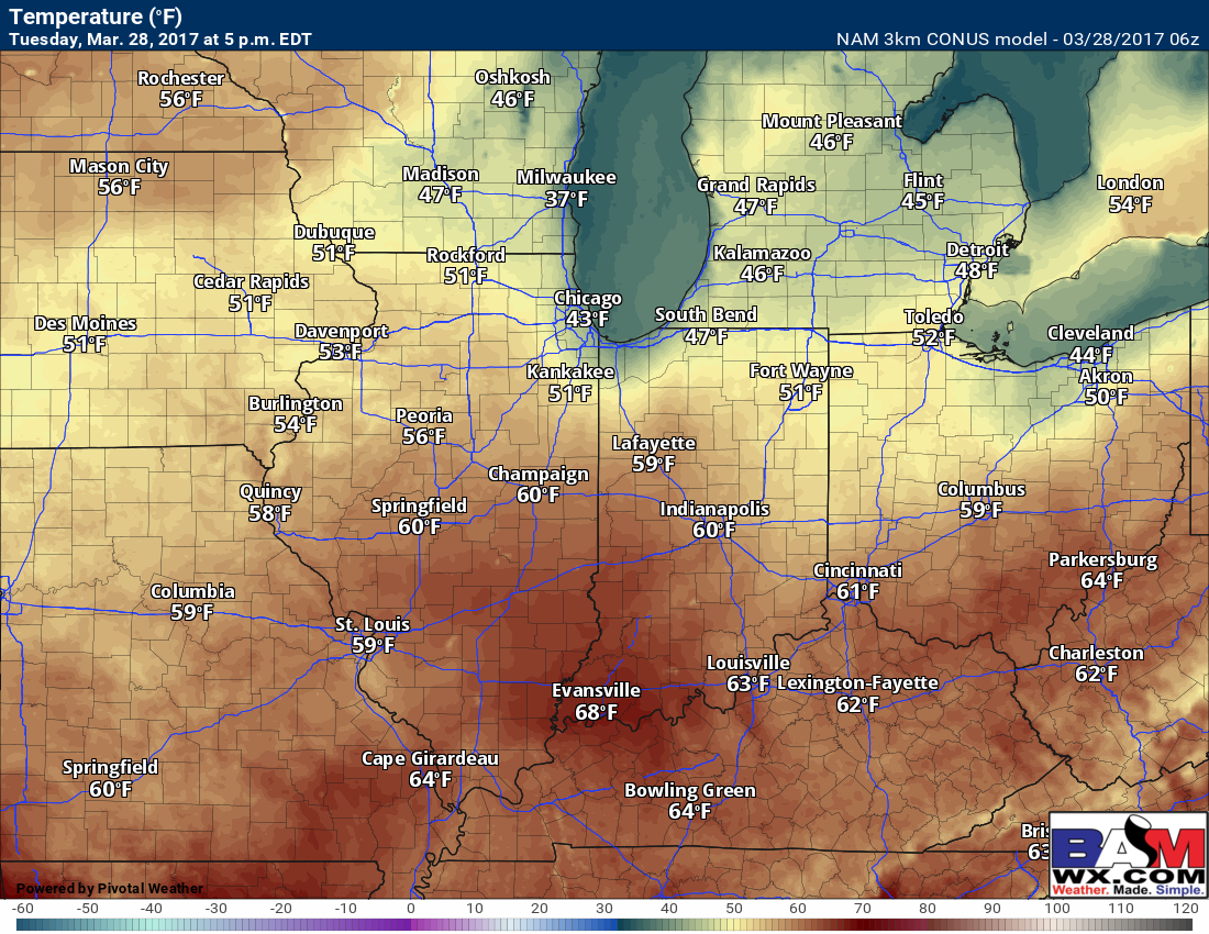
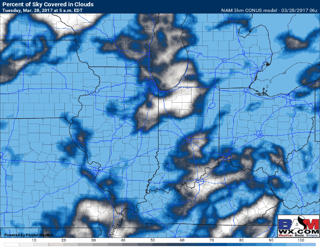
There is some low-level clouds/mist hanging around that will be erode as we get deeper into the day. Here’s a look at high temperatures forecasted, in the upper 40s/lower 50s north and mainly in the upper 50s to 60s central to south.
Cloud conditions today will be a mix of clouds and sunshine especially this afternoon…winds out of the north to northeast at 5-15 mph.
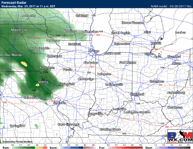
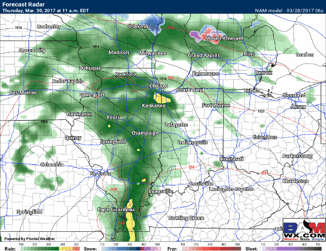
Next chance for showers and some thunderstorms comes Wednesday morning into Thursday morning mainly for eastern Iowa into Illinois as our next low pressure tracks into the Midwest. These will be more scattered in nature Wednesday into Thursday as well.
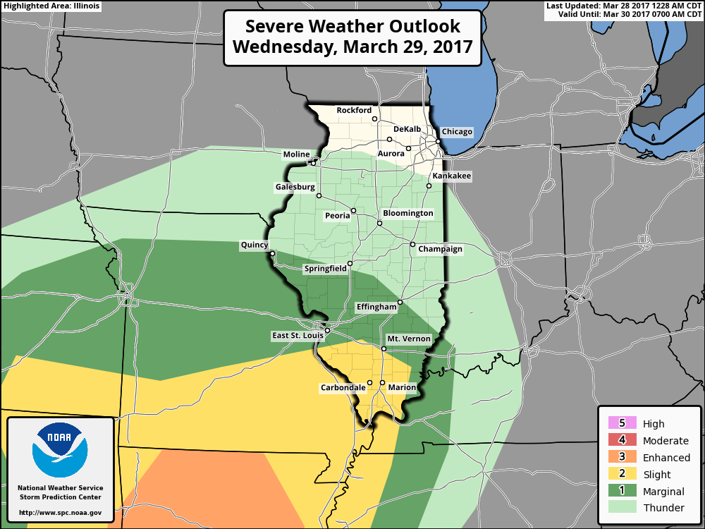
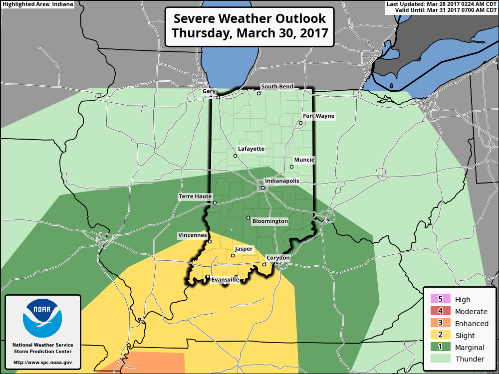
Day 2 slight risk across southern IL for Wednesday night into Thursday…some gusty winds and isolated hail cannot be ruled out.
Showers and some thunderstorms move east as the surface low tracks east much of Thursday mainly across Illinois into Indiana and then mostly Indiana and Ohio getting into Friday. Again, these will largely be scattered in nature and not a washout.
Day 3 slight risk issued for some gusty storms and isolated hail for the southern half of the Midwest…confidence is average on this as right now.
High pressure is overhead later on Friday into Saturday and Sunday increasing our chances for more sunshine. Our next chance for showers comes Monday into Tuesday as our next low pressure treks into the Midwest.
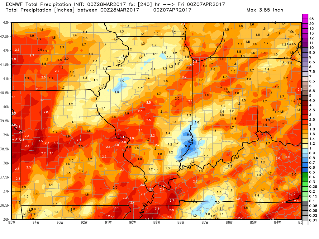
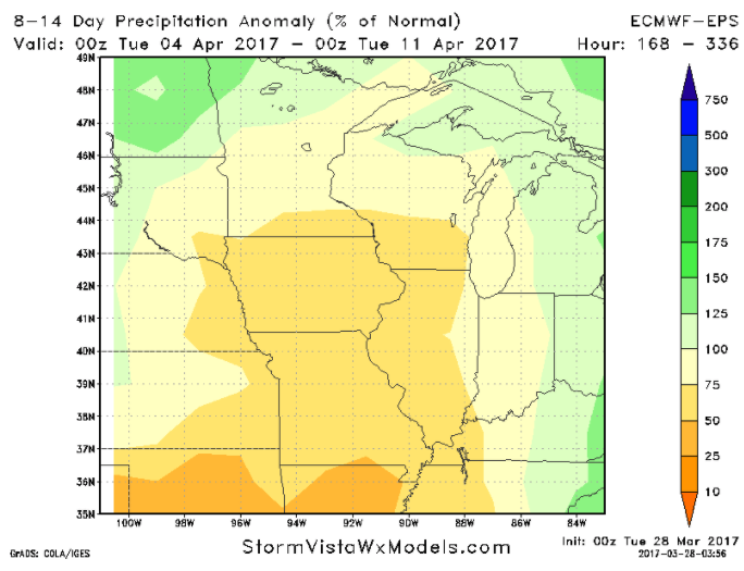
10-day rainfall totals from the European continues the theme for very active across the Midwest, this won’t come all at once but as discussed above it will come over multiple shower and storm chances over the next week and a half.
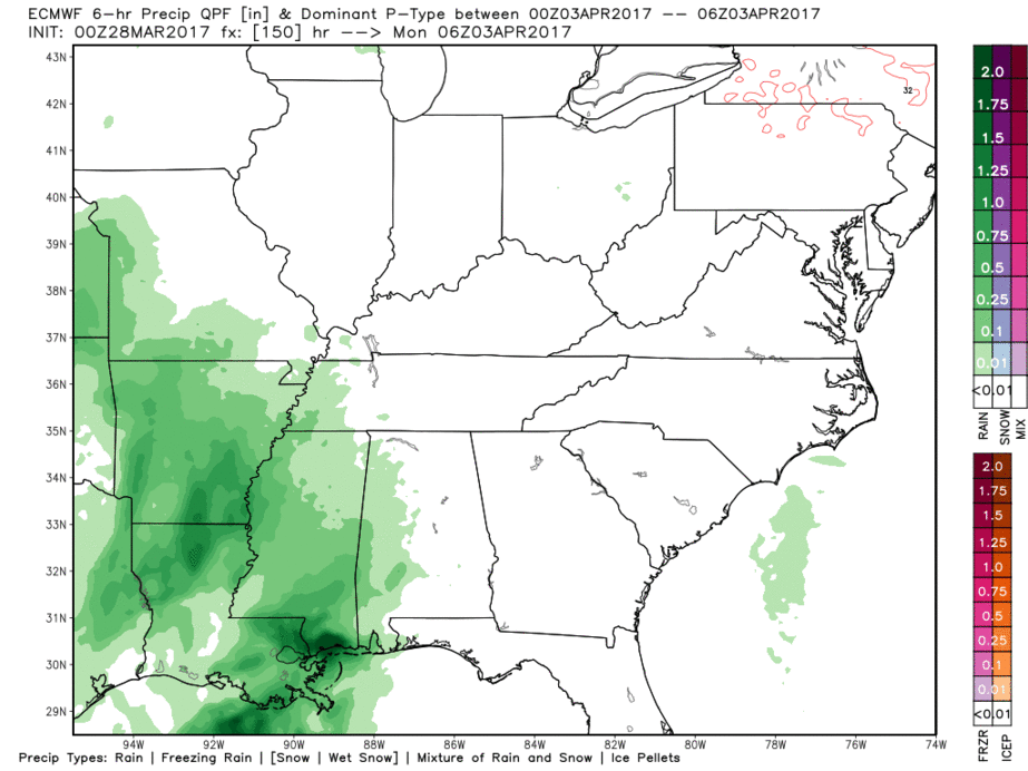
A solid window for some planting possible in the first to second week of April? This is a look from the latest European ensemble precipitation from normal forecast…we are watching this very closely, check back often.
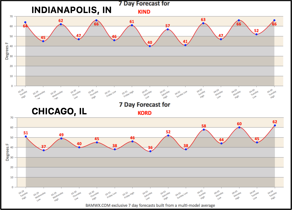
Today’s 7-days from Indianapolis and Chicago…slightly cooler conditions over the next few days in northern Illinois, otherwise normal to above normal temps expected through the weekend into next week.
Confidence and Risk:
- Average confidence some low-level clouds/patchy fog hang around this morning across the Zones, with increasing confidence of sunshine this afternoon.
- Above average risk for some patchy fog across northern Illinois early Wednesday morning.
- Above average confidence of showers and storms increasing Wednesday through Friday as a low pressure tracks into the Midwest.
- Average risk for stronger storms Wednesday night into Thursday across the southern tier of the Zones.
- Above average confidence of high pressure overhead this weekend keeping this drier.
- Above average confidence of additional showers coming Monday into Tuesday as our next low pressure approaches the Zones.
Today’s video (8 min):