Key Points – Friday, April 7, 2017:
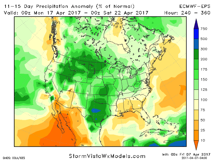
Synopsis: Good Friday morning and thanks for checking out today’s forecast! In our video this morning we discuss frost potential Saturday morning, a big warm-up Saturday through Monday and our next shower and t’storm chance on Monday. Next week, overall, is a much drier stretch than what we’ve seen in a while. We see a scattered storm chance on Monday into Tuesday as a cold front sweeps through, dry mid-week and then eyeing our next chance for storms coming late next week. Overall we are drier than normal over the next week, but data in the 11-15 day brings those above normal rains right on back. Have a great weekend!
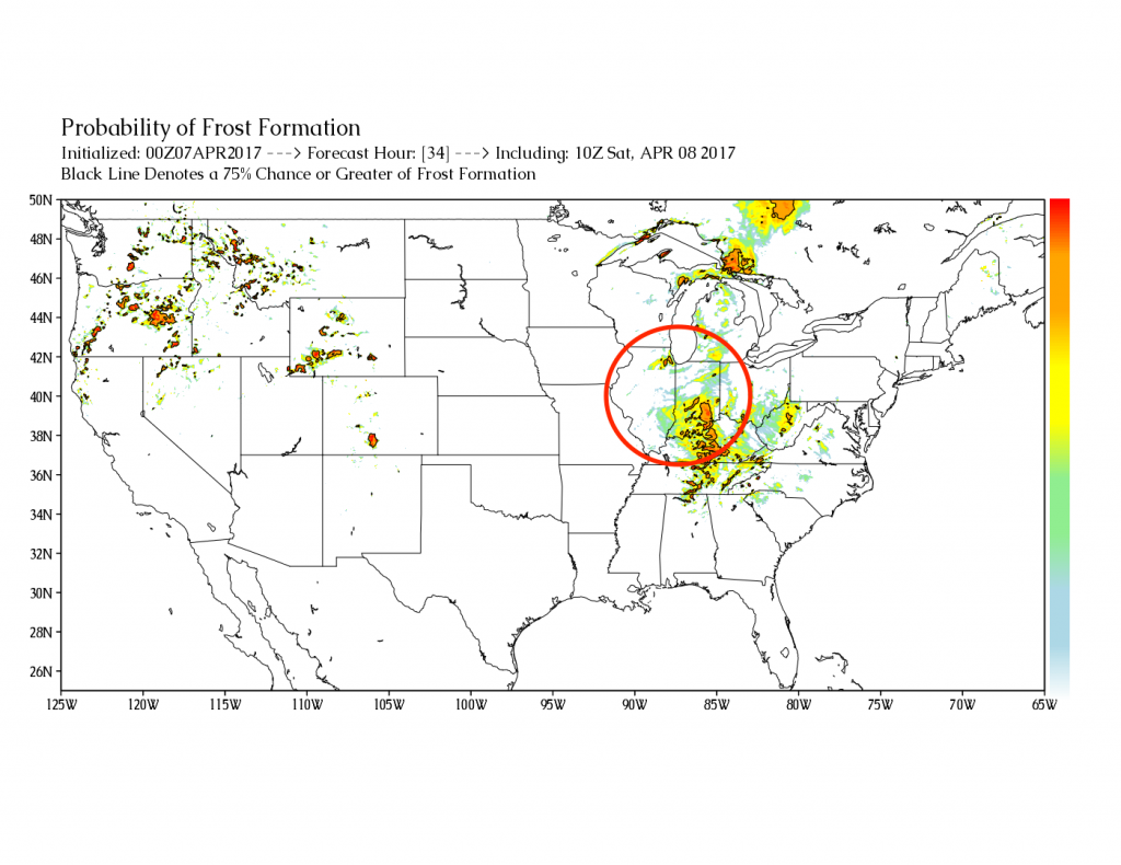
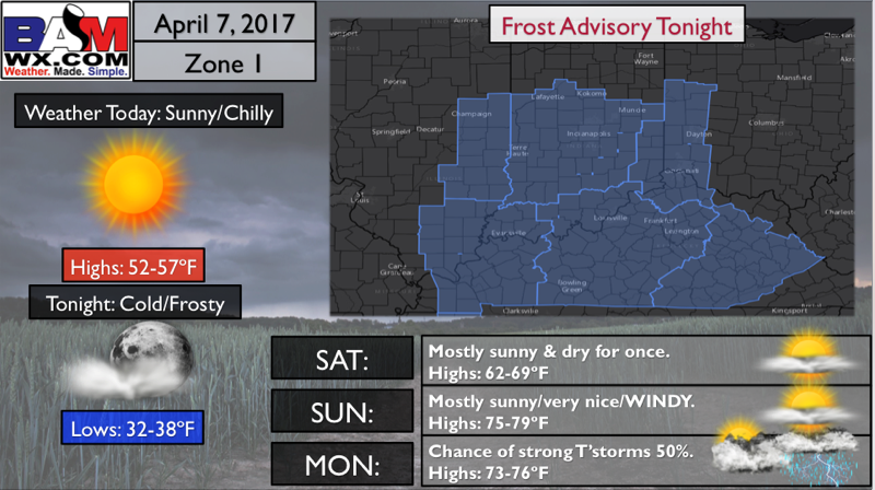
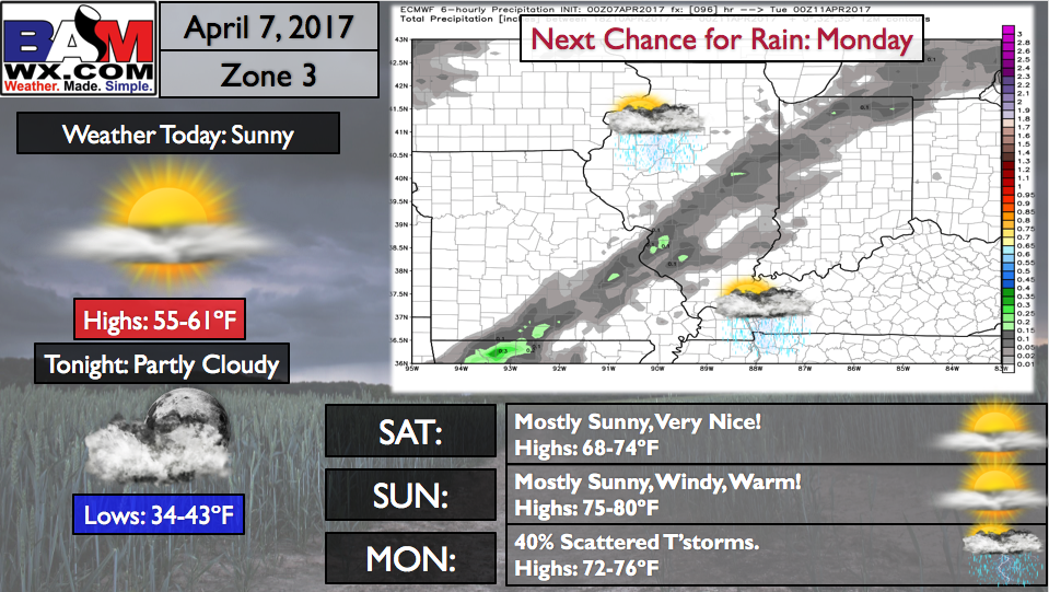
Friday we see plentiful sunshine with highs mainly in the 50s, possibly touching 60 to the south. We have frost potential Saturday morning via our exclusive new product that forecasts frost on vegetation probabilities. The further east you go across the Midwest including SE IN into Kentucky and western OH the higher the probabilities.
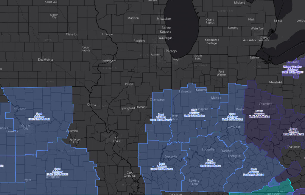
We actually do have some frost advisories and freezing warnings out for Saturday morning as well:
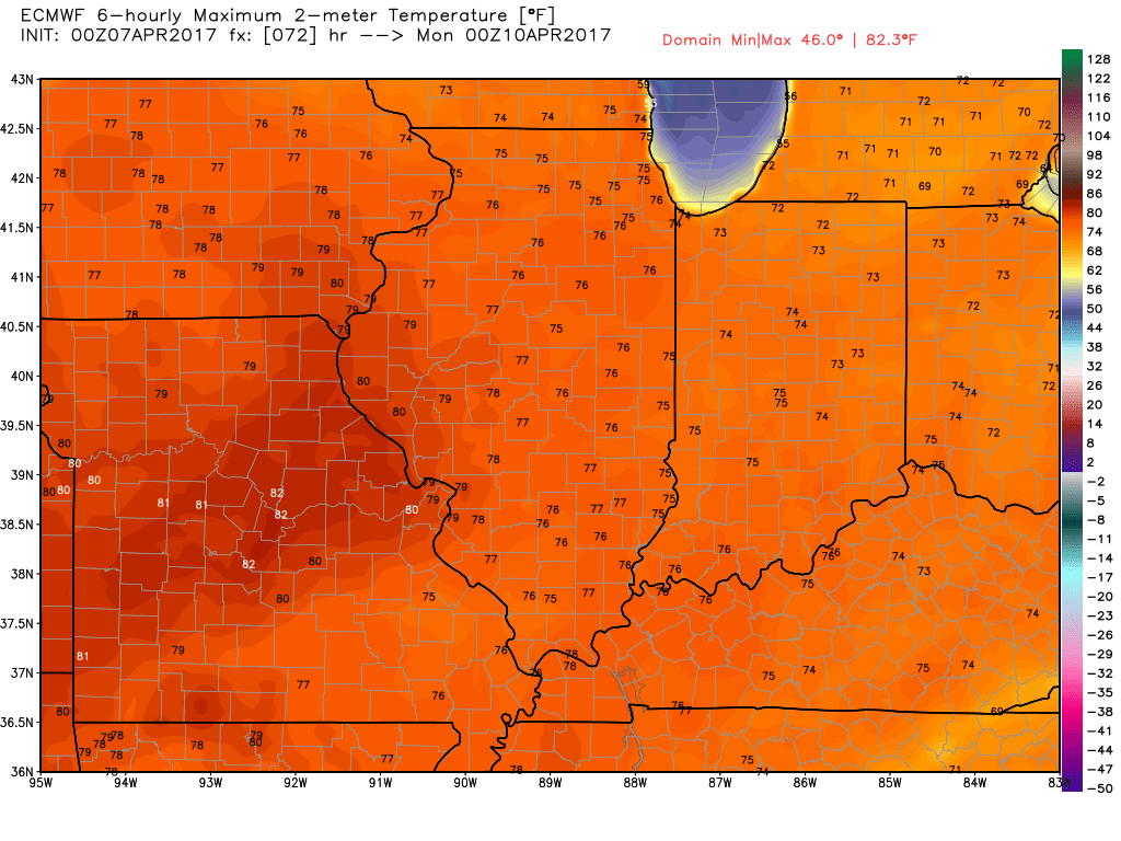
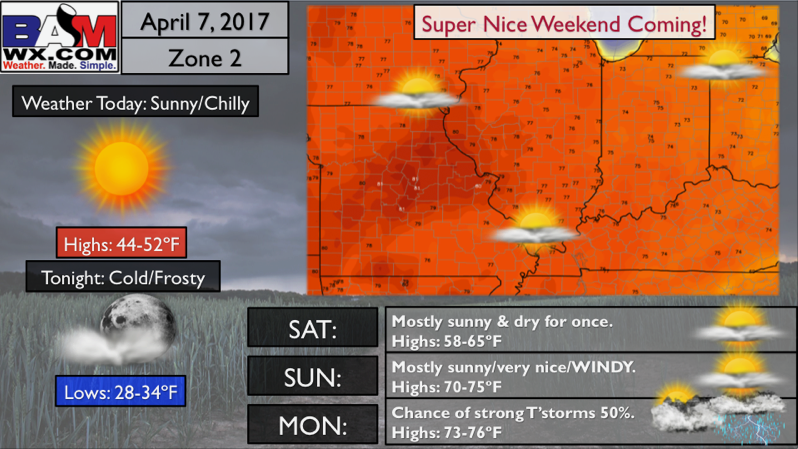
We heat up in a big way Saturday and Sunday…check out these highs on Sunday! In all actuality, these may be slightly underdone given on strong the winds will be out of the southwest (warm-air advection pumping in).
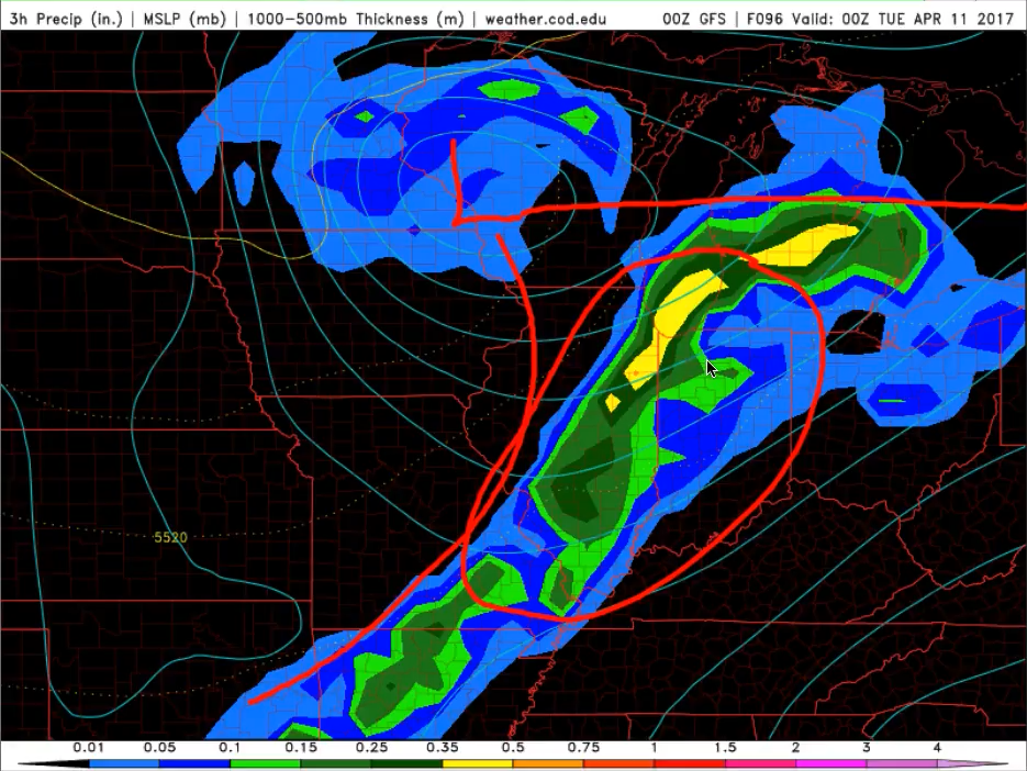
Getting into Monday our next storm system works into the area…models aren’t too excited with precipitation from this system. It’s possible we get some gusty to strong storms out of this, maybe some isolated large hail. The number 1 key here once again is how much moisture we can get into the area. If that’s the case, some strong storms will be possible. Continue to monitor for this.
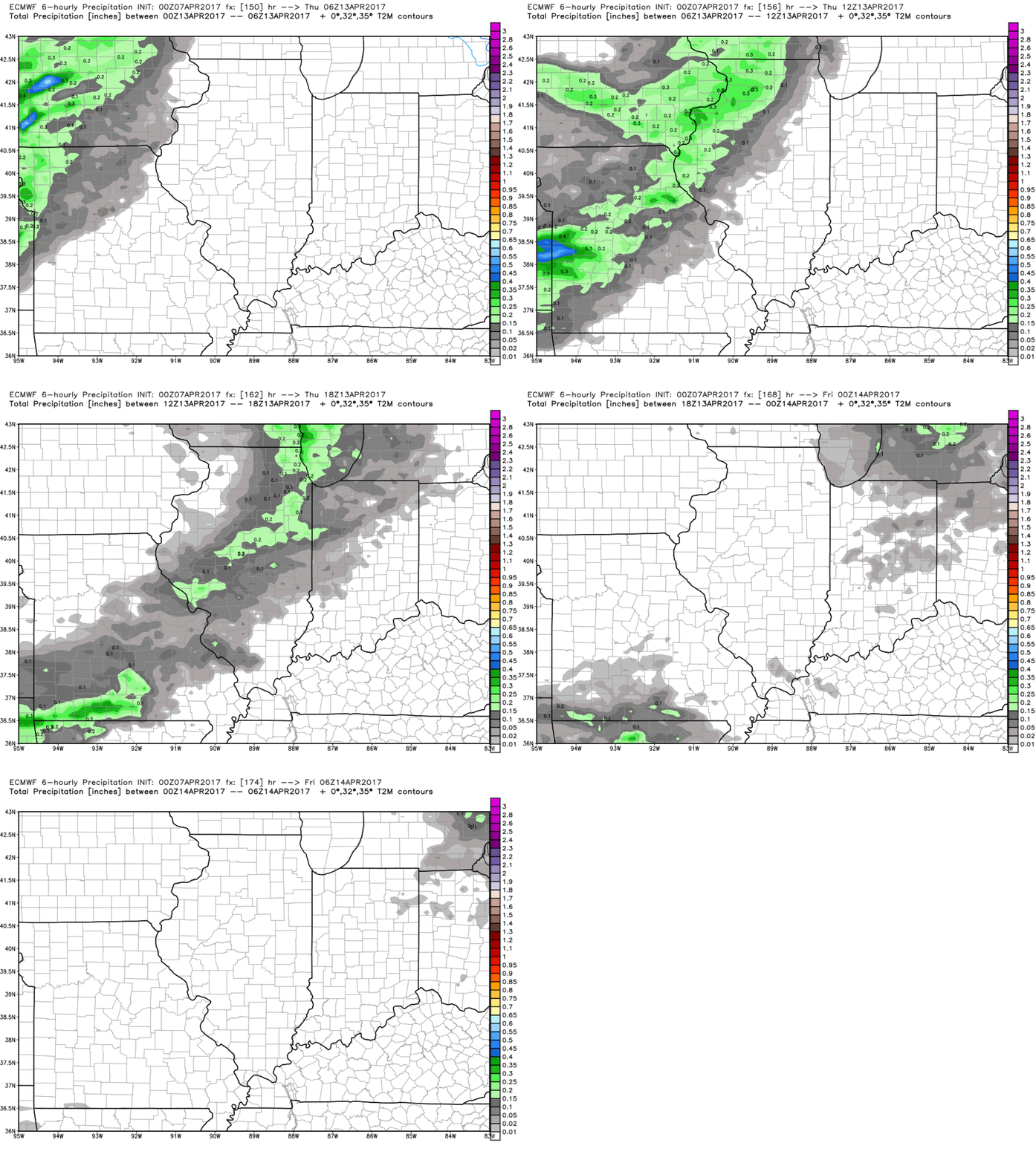
Next Thursday to Friday issue in our next chance for storms comes to the Midwest.
Overall, the next week or so is drier than normal across the Midwest, but this is short-lived given the increasing threat for more widespread above normal rainfall in the 11-15 day.
Zone 1 Quickcast:
Zone 2 Quickcast:
Zone 3 QuickCast:
Zone 4 Quickcast:
Confidence and Risk:
- Average risk for frost on vegetation Saturday morning especially across the southern half of IN into western OH…lesser risk exits further west into IL and IA.
- High confidence of plentiful sunshine and warm temperatures this weekend…some folks may even see 80s by Sunday!
- Above average risk for strong storms Monday…data isn’t too excited with the potential, but we need to watch this closely as we get closer.
- Above average confidence we remain overall drier than normal during the next week…it’s getting into week 2 where we think above normal rains turn back on.
Today’s video (6 min):
