#ILwx #INwx #OHwx Fri short-term:
Synopsis: Good afternoon, today’s update will be short and sweet, just wanted to update you all on the latest data in terms of the weekend and early next week forecast. We continue to have support for a wave of energy moving west to east over night that call for some snow showers, specifically across northeast Illinois down through portions of Zones 1/2. Data has trended slightly cooler with temperatures tomorrow morning where the snow is likely to fall which has also trended up our snowfall totals as well which we discuss below. Sunday is rather quiet in the weather department, we are still watching early next week for a cold front to move west to east across the Midwest, gusty winds, heavy rains and even a strong storm is not off the table. Have a great weekend!
The 3km NAM has a decent handle on the timing and location of the snow showers over night, we break everything down in the video. A few slick spots will be possible across northern IL and areas east where the snow does coat the surface, so if you do have a zero tolerance lot we recommend keeping an eye on these overnight into Saturday morning. Temps warm into the 40s/50s on Saturday with a southeast wind so not expecting this snow to hang around where it does accumulate.
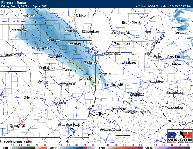
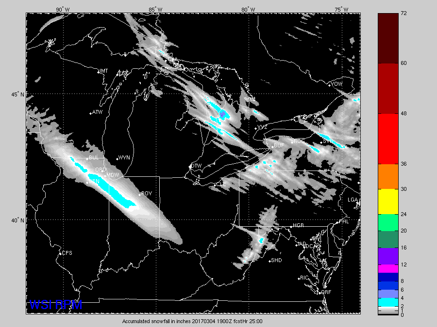
Thoughts on accumulations using the RPM model…a few locations from Rockford/Kankakee, IL southeast to Lafayette/Indy even as far south as Cincinnati may see small accumulations of snow. Currents thoughts are a ~an inch with isolated 2″ possible…other hi-res data has suggested isolated amounts near 3″, but confidence is low with this solution at this time. Skies clear on Saturday during the afternoon into Sunday and things warm back up into the 50s/60s.
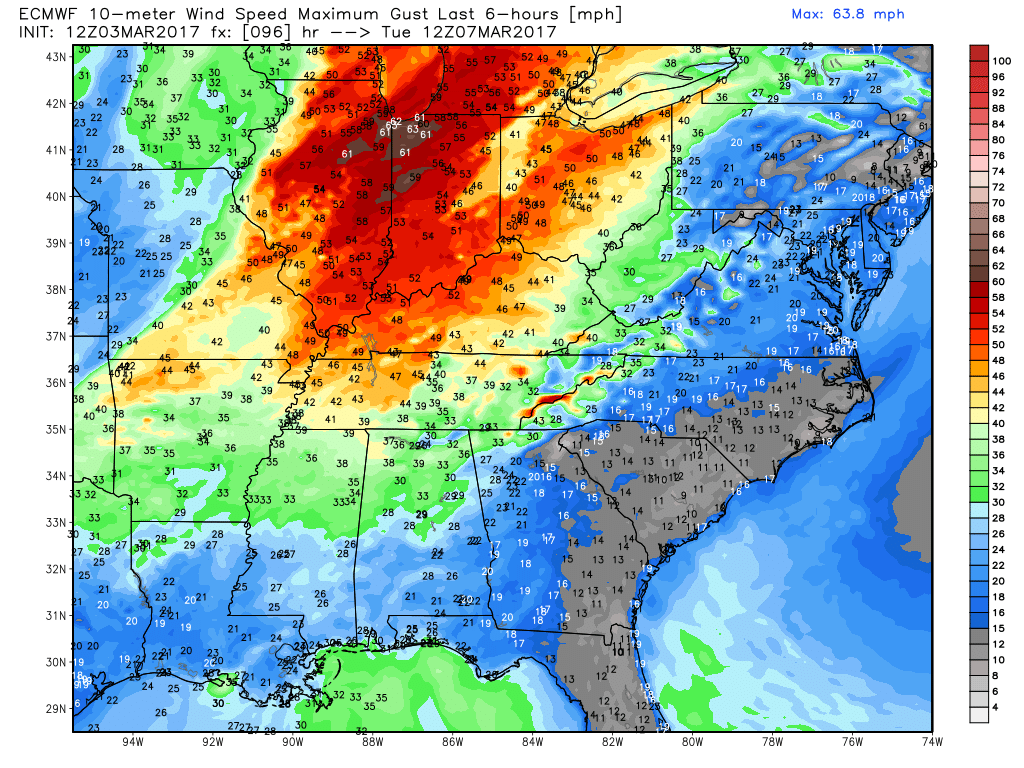
We continue to watch for some gusty storms late Monday into Tuesday across the Midwest…if things progressively get worse we will provide and update later on this weekend to make sure everyone is covered.
Confidence and Risk:
- Above average confidence of snow showers and small accumulations tonight into Saturday morning stretching from northern IL to central IN even as far south as Cincinnati, OH.
- High confidence we warm back up this weekend into the 50s/60s so any snow that does accumulate won’t stick around for long.
- Average confidence on gusty storms on Monday night into Tuesday next week.
- Today’s video (4 min):