Key Points – Monday, February 20, 2017
Synopsis: Good Monday morning and welcome to another new week! Most areas are starting off foggy this morning, dense fog even with visibilities being reported less than a quarter of a mile in many locations. In fact, it may take a bit for the fog to burn off this morning, and the longer it takes for the fog to burn off the more likely it is to impact our high temperatures today (and vice versa, the quicker it burns off the more likely we warm into the 60s again). Showers and few rumbles of thunder will be possible tonight into Tuesday as a disturbance moves west to east. Partly to mostly sunny skies and continued warmth overatakes the Midwest mid-week before our next system of interest, the one we’ve been mentioning since last week, moves in with the potential for strong to severe storms. We have our first wave of storms possible later Thursday into Friday lifting north off of a warmth front, then the next batch coming Friday into Saturday morning as the trailing cold front brings an additional chance for strong storms. We will observe chillier weather as this powerful pressure system moves east, into next week, even a little wintry weather possible? We discuss all the details in the video so make sure to watch through the end! Have a wonderful week, if you have any questions please feel free to reach out.
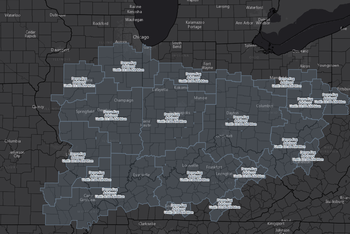
Latest Dense Fog advisories this morning:
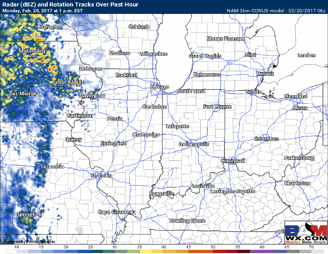
Showers and a few storms possible later today through the overnight as a disturbance moves east.
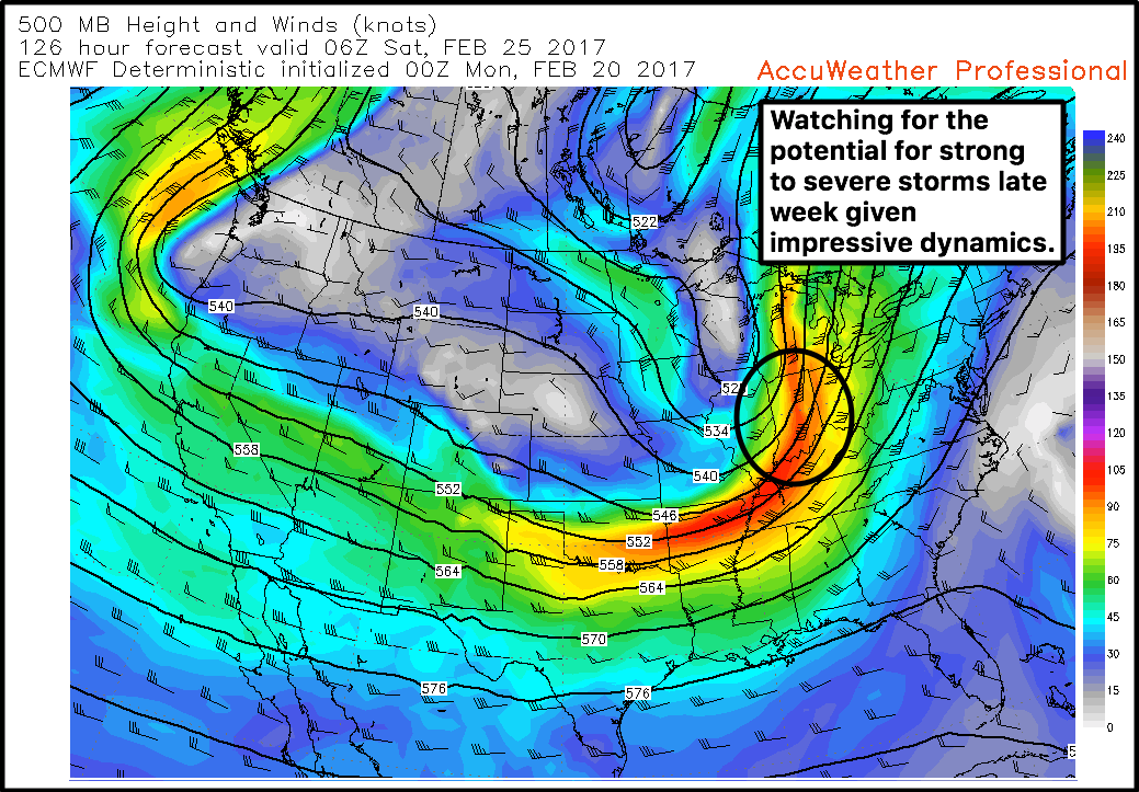
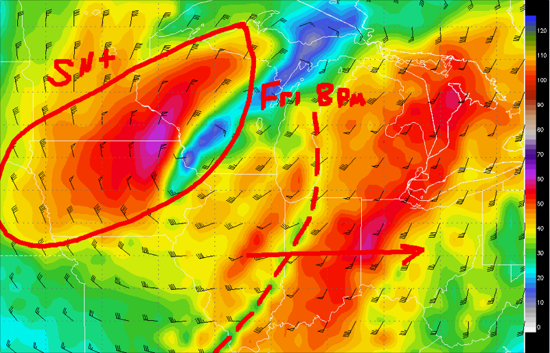
The focus, still as it has been for quite some time, is late week strong to severe storms. We continue to see impressive upper-level dynamics associated with this disturbance, where the first wave of thunderstorms are possible Thursday night (watching for hail potential with this first wave); a trailing cold front Friday will bring the potential stronger storms on a squall line moving west to east.
This is a rough area right now where we are watching for strong storms on Friday, stay glued to the forecast as we progress forward this week and fine-tune the forecast.
Impressive snow showers will be possible on the backside of this system as it exits to the east as well, details are a little hazy at this time but confidence is increasing on this threat.
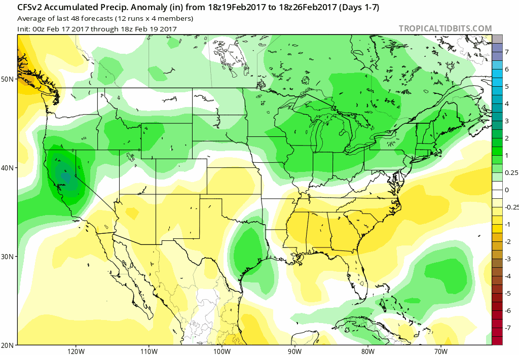
Active pattern over the next month and a half depicted well by the CFS weeklies, multiple chances for severe weather in between as well.
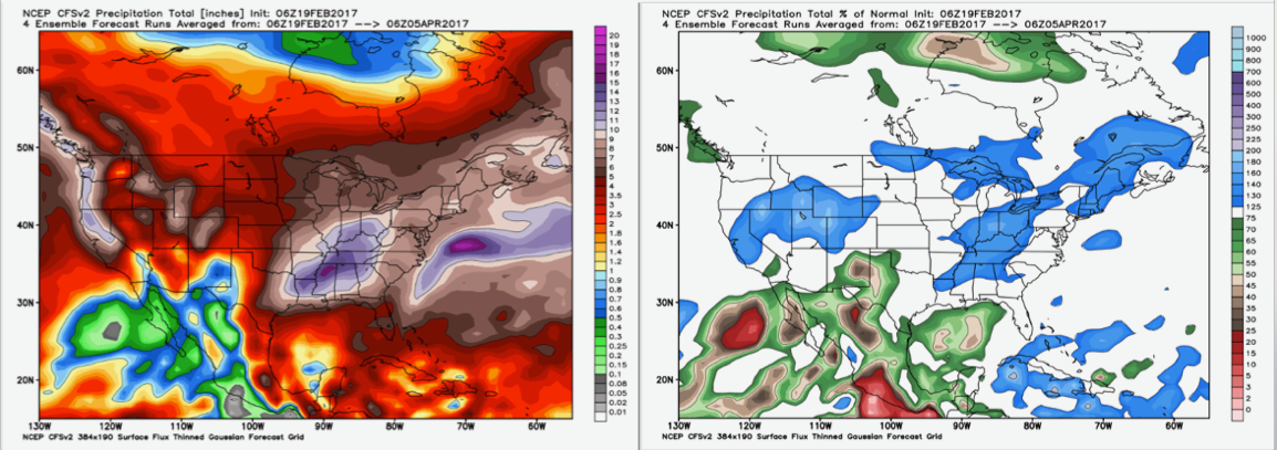
Precipitation totals/percent from normal through early April from the CFS show how active we really are in terms of above normal precipitation.
Confidence and Risk:
- Above average confidence dense fog hangs around today into late morning across the Midwest.
- High confidence we see major warmth continue this week.
- Above average confidence showers and a few rumbles of thunder possible later today into Tuesday as a disturbance moves east.
- Increasing confidence of strong to severe storms late week as a powerful low pressure system moves west to east into the Ohio Valley.
- Above average confidence we turn chillier next weekend, increasing confidence of wintry potential as well.
- Increasing confidence we have a very active pattern over the next month and a half.
Today’s video (7 min):