#ILwx #INwx #MIwx Zone 2/4 Update: Severe Risk Tonight, Much Cooler Into Next Week. E.
Key Points: June 22, 2017
Synopsis: Good Thursday morning! We are tracking a cold front moving through the Dakotas this morning bringing some severe weather. This boundary will sag south today and tonight, bringing a severe threat to the region tonight. This will push east tomorrow morning ushering in a cooler regime for the weekend into next week. The cooler pattern will persist through much of the week leading to a refreshing pattern with limited rainfall threats. Somewhat warmer conditions are expected to return next weekend along with a renewed active pattern. Have a blessed day!
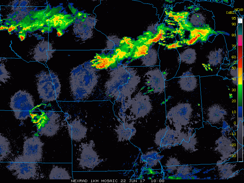
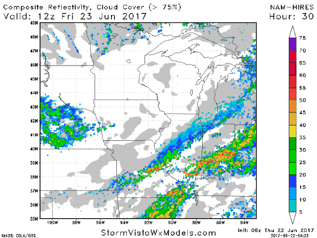
Current radar shows the boundary just to our north.
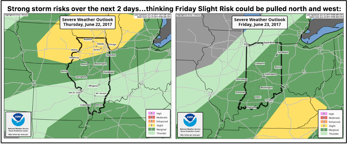
As we move through the afternoon and into the evening, the severe threat increases. The SPC outlines our area for this risk tonight into Friday.
Here’s a look at radar through tonight highlighting those storms.
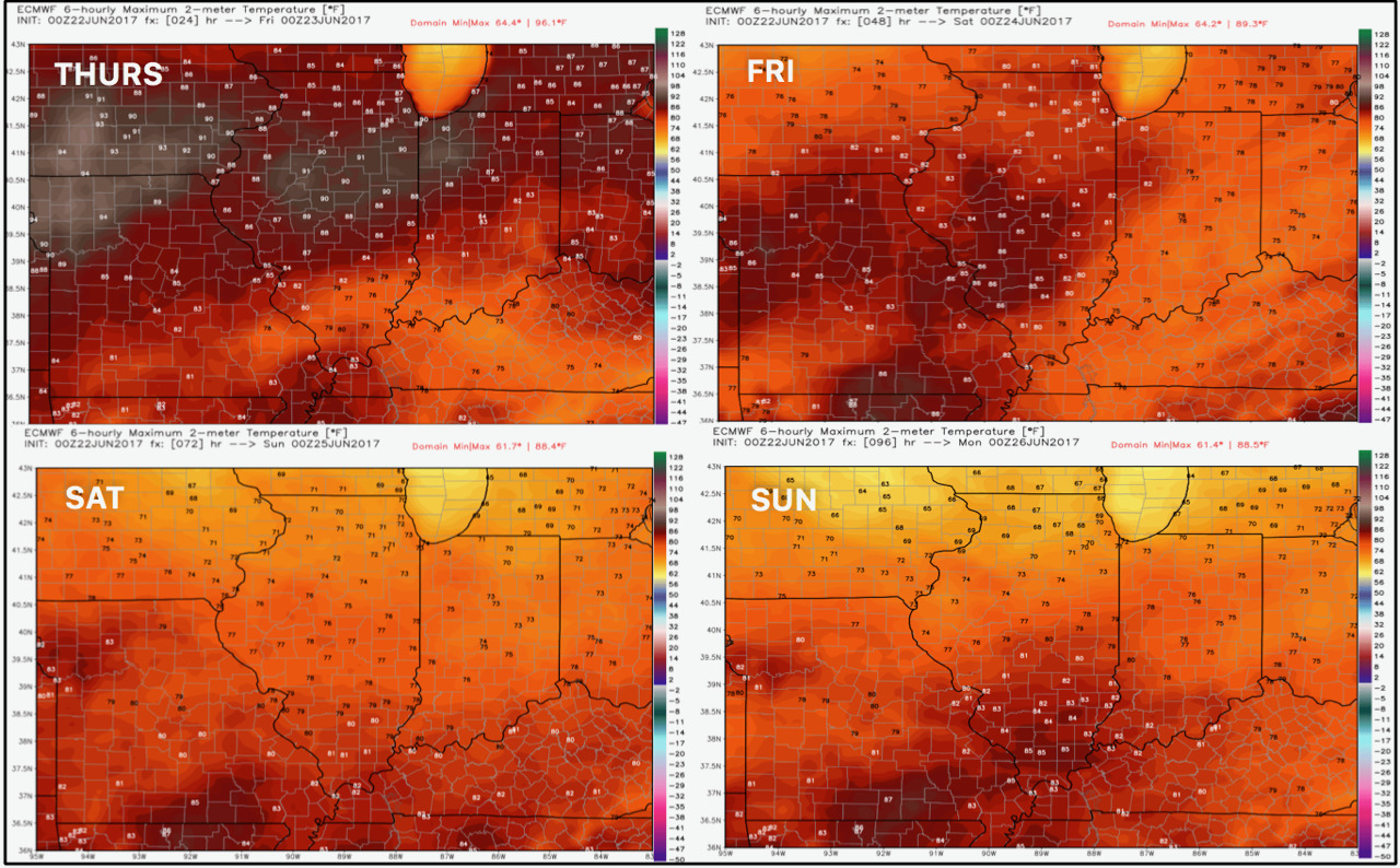
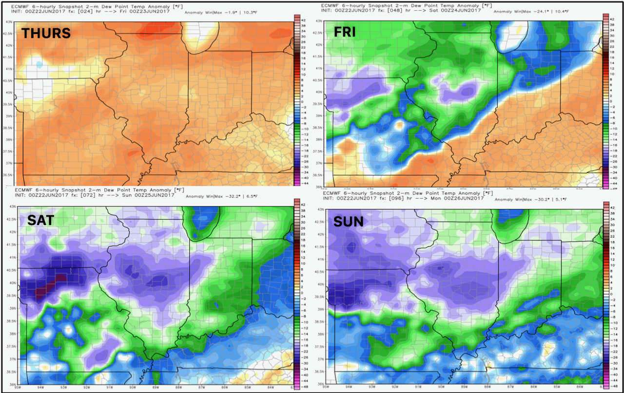
Much cooler air comes in for the weekend, shown below.
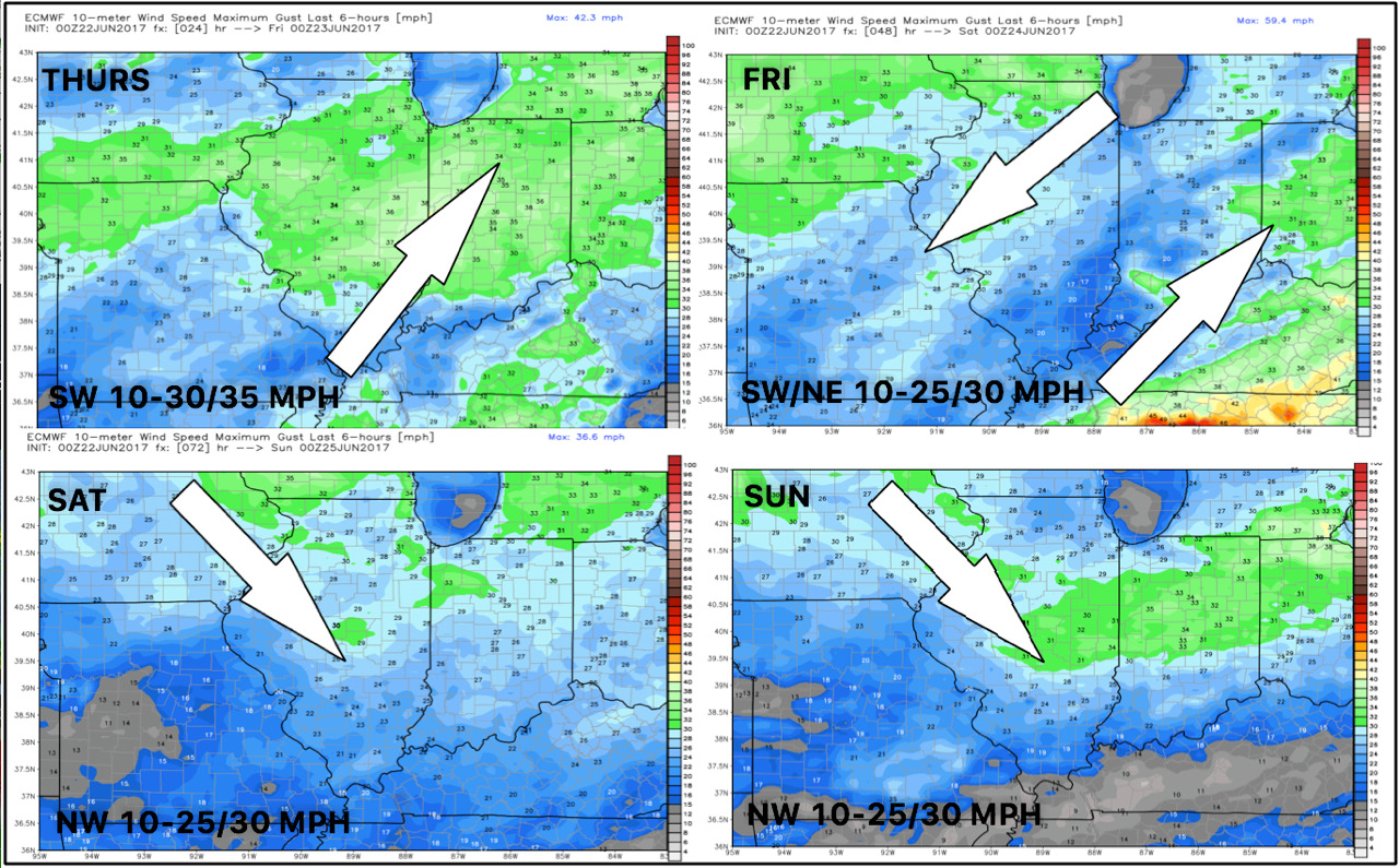
Wind forecast next 4 days.
Much drier air comes in with the cooler air as well, shown well by dew point anomalies.
Friday will be an interesting day with moisture from Tropical Storm Cindy moving into the southern Ohio Valley. At this time, we believe most of our zones will be spared, but any subtle shift north may give southern portions of the zone some good rains.
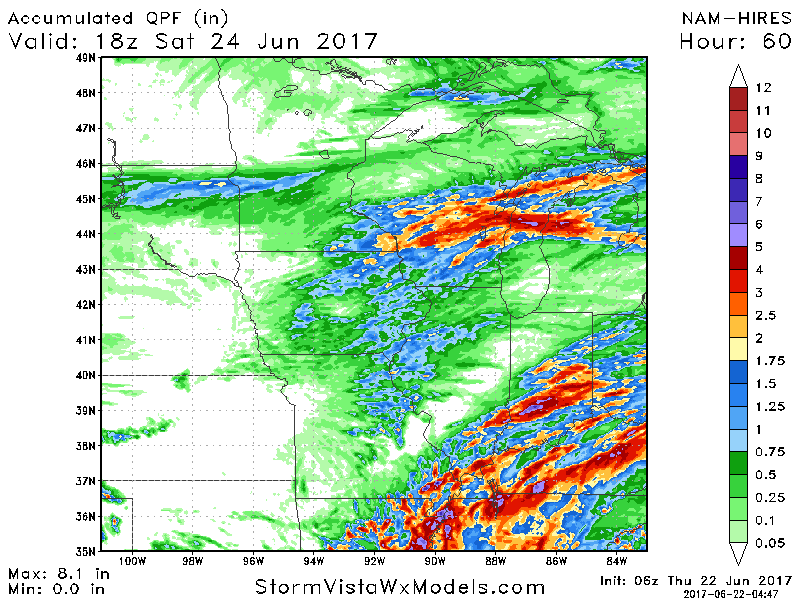
Total 3 day rainfall shows the sharp cutoff well.
Cool air looks to hang around through much of next week. Our week 1 forecast is quite chilly compared to normal!

Confidence and Risks:
- Above average confidence on a severe weather threat tonight into early tomorrow with gusty winds the main threat.
- Average confidence that most of the rain from Cindy misses the region to the southeast.
- Above average confidence on cooler than normal temperatures this weekend into next week.
- Above average confidence in active times returning later next week and beyond.
Today’s Video (8 minutes):