#ILwx Active Pattern Set To Continue Into June. Details Here!
Key Points: May 24, 2017
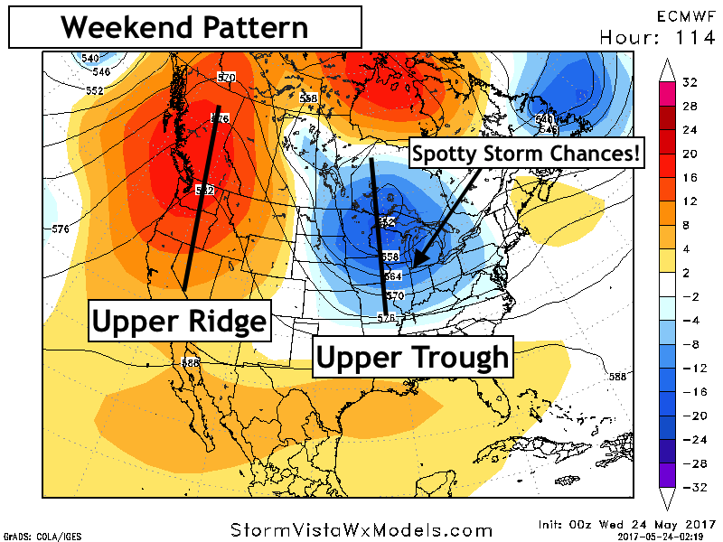
Synopsis: Good Wednesday morning! We are tracking an upper level low pressure system across the Ohio Valley bringing some rainfall to the eastern portion of the state this morning. This will continue through the day today with steady rain east, and only a few showers west. Another system is possible Friday morning in the form of showers and thunderstorms. The weekend looks to continue that spotty shower and thunderstorm threat as another upper trough approaches the region. Slightly cooler than normal temperatures and active conditions look to continue into next week as well. Have a blessed day!
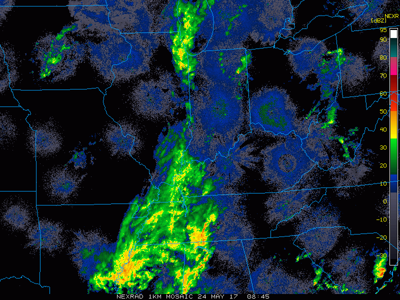
- Radar shows the rain in southeastern Illinois this morning.
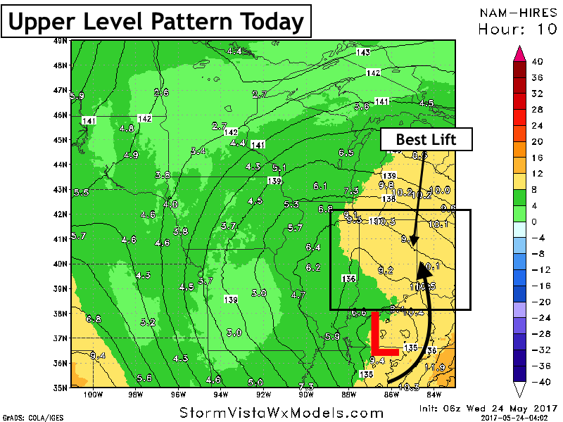
- Best rains will definitely be right along the Indiana state line closer to the best lift.
- Rains will continue today mainly across the east before ending overnight. This will set up a fairly nice Thursday with largely dry conditions and temperatures in the 70s.
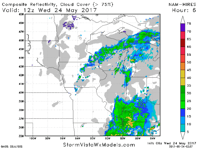
- Total rainfall looks heaviest east with haves and have nots expected across our region.

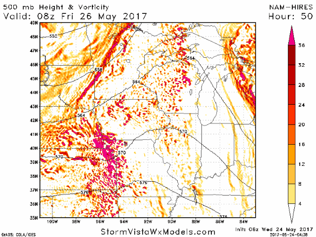
- Another threat for showers and thunderstorms will arise Friday morning as an MCS moves through. Stay tuned for more details as the track of this will determine who sees what!
- The weekend pattern continues to look active with spotty storm chances thanks to an upper trough nearby.
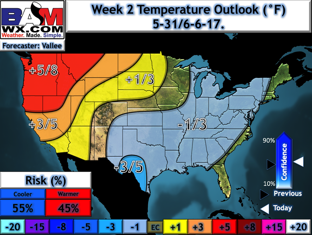
- Week 2 does look to be trending warmer as an upper ridge in the Northwest slowly moves east. As of now, it still looks near to slightly below normal, but is trending toward warmer temperatures by the end of the week.
Confidence and Risks:
- Above average confidence that rains today will feature “haves and have nots” with our region on the western edge of the best lift. Western Illinois likely will not see much rain at all.
- Above average confidence in another round of showers and storms Friday morning. However, average confidence on track of this system. Stay tuned!
- Average confidence in spotty storms continuing through the weekend.
- Average confidence in this regime continuing into week 2, but some signs of a warmer regime is showing up toward day 15.
Today’s Video (7 minutes):