#IAwx #MOwx #KSwx #NEwx Spotty Storm Chances Along With Heat Through Early Next Week. E.
Key Points: June 6, 2017
Synopsis: Good Tuesday morning! Radar this morning shows some showers across Nebraska as a weak disturbance continues to push eastward. This will spark some thunderstorms this afternoon across Nebraska and Kansas, some of which can be strong. Overall, this week will be dominated by a large ridge of high pressure leading to hot conditions late this week into the weekend. Definitely some serious heat on the table with some possibly surpassing 100°F! By next week, we are still seeing signs of change as the ridge shifts eastward. This will bring back rain chances especially north across the region along with somewhat cooler temperatures. Have a blessed day!
- Radar shows showers across Nebraska this morning.
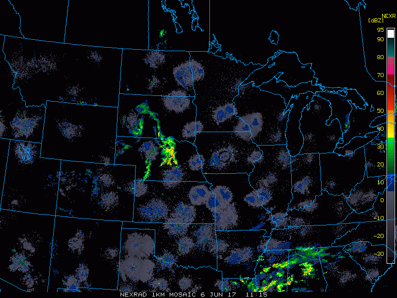
- As we move through today, this disturbance pushes eastward with showers and thunderstorms across Nebraska and Kansas. This pushes through Kansas overnight into Wednesday.

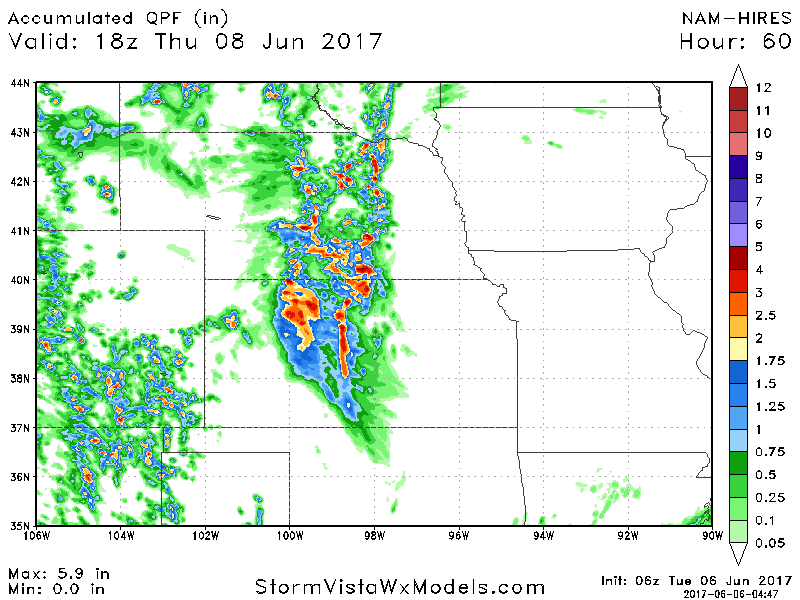
- Total rainfall through Wednesday night will be very storm dependent with some seeing 2-4″, while areas close by see nothing.
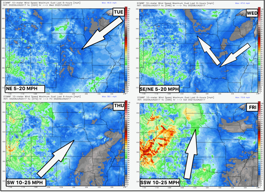
- Wind forecast over the next 4 days is shown below.
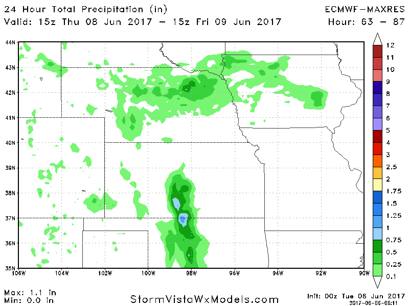
- The next rain threat comes Thursday night into Friday morning as a weak piece of energy moves through. It will be quite spotty, shown well below.
- Overall, the pattern through the week will be dominated by an upper ridge. This will allow warmer temperatures to occur by week’s end.

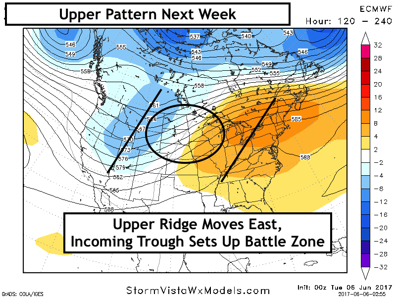
- The pattern looks to change into next week as the ridge pushes east, setting up a battle zone and a more active regime, especially north.
- Our week 2 rainfall forecast highlights the wetter trend well- stay tuned!

Confidence:
- Above average confidence some heavy rainfall and potential strong storms to the west over the today into tomorrow.
- Overall, we are warmer than normal across the northern half of the zone through the week, and much warm overall through the coming weekend into mid-next week.
- Much of the area is drier than normal across the central Plains this week and then we start seeing more consistent rains featured in the week 2 forecast.
Today’s Video (7 minutes):