#IAwx #KSwx #MOwx #NEwx Hot This Weekend With Storms North, Cooler Next Week. E.
Key Points: July 21,2017
Synopsis: Good Friday morning! We continue to track excessive heat risks through the weekend along with some severe weather risks across northeastern portions of zone 8. As we head into next week, temperatures look to return toward seasonable or even slightly below normal levels (mainly 80s and some 90s). The exception to this “rule” may be in Kansas where above normal temperatures will continue. We continue to think most activity stays in northern and eastern areas through Saturday while southern area stay drier. However, as cooler air eases into the region, showers and storms will likely return to Kansas and Missouri into early next week. If you have any questions, do not hesitate to reach out. Have a blessed day!
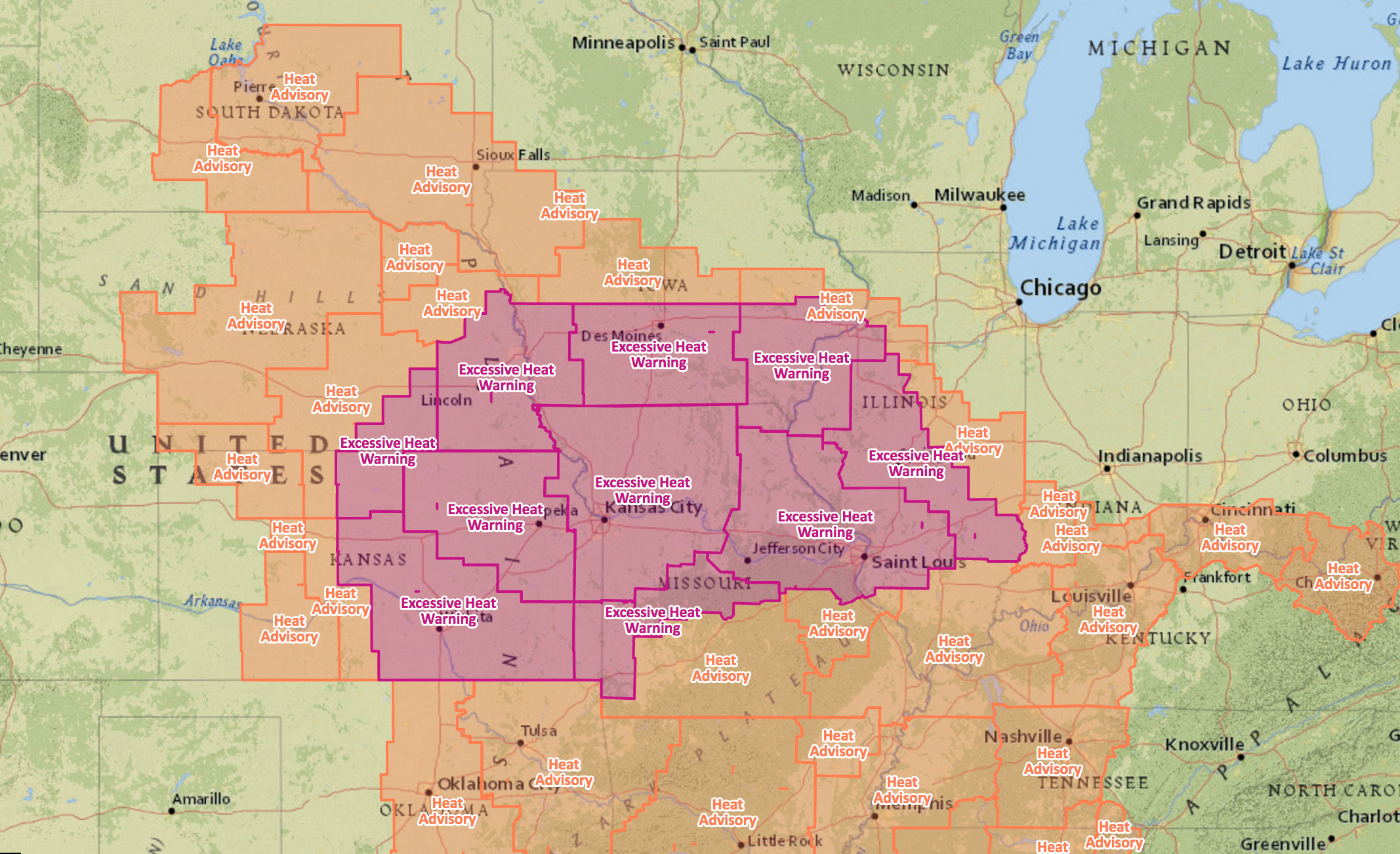
More excessive heat warnings and heat advisories are up for a large portion of the region.
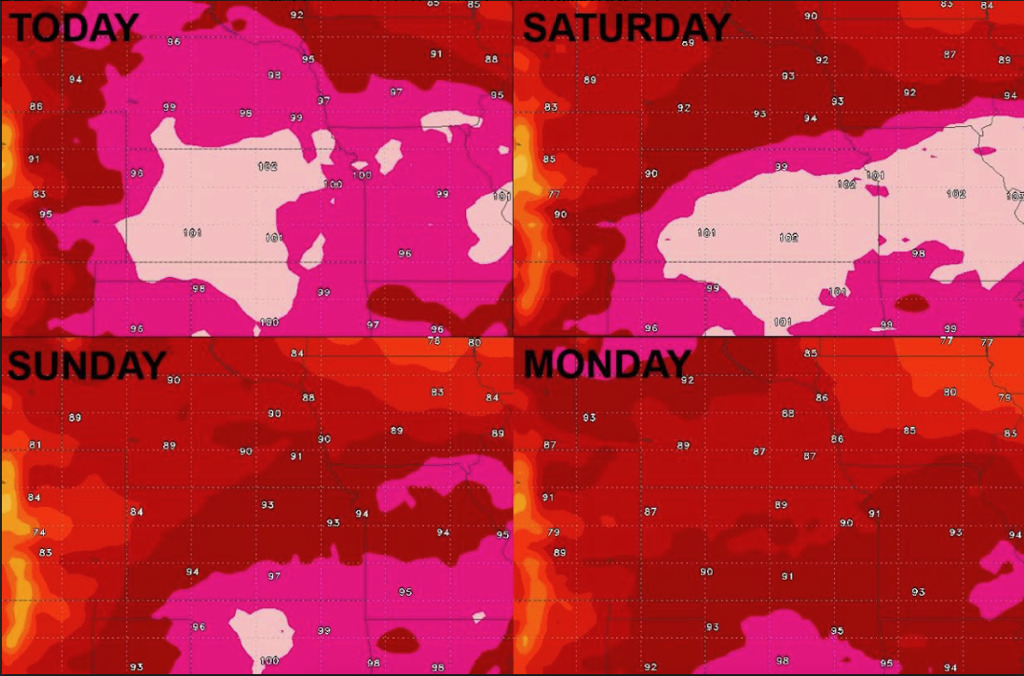
High temperatures over the coming days look to support this with temperatures in the 90s and 100s.
Dew points will also be elevated making it feel like 105-115°F!
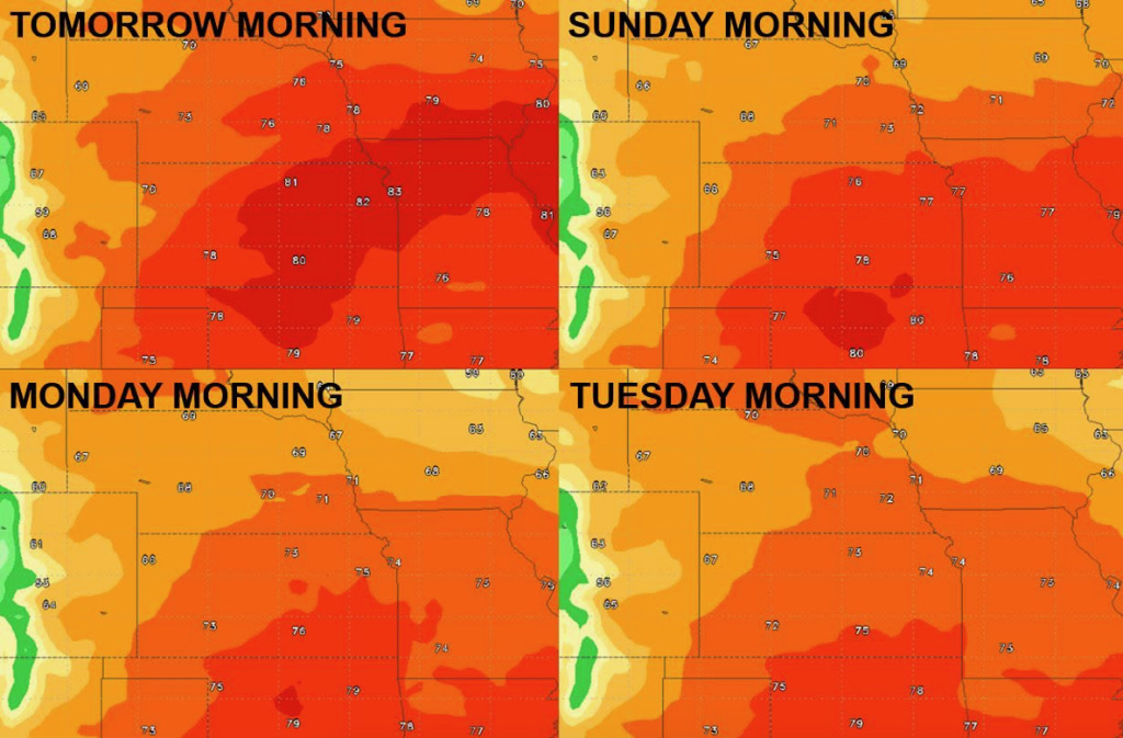
Temperatures overnight will also stress crop, only dipping into the mid-70s to lower 80s.
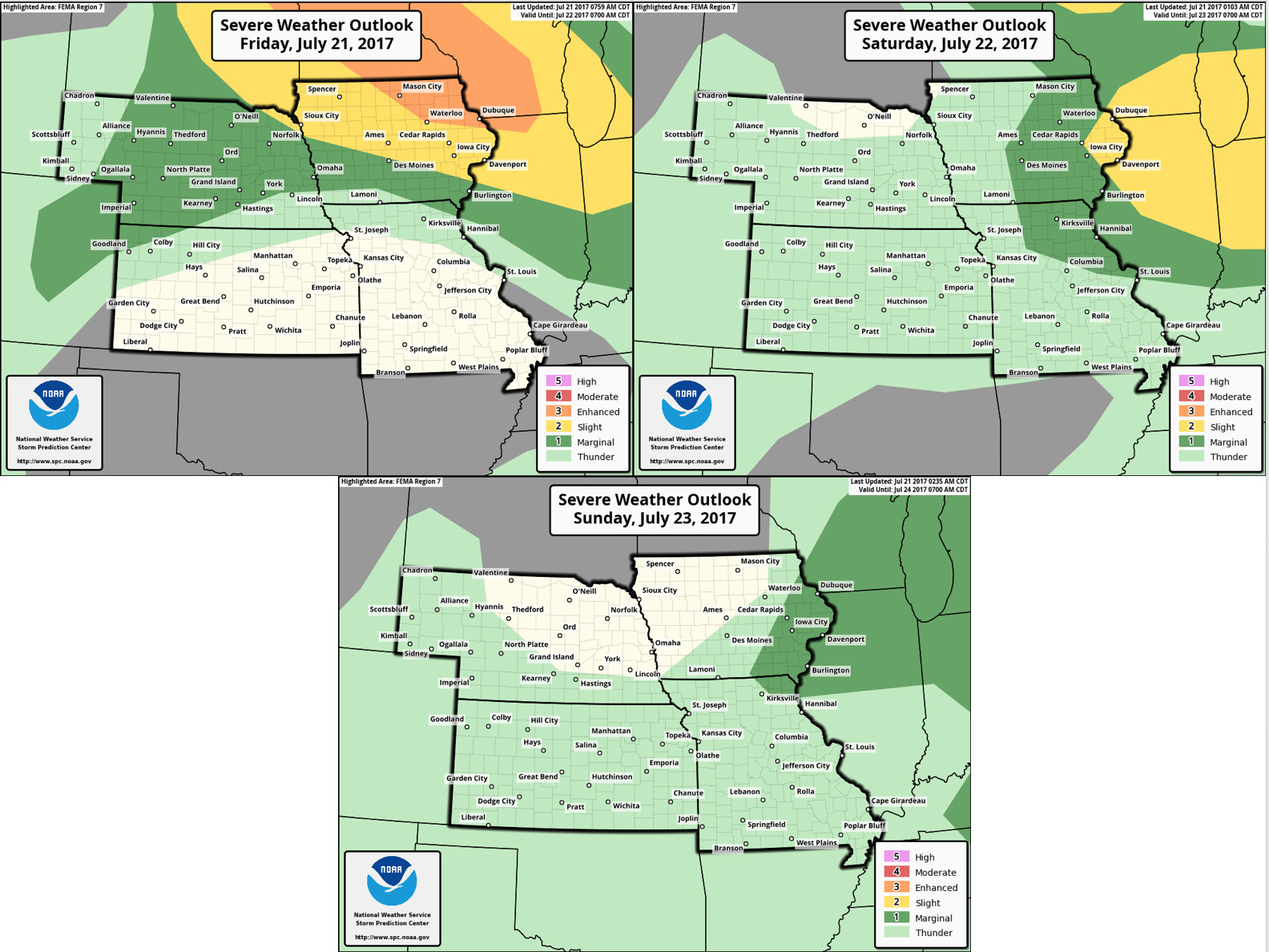
Severe weather outlook over the next 3 days highlights biggest threat in Iowa.
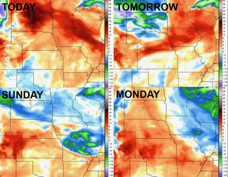
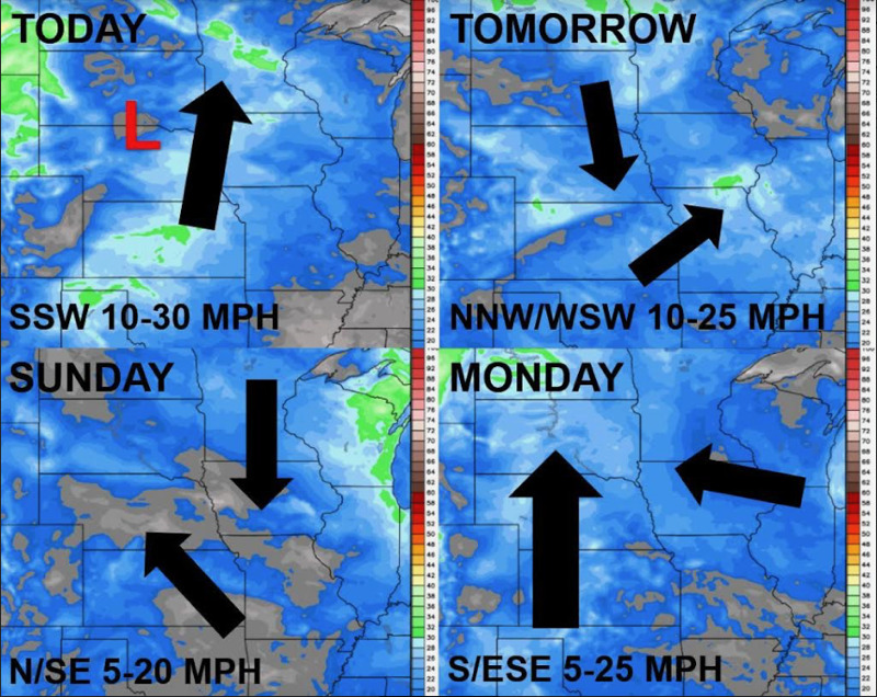
Winds over the coming days are below.
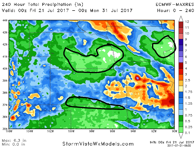
Total 10 day rainfall will be quite variable and storm dependent. Note some areas may get crushed with rains while nearby sees nothing. This is shown well below.
Risks and Confidence:
- High confidence the next 3 days will hold excessive heat for many locations across the central Plains.
- Above average confidence multiple waves of moisture still possible overtop of the ridge into the weekend…areas south will stay drier.
- Increasing confidence we see a cooler pattern work in into next week across the central Plains that we have seen this week with some rain chances south.
- Today’s Video (6 minutes):