Good Monday morning,
Focusing on the forecast for Friday night and into Saturday. The forecast this week is volatile no doubt about it. Several chances of rain and storms over the next 7-10 days. Its timing these chances that can prove to be very difficult as we saw on Saturday with the Mini. Whenever we have a north-west flow aloft in the atmosphere the weather pattern becomes increasingly difficult to pinpoint certain waves and timing with those waves. Here is our first call forecast for now.
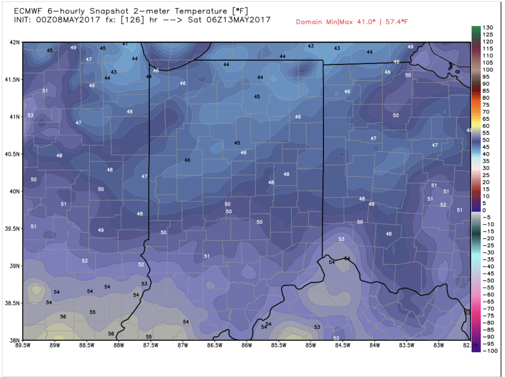
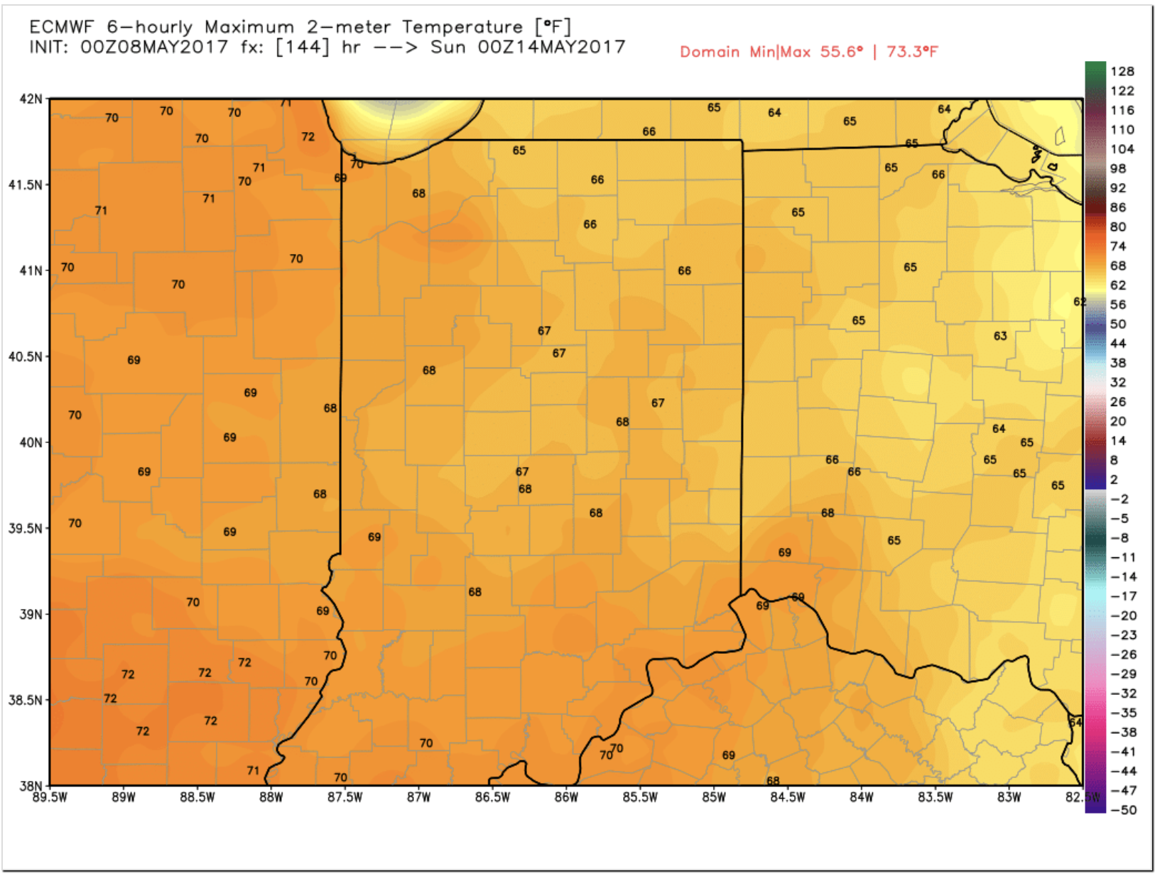
Friday setup starts at 12:01AM. Here is what temps will be like during setup.
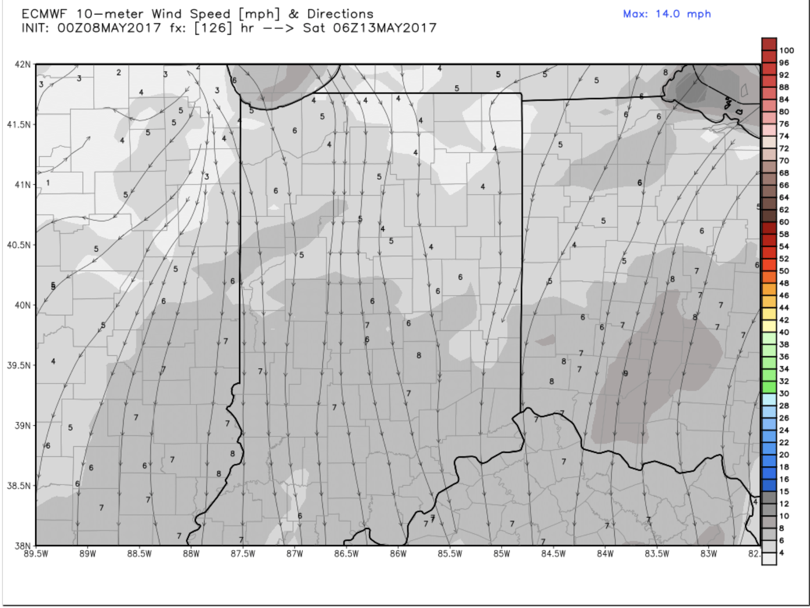
We are looking at a north wind during setup at 5-15 MPH gusting to 20 at times. With that being said I have no concerns with wind esp going off off experience with buildings blocking wind in years past.
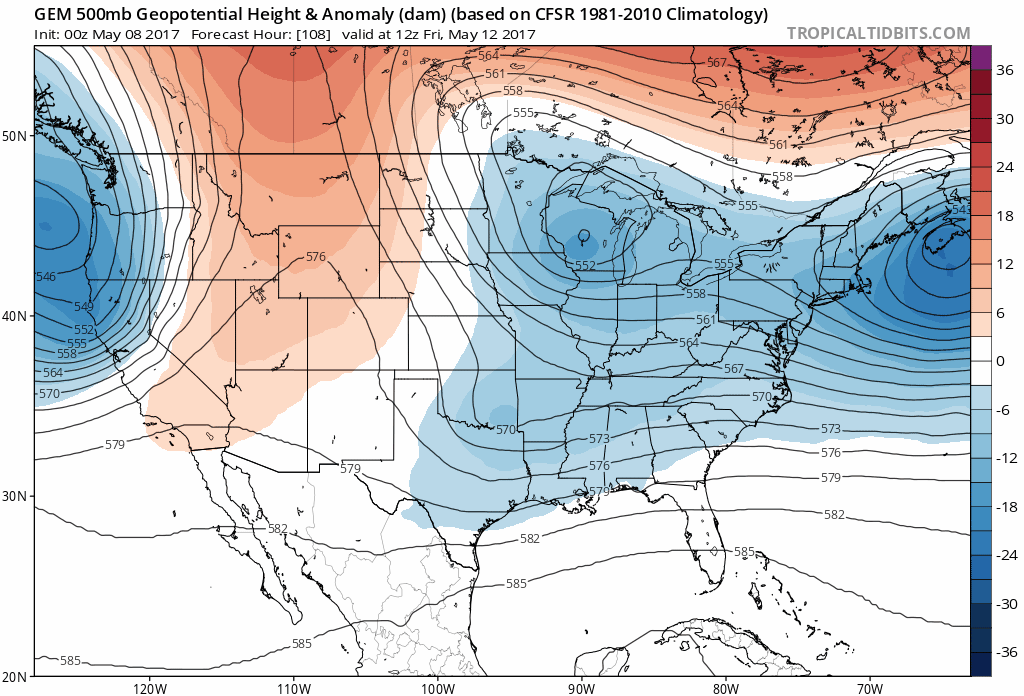
The issue right now I see is 2 of our 3 models that go out 5-7 days are trying to keep us on a NW flow with a possible upper level low hanging around. IF this solution pans out I would look for rain and possibly some thunder late Friday evening during setup. 1 of the models even tries to keep showers around on Saturday. The forecast is 110% dependent on what the upper level low does. The model suggesting the low hangs around is the Canadian model and you can see what I mean by that below.
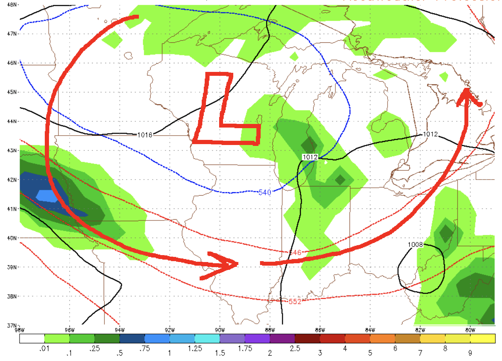
Currently my call is a 40% chance of rain Friday night 8pm-2am from this energy moving NW to SE. It doesn’t look like anything severe or wild. If it rains perhaps up to 0.50″ of rain. It’s a fluid forecast that will need fine tuned.
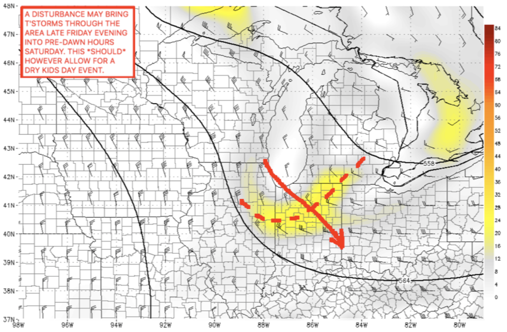
Currently my call for Saturday is skies to become partly sunny and to dry out. That is favoring the European model solution. If the Canadian model wins out we will trend cloudy with showers but that’s not my idea for now. Temps will be in the upper 60s to ~70 afternoon. Winds NW 5-15 MPH.
If you have any questions please do not hesitate to contact me.
Respectfully,
Michael Clark
Meteorologist in charge
Bamwx.com