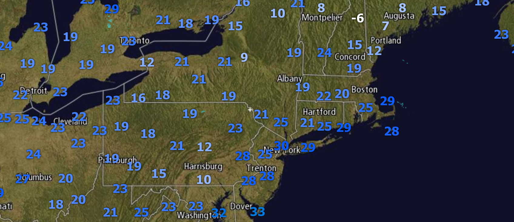
Good morning. The radar is quiet this morning, but it is very cold out there! Here are the latest temperatures as of 6 AM.
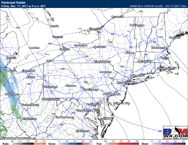
The forecast for today from yesterday afternoon’s update has not changed much, with some mixed precipitation moving across Ohio, northern West Virginia, and western PA this afternoon into the evening before a change to rain. Some slick spots are possible before the change over. Some light snow is possible in interior eastern PA and the Hudson Valley late tonight with a small accumulation possible. Here is the expected radar.
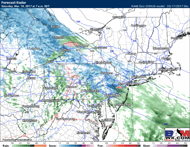
Saturday looks to feature a mix of rain and snow for most with little to no roads/pavement issues as temperatures should be above freezing. Notice toward the evening a more concentrated band of snow is expected to develop – where that occurs is VERY uncertain and will determine who sees any significant accumulation. Here’s the projected radar through Saturday.
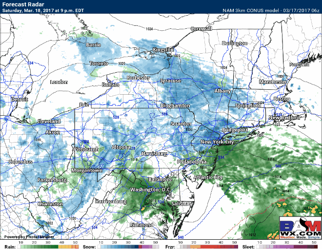
Saturday evening into Sunday morning is the real worry for any significant snow across NYC, Long Island, and southern New England. Where this banding sets up is crucial and VERY uncertain right now. The latest NAM would now suggest heavier snow from NYC eastward across Long Island and southeastern New England.
The European is still further south and east – lowering confidence.
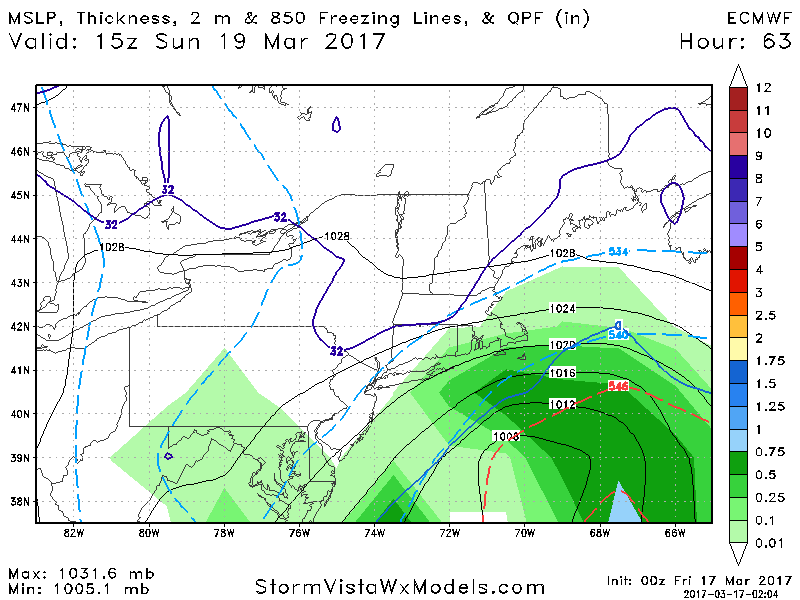
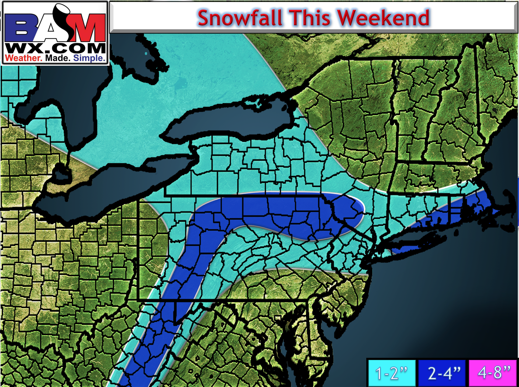
Here’s some updated thinking for snowfall. Again, note this is VERY uncertain and dependent on where a very narrow band of snow can set up. I’ll have an update this afternoon with the latest data.
Risks and Confidence:
- High confidence on some mixed precipitation through Saturday night across the region with some accumulation, especially on grassy surfaces.
- Low confidence on where a band of snow sets up Saturday night into Sunday morning. This band is very difficult to pinpoint and I will continue to watch this through the day and into the weekend.
The video below covers it all. ~Ed