#CTwx #MAwx #RIwx #NYwx #NJwx Dreary Into the Afternoon, Taste of Summer This Weekend! E.
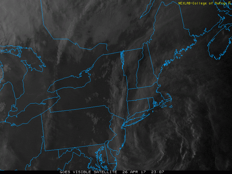
Good morning! We continue to watch a weak area of low pressure spinning off the coast of New England leading to fog and some light rain this morning. Here’s the latest satellite.
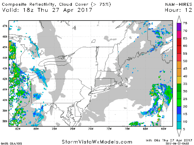
A cold front approaching from the west will push this system eastward and also bring some showers and thunderstorms across western areas today. Some may be gusty will hail.
Temperatures will rise into the 70s and 80s west, but be stuck in the 50s and 60s with more clouds across New England.
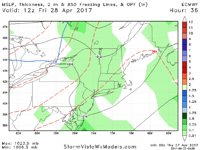
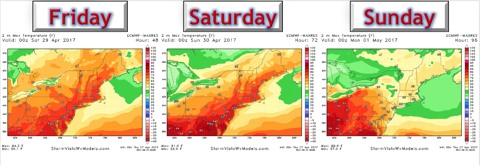
A weak cold front will stall across New York and New England through the weekend. Here’s the European through Sunday.
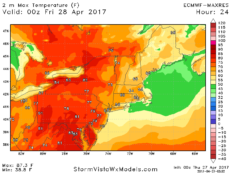
Temperatures will be very warm away from the shores Friday and Saturday, then cool Sunday as easterly flow takes over across New England. Ohio and western PA will remain warm even into Sunday. High temperatures each day are shown below.
More showers will occur Monday into Tuesday as a warm front, then cold front moves through the region.
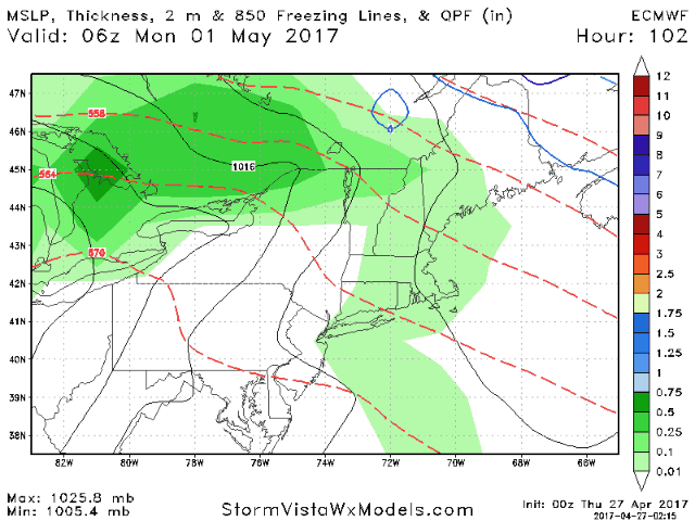
Total rainfall looks light across New England, but up to 1 inch in Ohio and western PA thanks to additional thunderstorms.

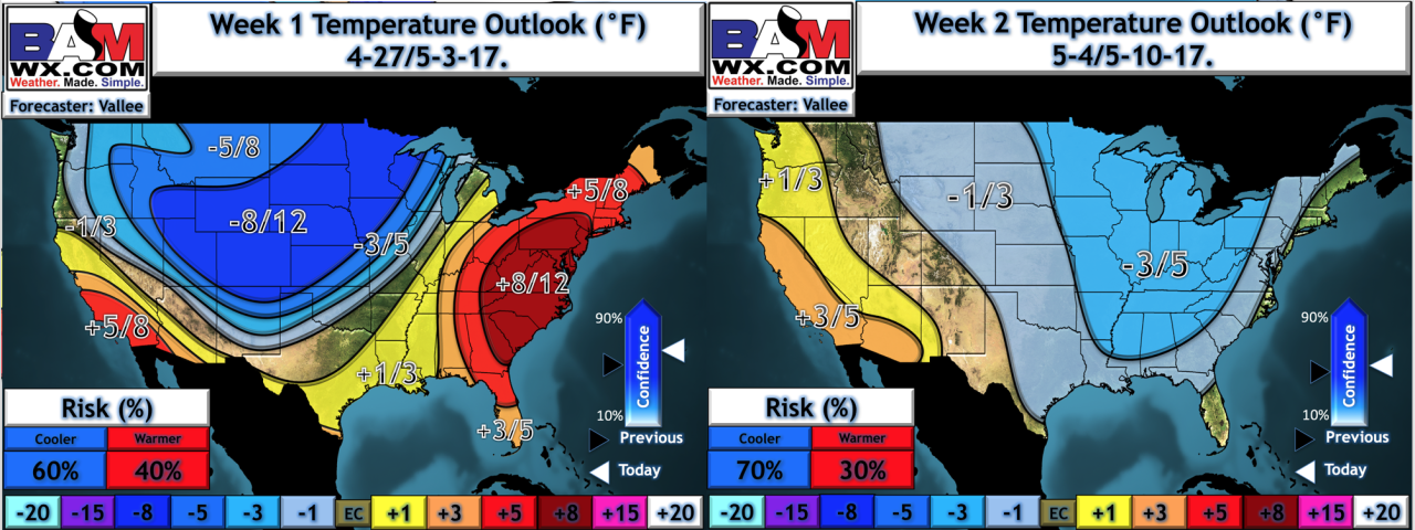
Overall, week 1 looks quite warm, with temperatures even below normal into week 2. Here’s a look at our forecast.
Have a wonderful day! ~Ed