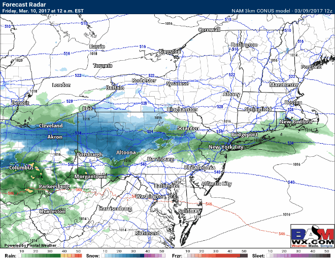
Good afternoon. Data remains similar this afternoon for the snow expected overnight into Friday. A bit of rain or perhaps a rain/snow mix will overspread the region this evening west and overnight further east, quickly changing to snow as temperatures rapidly drop. Here’s a look at the high resolution radar through the event.
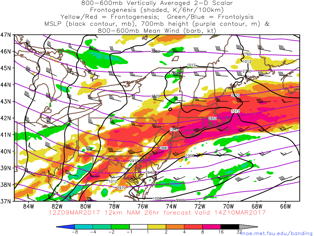
Our “frontogenesis” products (lift in the atmosphere) give us a good idea of where the steadiest bands of snow can be. Here’s the latest.
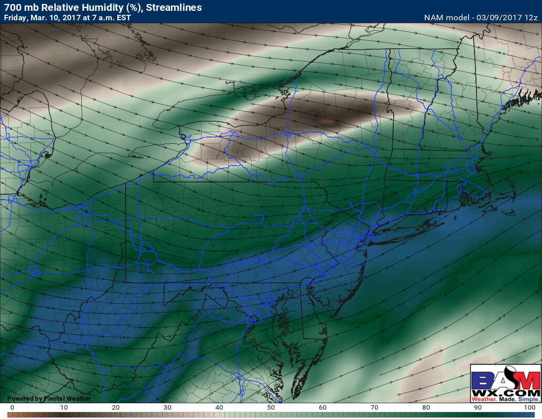
With that said, north of about I-84 is that some dry air will be present, leading to a tight gradient in snowfall accumulations. Here’s an idea of the relative humidity (moisture) at cloud level. Notice the northern Hudson Valley, northern CT and western MA has lower values – dry air!
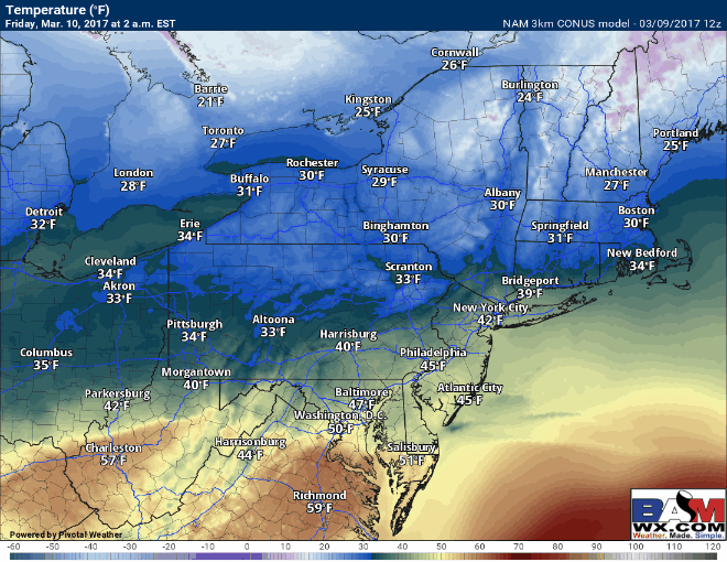
Temperatures look similar to past updates with most areas near to slightly below freezing during the event, warming into the 30 in the afternoon, then flash freezing back into the teens tomorrow night.
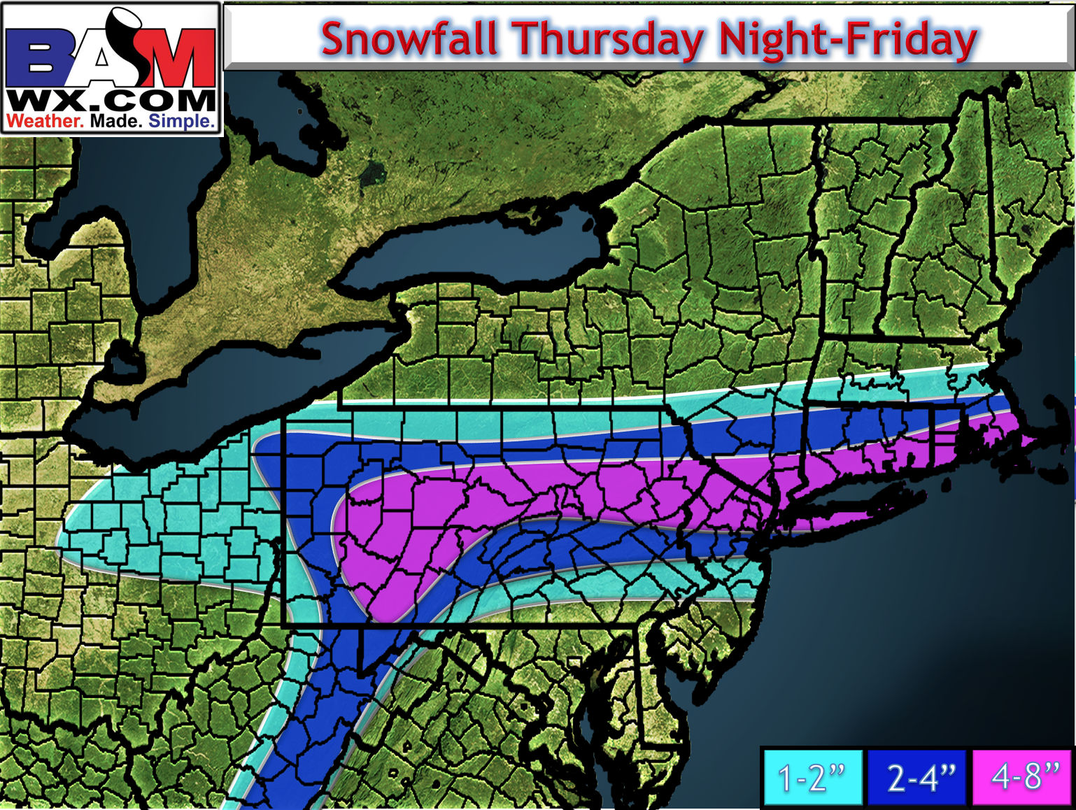
Latest snowfall map, tweaked ever so slightly.
I’ll touch on the next threat for Tuesday in the video below so make sure to watch!