Synopsis: Good Monday afternoon! This update covers the latest thoughts regarding the ongoing rainfall across the region as a slow-moving frontal boundary continues to move through. The heaviest rains look to fall in the southern portions of the area this afternoon lasting into Tuesday, then the rains will decrease in coverage/intensity as the front pushes east and out of the region mid-week.
Video (5 min):
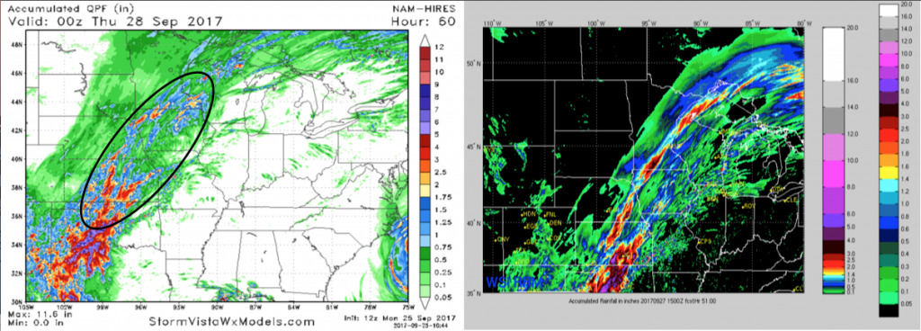
Here is the latest rainfall guidance off the hi-res NAM and RPM models. Both models indicate 2-4″ of ADDITIONAL rain in portions of central Kansas. Still looking at localized heavy rains further north along the front from southeast Nebraska, across Iowa, and south/east Minnesota.
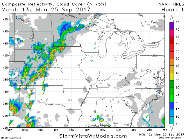
Latest future radar off the hi-res NAM times everything out for you: