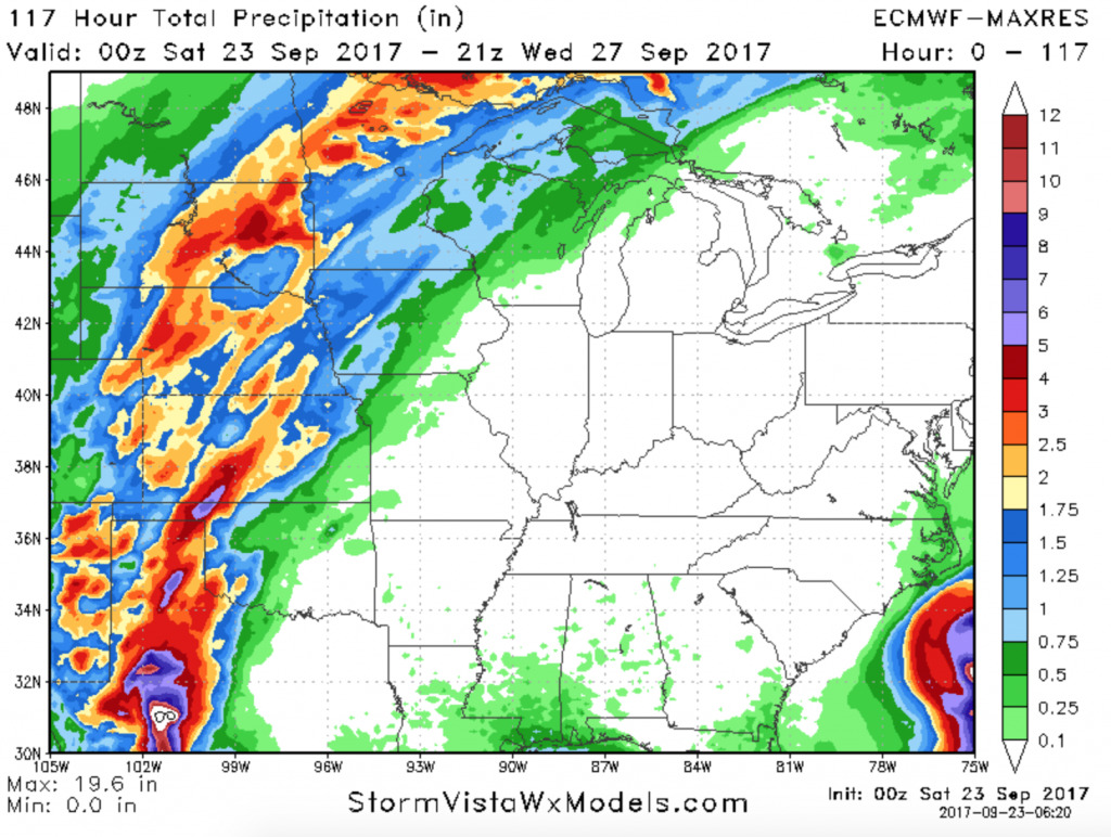
Synopsis: Good Saturday afternoon. A stalled frontal boundary slicing the northern and western Plains is setting up quite the gradient in weather conditions…from sun and heat further south and east, to rain and sharply cooler temperatures behind the front. This front will slowly make some eastward progression over the next few days, with the heavy rainfall threat continuing through Tuesday. Latest on timing/coverage and rainfall amounts in the video below. Have a great afternoon, and let us know if you have any questions!
Short-term video (7:36):
Rainfall accumulation forecast off the European model through the middle of next week: