Key Points – Friday, August 25, 2017:
Synopsis: Good Friday morning! In today’s video we discuss the additional showers and storms forecasted to move across mainly Nebraska and Iowa as we head into the weekend, some of these possibly being strong to severe with localized heavy rainfall. Quiet weather settles in early next week, all eyes still on Hurricane Harvey as potential impacts to the southeastern parts of the forecast area definitely remain in play as well. If you have any questions please let us know, have a blessed weekend!
Today’s video (7 min):
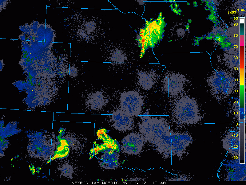
Current Radar shows us waking up to additional showers across eastern Nebraska and western Iowa this morning:
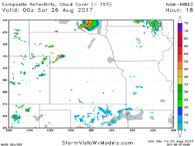
Next chance for greater coverage of showers and storms is overnight into Saturday mainly across parts of Nebraska into Iowa:
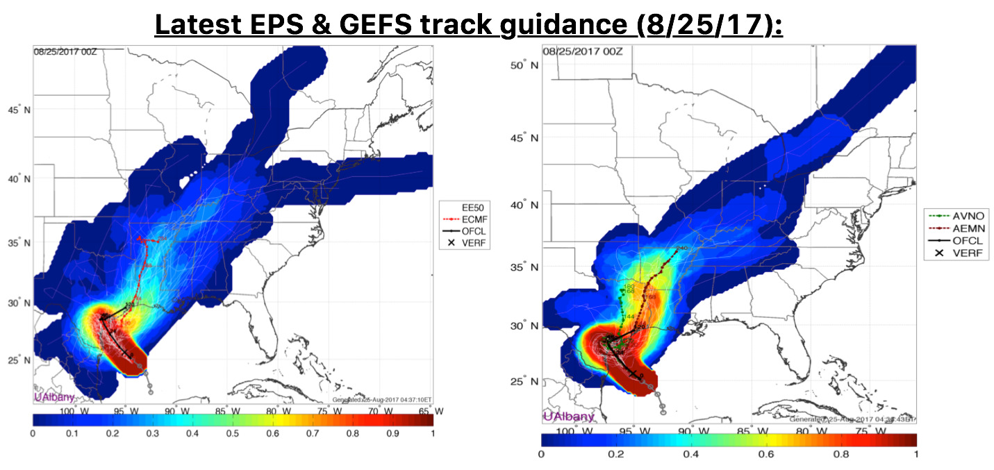
Still focusing our attention on potential Hurricane Harvey impacts into next week as latest data continues to track it north impacting southeastern zone locations. The specifics are still fluid as it all depends on how long it stays down south…we will update on this often.
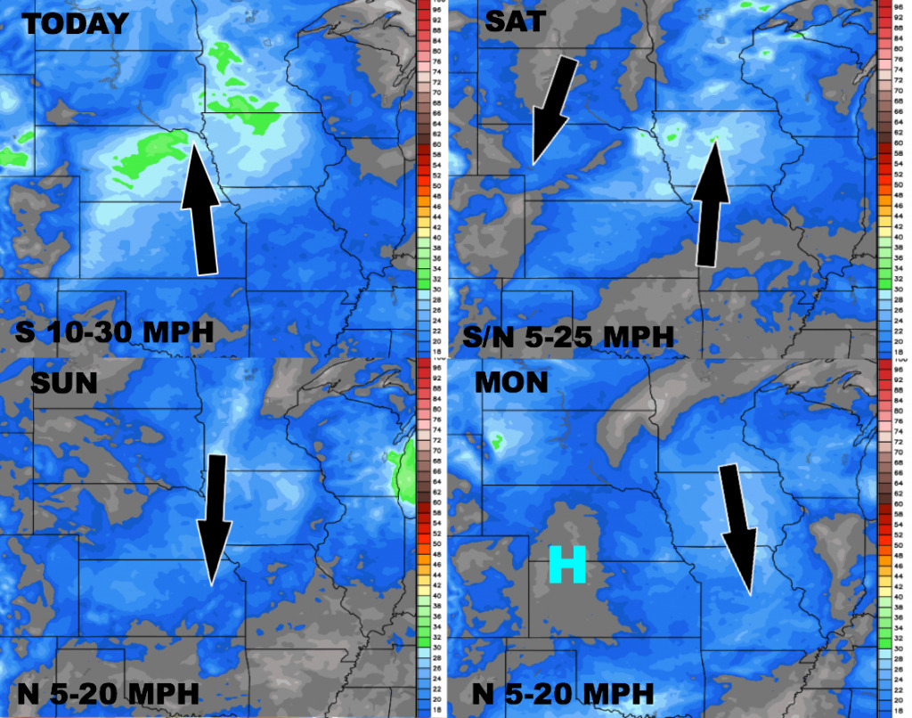
Wind forecast over the next 4 days:
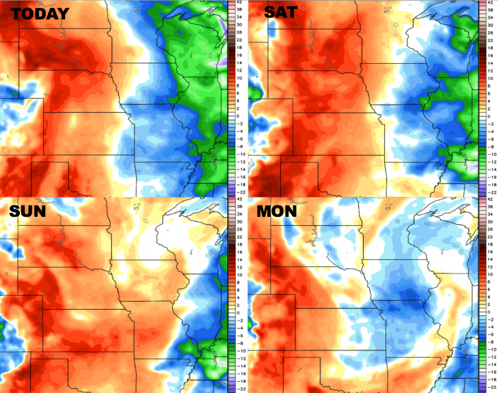
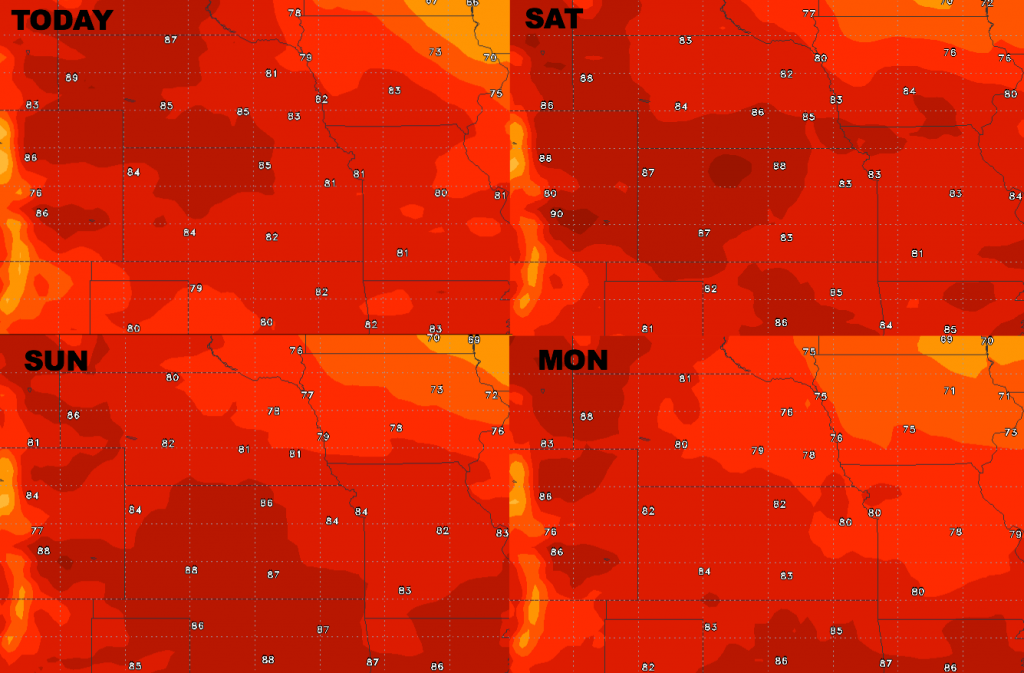
High temperature guidance into early next week:
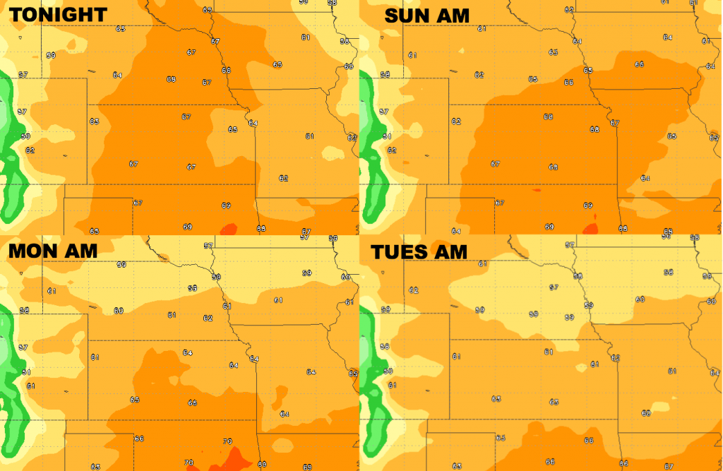
Low temperature guidance into early next week:
Dew points from normal…increasing humidity through the weekend with drier air early next week.