Key Points – Thursday, August 24, 2017:
Synopsis: Good Thursday morning! Today we discuss the isolated to scattered shower and storm threat working east mainly across the northern tier of the forecast area as we head into the weekend (can’t rule out a few isolated strong storms) as well as some potential implications of tropical storm Harvey to the southeastern zone locations as we head into next week. If you have any questions please let us know, have a blessed day!
Today’s video (6 min):
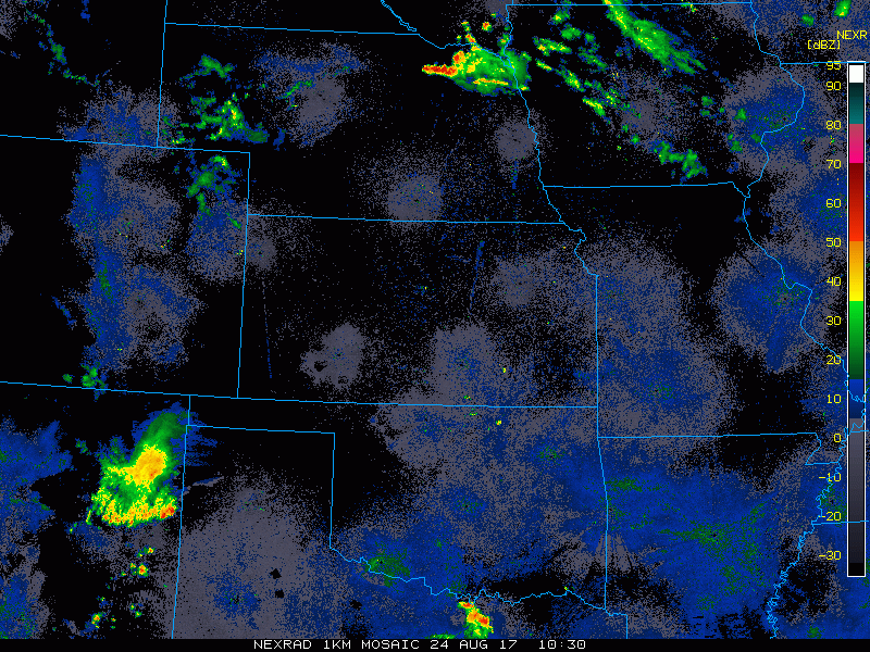
A few scattered showers and storms working east across the northern tier of the forecast area this morning:
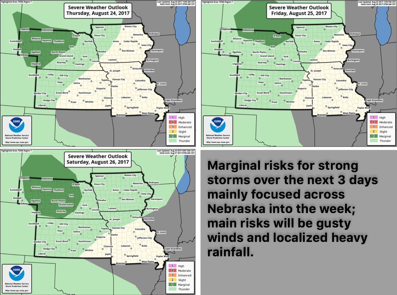
Although the risk isn’t great, in the video we highlighted a couple strong storms not out of the question across Nebraska and NW Iowa locations at times over the next 3 days:
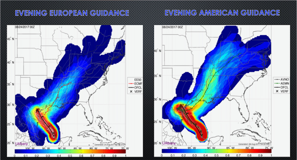
We also discussed in the video implications to the southeastern zone locations with tropical storm Harvey and potential impacts…all dependent on the speed of the trough working east but some localized heavy rainfall and gusty winds not be out of the question close to the Bootheel of Missouri into early next week.
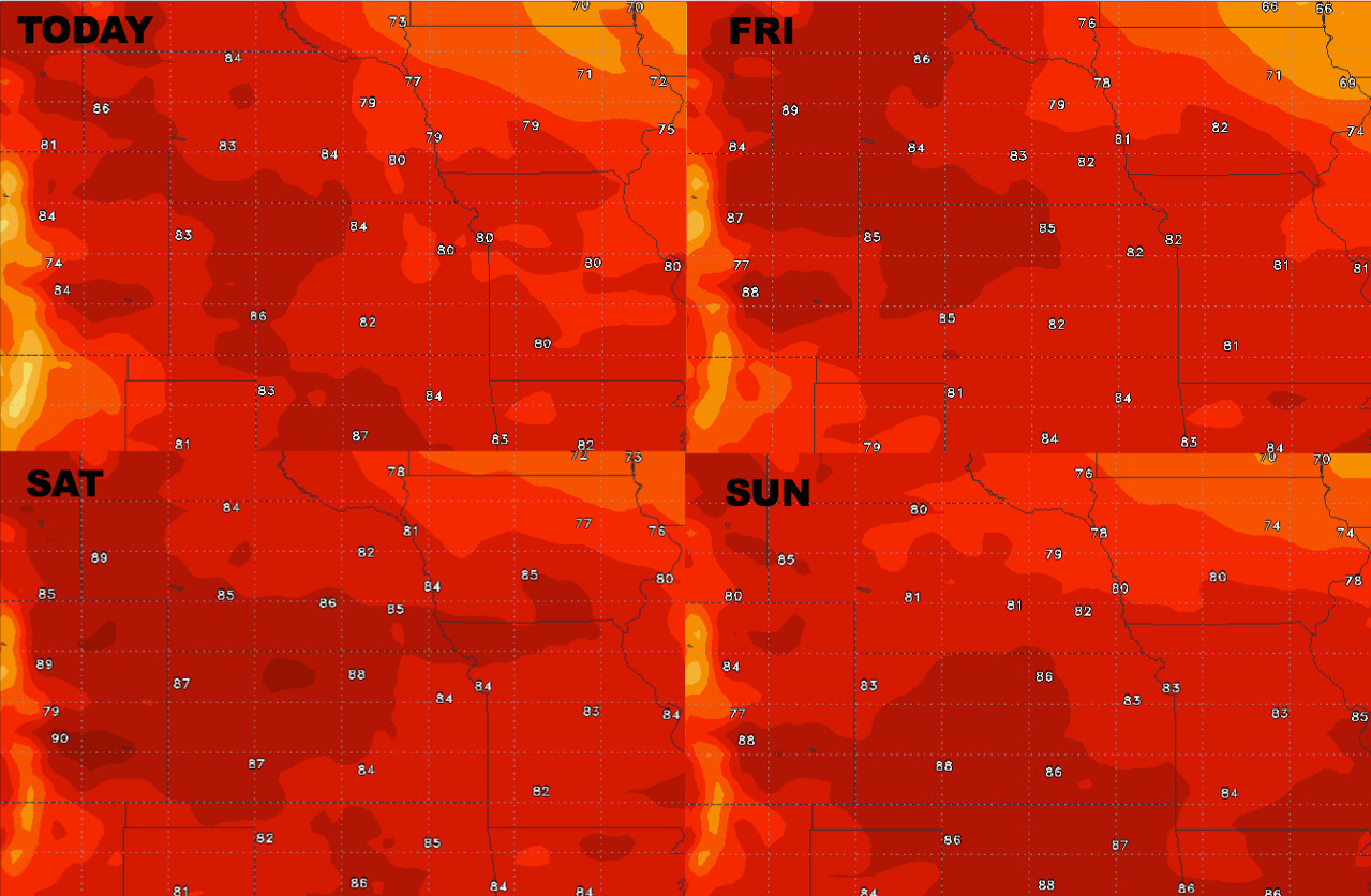
High temperature forecast as we head into the weekend:
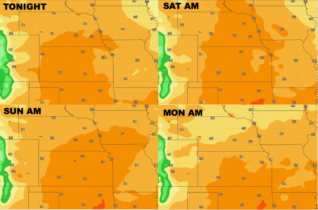
Overnight low temperature guidance is slightly elevated with overnight lows here into the mid to upper 60s at times:
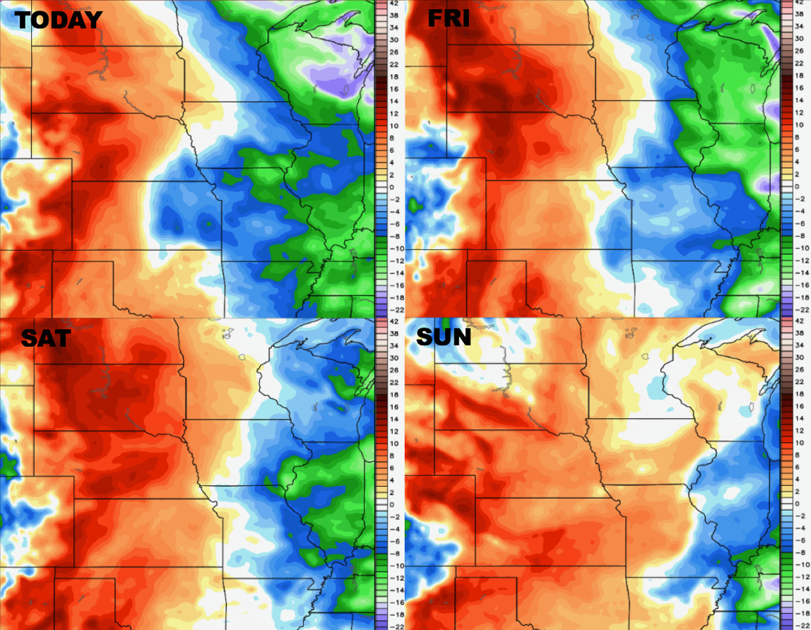
Dew points from normal show the more humid air mass working in across the western half of the forecast area:
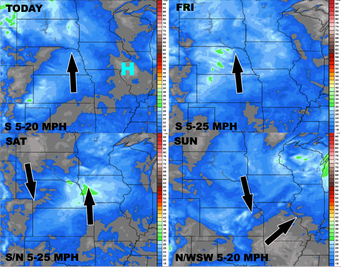
Wind forecast over the next 4 days is below: