Key Points – Tuesday, August 29, 2017:
Synopsis: Good Tuesday morning! We continue to remain quiet with weather across the central Plains this morning with a few locations waking up to patchy dense fog…can expect this to continue into late week each morning going forward. We also discuss the latest on Harvey and the impacts to our far southeastern zone locations Thursday into Friday bringing heavy rainfall potential. Otherwise, our next best rainfall chance comes late Thursday night into Friday from west to east across the central Plains. In the video we also discuss the temperature trend into next week. Have a great day, and let us know if you have any questions!
Today’s video (6 min):
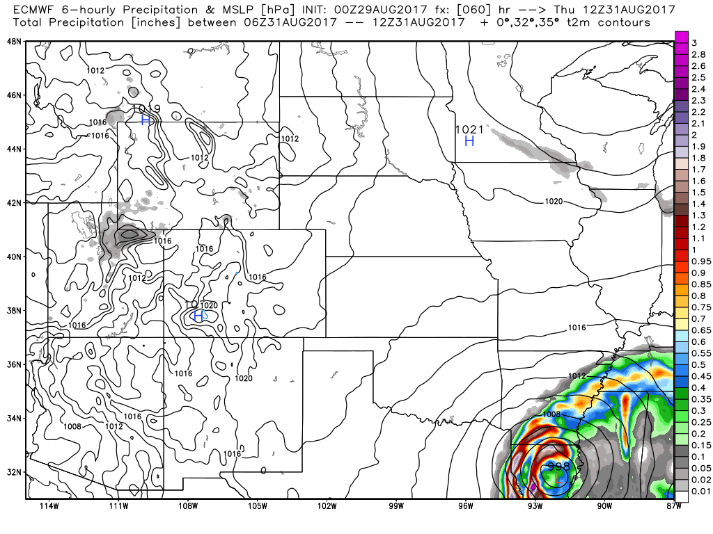
Still watching for impacts of Harvey to the far southeastern locations of the forecast area Thursday into Friday from southwest to northeast:
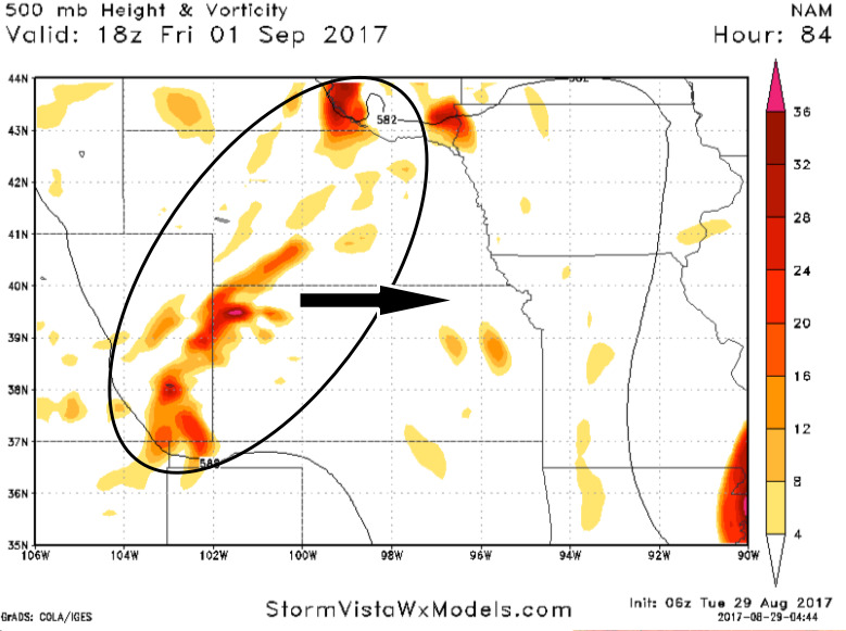
Beyond this, a small disturbance looks to bring our next best rainfall chance on Friday from west to east:
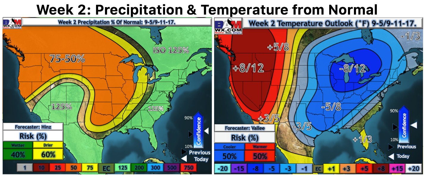
Colder and drier pattern settles into the central Plains overall as we move into the week 2 timeframe to open up September as a strong ridge sets up across the western US with a big trough working in across the central/eastern US:
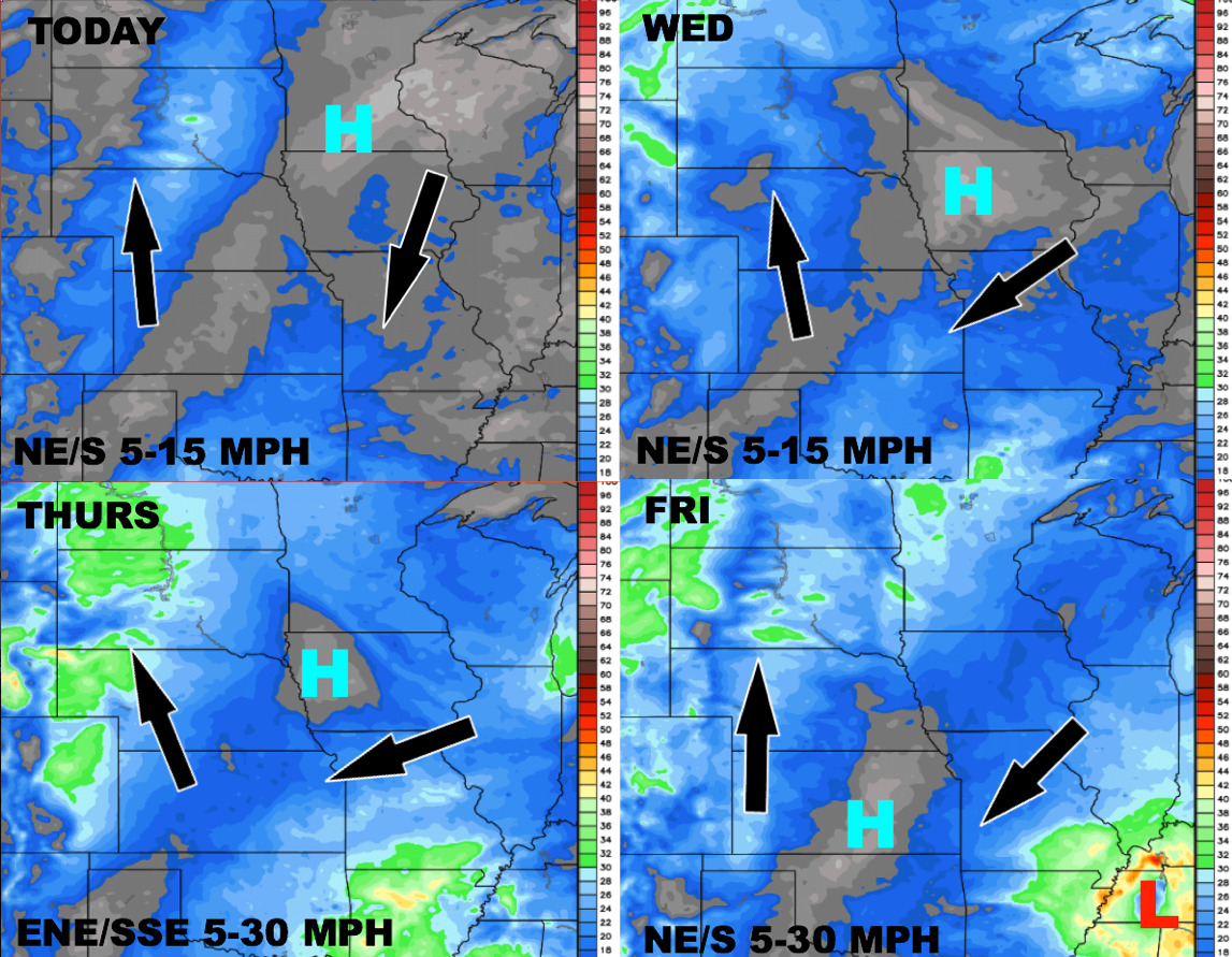
Here’s your wind forecast guidance over the next 4 days:
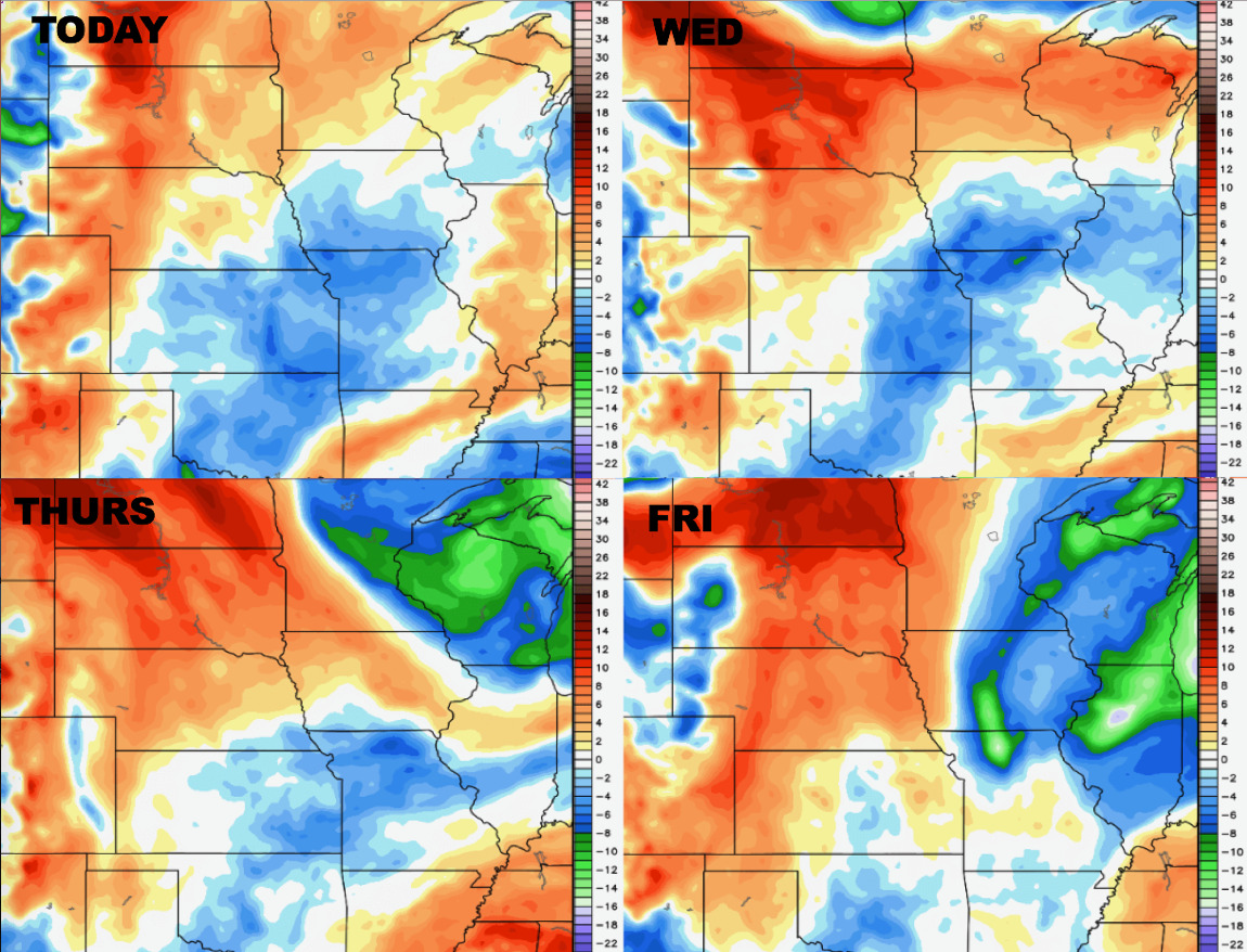
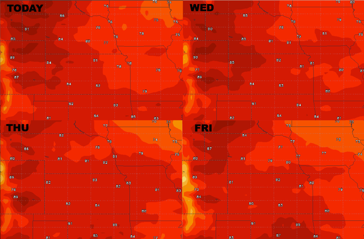
Daytime high temperature guidance is below into late week:
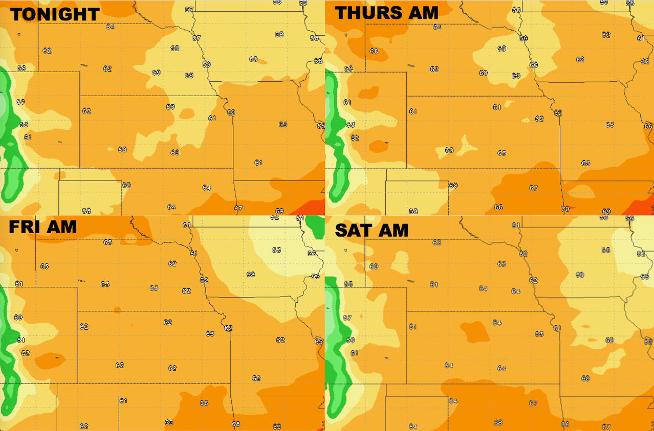
Overnight low temperature guidance over the next 4 mornings:
Here’s your dew points from normal as well: