Key Points – Thursday, August 17, 2017:
Synopsis: Good Thursday morning! Waking up to much drier conditions across the area after a very active first half of the week. Although most of the today is nice, additional scattered storm chances work in this evening across the western half of the area, with a strong storm risk over portions of Nebraska and western Kansas. This disturbance will work eastward on Friday with additional scattered storms, but not as widespread or heavy as earlier this week. The weekend doesn’t look too bad, but there are additional storm chances to note. All the details in the video. Have a blessed day, and let us know if you have any questions!
Today’s video (8:45):
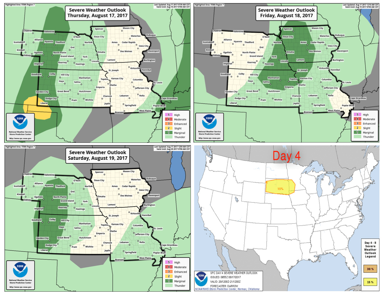
Strong storm outlooks over the next 4 days are below:
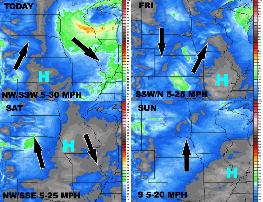
Wind forecast guidance over the next 4 days:
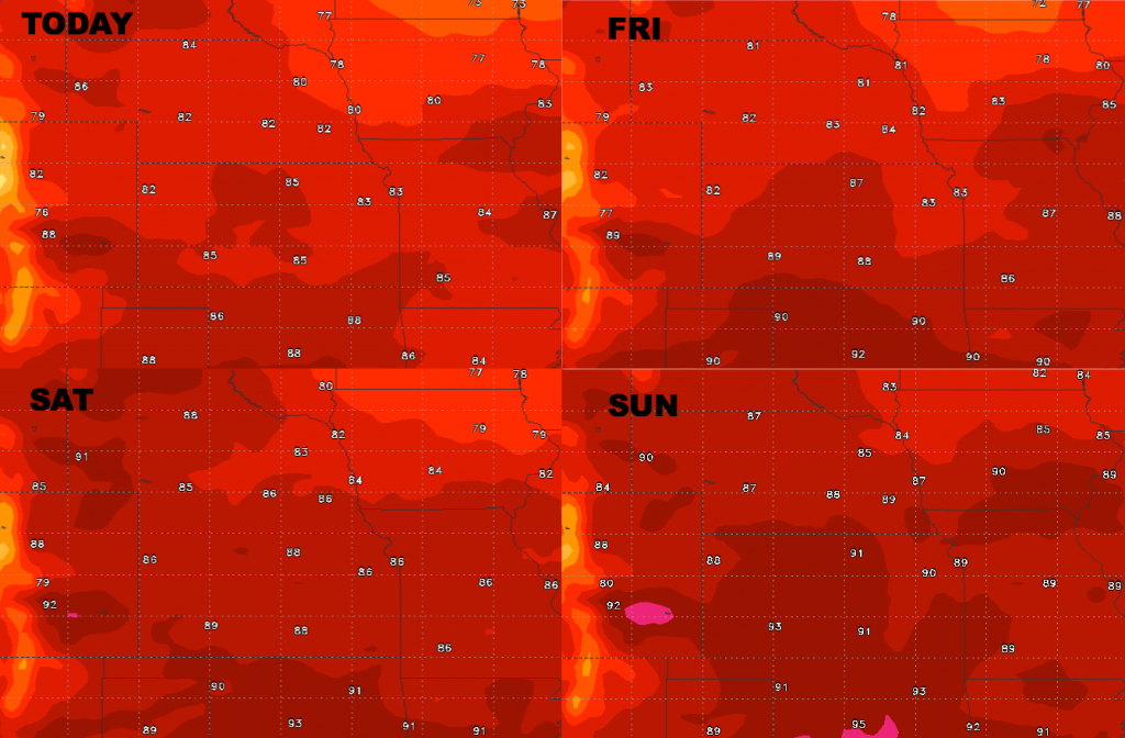
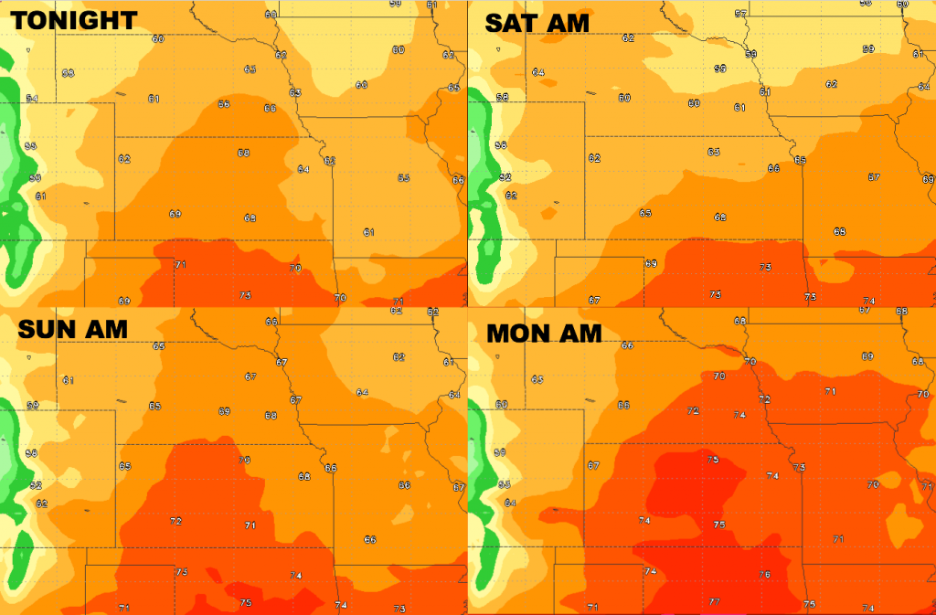
High temperature guidance into the weekend:
Overnight low temperatures over the next 4 days:
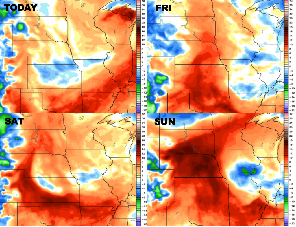
Dew points from normal are below as well: