Synopsis: Good Monday afternoon! Expecting things to become quite active this evening through the overnight areas with a flash flooding and severe storm threat as a potent wave interacts with a stalled front across the region. Focus for storm chances will shift further southeast across the region on Tuesday. Details on where the heaviest rains look to set-up as well as timing in the video. Have a great afternoon, and let us know if you have any questions!
Short-term video (7 min):
Flash Flood Watch for portions of central Nebraska from 6pm this evening to 7am on Tuesday. Repeated rounds of storms tonight could lead to 2-4″ of rain in this area.
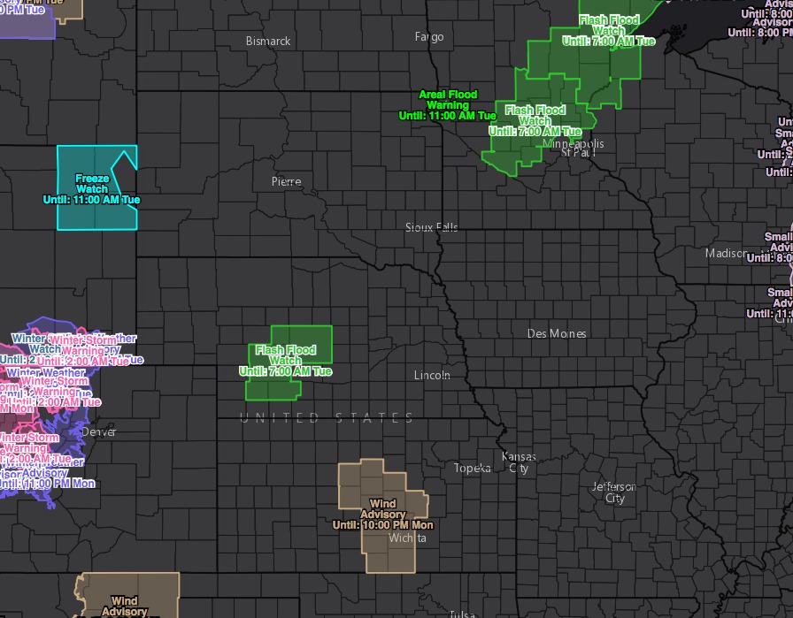
Parts of west-central Kansas and southern Nebraska have been upgraded to a slight risk for severe storms this evening through the overnight hours. Damaging winds and hail are the biggest threats, but cannot completely rule out an isolated tornado.

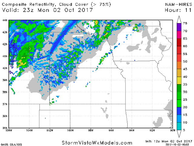
Latest data initiates storms by 5/6pm, then growing and expanding through the night-time hours.
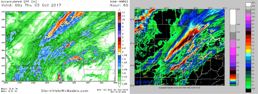
Rainfall guidance into Wednesday is shown below. Note both models place a heavy band across central Nebraska tonight, as well as additional storms with locally heavy rains further southeast late Tuesday as the front shifts further to the south and east.