Key Points – Thursday, October 5, 2017:
Synopsis: Good Thursday morning! Very unsettled pattern over the next couple of days with a frontal boundary lingering across the area, as well as a strong storm system sweeping through late Friday which will bring the threat for severe storms across portions of Kansas along with heavy rains setting up. This system gradually pulls east on Saturday with an gradually improving forecast for the weekend. Another front swings in on Monday with renewed rain chances along with much cooler temperatures overspreading the area.
Today’s video (8 min):
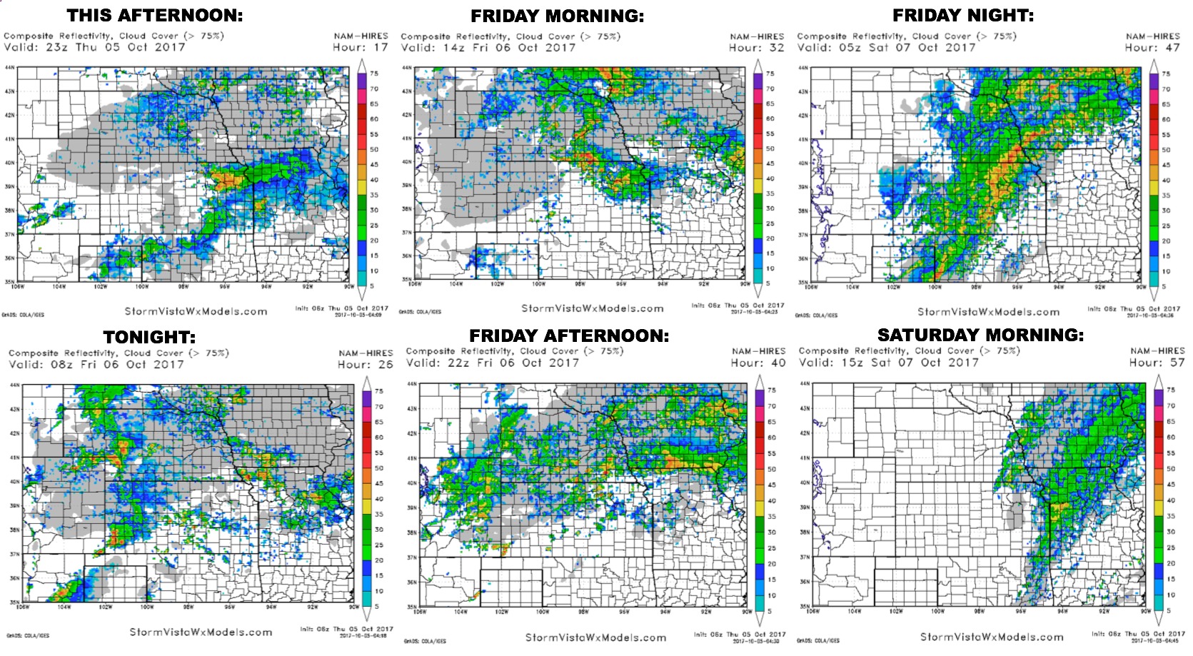
Here is a look at the rainfall coverage forecast from today through early Saturday. Scattered showers and storms around today, rains increase Friday as the front starts to lift north a bit as a warm front in response to a low pressure system working into the western Plains. Heavy rains will set up along the warm front, then as the cold front moves through Friday night very heavy rains set-up over Kansas, southeast Nebraska, Iowa, and northwest Missouri.
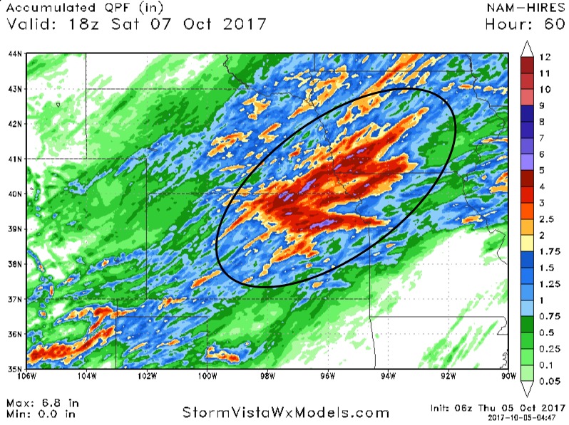
Here is a look at forecast rainfall totals from the hi -res NAM model through Saturday afternoon. Band of 2-4″ with locally higher amounts over the central part of the area.
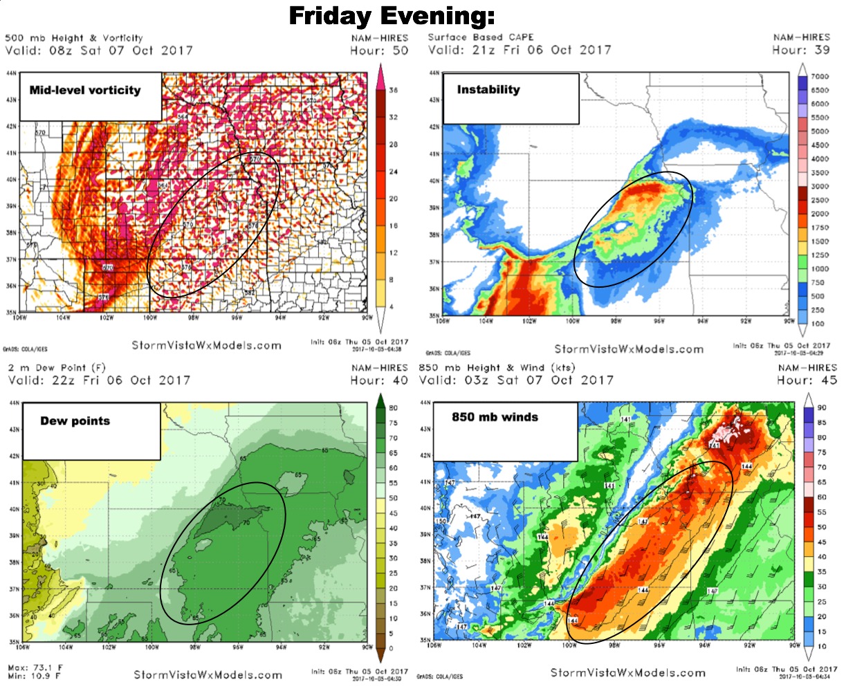
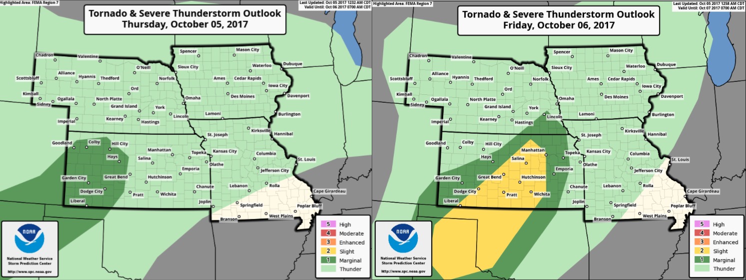
Still looking at a favorable set-up for some severe storms later Friday afternoon into Friday night mainly across portions of Kansas:
Here are the latest severe storm outlooks from NOAA today and Friday.
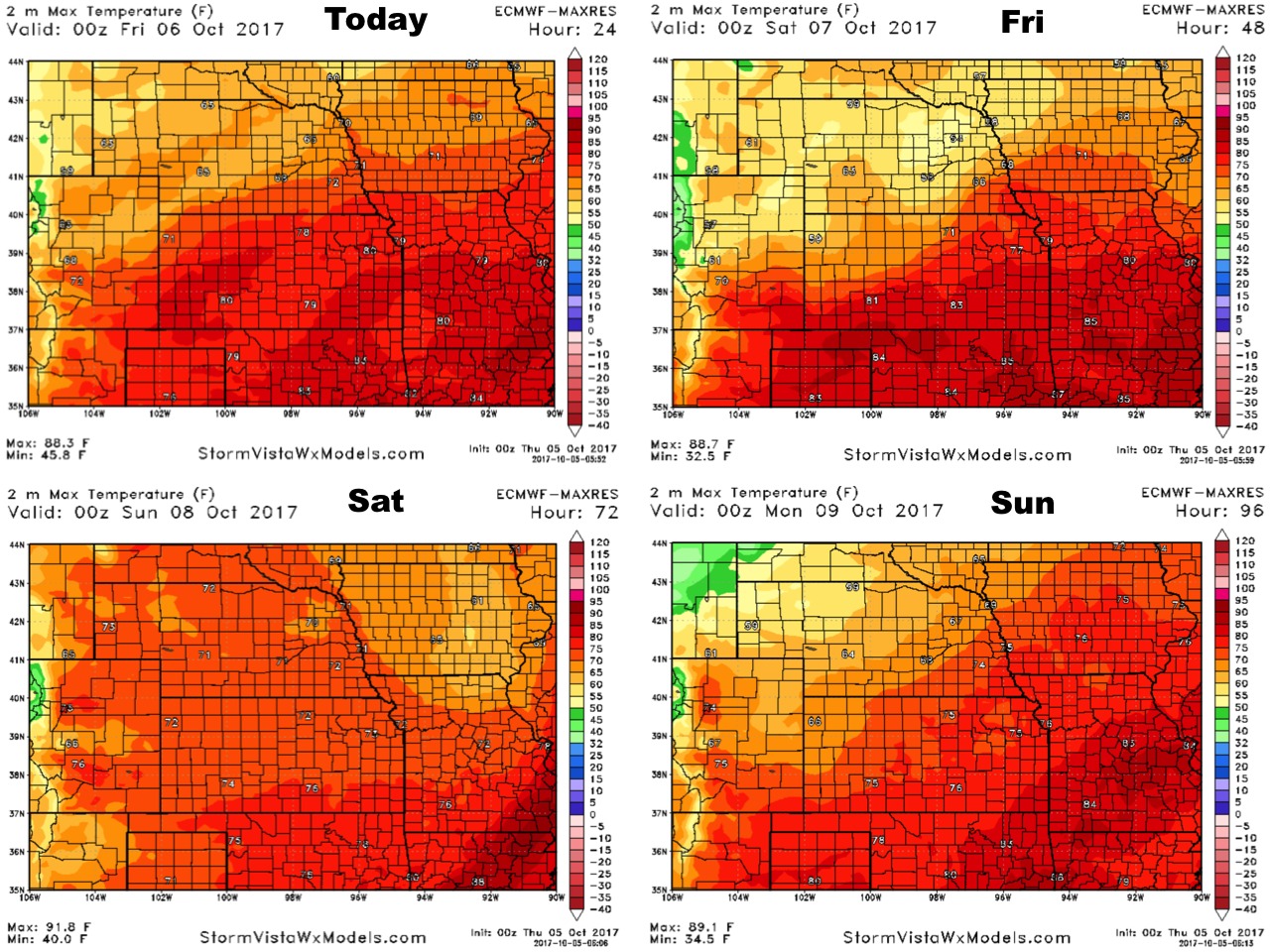
High temperatures over the next 4 days:
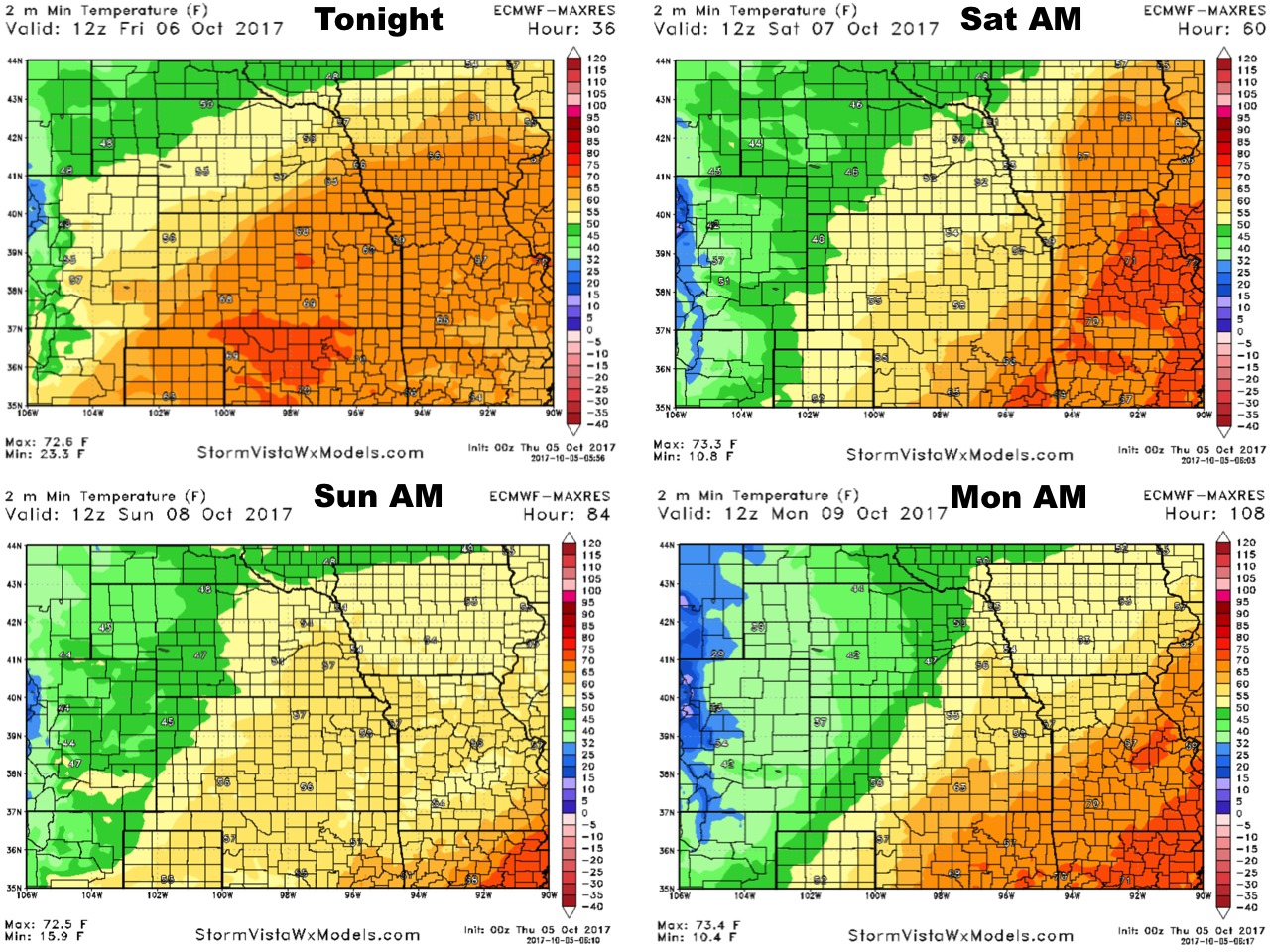
Low temperatures over the next 4 nights:
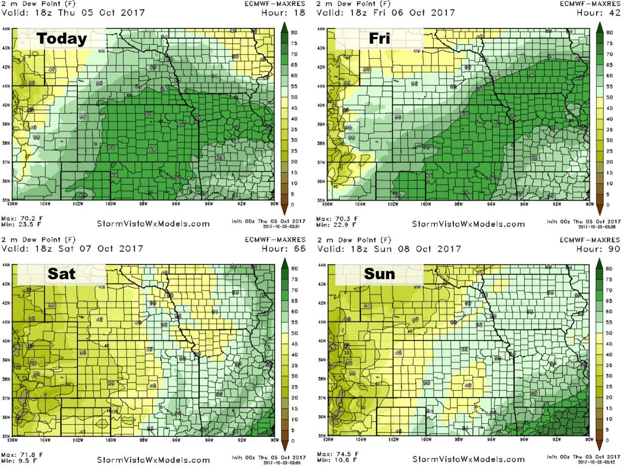
Dewpoints from normal over the next 4 days:
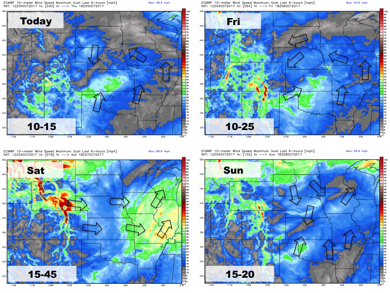
Wind forecast over the next 4 days: