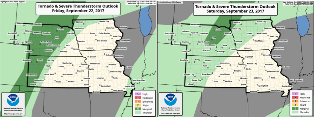
Synopsis: Good Friday afternoon! It is a hot and windy day across much of the region, ahead of a frontal system pushing into western Nebraska. This front will get hung-up across the western Plains through the weekend, with repeated rounds of showers and storms. Areas further east and south stay mainly dry and continued hot. The update takes a look at the latest data regarding placement and amounts of rain through the weekend in detail! Have a great afternoon, and let us know if you have any questions!
Short-term video (8 min):
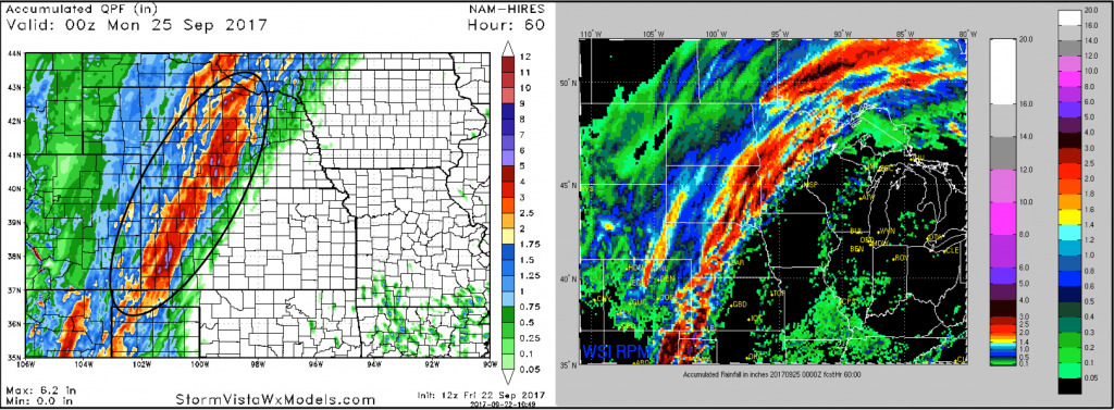
Here is a look at the latest rainfall guidance through the weekend. Band of 2-4″ rains look to set-up from central Nebraska to western Kansas along a stationary boundary. Mainly dry off to the east other than a few local pop-up storms.
Cannot rule out a few strong storms in this area as well: