Key Points – Tuesday, August 8, 2017:
***We are so excited for this week and all of you that have signed up for our open house! As a reminder, you will receive all of our product via email, just make sure you’re looking at the right forecast locally; remember, the advantage of having a team of meteorologists at your fingertips can be priceless. With our service you will have access to our team of meteorologists 24/7.
Throughout the week we really want you to take advantage of the content we put out and use it to your advantage! At anytime this week you feel like you have seen enough to make a decision and you’re ready to sign up we will offer you a 20% off discount if you sign up BEFORE your trial expires August 11th. Please do not hesitate to reach out to us at anytime if you have any questions. Have a blessed week! -BAM staff.***
Synopsis: Good Tuesday morning! In the video we discuss patchy fog/stagnant air across parts of the central Plains over the next 4 days, however, expecting these to burn off by lunch-time. Watching for a few showers across western parts of the central Plains today, not widespread but there is potential here. Waking up Wednesday morning to showers/storms tracking east throughout the day as well. Another stout piece of energy moves south and east Thursday increasing storm coverage across the forecast area. Again, not everyone cashes in here on the rainfall, many stay drier, but we target coverage over the next 3 days is ~40/50% with these pieces of energy. In terms of temperatures, the cooler than normal regime will continue over the next week across the central Plains. If you have any questions, please let us know, have a blessed day!
Today’s video (8:40 min):
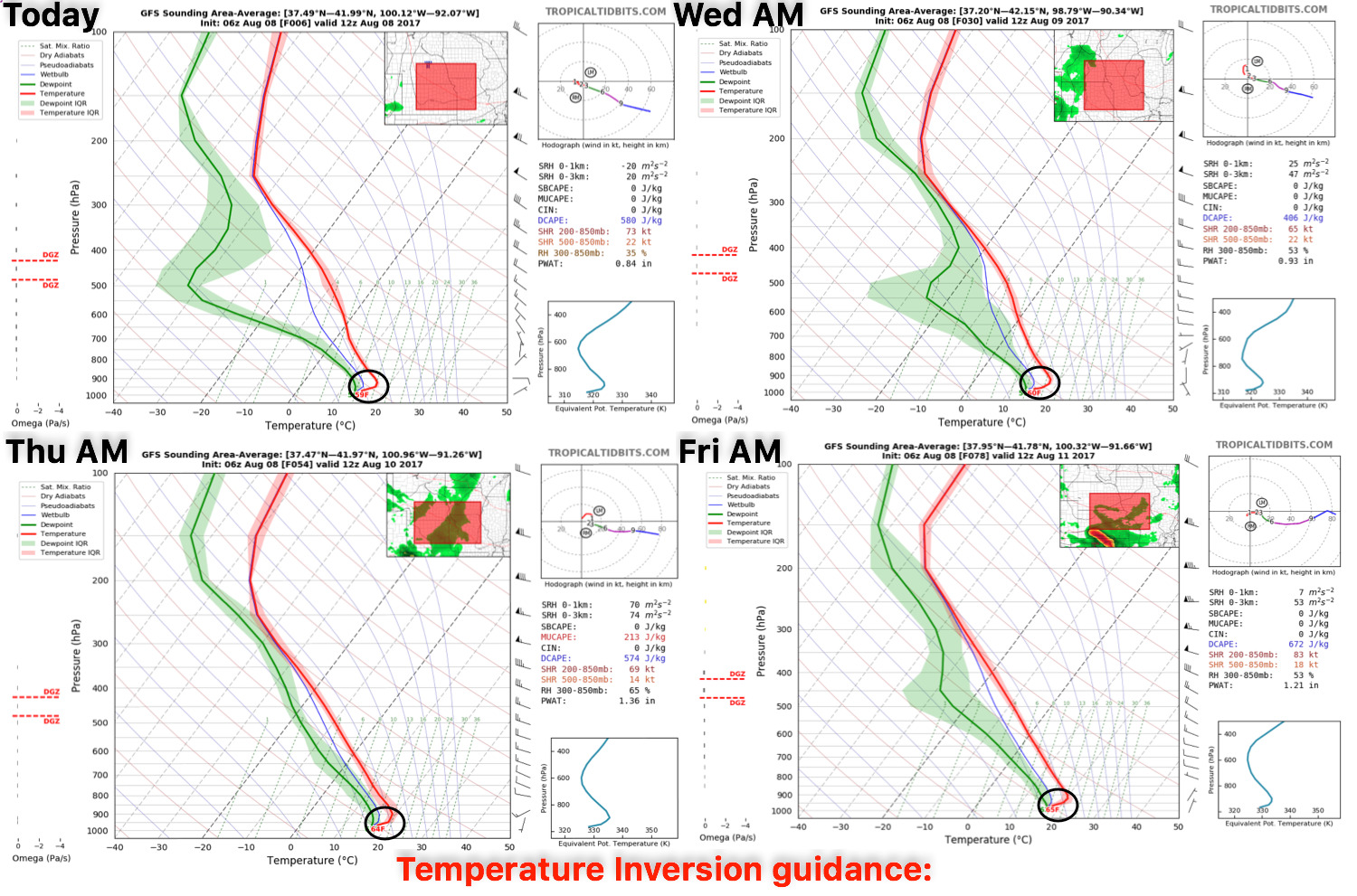
Temperature inversion guidance over the next 4 days is below…some patchy fog/stagnant air will be possible across the central Plains, although we expect these inversions to break by lunch time each day as well.
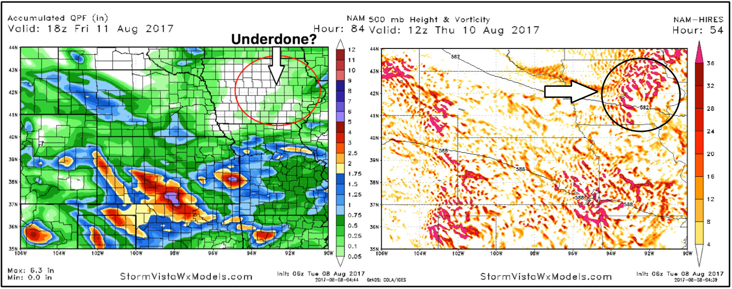
Rainfall guidance over the next 4 days is on the left…we circled an area across Iowa because the forecast model data has energy pushing east late Wednesday night into early Thursday morning that has potential to bring some rainfall where the model has it drier. Otherwise, where it does rain this week 1-2″ with isolated higher totals possible.
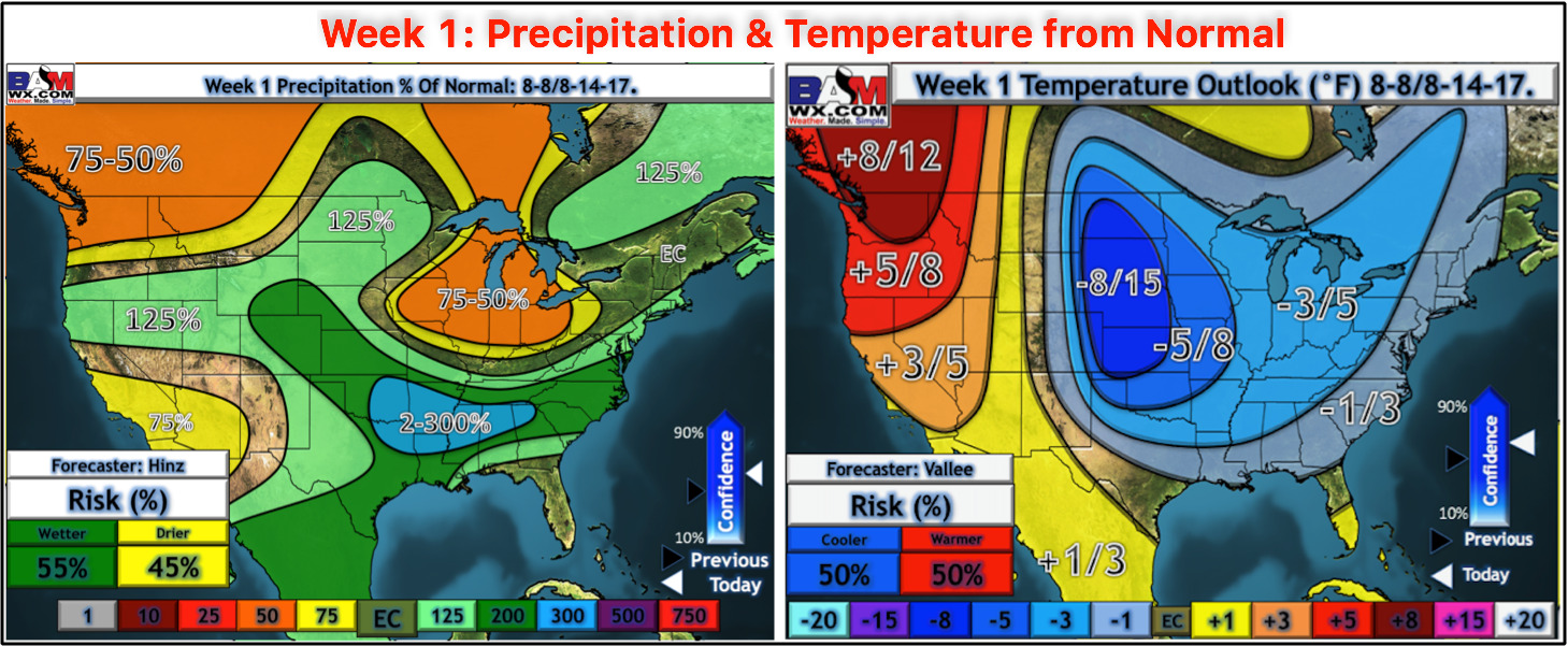
Here’s the latest updated week 1 precipitation and temperature from normal outlook posted this morning:
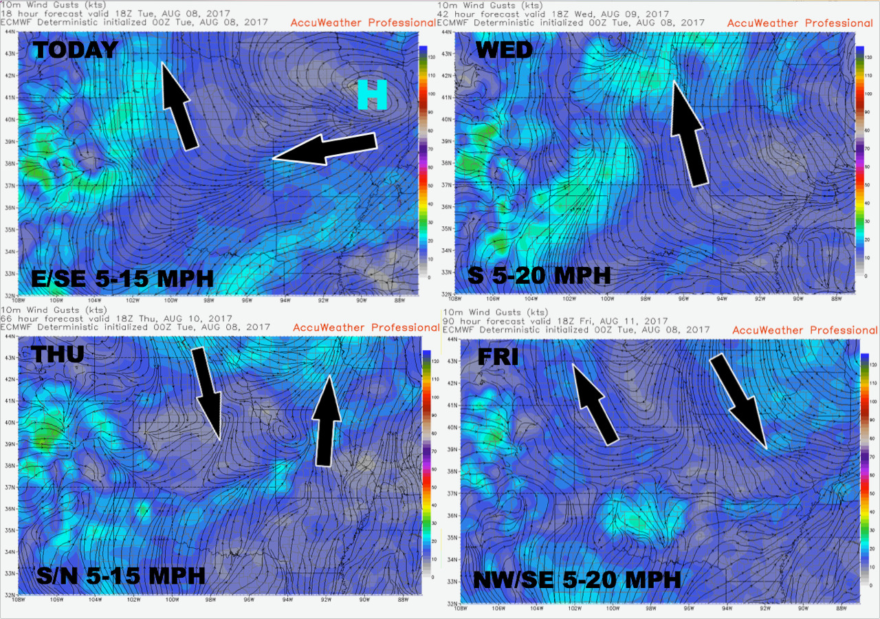
Wind guidance next 4 days:
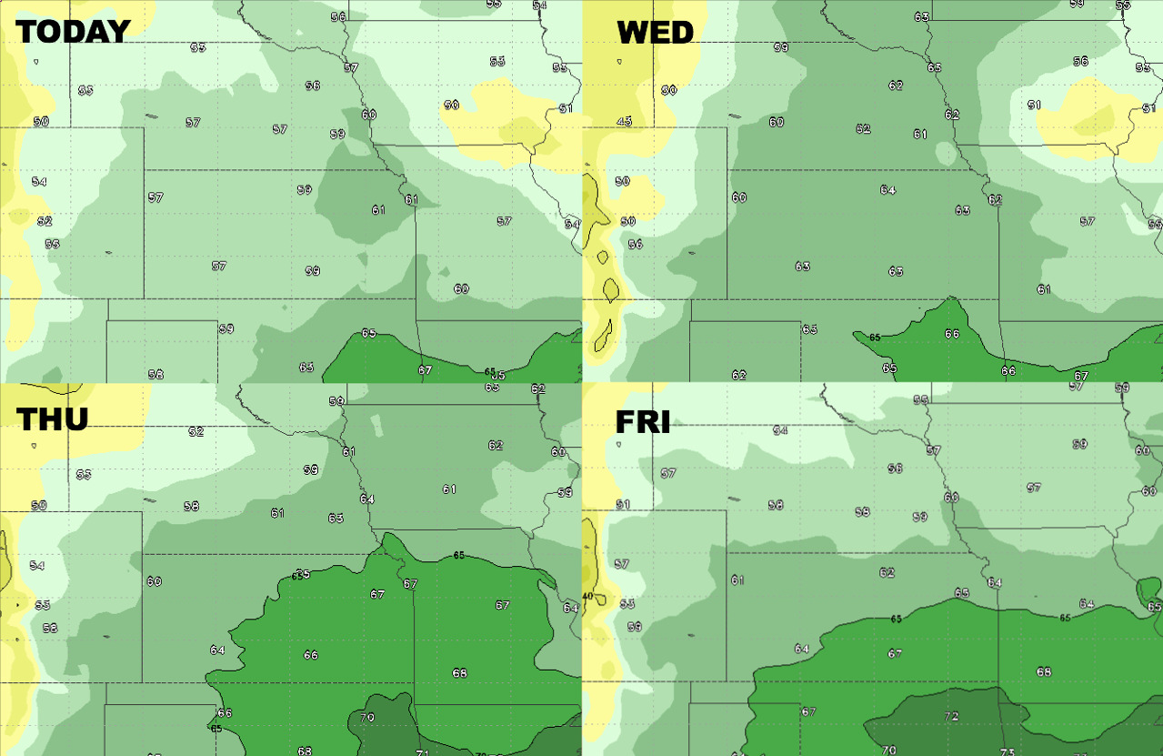
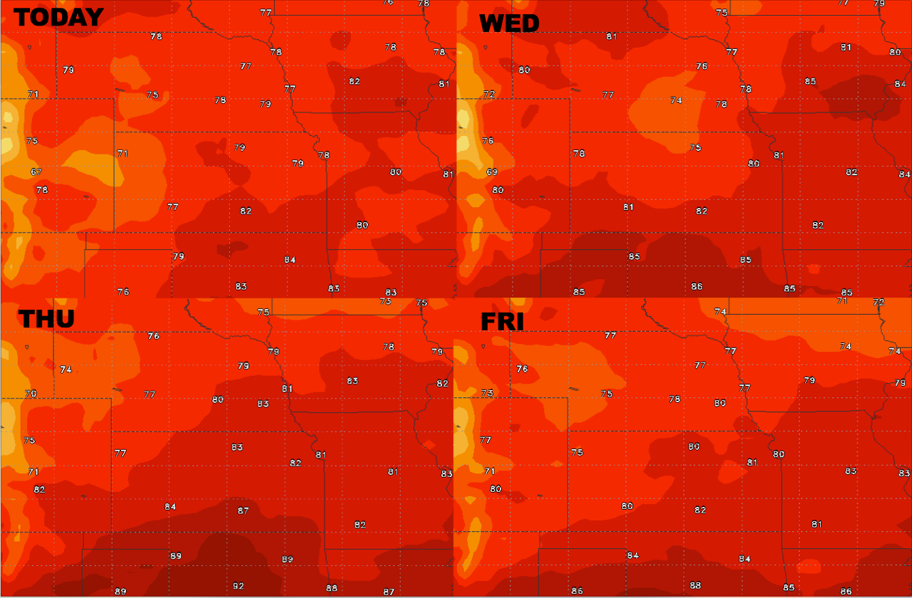
High temperature forecast guidance into late week:
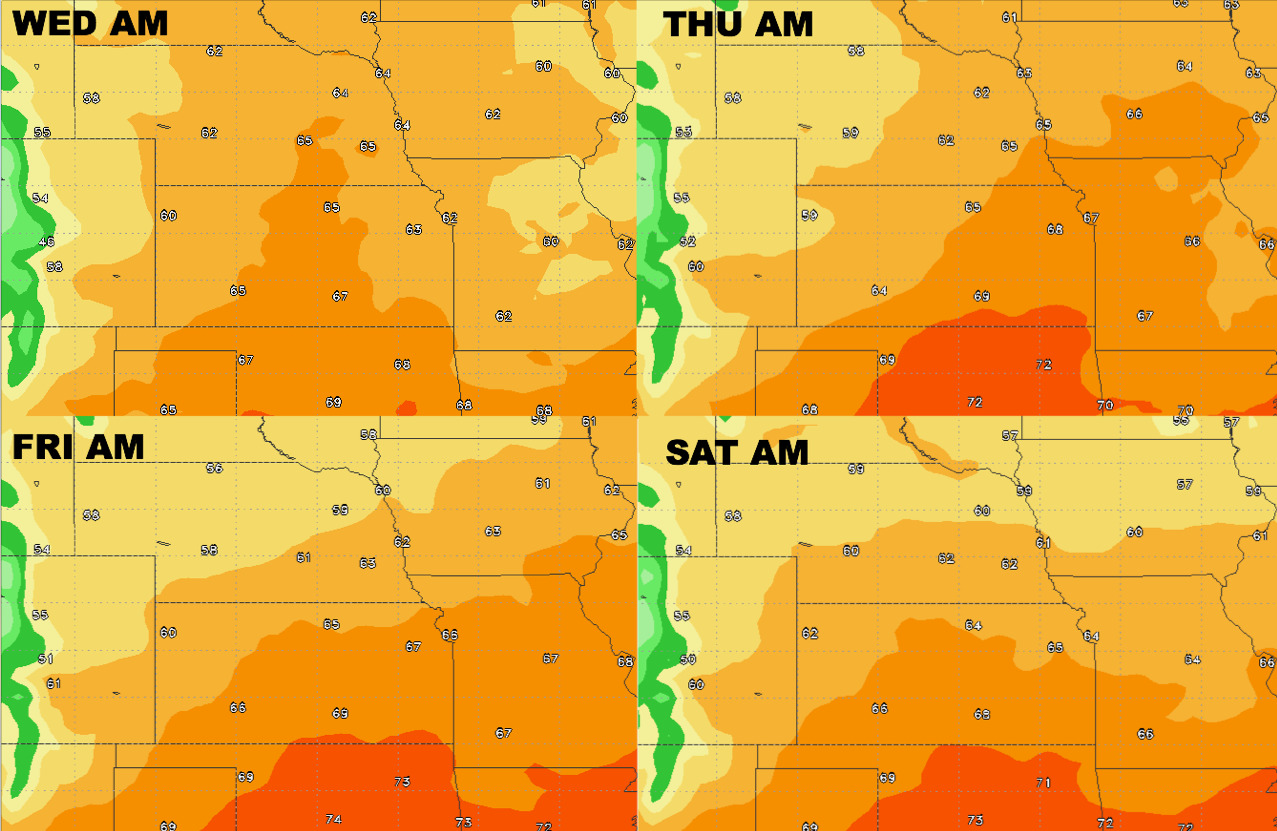
Overnight low temperature guidance into early weekend:
Dew point forecast guidance over the next 4 days: