Key Points – Monday, August 21, 2017:
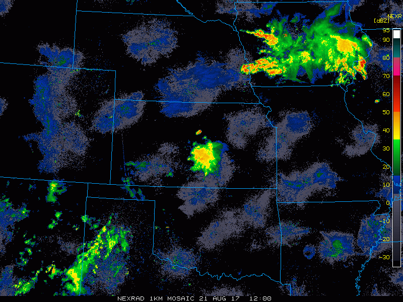
Synopsis: Good Monday morning! Waking up to storms moving across Iowa this morning which have dumped very heavy rain in west-central Iowa over the past 24 hours. It will become more active across the region going into this afternoon and especially this evening into the overnight as storms work in from northwest to southeast along a cold front. These storms will clear the region on Tuesday with cooler temps and lower humidity taking hold for mid-week. Be sure to watch the video for details regarding the timing of storms going through tonight along with rainfall potential. Have a blessed day, and let us know if you have any questions!
Today’s video (6 min):
Current radar (through 8:20 AM CDT):
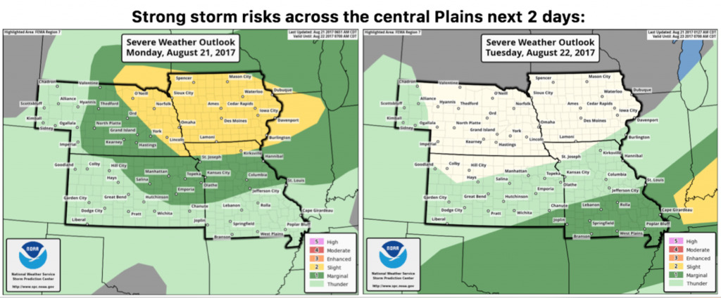
Severe storm risk areas today into Tuesday are shown below. Slight risk across all of Iowa into east central Nebraska and northern Missouri, where the greatest severe threat lies today. Damaging wind and hail will be the main threats. Strong storm threat shifts into southern Missouri/southeast Kansas on Tuesday, with clearing working in behind the cold front.
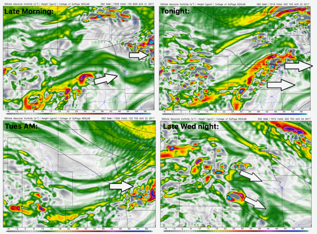
Here is the upper level energy forecast going through tonight then again for late week. Plenty of energy working into the region today then becoming focused along a cold front tonight. The region catches a break from any disturbances late Tuesday through Wednesday, then additional energy works in late week mainly west, with isolated rain/storms.
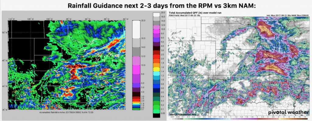
Rainfall potential over the next couple of days is shown below. Storms will drop locally heavy rain totals, most widespread from Iowa into eastern Kansas and the western half of Missouri.
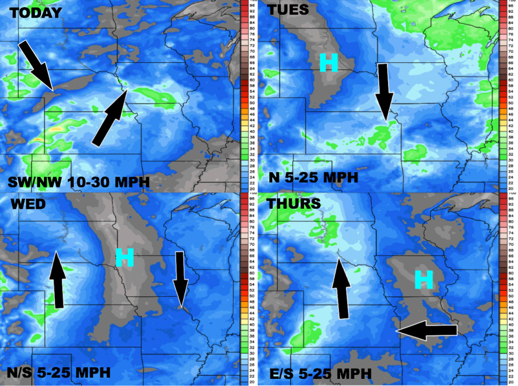
Wind forecast over the next 4 days:
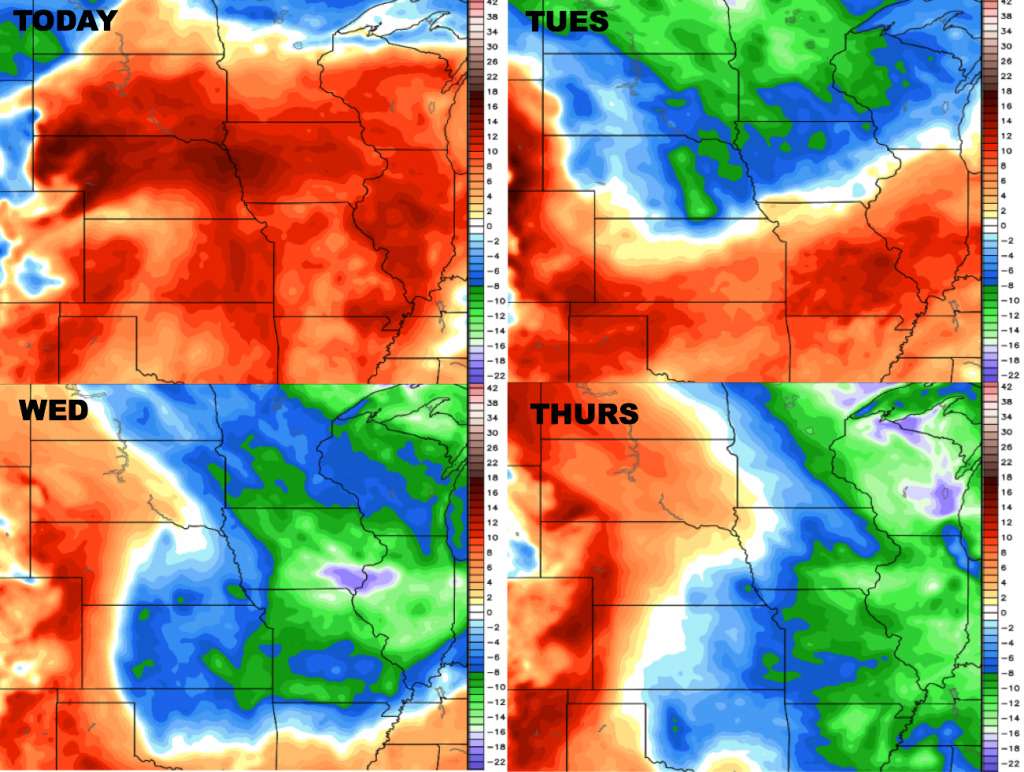
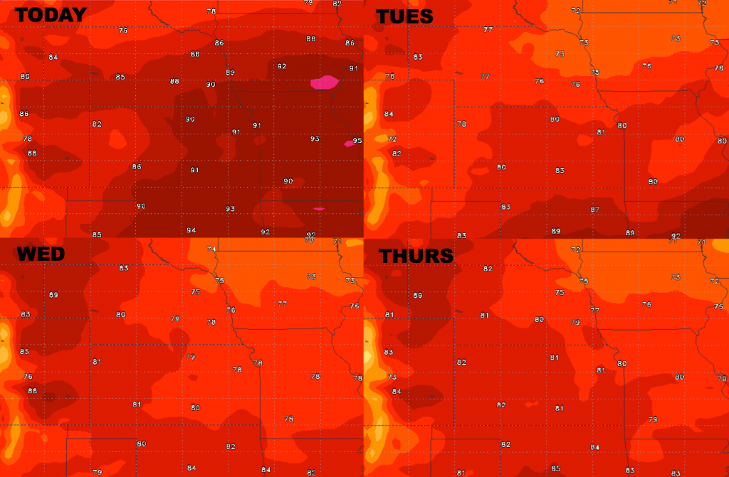
High temperature guidance over the next 4 days:
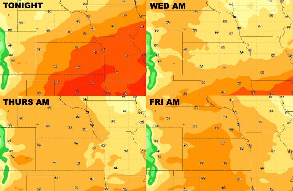
Low temperature guidance into late week:
Dewpoints from normal…much drier air builds in behind the cold front for mid-week.