Key Points – Tuesday, September 19, 2017:
Synopsis: Good Tuesday morning! The main weather story today will be a strong system moving into the northern Plains later today through tonight. The majority of severe storms look to stay north of our region, but we can’t rule out a few severe storms in the far north late tonight. This front lingers into the eastern forecast area Wednesday into Thursday with a few additional storms. Breezy and warm late week with our next focus on a strong front that looks to become quasi-stationary across the western Plains this weekend, bringing a heavy rain threat. Turning cooler next week. Details in today’s video. Have a blessed day, and let us know if you have any questions!
Today’s video (6 min):
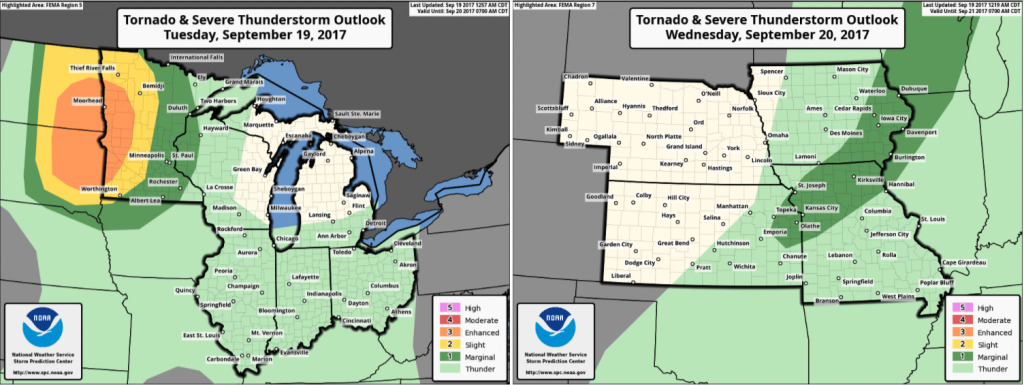
Here are the severe storm outlooks over the next 2 days. Watching the Dakotas/Minnesota for large hail, damaging winds, and isolated tornadoes today. Can’t rule out strong to severe storms in extreme northeast Nebraska and northwest Iowa. As this front works east, a marginal threat for severe storms across the eastern forecast area Wednesday, but not expected to be overly widespread.
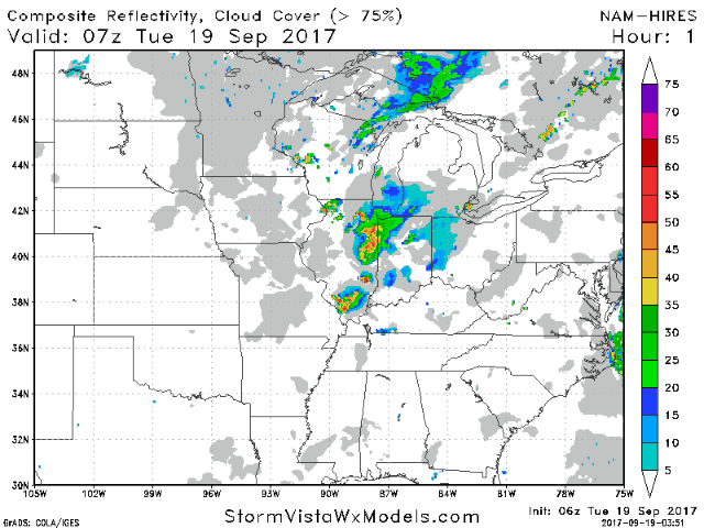
Here is the hi-res NAM future radar going out through Thursday morning:
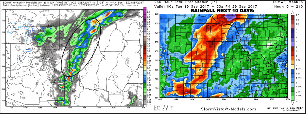
The next weather story will be a heavy rain threat this weekend across the western half of the region, as a front gets hung up across this region. Rain totals of 2-4″ possible from the western half of Kansas through a large chunk of Nebraska. Amounts and placement will be fine tuned over the coming days.
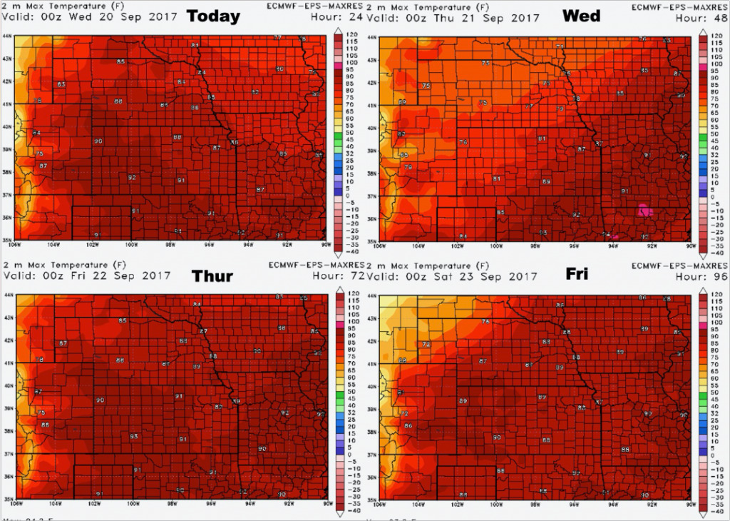
High temperatures over the next 4 days:
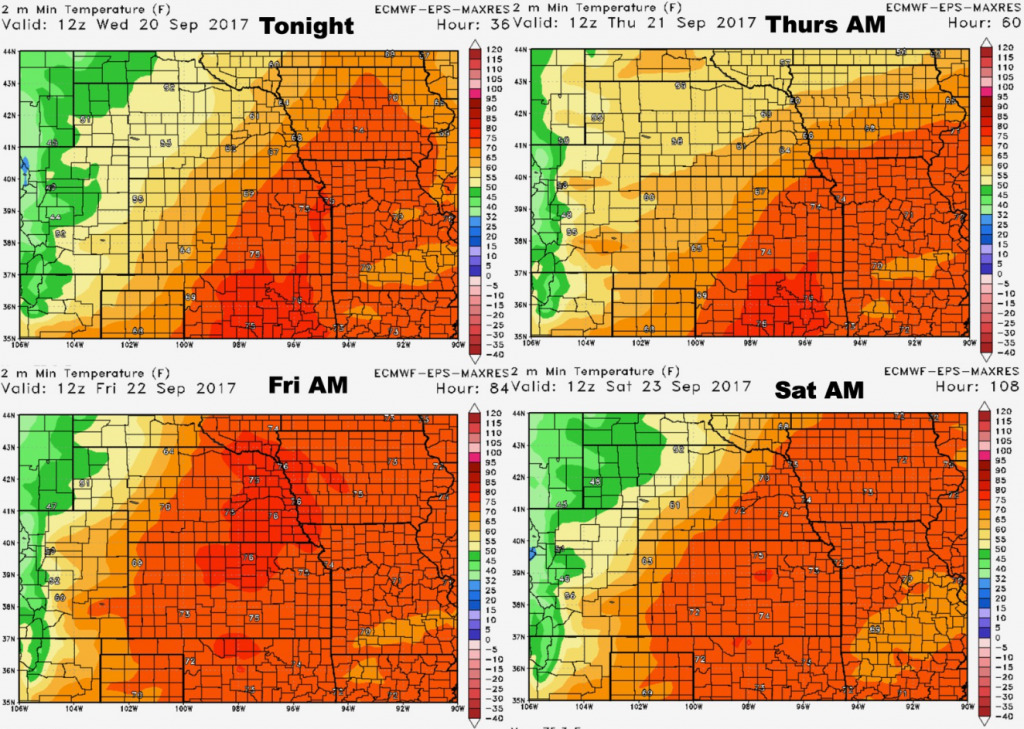
Low temperature guidance over the next 4 nights:
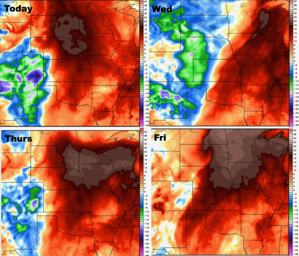
Dew points from normal over the next 4 days:
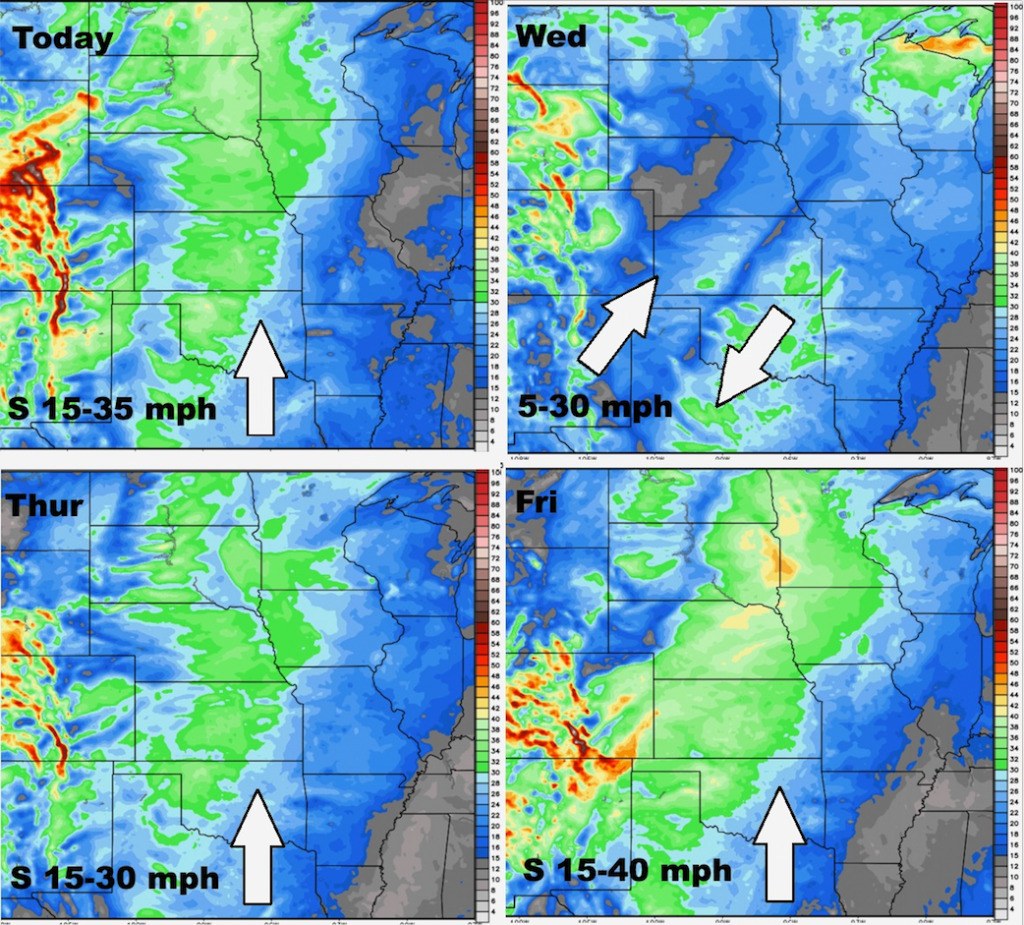
Wind forecast over the next 4 days: