Key Points – Friday, September 1, 2017:
Synopsis: Good Friday morning! A disturbance is working east across the region this morning, with scattered showers across Nebraska into northern Kansas. Showers and a few storms will work east and increase in coverage some as we go into this afternoon through tonight, exiting to the southeast early Saturday. Much of the Labor Day weekend looks dry and warm before a big cool-down arrives by Tuesday of next week. Detailed analysis, including a look at weeks 3 & 4 outlook are in today’s video. Have a blessed day, and let us know if you have any questions!
Today’s video (6 min):
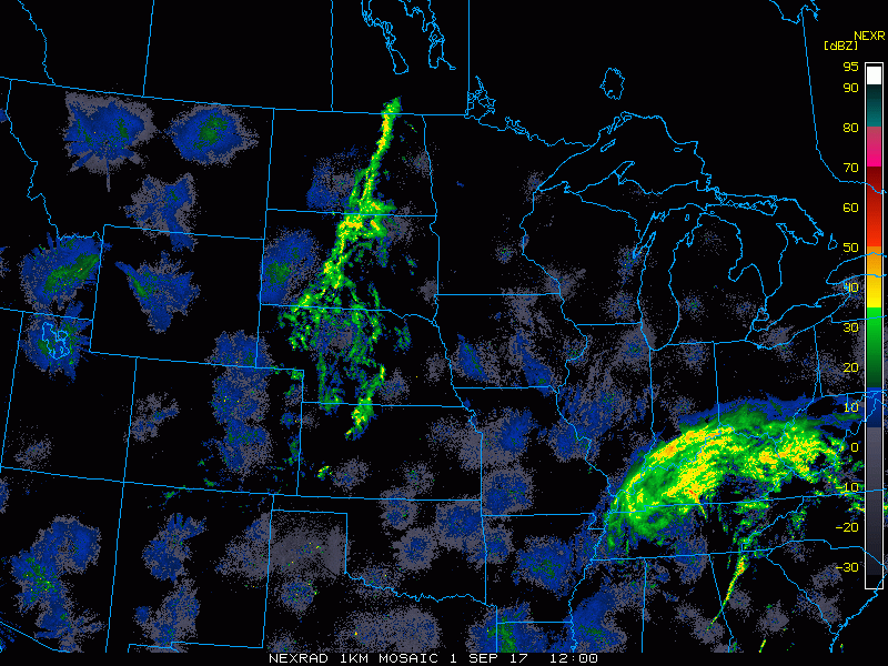
Current radar:
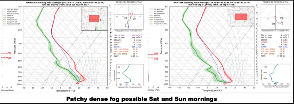
Watching for patchy fog potential tonight mainly across Nebraska and Kansas, with patchy dense fog possible across the region Saturday night.
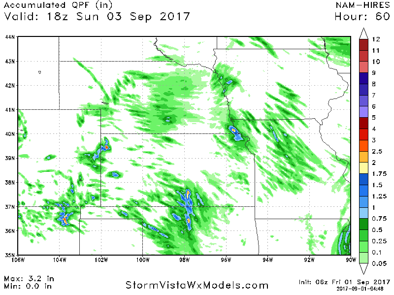
Rainfall totals over the next 60 hours are shown below. Most of this falls today through late tonight. Mostly looking at scattered light rain amounts, with localized spots seeing somewhat heavier rain.
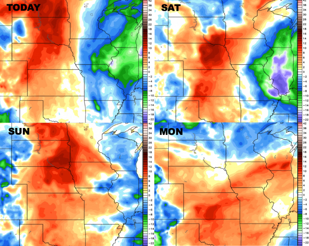
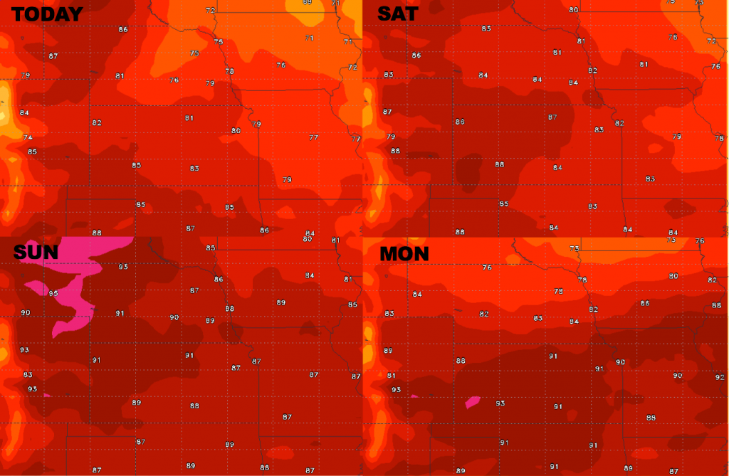
High temperature guidance through the Labor Day weekend…brief heat building in:
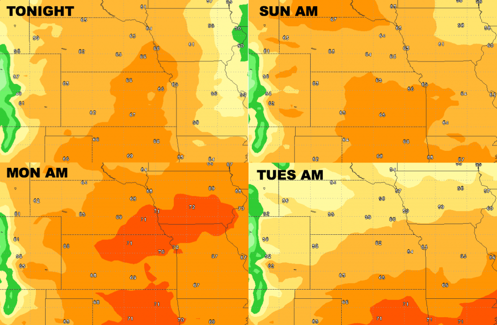
Low temperature guidance into early next week:
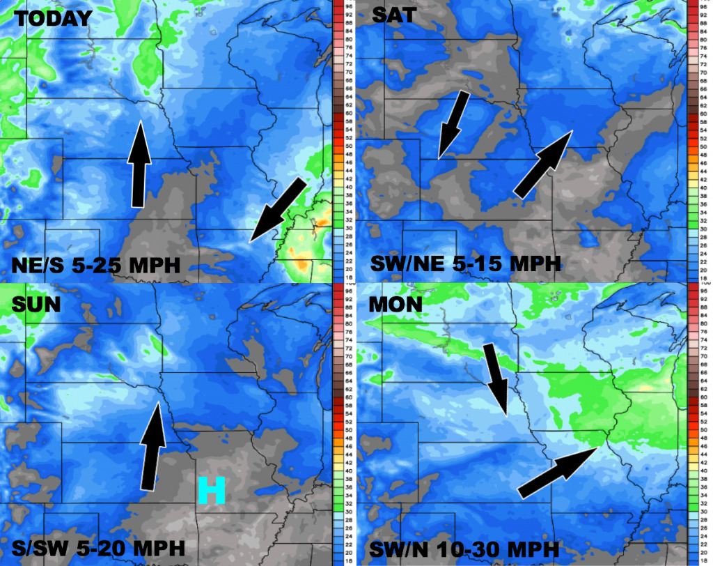
Wind forecast over the next 4 days:
Dewpoints from normal…more humid west and drier air east through Saturday, then more humid area-wide Sunday and Labor Day.