Key Points – Thursday, September 14, 2017:
Synopsis: Good Thursday morning! The region is gradually starting to see a more active pattern develop after a pro-longed period of dry conditions. There is the risk for a few strong to severe storms across mainly northern portions of the region Friday and Saturday. While the rainfall coverage/amounts won’t be too impressive for most into the weekend, the pattern continues to become more active next week. Details in today’s video. Have a blessed day, and let us know if you have any questions!
Today’s video (6 min):
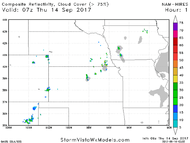
Other than a few spotty storms today, most of the region remains dry during the day-time. As we go into this evening and overnight, scattered storms will increase across Nebraska. Scattered storm chances shift further south and east with time Friday and Saturday.
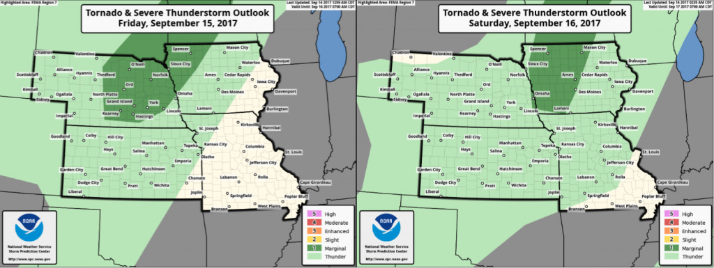
There is a marginal risk for a few stronger storms in northern portions of the region Friday/Saturday (areas in dark green).
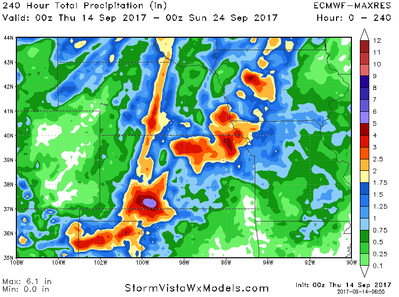
10-day rainfall off the European model shows 1-3″ rainfall potential for many areas.
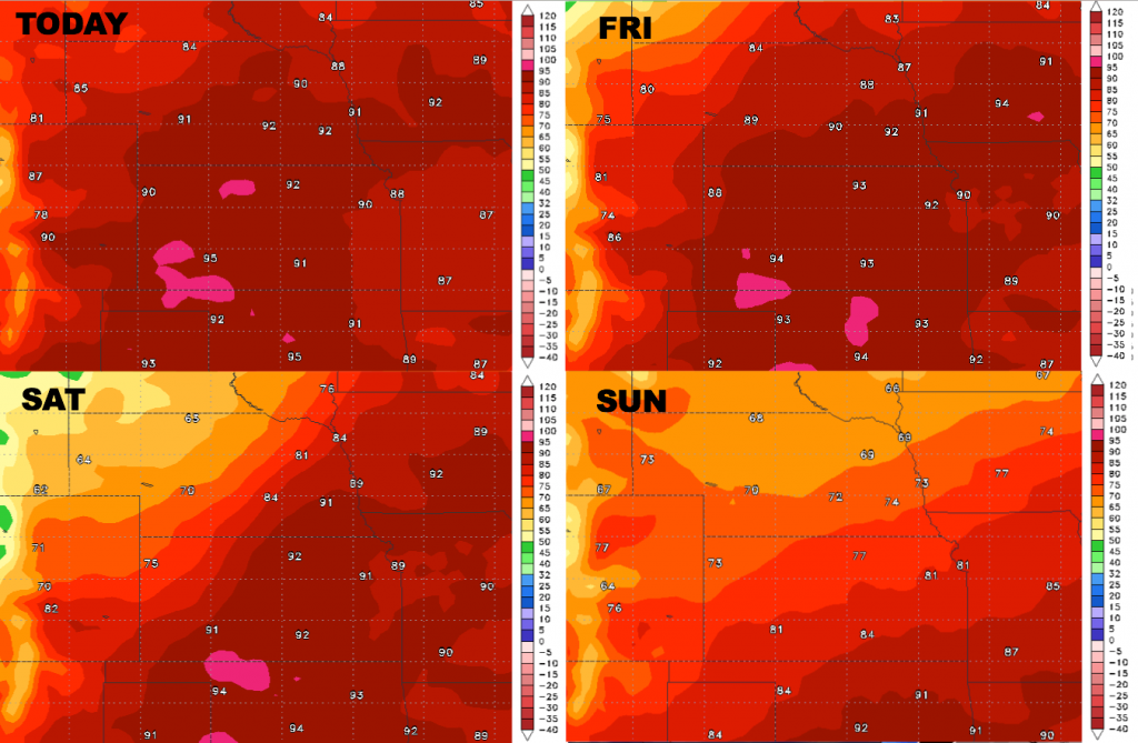
High temperatures over the next 4 days:
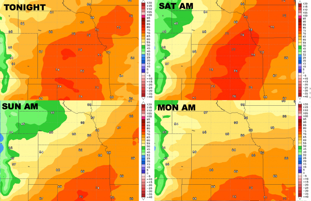
Low temperatures over the next 4 nights:
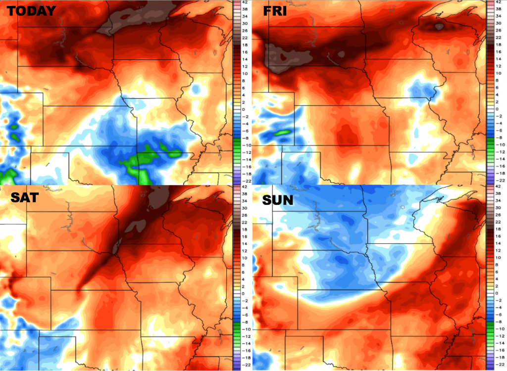
Dew points from normal over the next 4 days:
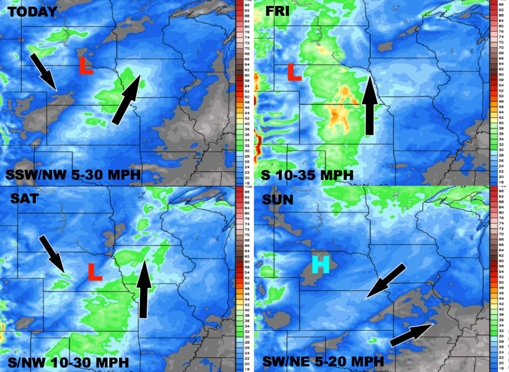
Wind forecast over the next 4 days: