Key Points – Thursday, September 28, 2017:
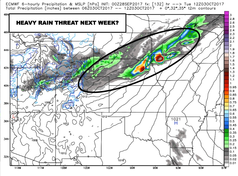
Synopsis: Good Thursday morning! Overall a very nice day shaping up across the region, outside of a few showers in extreme western areas. The main focus in this forecast will be an increasingly unsettled forecast for portions of the region from this weekend and continuing through next week. Today’s video discusses where we have a heavy rain threat next week, and which areas are expected to stay drier.
Today’s video (7 min):
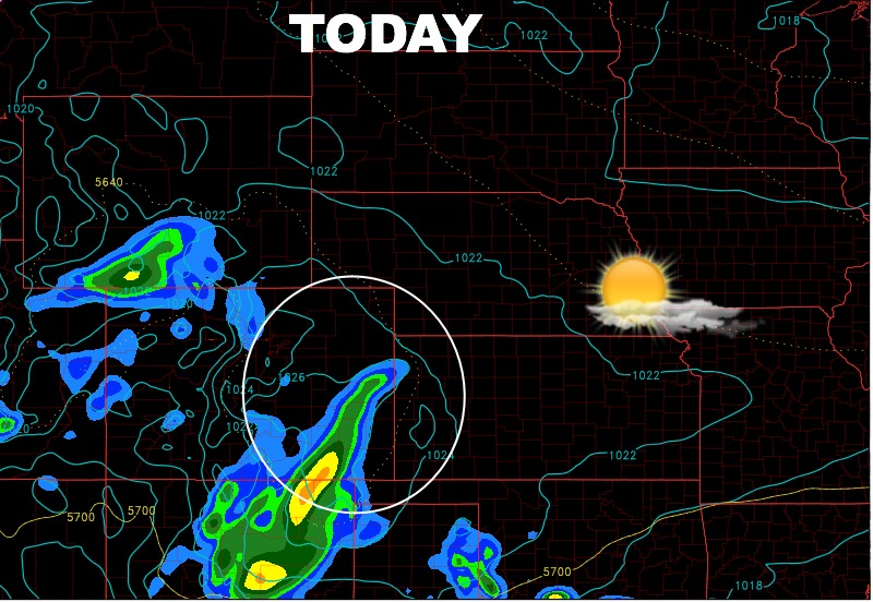
Cannot rule out some light rain clipping southwest Nebraska and western Kansas, but overall dry with more sun the further east you are.
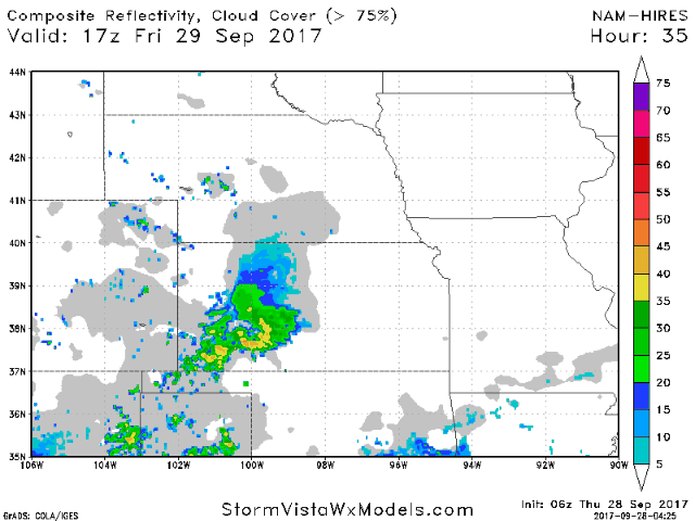
As high pressure moves to the east Friday into Saturday, increasingly southerly flow brings in scattered showers Friday night and Saturday. Here is the hi-res NAM forecast radar going from mid-day Friday to mid-day Saturday. Still remaining dry to the east.
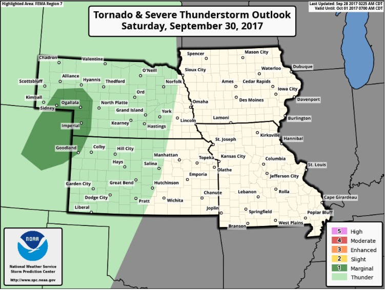
Threat for isolated marginally severe storms with wind/hail in western Nebraska and northwest Kansas Saturday afternoon and evening.
Next week looks active for the northern parts of the area, where a heavy rainfall threat is looking more likely. A frontal boundary looks to stall around Nebraska and northwest Iowa with potential for repeated rounds of heavy rainfall along that. Areas further southeast stay mainly dry. (Similar to the set-up last weekend!)
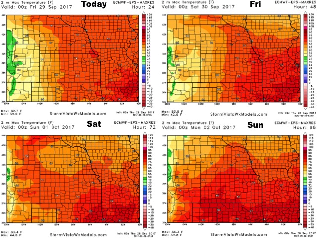
High temperatures over the next 4 days:
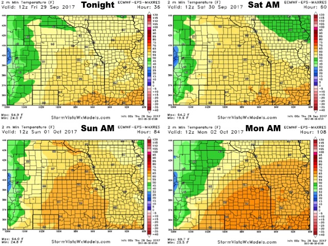
Low temperatures over the next 4 nights:
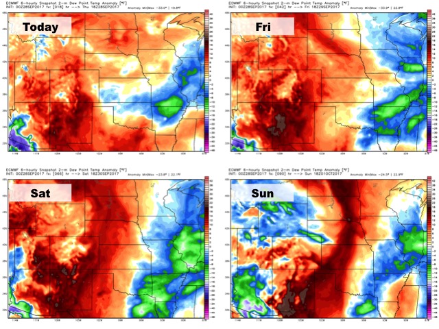
Dew points from normal:
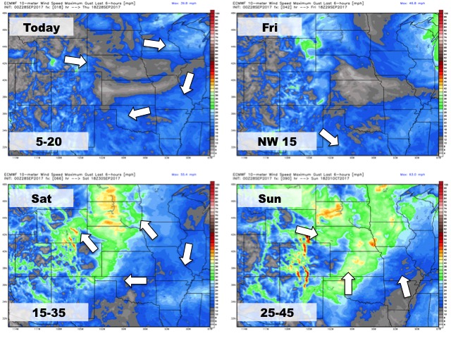
Wind forecast over the next 4 days: