Key Points – Wednesday, August 23, 2017:
Synopsis: Good Wednesday morning! Another nice day on the way with mainly dry conditions and comfortable temperatures. The western portions of the region will see the next storm chances working in mainly as we get into late Thursday, with chances continuing (mainly west and north) into the upcoming weekend. Not looking at anything widespread or overly impressive, but a couple stronger storm risks are there. Detailed analysis in the video. Have a blessed day, and let us know if you have any questions.
Today’s video (5:45):
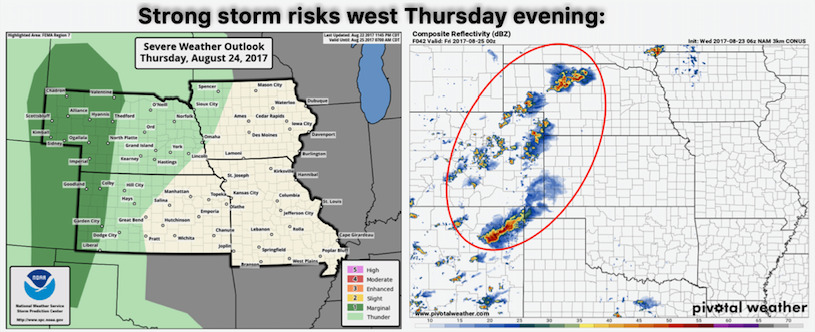
Targeting our next strong storm risk across western Nebraska into far western Kansas late Thursday, can’t rule out isolated strong storms with wind and hail.
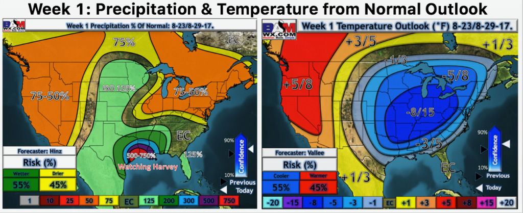
Here is our week 1 temperature and precipitation from normal outlook. We will monitor the track of a tropical system that looks to make landfall in Texas this weekend. If this system tracks far enough north into next week before being steered east, this could affect the far southeast portions of the area (Missouri), but this far out that is a big question mark. More on this in the video.
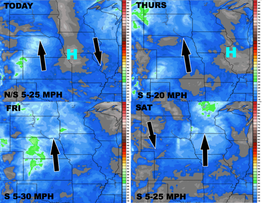
Wind forecast over the next 4 days:
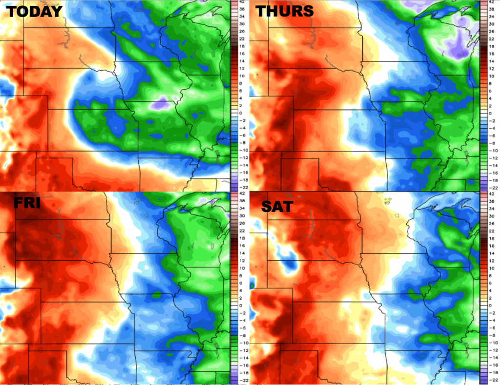
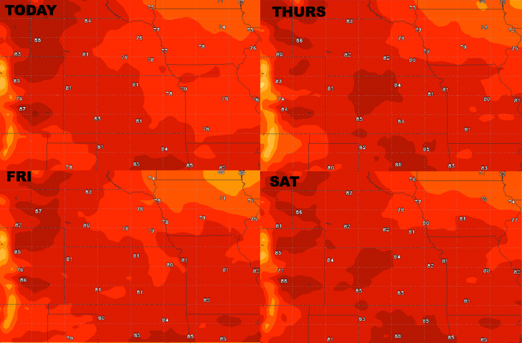
High temperature guidance through Saturday:
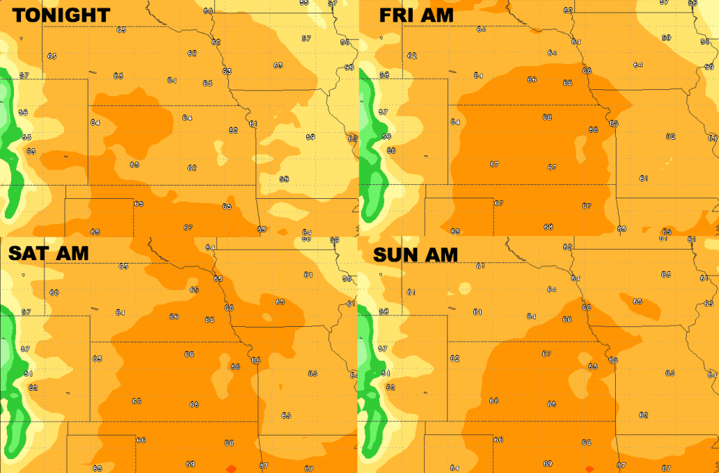
Low temperature guidance over the next 4 days:
Dew points from normal…air remains dry over the eastern half of the area, while it becomes more humid further west heading through late week.